Map of Europe

Navigate map of Europe, Europe country maps, satellite images of the Europe, Europe largest city maps, political, physical map of Europe, driving directions and traffic maps.
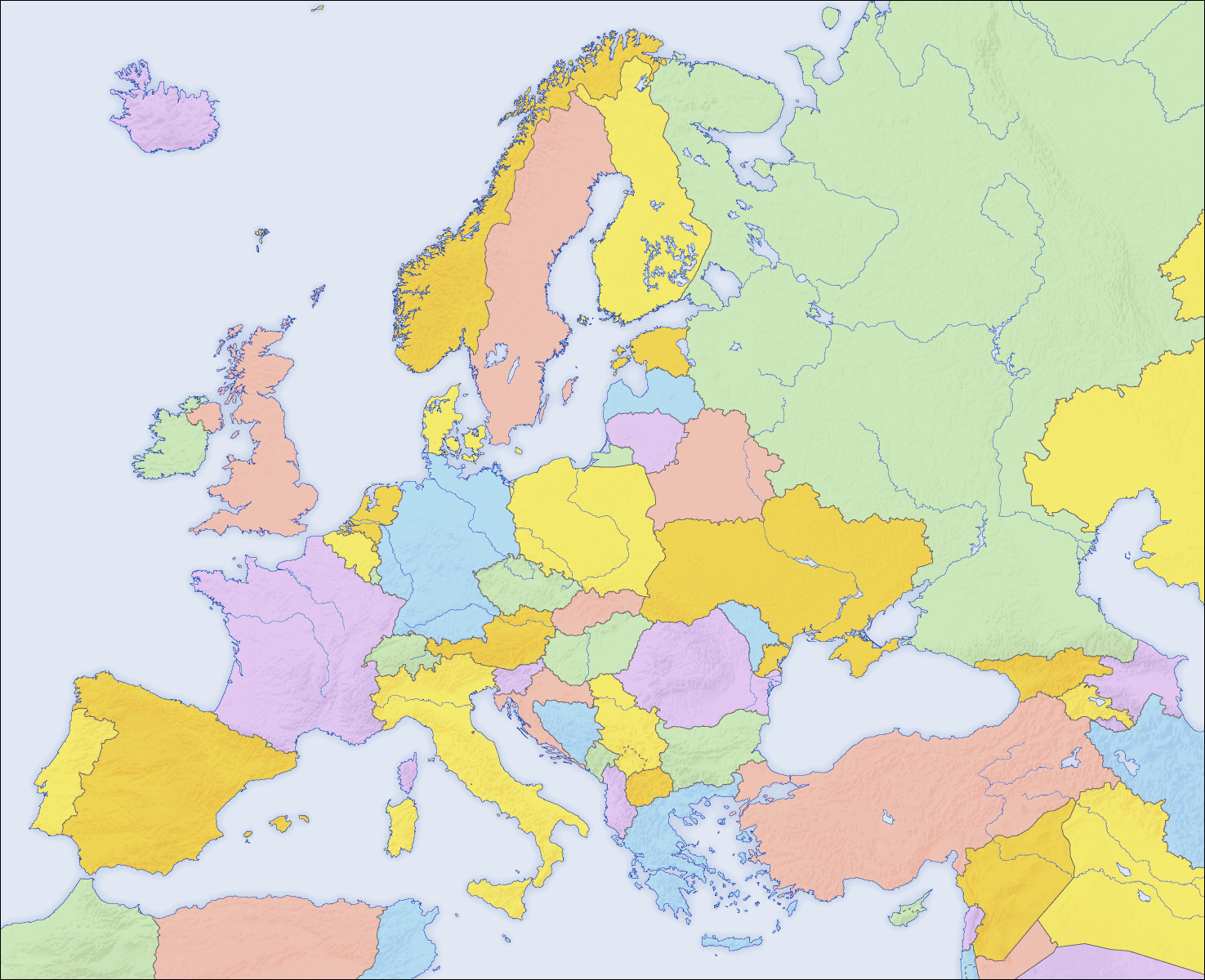
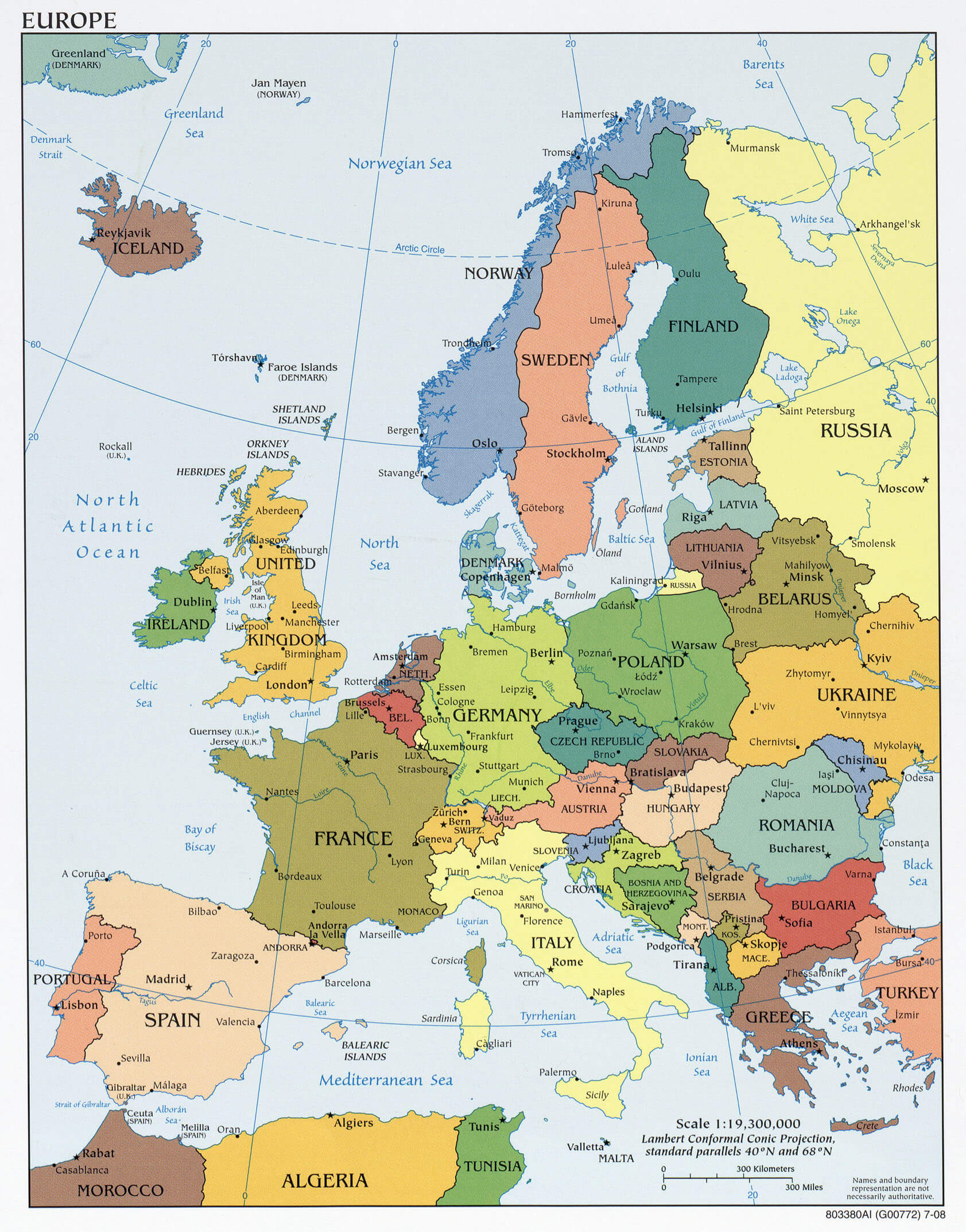
Discover the beauty and diversity of Europe through our detailed map, which provides a comprehensive view of European countries, cities, and political boundaries. Whether you're a traveler planning your next adventure, a student exploring European geography, or simply someone interested in the continent's structure, this Europe map offers a rich visual guide. From the vast stretches of the Iberian Peninsula to the Nordic landscapes and Eastern European countries, our map of Europe showcases the unique tapestry of cultures, languages, and histories that define this diverse region.

Map of European countries includes political borders, major cities, and easily distinguishable country outlines, making it ideal for educational purposes or trip planning. You can also download a PDF version of the Europe map for offline access or to include in presentations. With this Europe political map at your fingertips, navigating and understanding the geographic relationships within Europe has never been easier. Dive into the details and explore all that Europe has to offer with our user-friendly, high-quality map resources.

World Continents Map

North America Map Europe Map Asia Map South America Map Oceania Map Antarctica Map

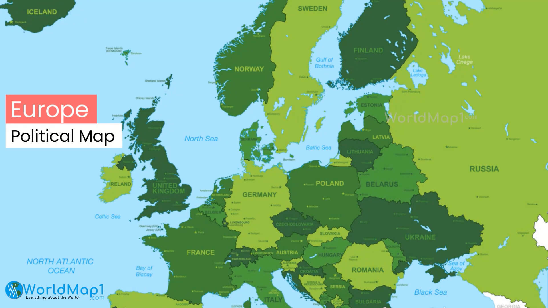
Comprehensive Political Map of Europe with Major Cities and Countries
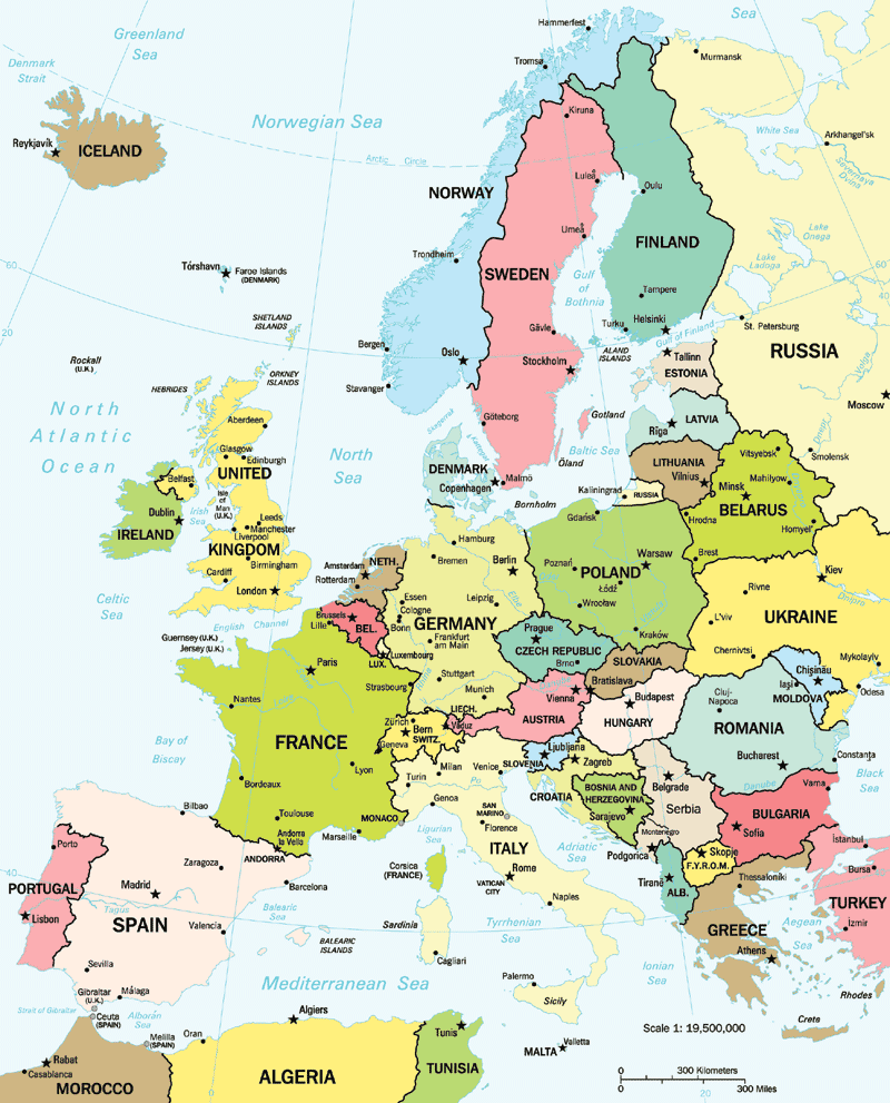
Comprehensive political map of Europe with major cities
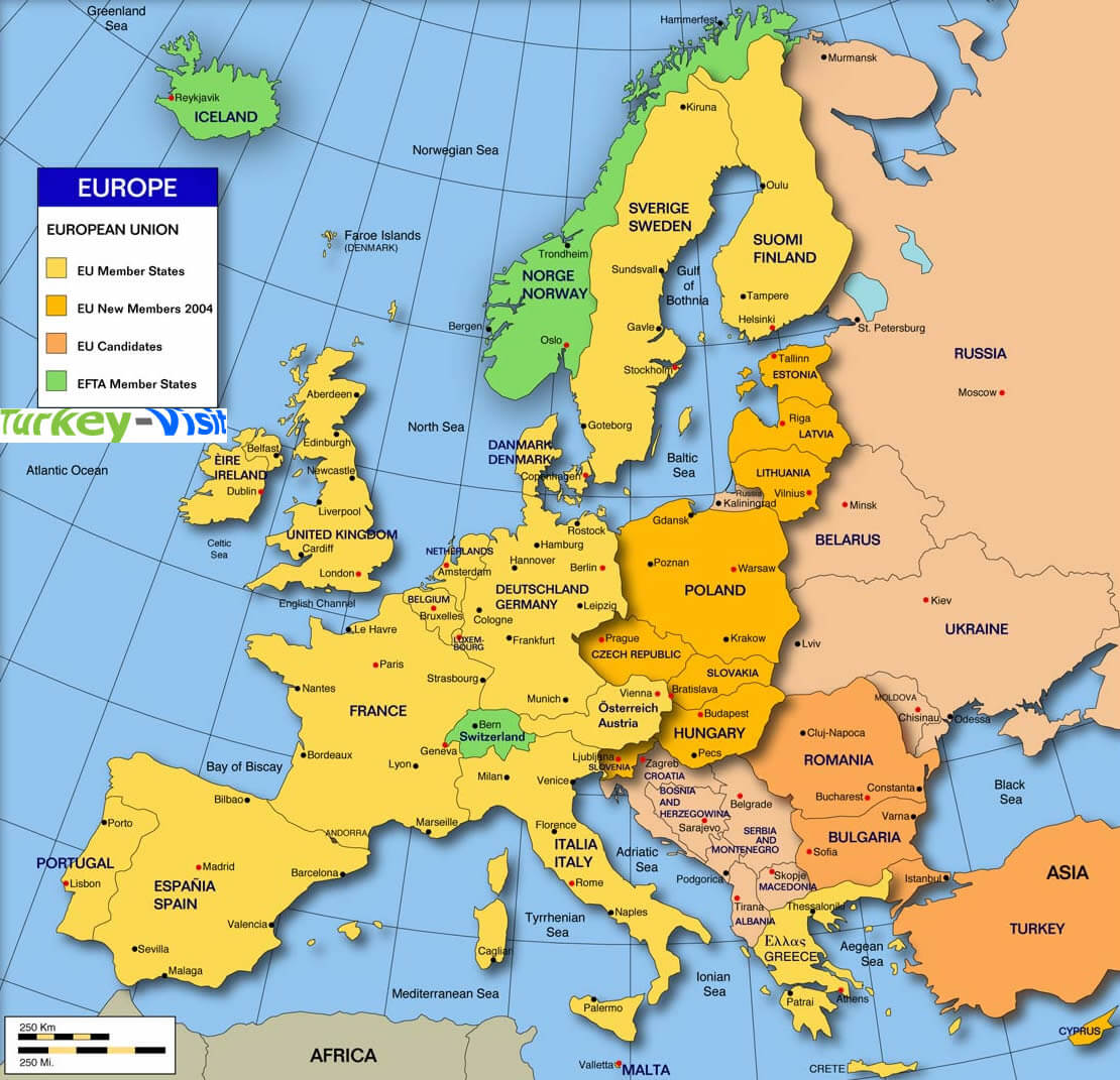
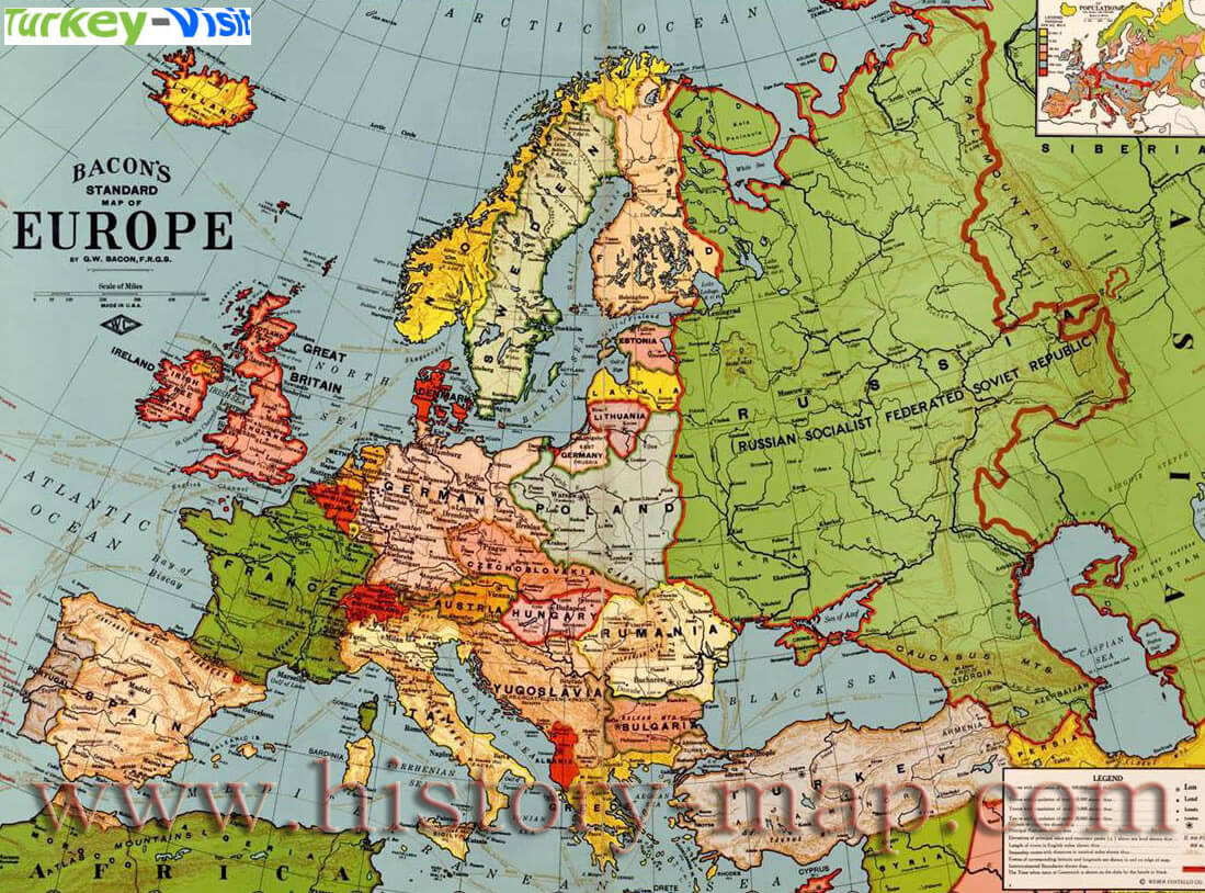
Map of Europe showing countries, cities, seas, and neighboring regions.

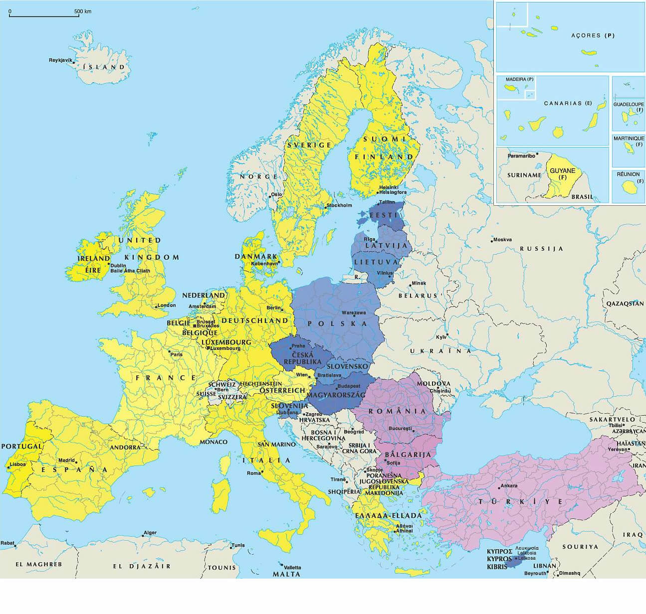
This detailed political map of Europe highlights countries, capitals and major cities, as well as surrounding seas and neighbouring regions. It's a useful tool for illustrating Europe's geography, making it ideal for travel planning, educational purposes and exploring the continent's diversity.
WorldMap1.com Donwload Now

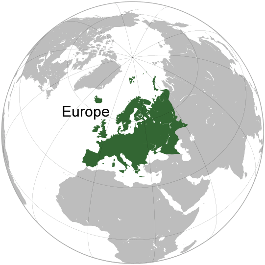
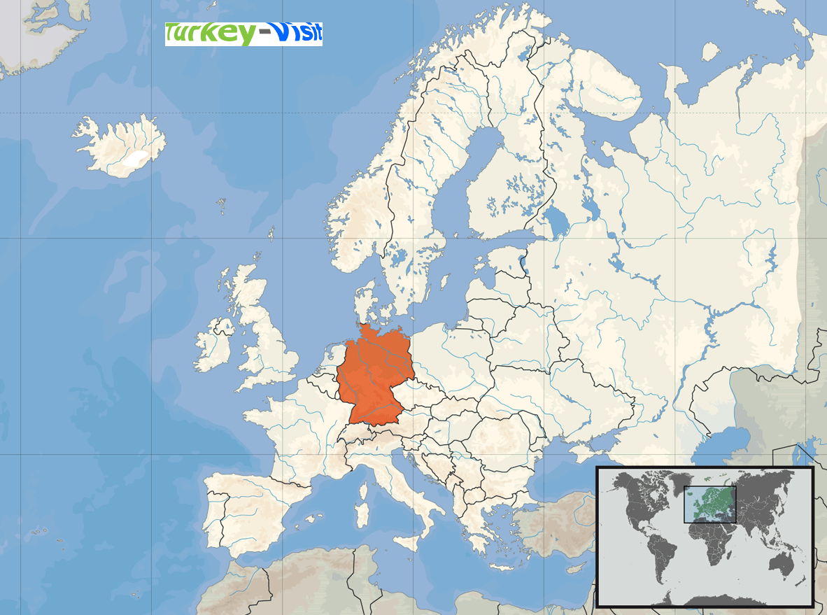
Where is Location of Europe on the World Map with Key Facts and Statistics
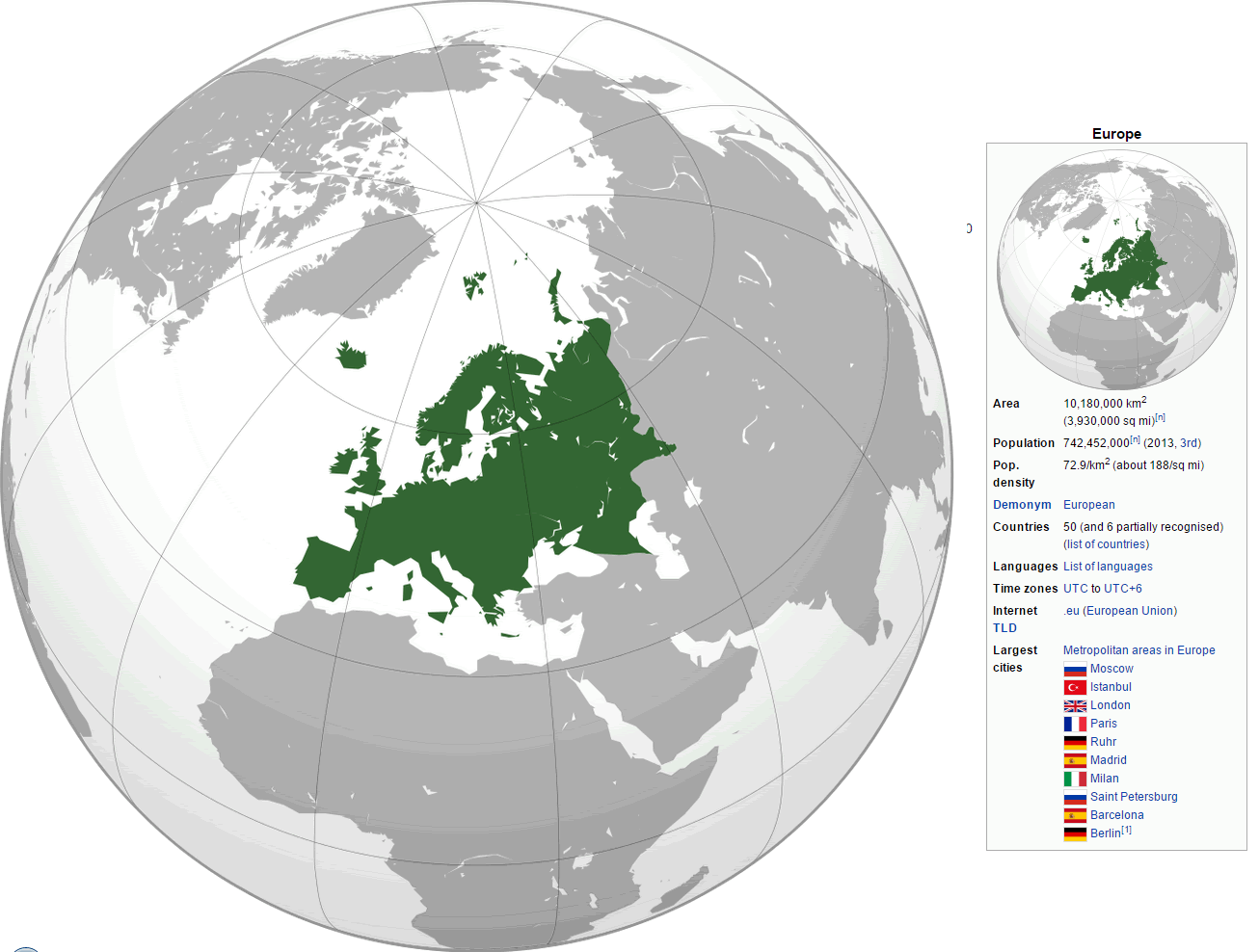
Where is Location of Europe on the World Map with Key Facts and Statistics
Map showing Europe's location on the world map with population and area stats.

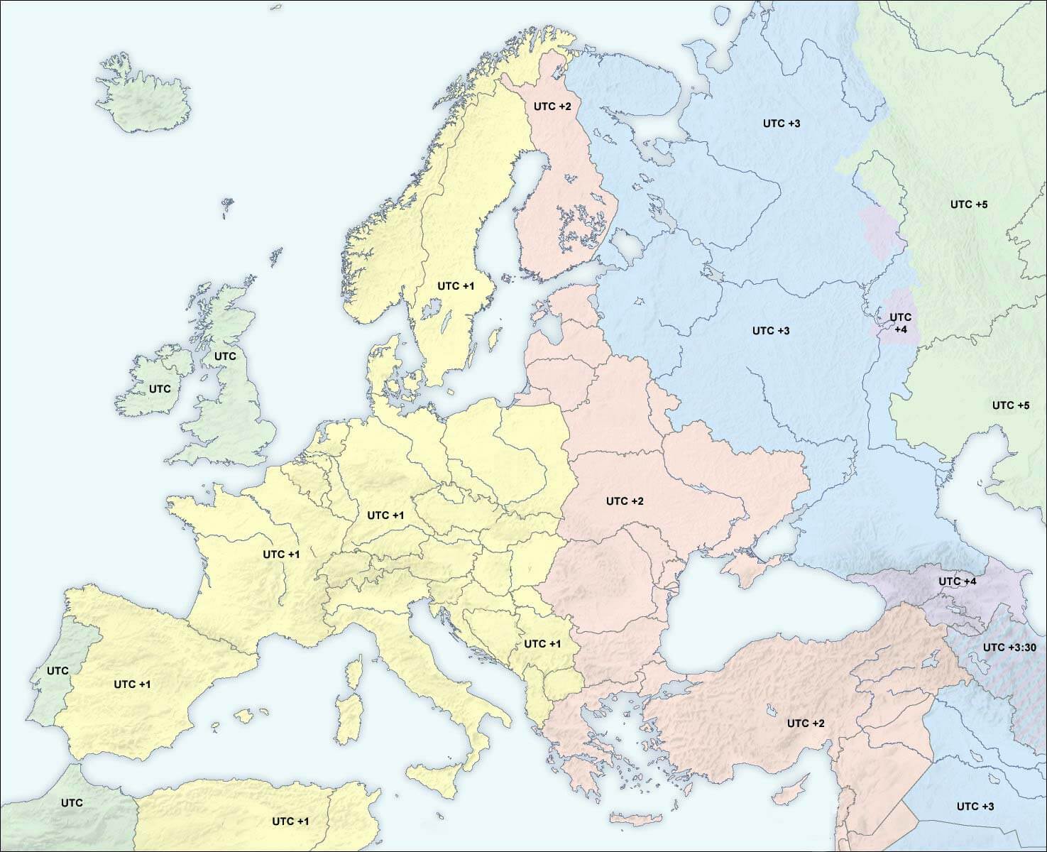
This world map highlights Europe's location in green, showing its position in relation to other continents. Accompanied by key statistics, it includes details of Europe's area, population, largest cities, metropolitan areas, internet TLD, population density, and time zones. This visual helps viewers understand Europe's geographic context and importance in global demography.

Europe Map with Earth View, Africa, and Asia
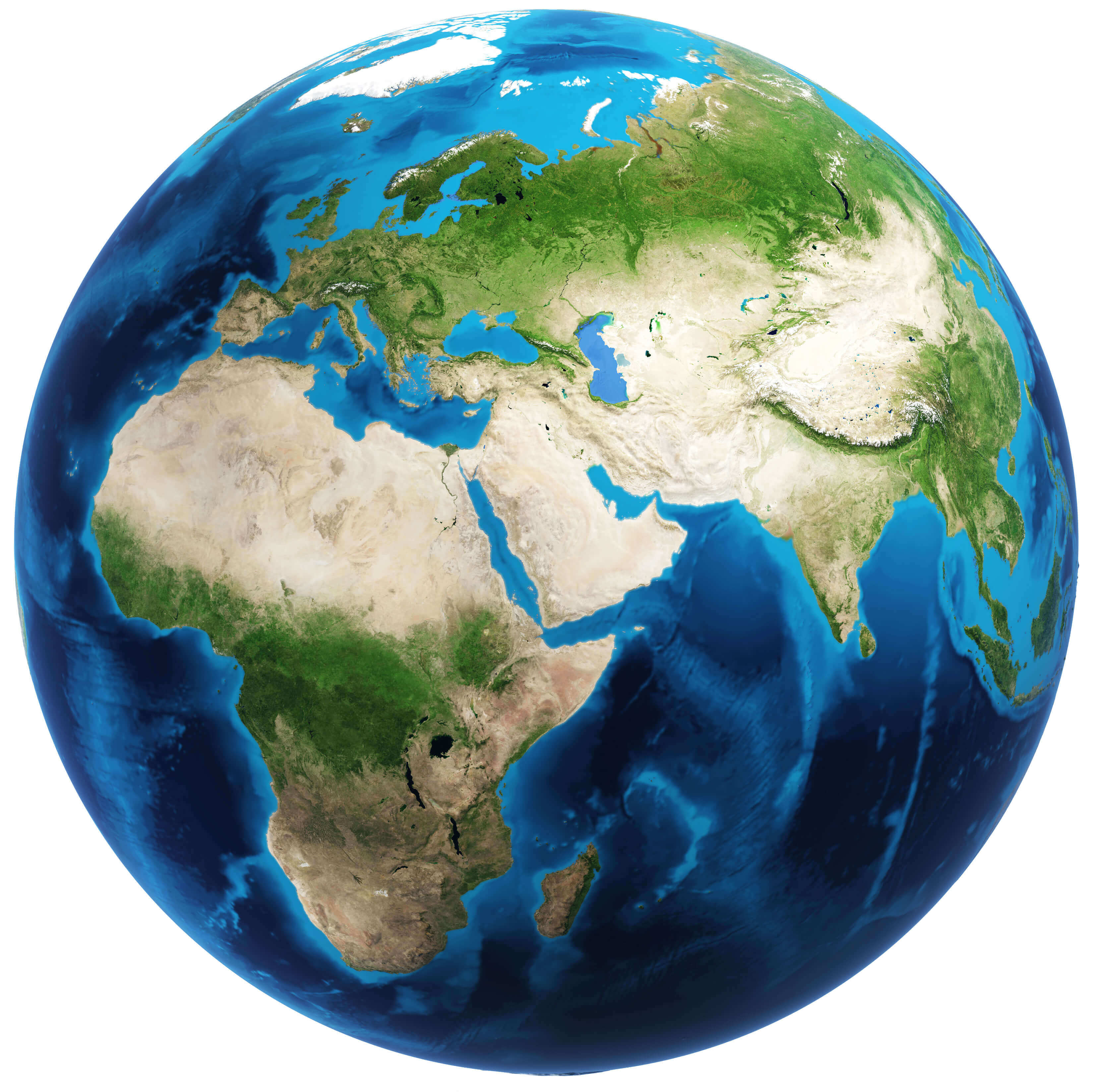
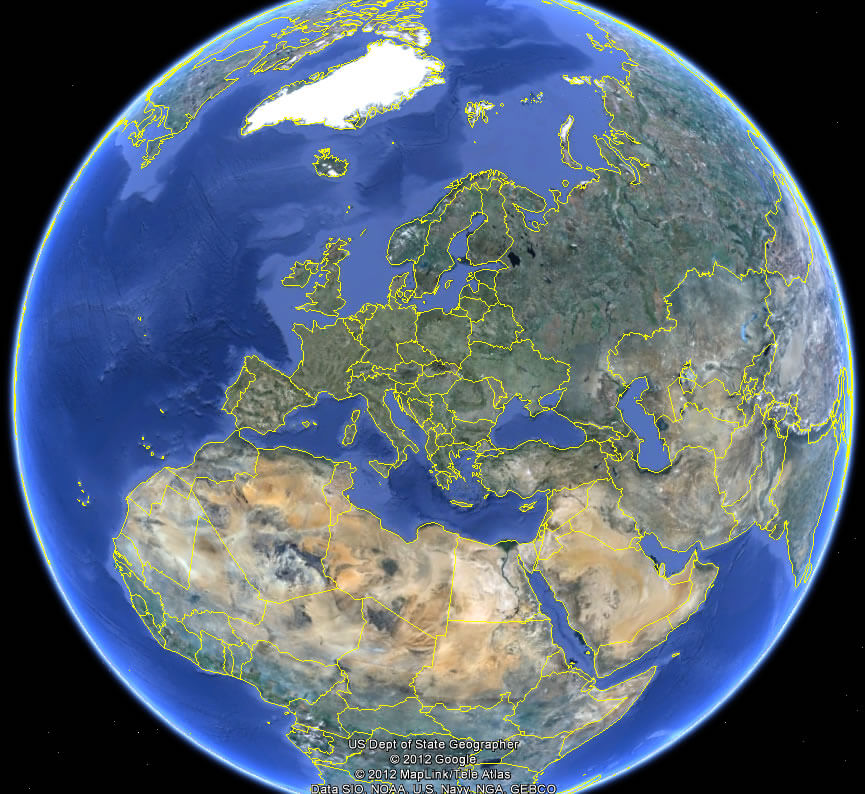
Globe view with Europe, Africa, and parts of Asia visible

This globe view map highlights Europe, Africa, and parts of Asia, showcasing the diverse terrains and water bodies that connect these regions. This image provides a perspective on the geographic relationships between continents, making it useful for visualizing global geography and the interconnectedness of these areas.

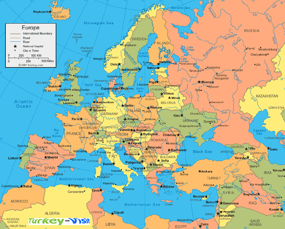
Detailed Political Map of European Countries and Capitals
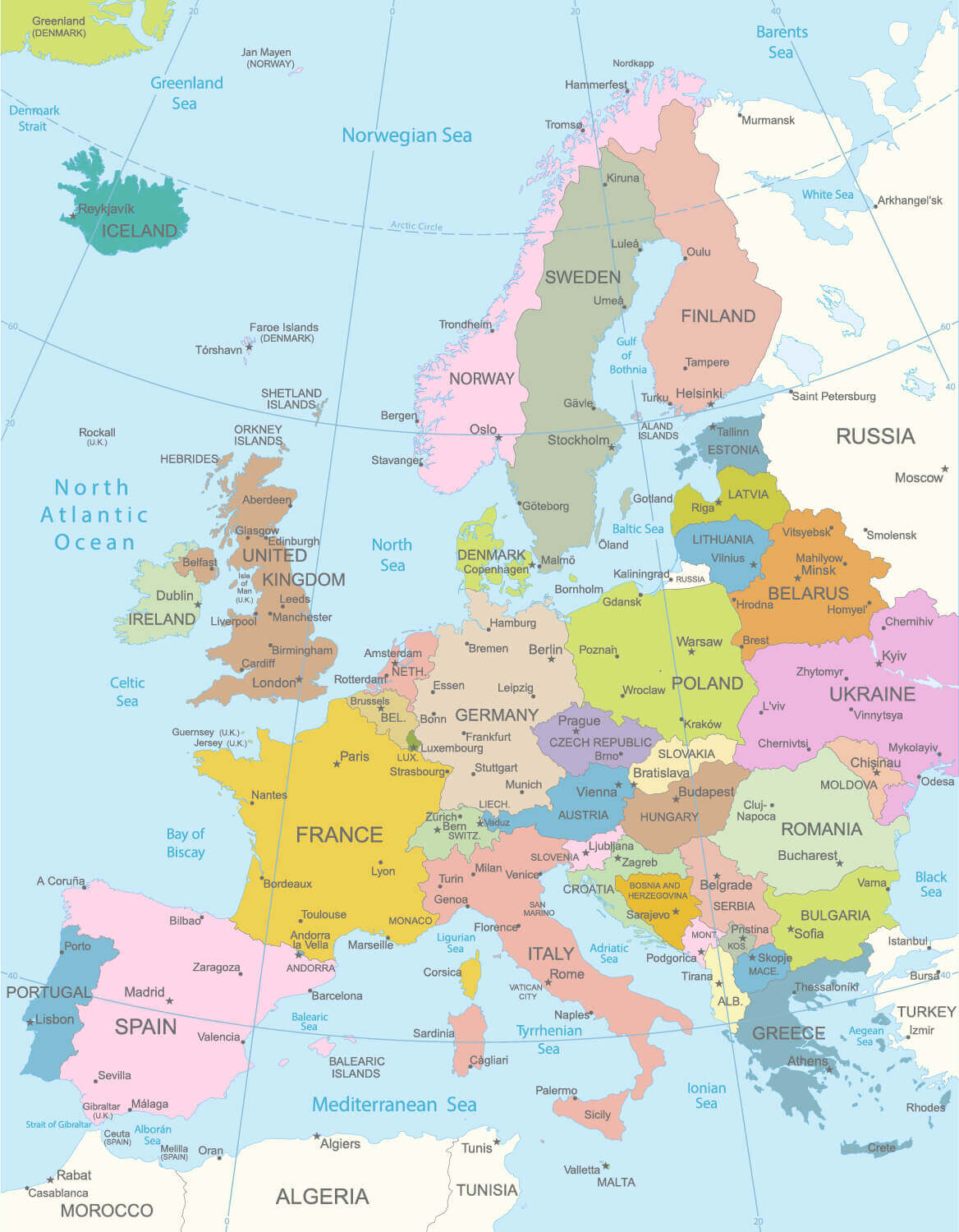
Detailed Political Map of European Countries and Capitals
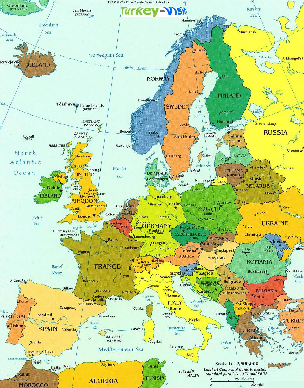
European political map showing countries, capitals, and major cities.

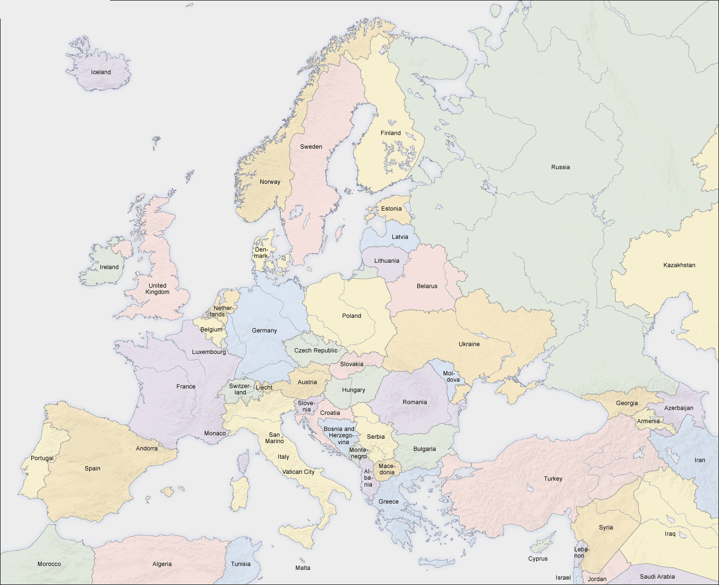
This political map of Europe highlights each country's borders, capitals, and major cities. Designed for easy reference, it highlights Europe's diverse geography, making it ideal for educational purposes and travel planning. Explore the different areas, from the Iberian Peninsula to Eastern Europe, and get a clear idea of how the continent is organised.

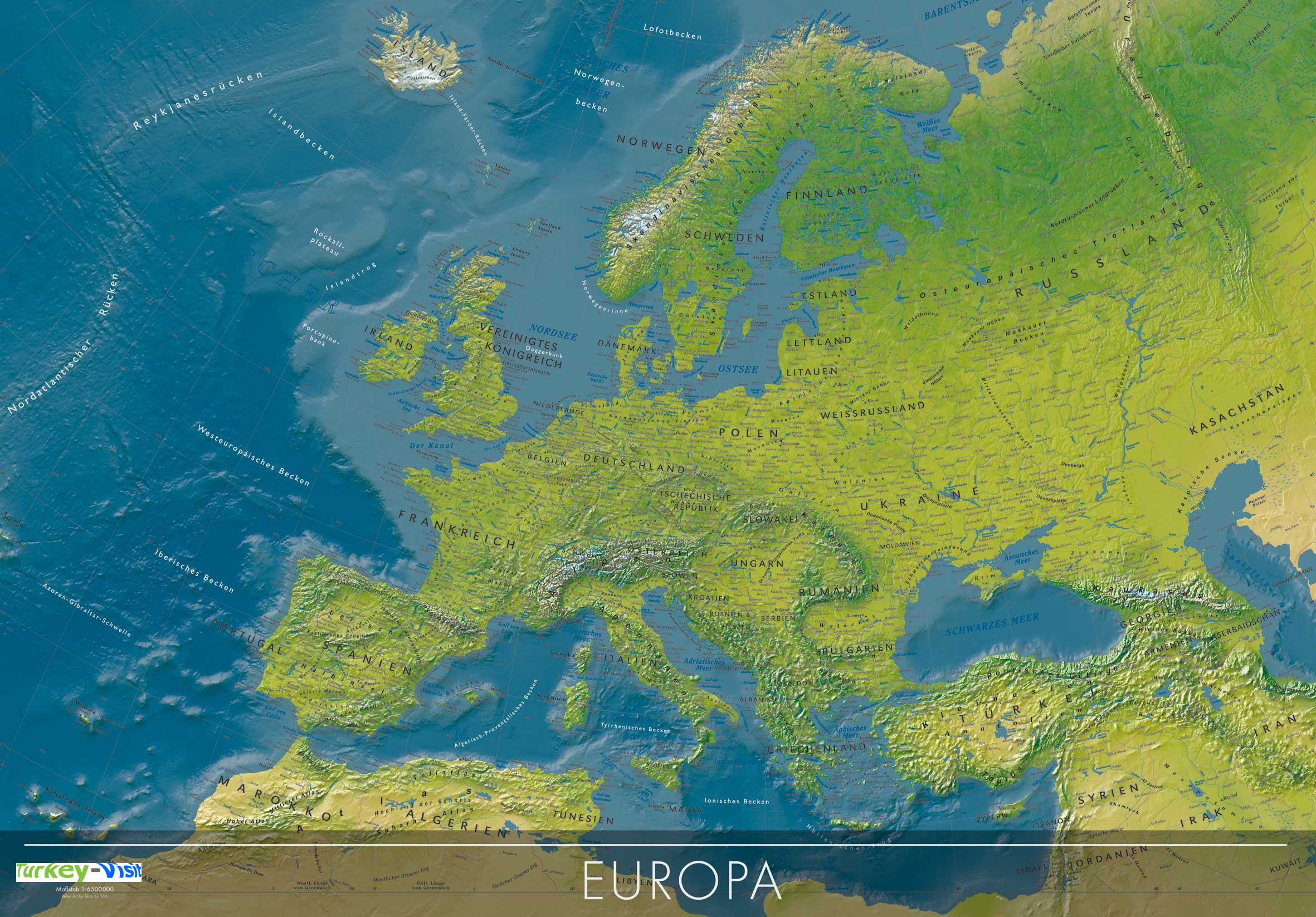
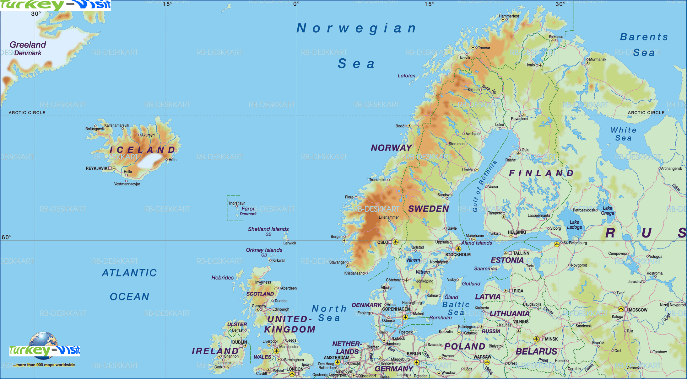
Physical Geography Map of Europe Highlighting Mountains and Terrain
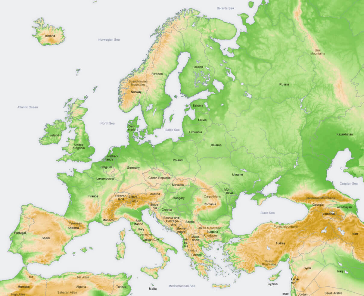
Physical Geography Map of Europe Highlighting Mountains and Terrain
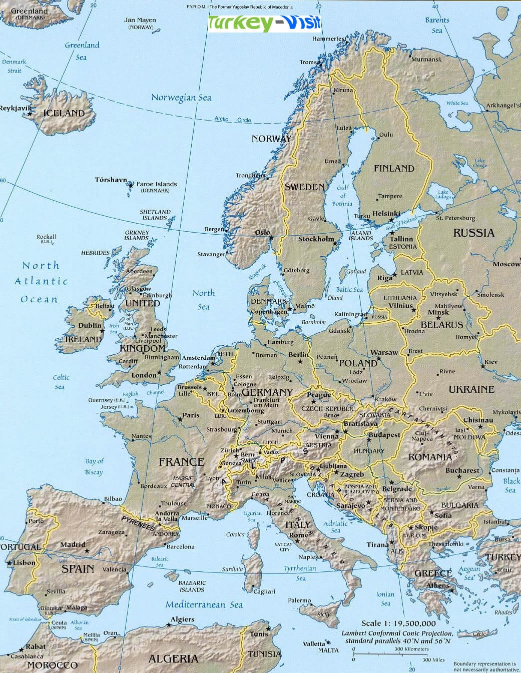
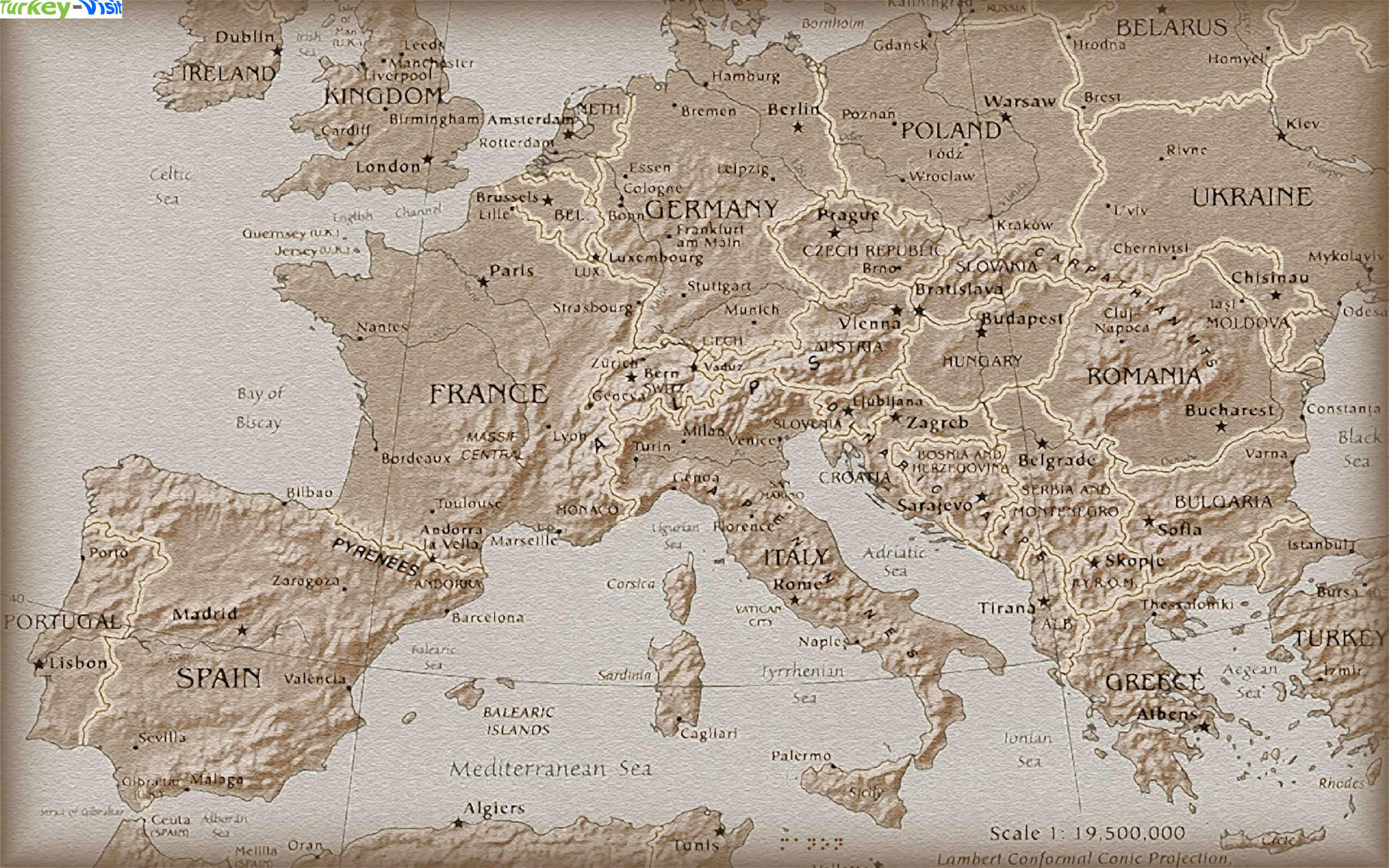
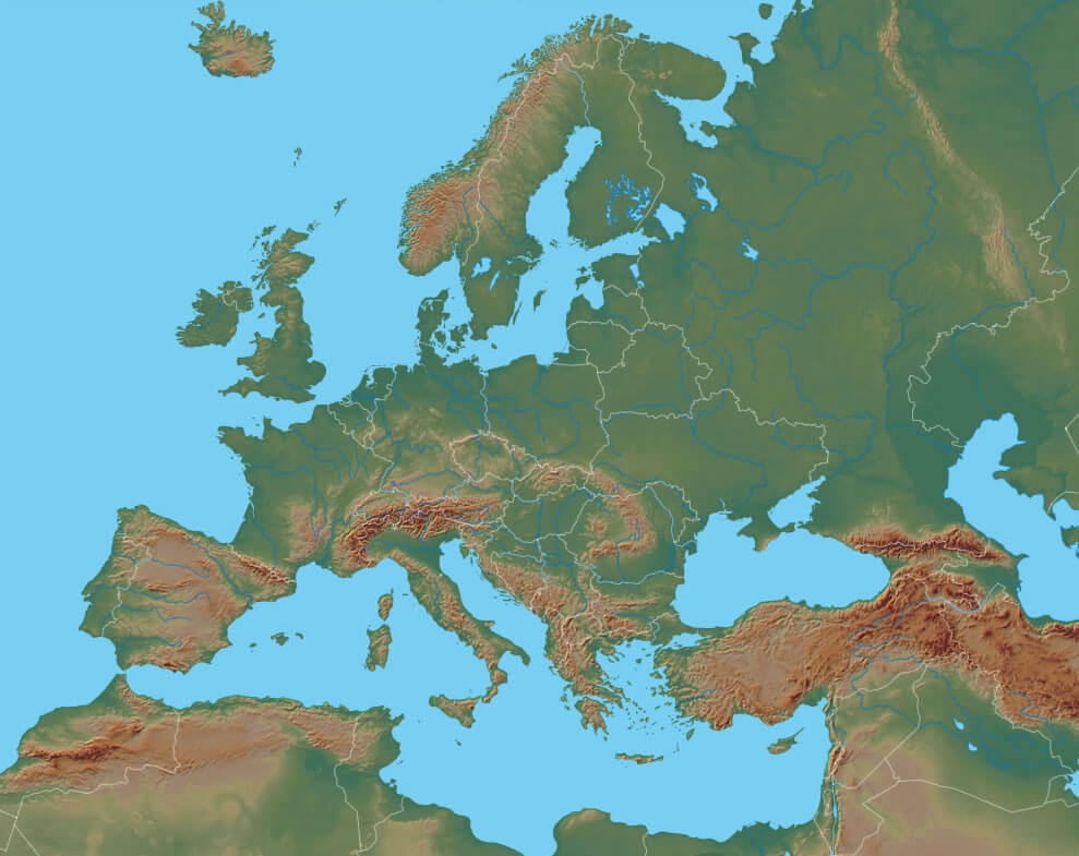
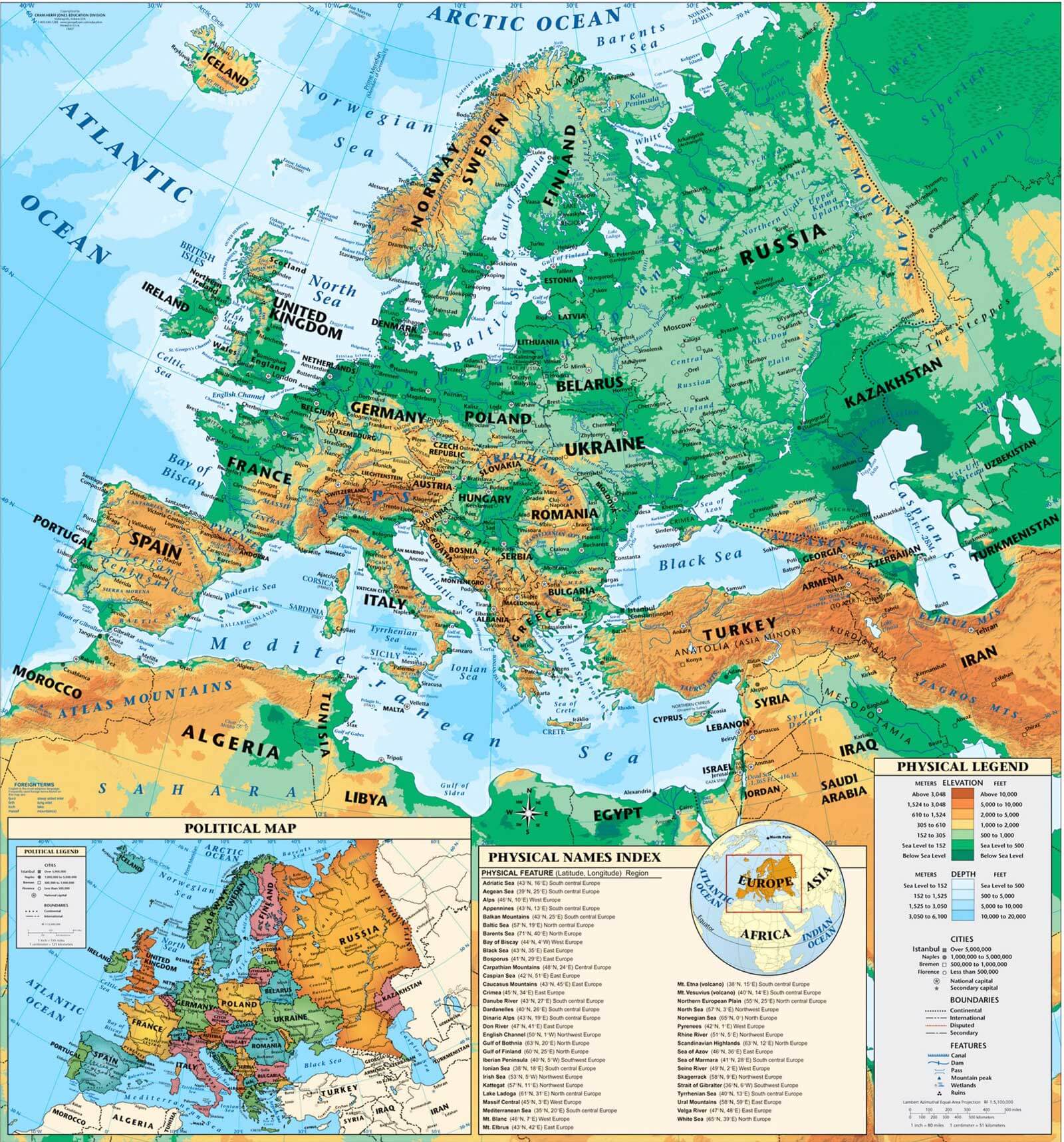
Europe physical map showing mountains, plains, and geographic features.

This physical map of Europe shows the diverse physical features of the continent, including mountain ranges such as the Alps, Pyrenees, and Carpathians, as well as vast plains and rivers. Ideal for geography enthusiasts, it provides a clear view of Europe's natural landscape and helps viewers understand the topography and elevation changes across the region.

Detailed Political Map of Europe with Country Borders and Major Cities

Detailed Political Map of Europe with Country Borders and Major Cities
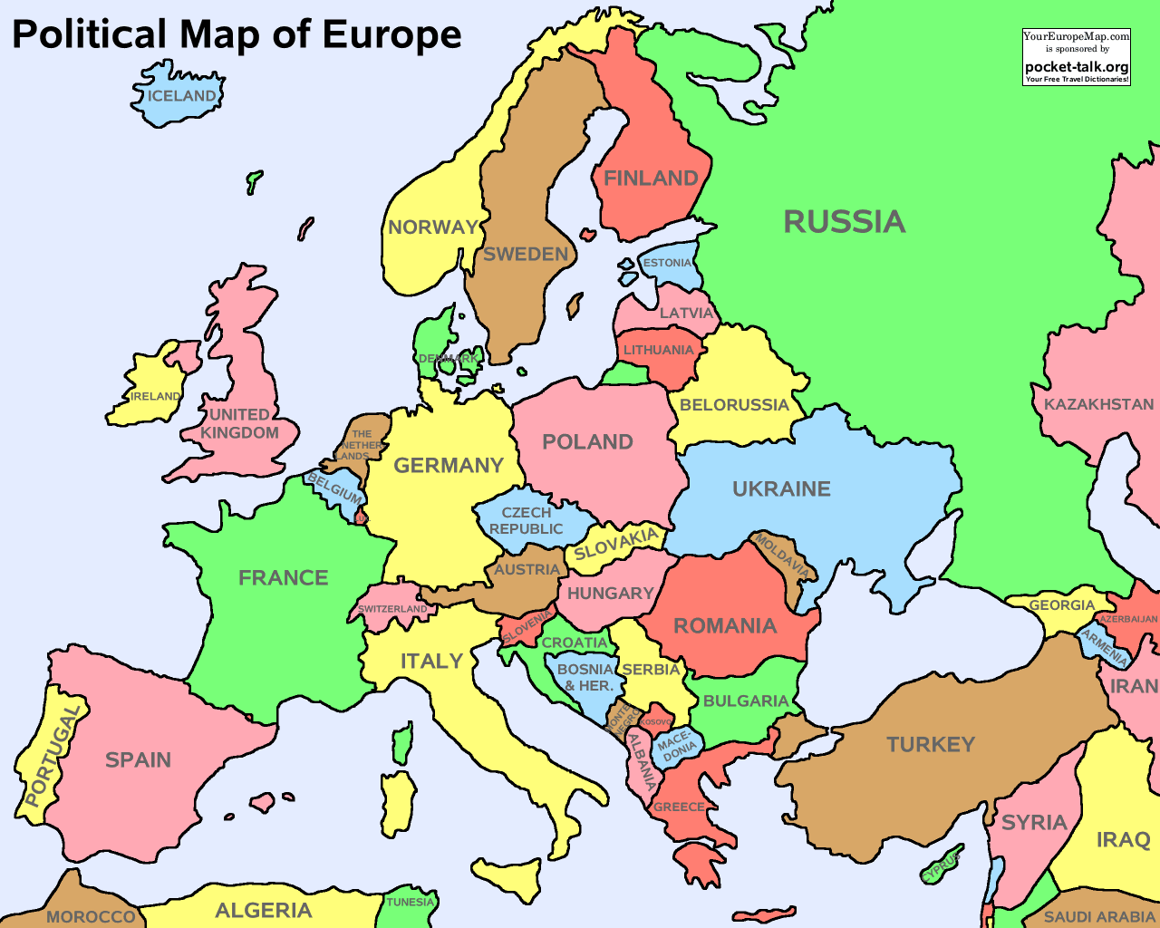
Political map of Europe showing countries, borders, and major cities

This political map of Europe highlights country borders, capitals, and major cities across the continent. Designed for easy reference, it provides a comprehensive view of Europe's political landscape and helps users identify each country and its neighbourhood. Ideal for educational and travel planning purposes.

Hand Illustrated Vector Map of Europe with Country Labels
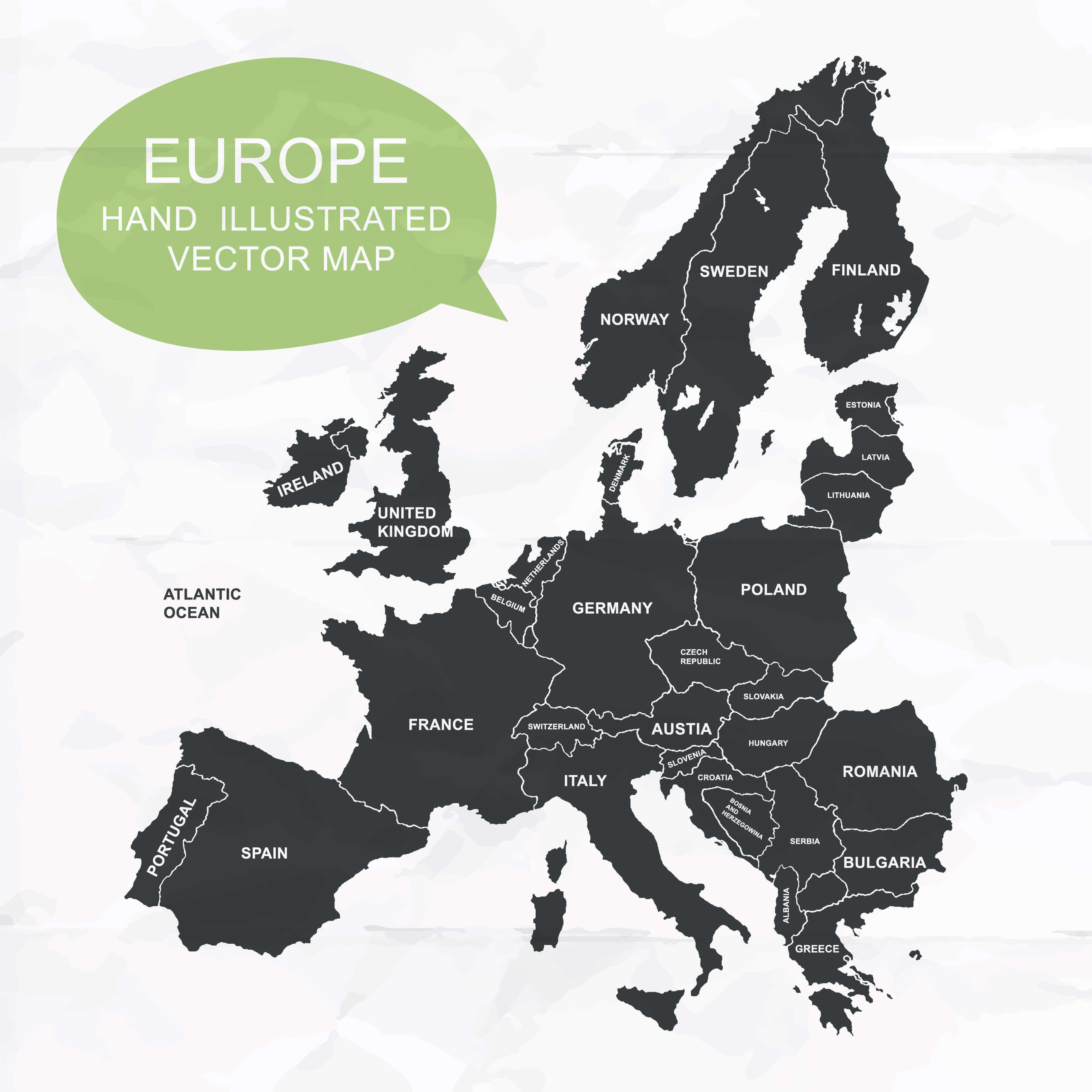
Hand Illustrated Vector Map of Europe with Country Labels
Hand illustrated vector map of Europe highlighting countries

This hand-illustrated vector map of Europe provides a stylized and modern view of the continent, with clear country labels and minimalistic design. Perfect for creative projects or educational use, it showcases Europe's layout in a unique, artistic style while retaining geographic accuracy.

Europe Map with National Borders and Countries Miniature Maps
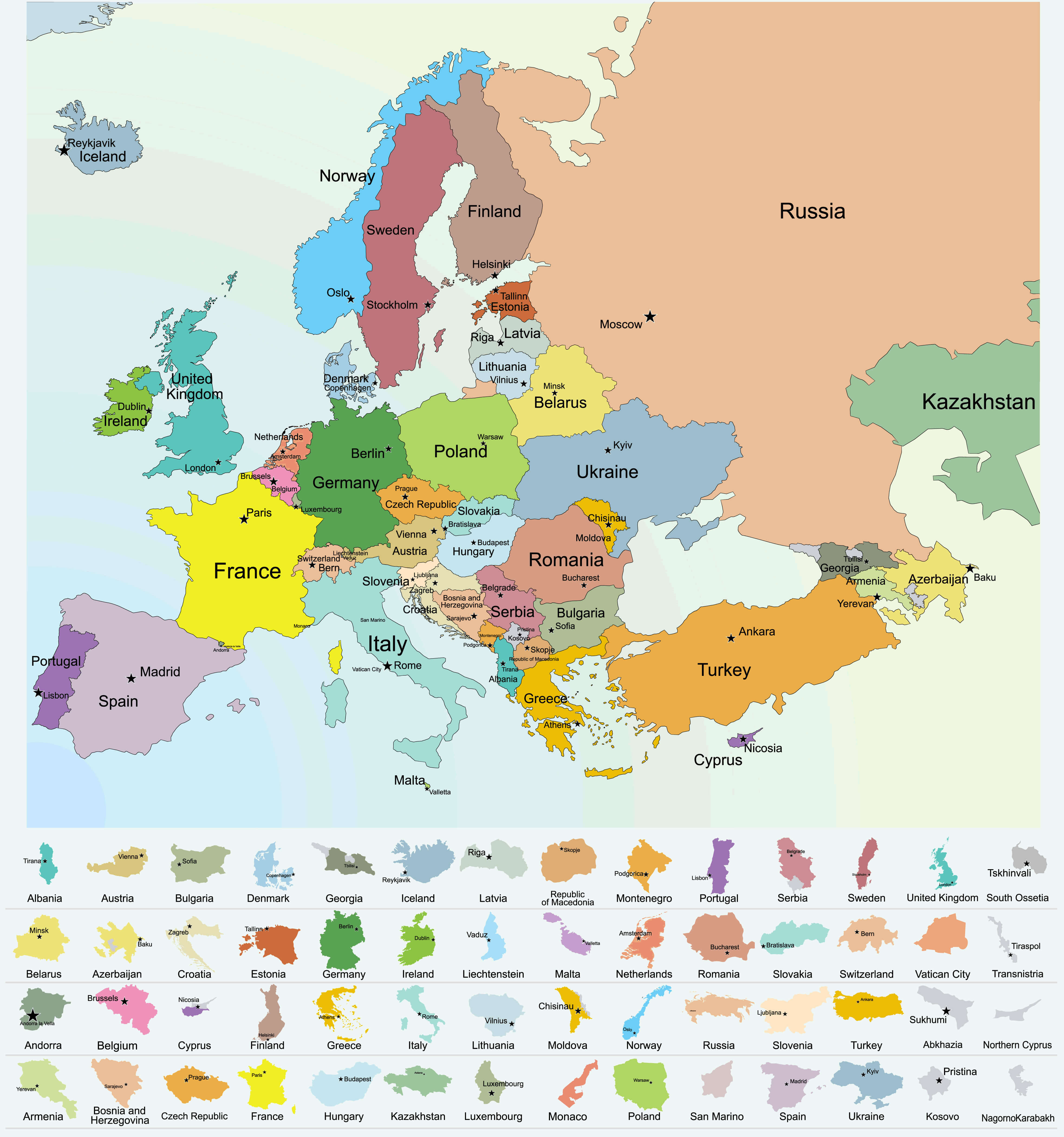
Europe Map with National Borders and Countries Miniature Maps
Map of Europe showing national borders, capitals, and country maps.

This colourful map of Europe highlights each country with distinctive borders, labeled capitals, and miniature maps at the bottom for easy identification. It's perfect for educational and reference purposes, helping viewers quickly understand the political layout of Europe and locate countries with ease.

Detailed Physical Map of Europe Highlighting Mountains and Rivers

Detailed Physical Map of Europe Highlighting Mountains and Rivers
Europe physical map showing mountains, rivers, and major geographic features.

This physical map of Europe displays the continent's varied topography, including major mountain ranges such as the Alps and Carpathians, extensive river systems, and surrounding seas. It provides an insightful look at Europe's natural landscape, ideal for studying geography and understanding the continent's physical features in detail.

Europe Political Map with National Borders and Major Rivers
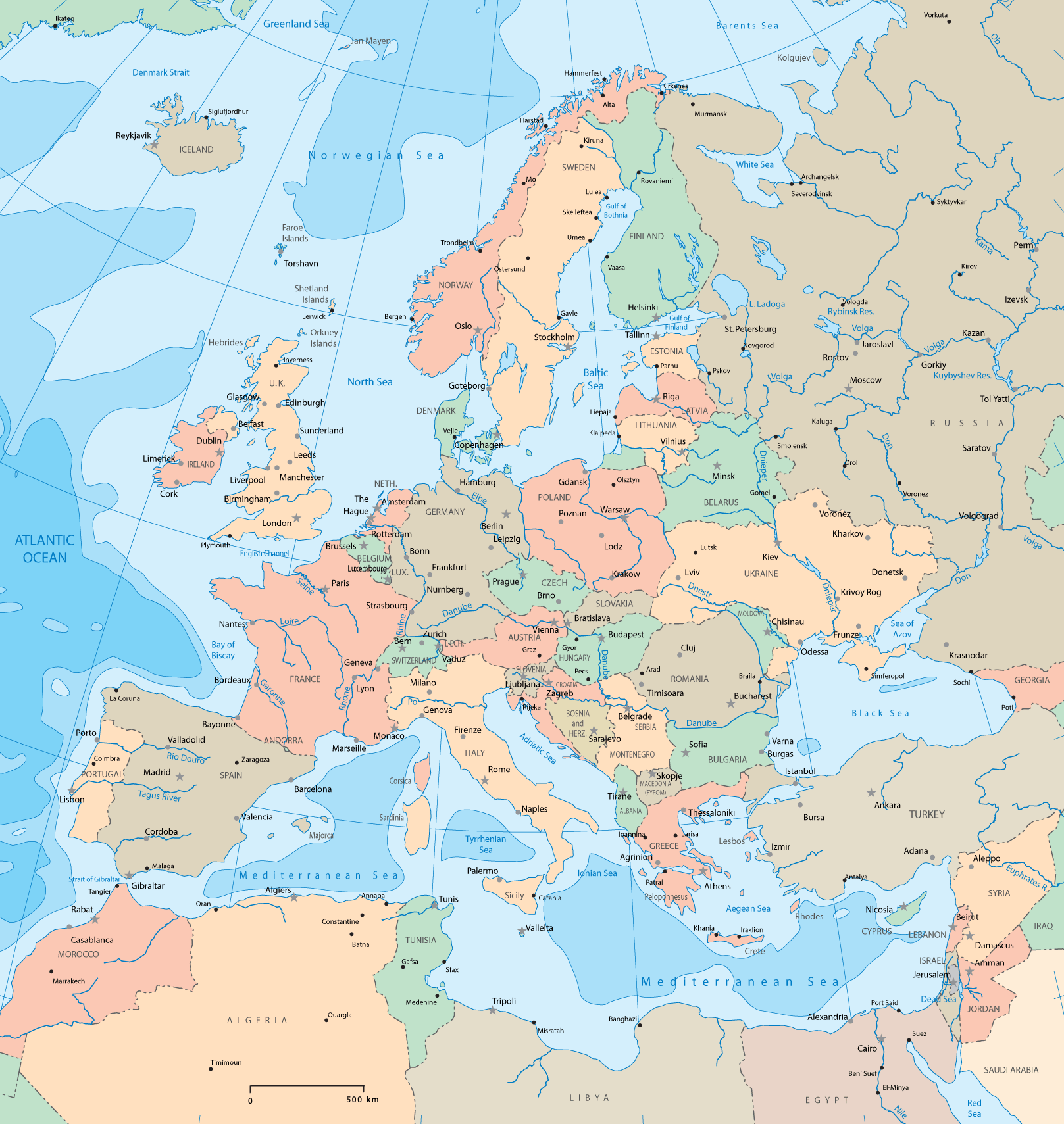
Europe Political Map with National Borders and Major Rivers
Political map of Europe showing countries, capitals, and major rivers.

This political map of Europe shows country boundaries, capitals and important rivers, providing a comprehensive view of both political boundaries and natural water systems. Ideal for geography studies, this map allows easy identification of European countries and their major river networks, illustrating the mixture of human and natural geography across the continent.

Stunning Satellite View of Europe Map at Night
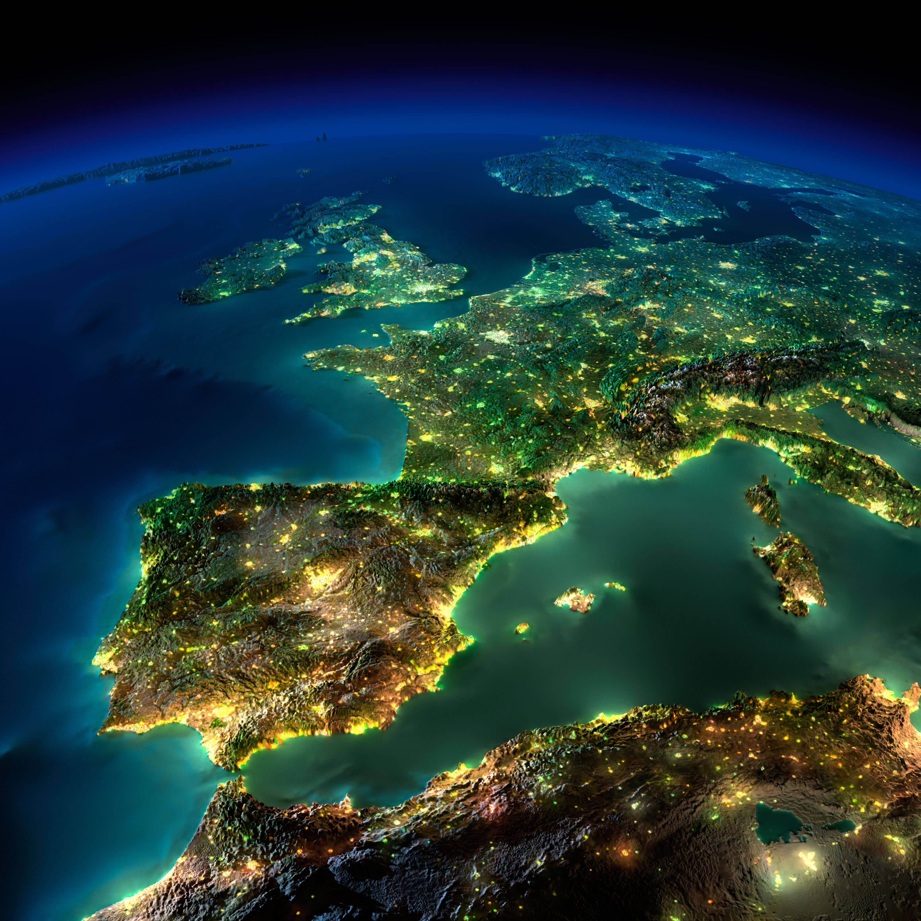
Stunning Satellite View of Europe Map at Night
Europe satellite map at night showing illuminated cities and landscapes.

This captivating satellite image of Europe at night reveals the continent's urban lights, highlighting densely populated areas and major cities. From the bright clusters in Western Europe to the more dispersed lights in the south, this view illustrates human presence across Europe's landscape, offering a unique perspective on its nighttime geography.

Satellite View of Europe from Space at Sunrise
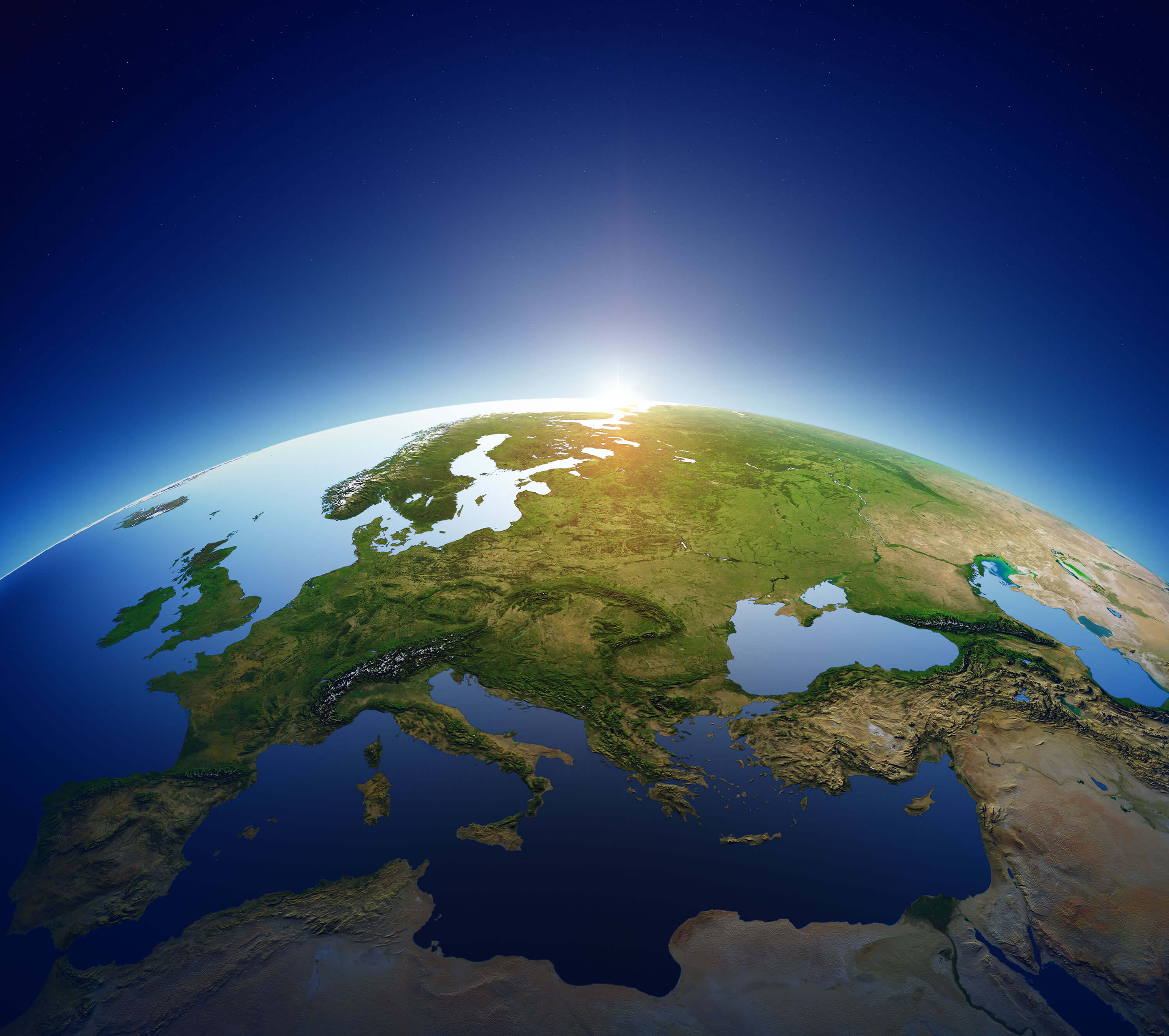
Satellite View of Europe from Space at Sunrise
Europe satellite map from space showing continents and sunrise over Europe.

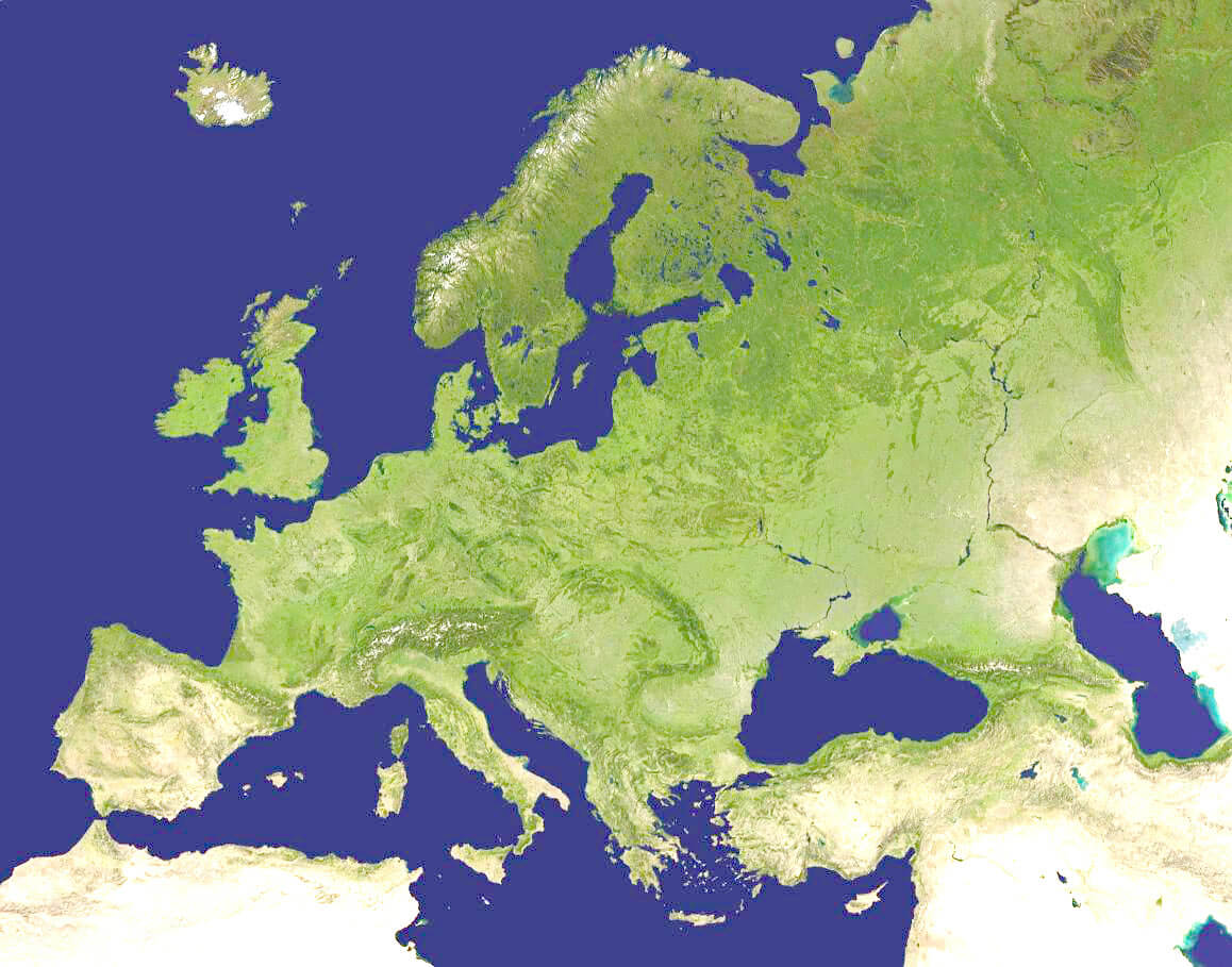
This stunning satellite image captures Europe from space, with sunrise illuminating parts of the continent. The image showcases Europe's natural landscapes, coastlines and terrain, offering a unique perspective on its geographical features. Perfect for understanding Europe's position on Earth and appreciating its vast natural beauty.

Topographical Map of Europe Showing Elevation and Terrain Features
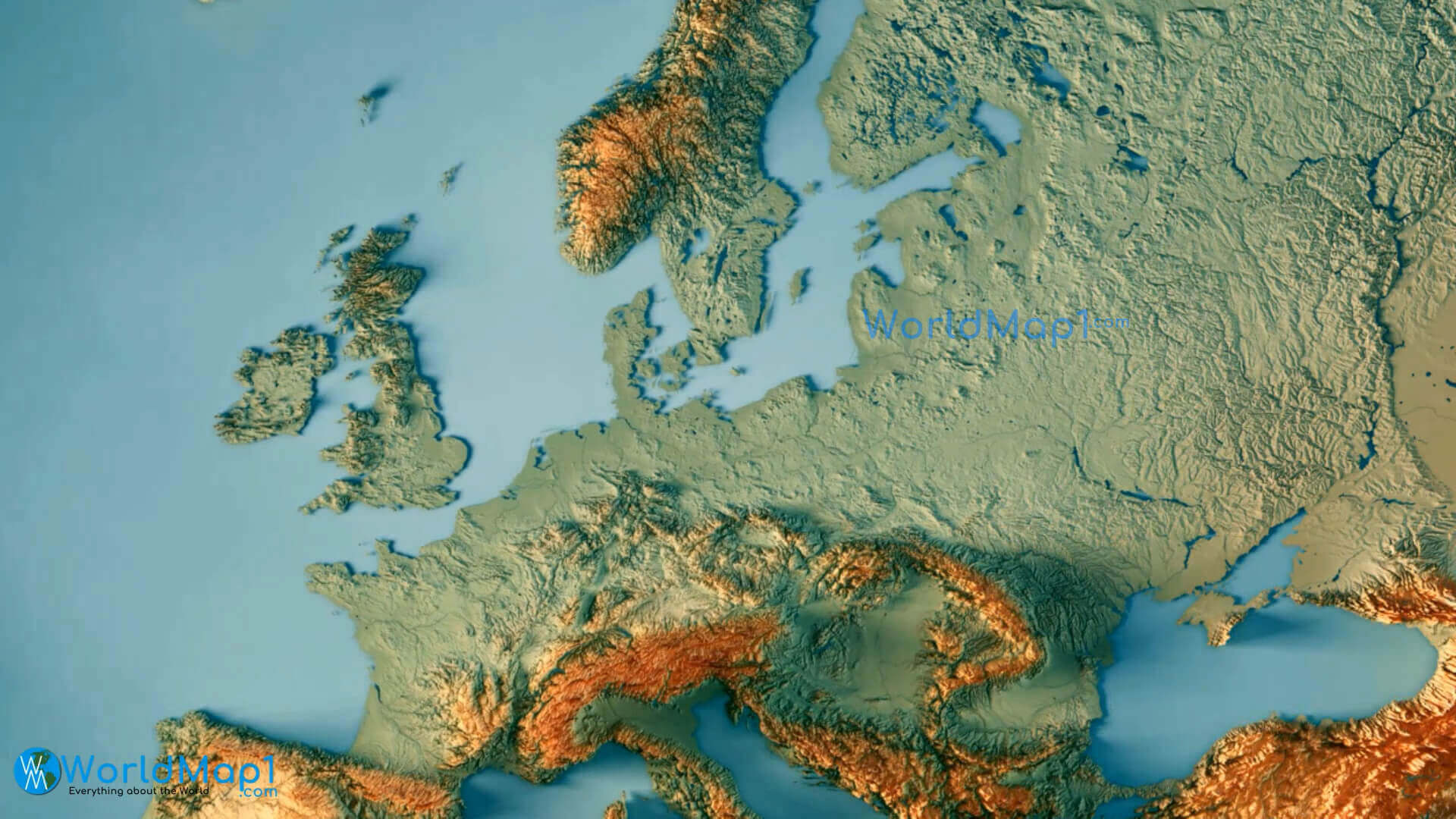
Topographical Map of Europe Showing Elevation and Terrain Features
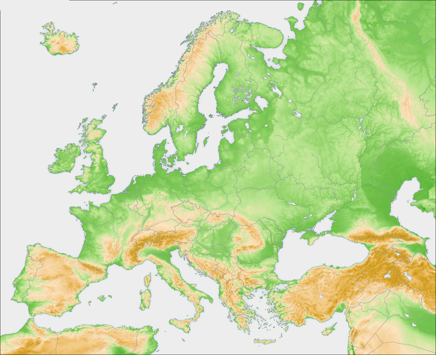
Europe topography map highlighting mountains and elevation changes.

This topographical map of Europe displays the continent's varied terrain, showcasing elevation changes from mountainous regions like the Alps and Scandinavian ranges to the flatter northern plains. Ideal for studying Europe's physical landscape, this map highlights the geological diversity across the continent.

3D Physical Map of Europe Highlighting Terrain and Coastal Features

3D Physical Map of Europe Highlighting Terrain and Coastal Features
3D physical map of Europe showing mountains, coastlines, and terrain details.

This 3D physical map of Europe showcases the continent's terrain, from mountain ranges such as the Alps to the diverse coastal areas along the Mediterranean and Black Seas. The image provides a realistic view of Europe's natural landscape, ideal for understanding geographic features and elevation changes across the region.

Stylized Map of Western Europe with Key Data Visualizations
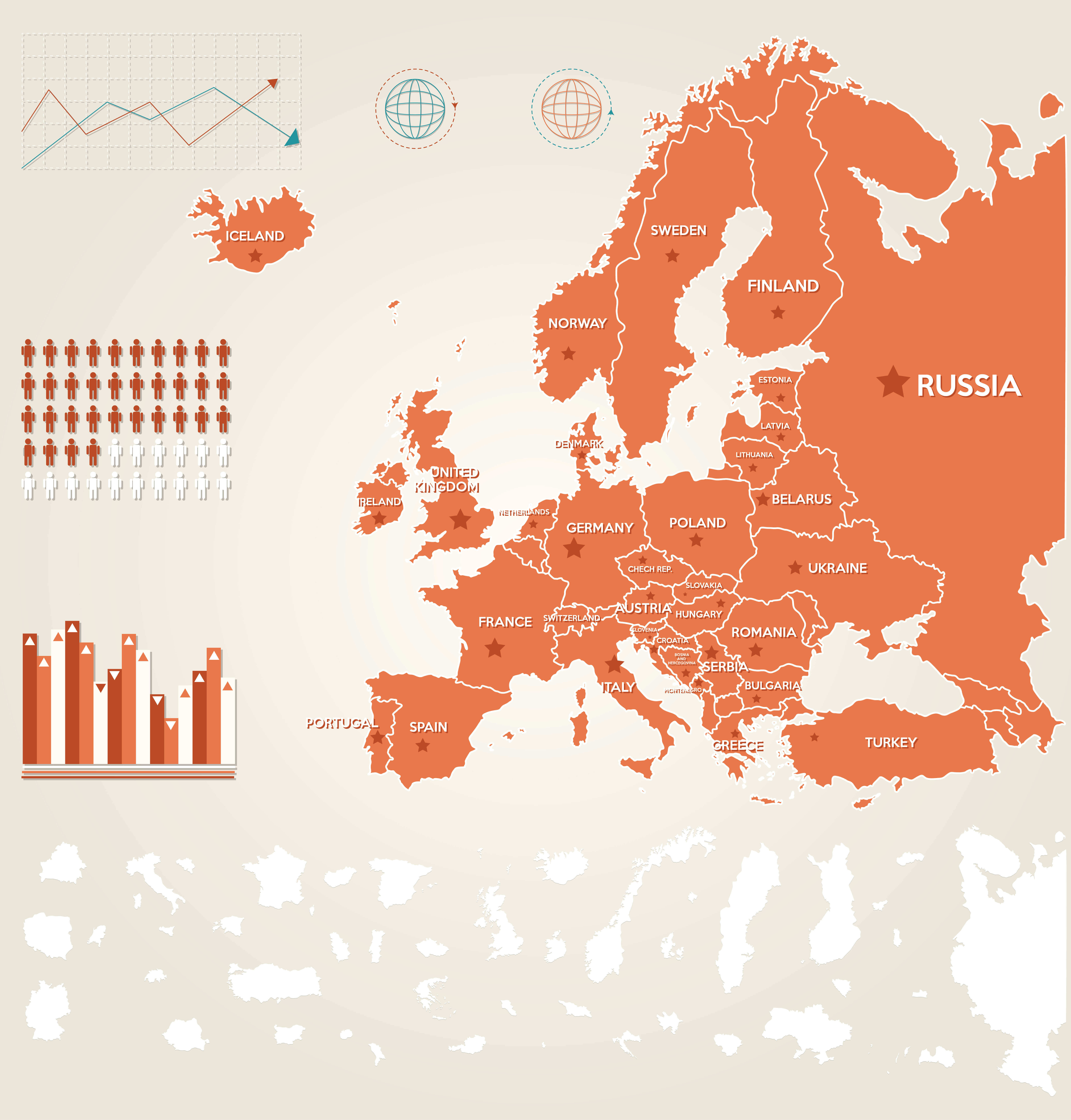
Stylized Map of Western Europe with Key Data Visualizations
This stylized map of Western Europe highlights major countries and includes data visualizations, such as population charts and infographics. Ideal for educational and analytical purposes, it provides a unique visual perspective on Western Europe, blending geographic information with demographic and statistical insights.

This

Highlighted View of Europe on a World Map with Key Information Points
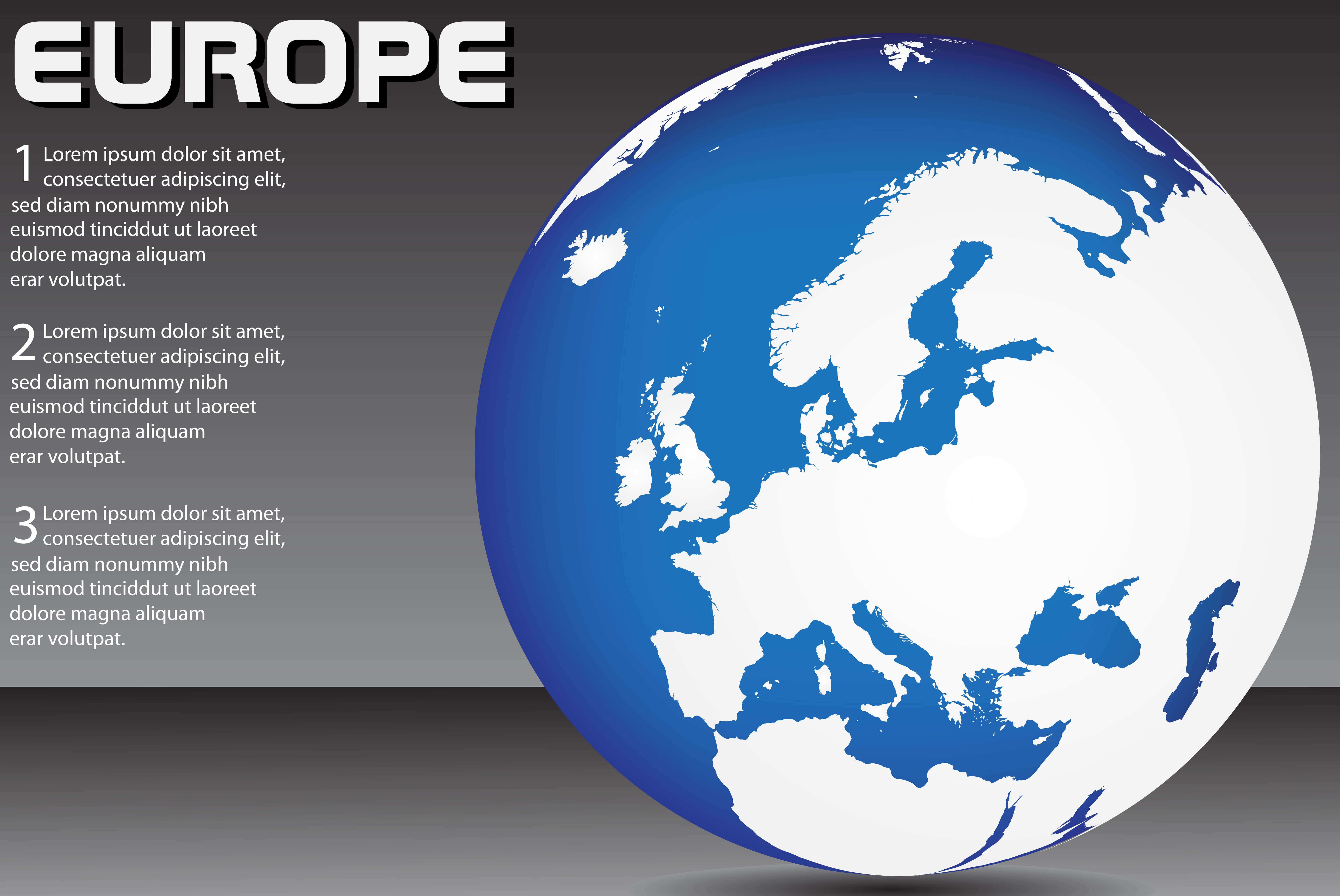
Highlighted View of Europe on a World Map with Key Information Points
World map focused on Europe, showing continents and key regions

This world map centers on Europe, offering a focused view of the continent in a global context. The stylized graphic highlights Europe's geographical position and includes designated information sections for additional details. Ideal for presentations or educational use, it combines visual simplicity with informative structure.

Europe Maps, Countries Map and Earth Views from Space

Please subscribe on "World Guide" channnel on Youtube at youtube.com/c/WorldGuide

Please view more Europe Countries' Maps

A collection of Europe Map


Europe Countries Map

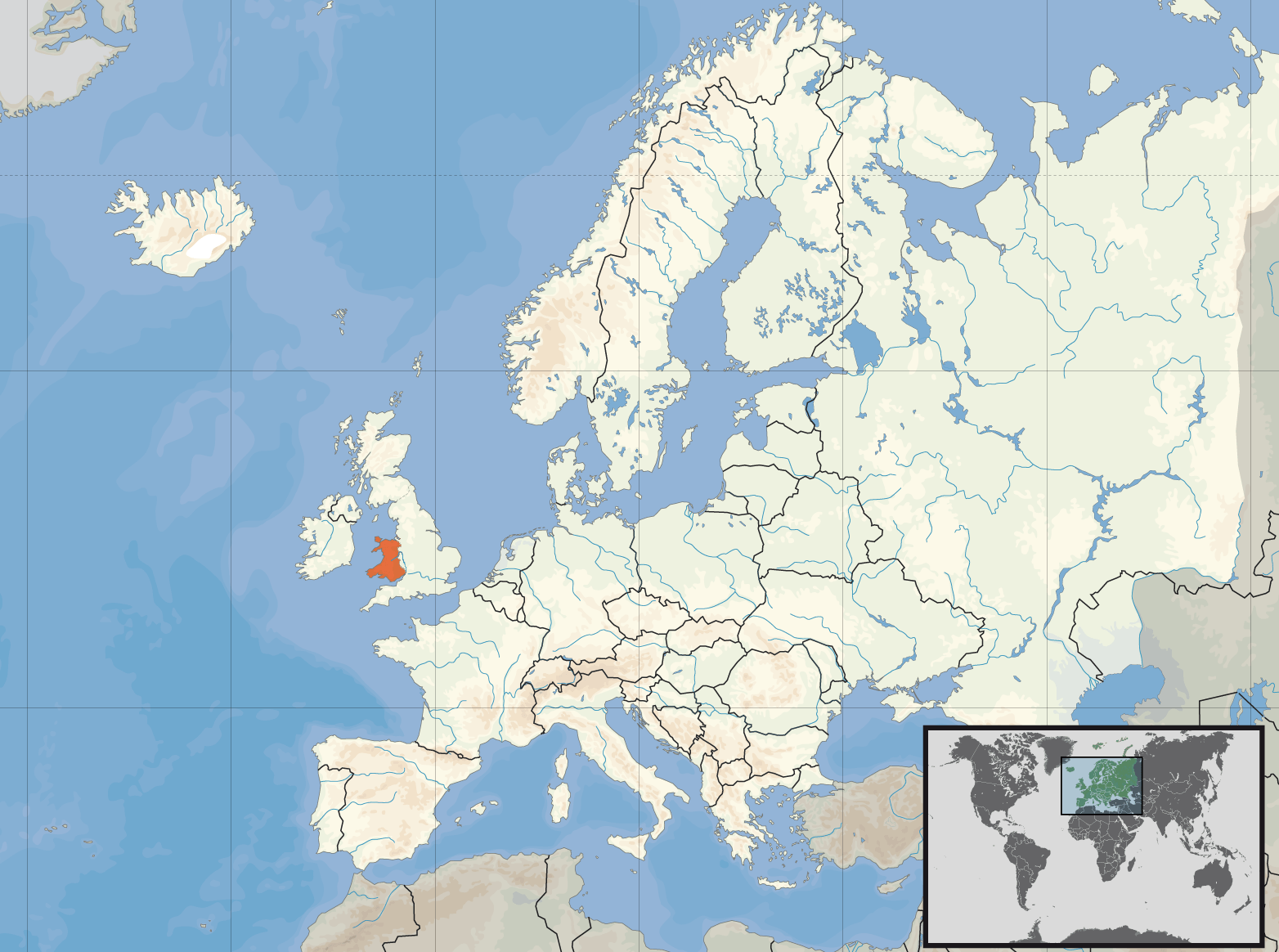
Macedonia Map Malta Map Moldova Map Monaco Map Montenegro Map Nagorno Karabakh Map Netherlands Map Northern Cyprus Map Norway Map Poland Map Portugal Map Romania Map San Marino Map Serbia Map Slovakia Map Slovenia Map South Ossetia Map Spain Map Sweden Map Switzerland Map Transnistria Map Turkey Map Ukraine Map United Kingdom Map Vatican Map Europe Map England Map Wales Map Scotland Map Abkhazia Map Akrotiri and Dhekelia Map Aland Islands Map Albania Map Andorra Map Armenia Map Austria Map Azerbaijan Map Belarus Map Belgium Map Bosnia and Herzegovina Map Bulgaria Map Croatia Map Cyprus Map Czech Republic Map Denmark Map Estonia Map Faroe Islands Map Finland Map France Map Georgia Map Germany Map Gibraltar Map Greece Map Guernsey Map Hungary Map Iceland Map Ireland Map Isle of Man Map Italy Map Jersey Map Kosovo Map Latvia Map Liechtenstein Map Lithuania Map Luxembourg Map

Europe Google Map, Street Views, Maps Directions, Satellite Images

worldmap1.com offers a collection of Europe map, google map, Europe atlas, political, physical, satellite view, country infos, cities map and more map of Europe.

World Top 20 Largest Countries by Population Map