Where is Ireland on the Map?
Explore the Emerald Isle with our detailed Ireland map! Discover picturesque villages, historic landmarks, and stunning natural wonders. Plan your next adventure today.
Ireland Map FQA
How many cities are in Ireland ?
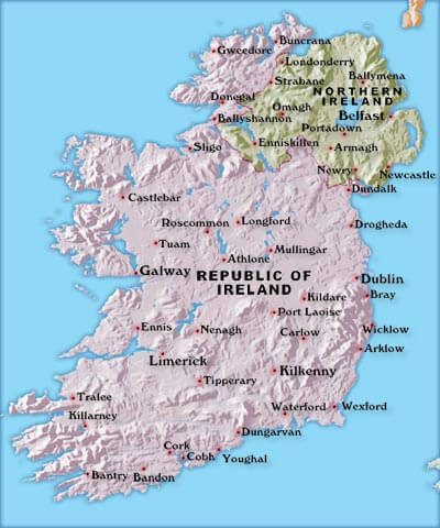
Ireland has about 40 cities and large towns. The 10 largest are: Dublin, Cork, Limerick, Galway, Waterford, Drogheda, Swords, Dundalk, Bray, and Navan.What are the major geographical features of Ireland ?
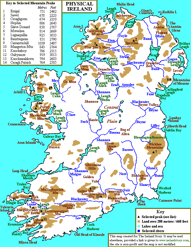
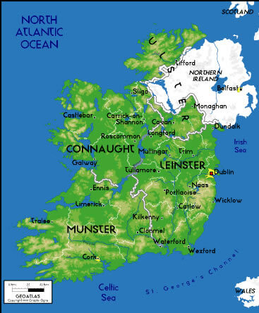
Ireland is an island in the North Atlantic with rolling plains, hills, and low mountains. It has many rivers, such as the Shannon, and coastal cliffs like the Cliffs of Moher. Lakes such as Lough Neagh are also notable features.MAP OF IRELAND
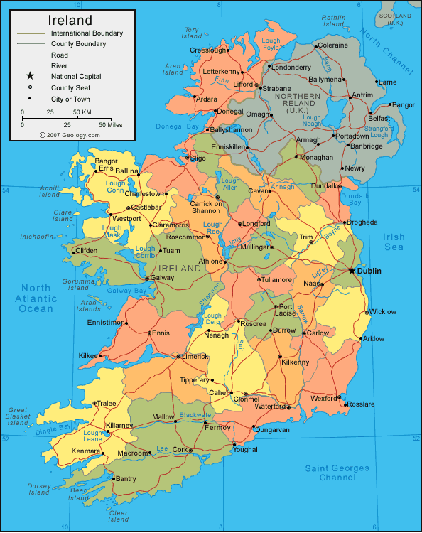
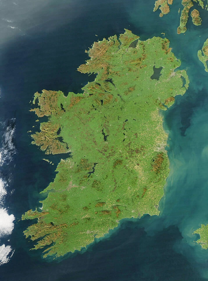
IRELAND SATELLITE IMAGE
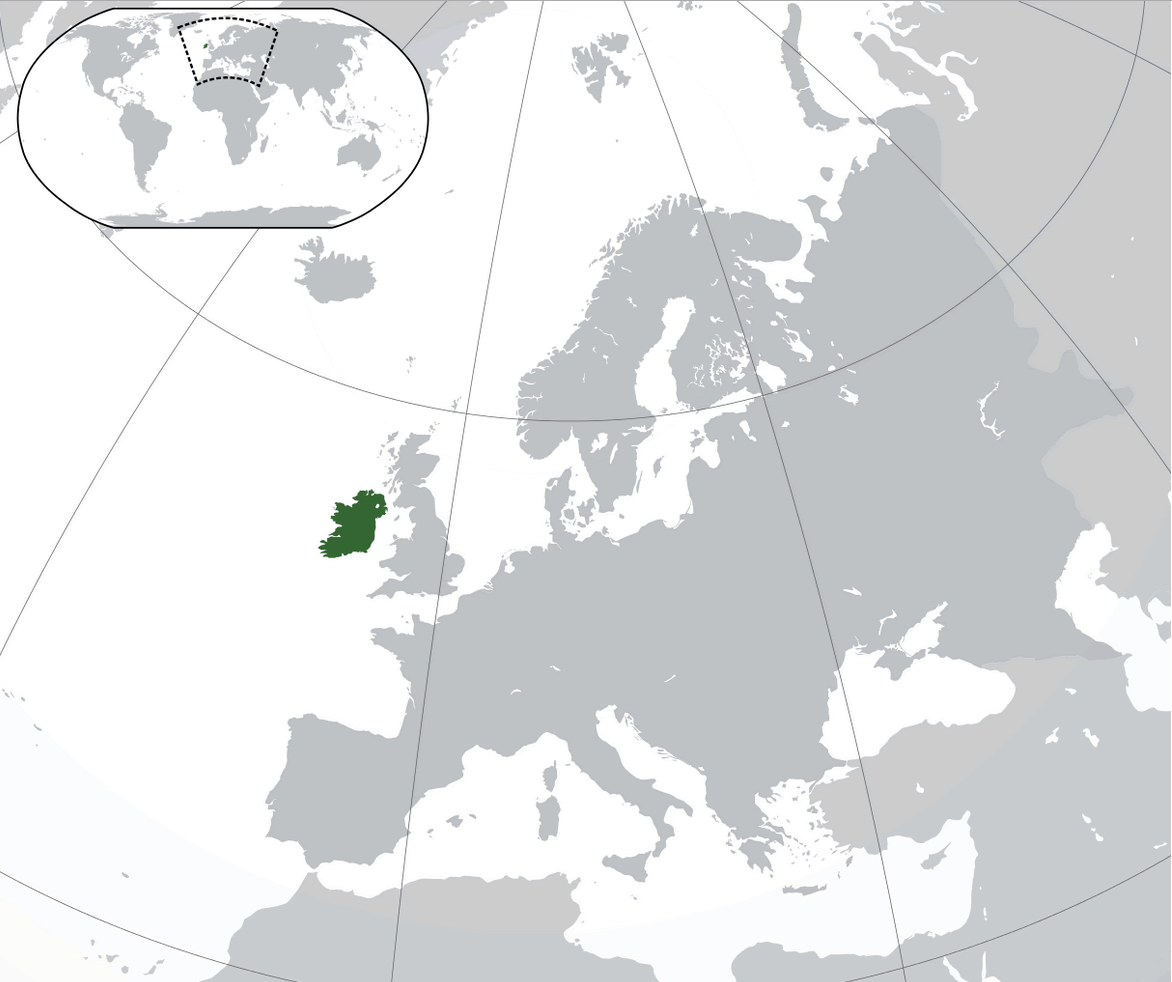
WHERE IS IRELAND IN THE WORLD
Can I download a high-resolution map of Ireland ?
Yes. Download high-resolution political and physical maps of Ireland for personal or educational use. Redistribution is subject to the terms of our license.Where is located Ireland on the Map
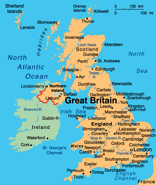
Ireland is an island nation located in northwestern Europe. It is situated to the west of Great Britain and is separated from it by the Irish Sea. The island of Ireland is divided into two political entities: the Republic of Ireland, which covers about five-sixths of the island, and Northern Ireland, which is part of the United Kingdom and covers the remaining one-sixth of the island.
Welcome to WorldMap1's Ireland map page, your ultimate guide to exploring the Emerald Isle! Ireland is a country with a rich history, stunning natural landscapes, and vibrant culture. Whether you're planning a trip to the bustling streets of Dublin, seeking the dramatic coastline of the Wild Atlantic Way, or visiting the ancient ruins of the Boyne Valley, our interactive map has got you covered. With detailed information on top attractions, hidden gems, and insider tips, our Ireland map is the perfect tool for planning your next adventure. So, pack your bags, grab your camera, and get ready to discover all the wonders that Ireland has to offer!
Belfast: Where Every Cobblestone Holds a Story
Please subscribe on "World Guide" channnel on Youtube at youtube.com/c/WorldGuide
Mapping the Majesty: A Deep Dive into the UK's Geographic Tapestry
The capital of Ireland is Dublin. Other main cities are Belfast, Cork, Galway, and Limerick. The country's population is around 7 million people.
Dublin is the Capital of Ireland, and the largest City in Ireland.
What are some facts about Ireland
- Area: 84,421 km2 (32,595 sq mi)
- Population: 7,026,636 (2022)
- Population Density: 77.8/km2 (201.5/sq mi)
- GDP (nominal): $382.754 billion (2018 est)
- GDP per capita: $78,335 (2018 est.)
- Religions:
Christianity 73
Islam
Jewish - Largest Cities:
Dublin
Cork
Galway
Limerick
Waterford
Drogheda
Dundalk
Belfast
Derry
Wexford
For more about Ireland >>
Brief information about Ireland
Ireland is an island nation located in northwestern Europe, and it is known as the Emerald Isle due to its lush green countryside. The country has a population of approximately 5 million people and is divided into two political entities: the Republic of Ireland, which covers about five-sixths of the island, and Northern Ireland, which is part of the United Kingdom.A Collection of Ireland Maps and Ireland Satellite Images
MAP OF IRELAND

IRELAND SATELLITE IMAGE

WHERE IS IRELAND IN THE WORLD

CITIES MAP OF IRELAND
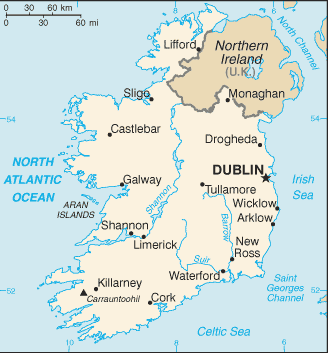
IRELAND CITIES MAP
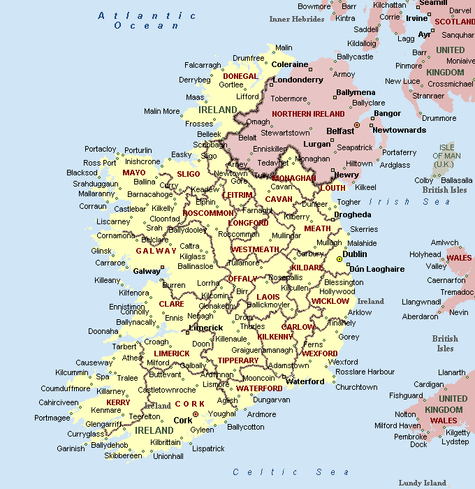
IRELAND MAP

IRELAND SATELLITE MAP
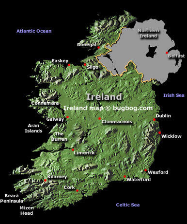
IRELAND CITIES MAP
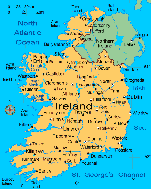
IRELAND MAP
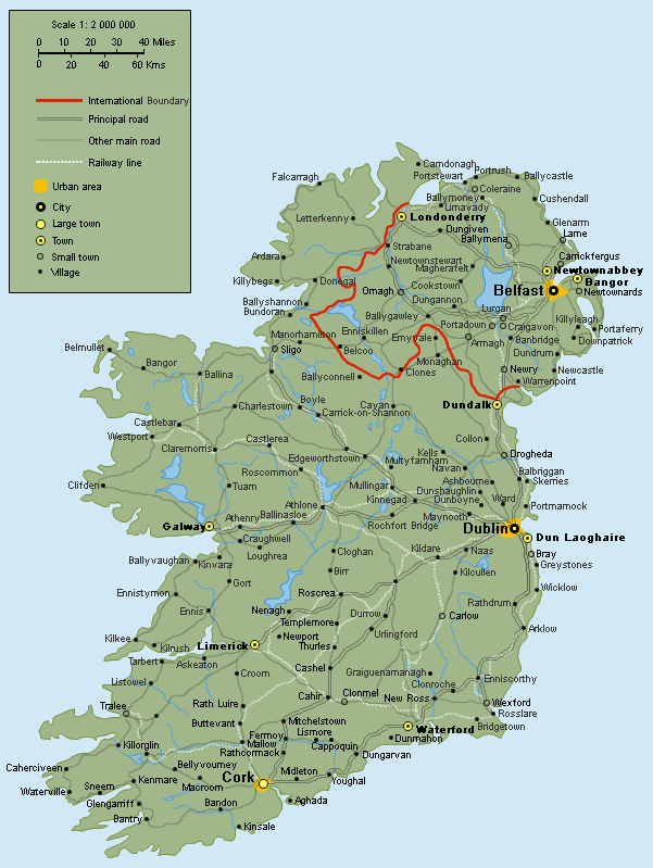
IRELAND MAP 1014
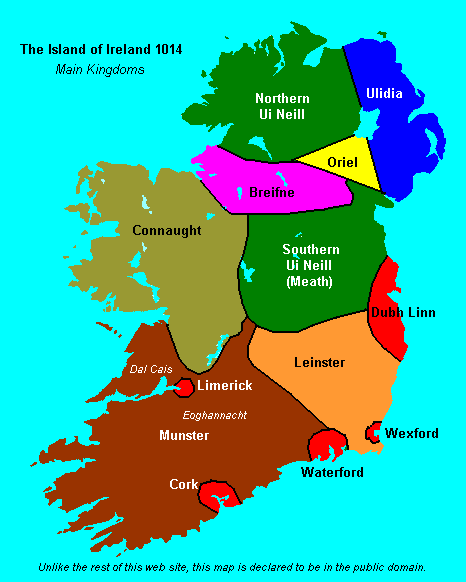
IRELAND MAP 650 AD
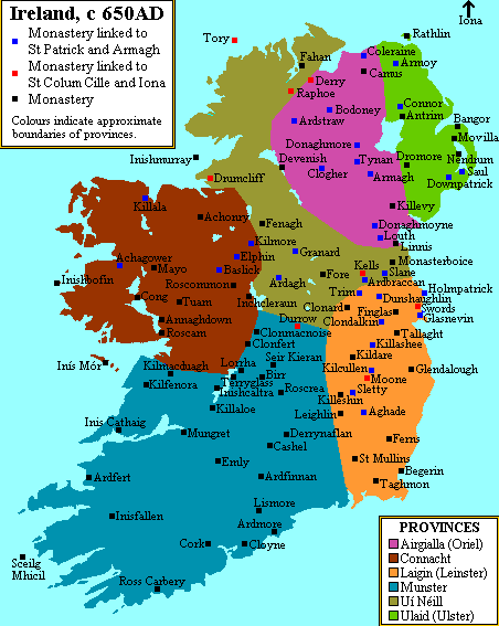
IRELAND MAP ICE AGE
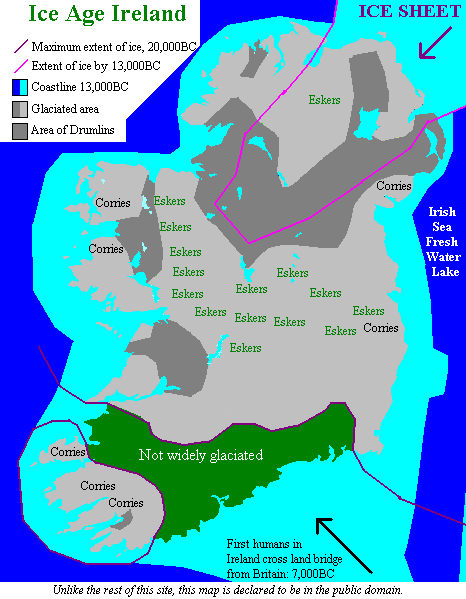
IRELAND MAP NORTHERN IRELAND
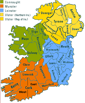
IRELAND MAP PROVINCES
IRELAND MAP UK
IRELAND PHYSICAL MAP
IRELAND POLITICAL MAP
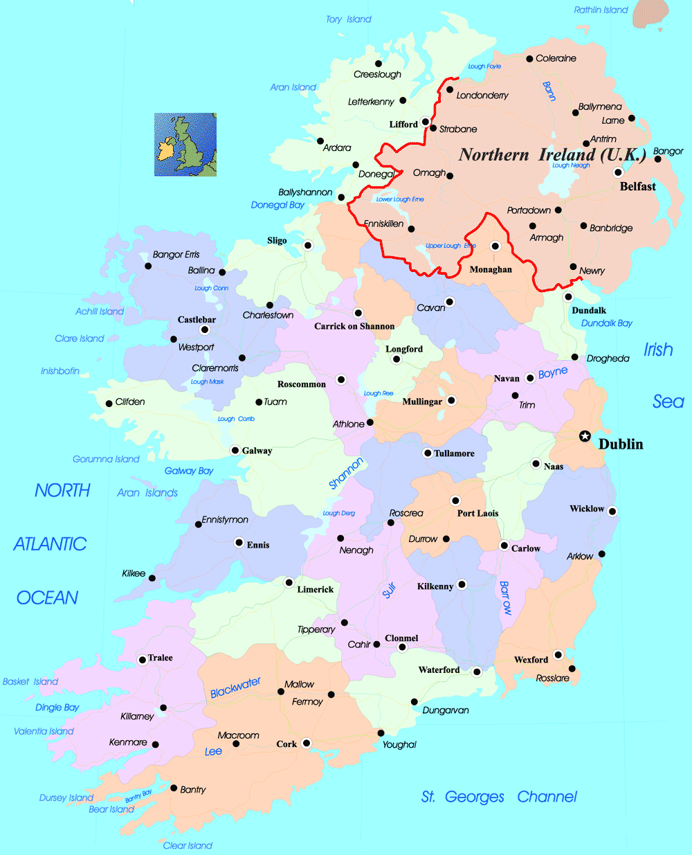
IRELAND REGIONS MAP
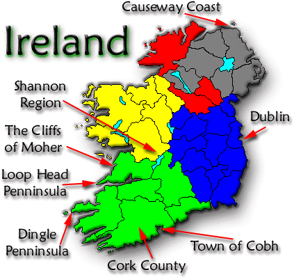
MAP OF IRELAND
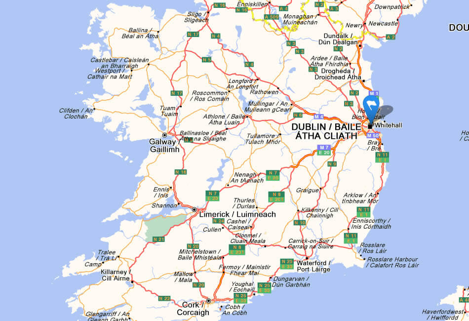
MAP OF IRELAND
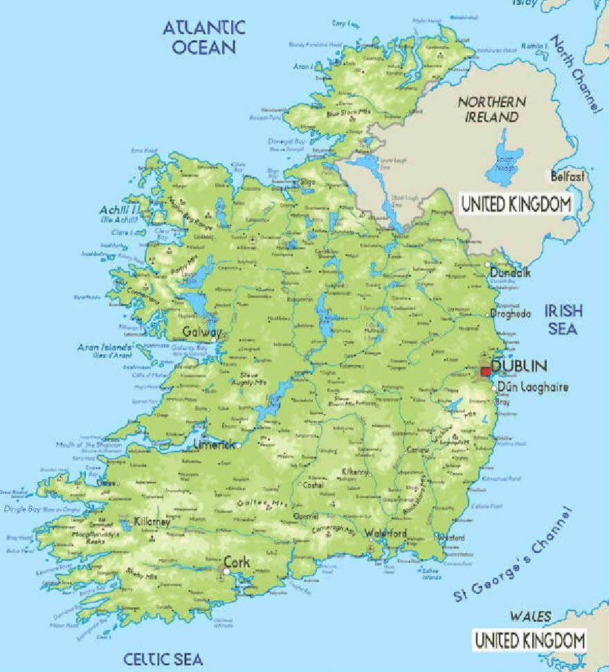
NORTHERN IRELAND MAP
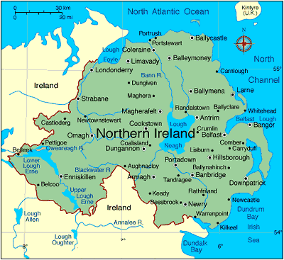
PHYSICAL IRELAND MAP
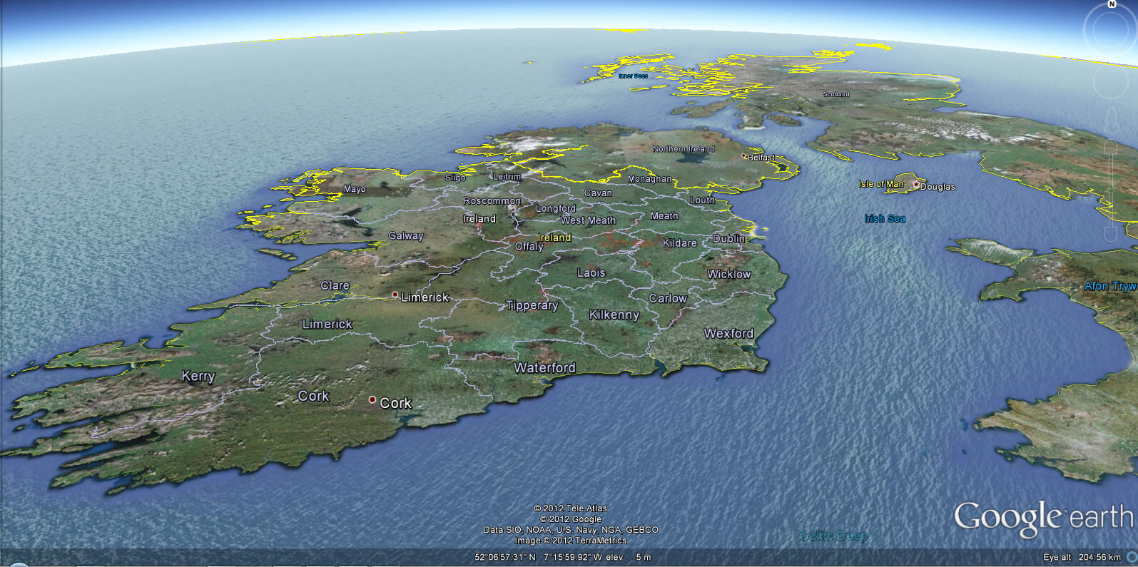
IRELAND EARTH MAP
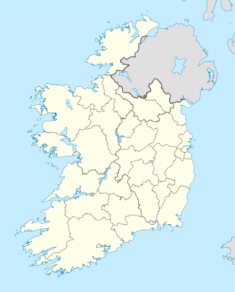
IRELAND PROVINCE BORDERS MAP
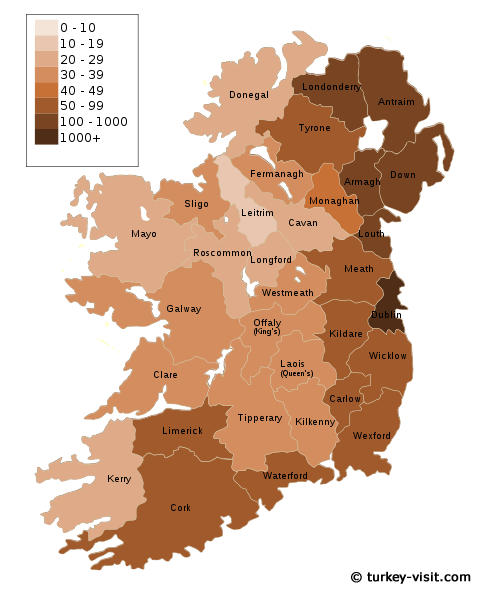
POPULATION DENSITY OF IRELAND MAP
- Head of Performance Marketing
- Head of SEO
- Linkedin Profile: linkedin.com/in/arifcagrici


