

Detailed EU Political Map
Countries, borders, capitals and major political divisions in a clear continental view.
View map →
Explore detailed political, physical, countries, cities, satellite, population, high-resolution, time-zone and historical maps of Europe. Start with our featured maps below, or choose a map type to quickly find the version that best matches your purpose.
 Explore a high-resolution Europe map showing Western, Eastern, Northern and Southern Europe, with countries, borders, major cities and geographic regions in clear detail. Ideal for education, travel, research and geographic reference.

Explore a detailed political map of Europe showing countries, international borders, major cities and political divisions across Western, Eastern, Northern and Southern Europe.

View Europe's major mountain ranges, plains, plateaus, rivers, lakes, coastlines and terrain in a detailed physical map designed for geography, education and reference.


Compare major time zones across Europe, including Western European, Central European and Eastern European Time, with regional boundaries and major cities.
What does a political map of Europe show? It shows countries, international borders, capitals, major cities, states, provinces and territories across the continent.
Countries, borders, capitals and major political divisions in a clear continental view.
View map →
See national boundaries and the locations of countries across Europe.
View map →
Locate countries together with capitals and major cities throughout the continent.
View map →What does a physical map of Europe show? It displays natural geography including mountains, rivers, lakes, plains, plateaus, terrain and elevation.

Study major mountains, rivers, lakes, plains and other natural features.
View map →

Explore countries, national borders, capitals, major cities, states, provinces and territories across countries and regions across Europe.


See countries together with important cities and regional geography.
View map →
A useful reference for geography, education and travel planning.
View map →Locate major cities, capitals, roads and transportation routes across Western, Eastern, Northern and Southern Europe.


Explore major cities together with key rivers and transportation networks.
View map →
What is a Europe satellite map? It uses imagery captured from space to show landscapes, terrain, forests, deserts, lakes, coastlines and other surface features.


High-resolution Europe maps provide greater detail for large screens, classrooms, presentations, research, design work and printing.

Detailed countries, cities and borders in a large-format map.
View map →
Detailed terrain, elevation and natural geography for closer viewing.
View map →
Compare standard time zones and regional time boundaries across Western, Eastern, Northern and Southern Europe.


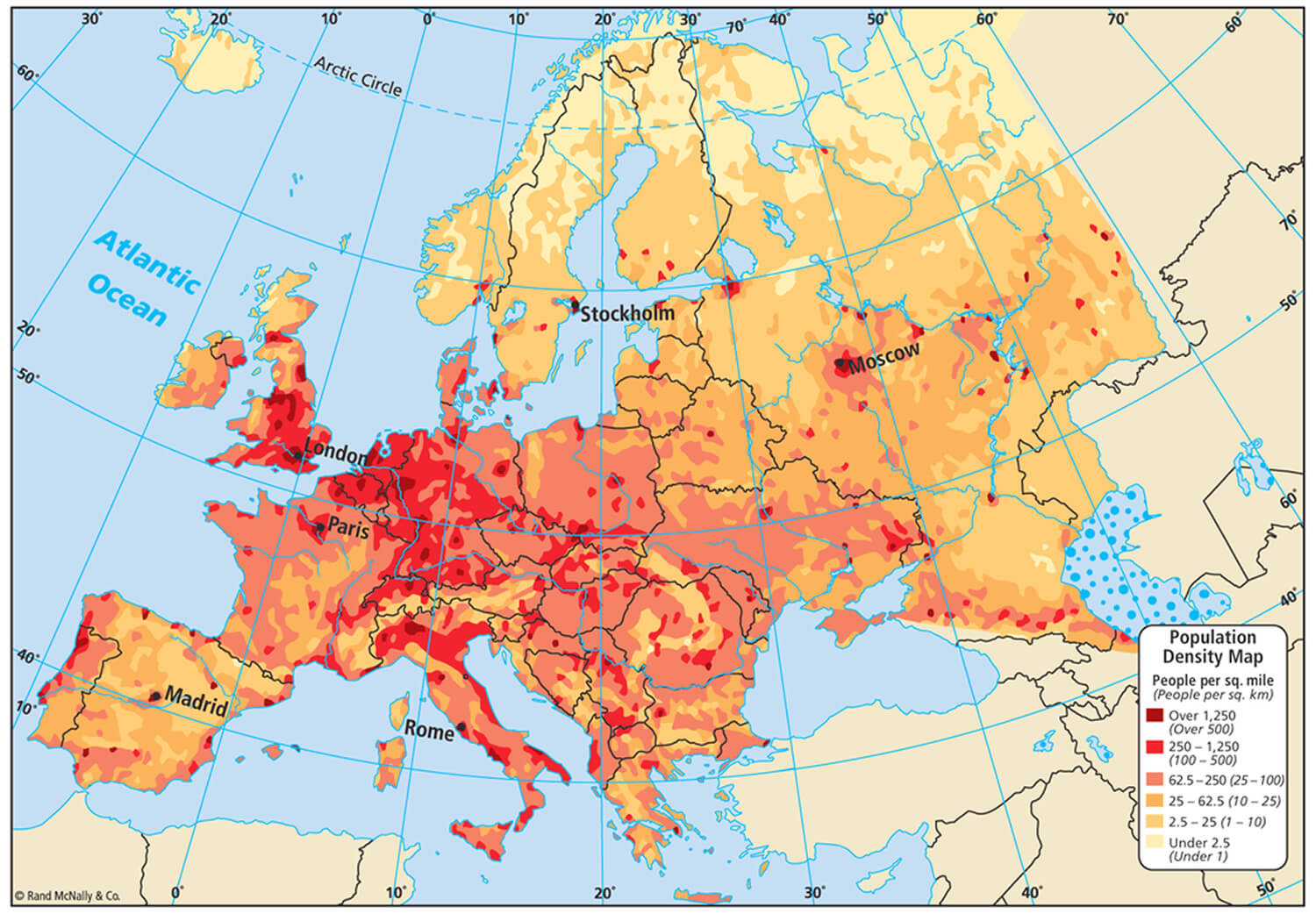
Explore population density, distribution and settlement patterns across Europe, from densely populated metropolitan areas to sparsely populated regions.
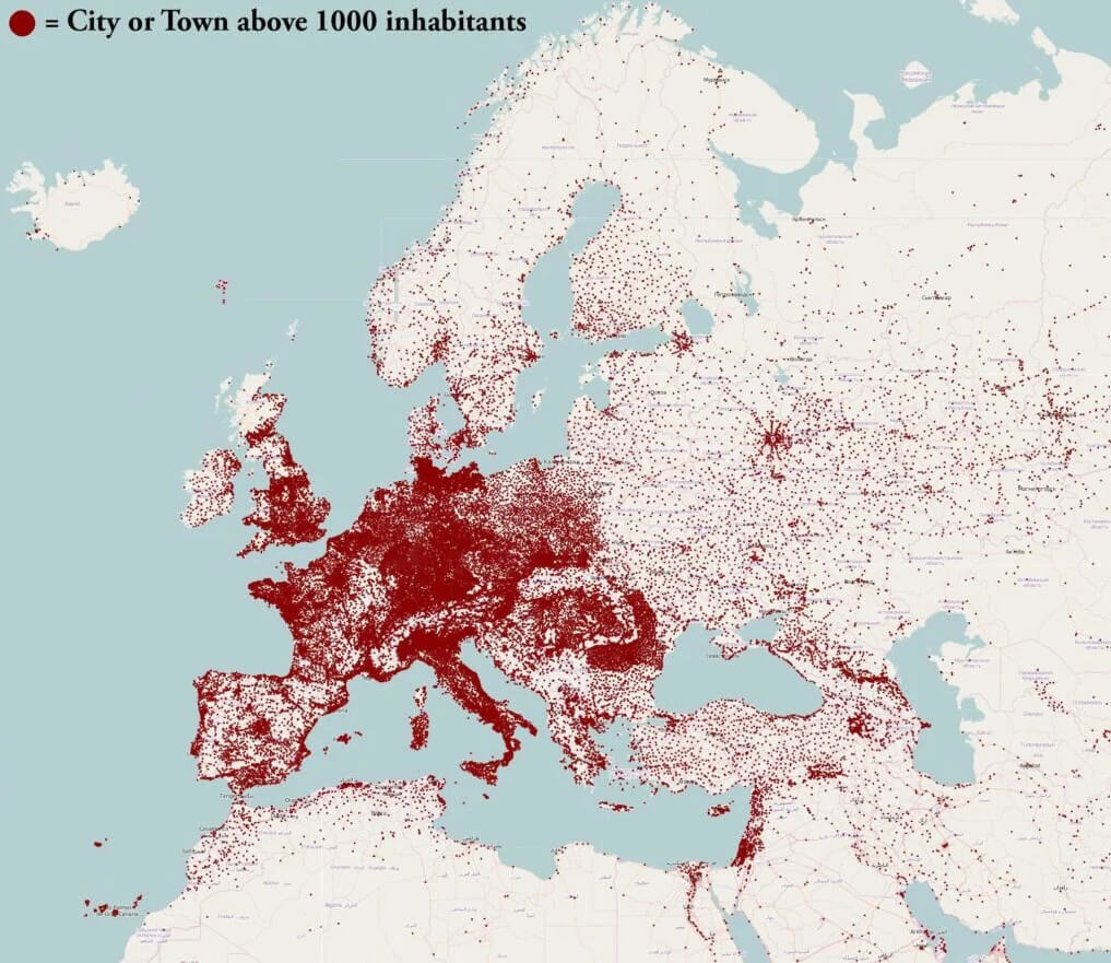

A detailed reference view of regional population density patterns.
View map →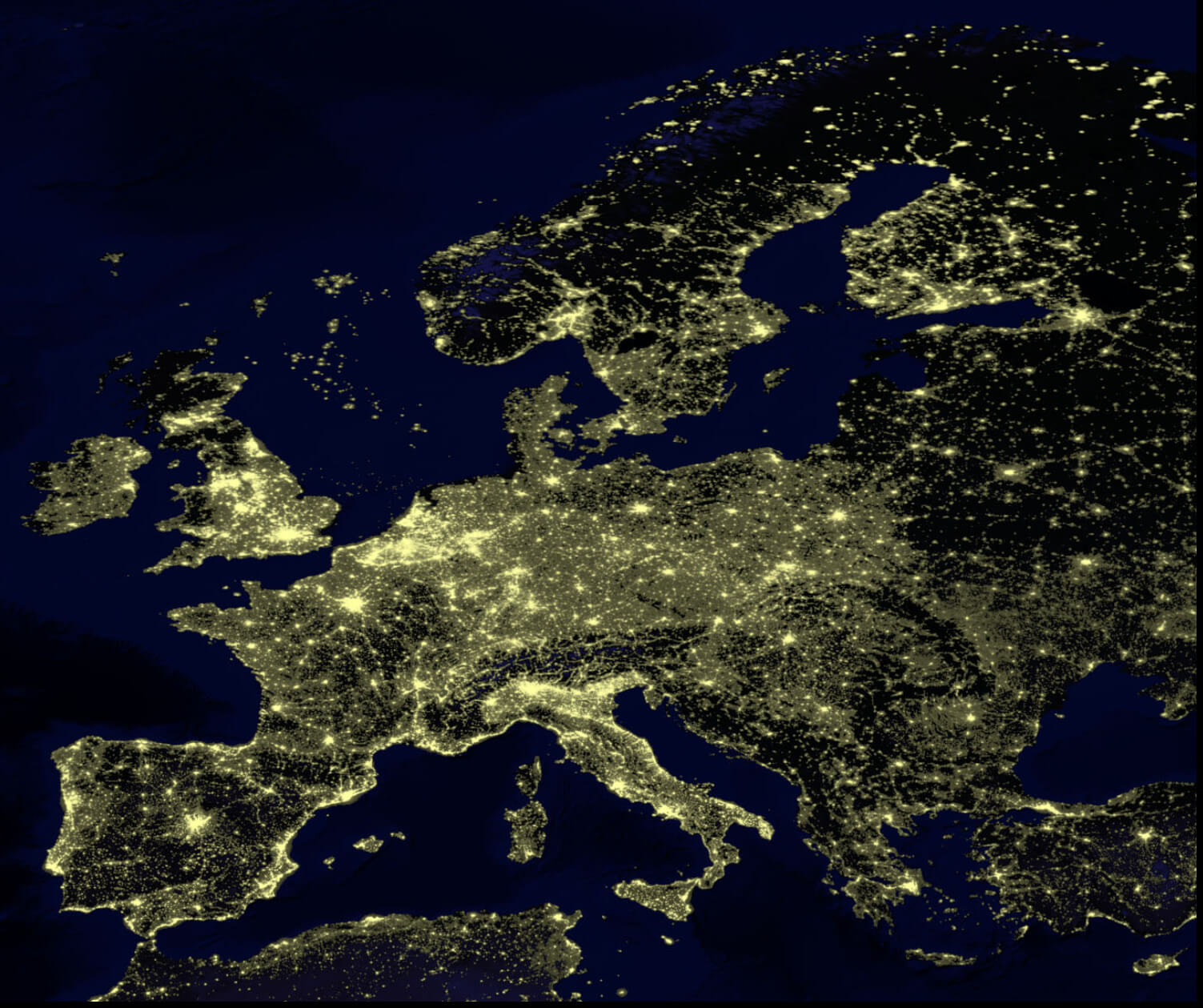
See where people are concentrated throughout the continent.
View map →Trace changing territories, borders, settlements, Indigenous regions and colonial landscapes across different periods of European history.


Europe's political borders, countries, and major territorial divisions following the unification of Germany.
View map →
The continent's changing borders, occupied territories, and major areas of conflict during the war.
View map →Looking for a specific country? Browse our complete collection of country maps organized by region and continent.
Choose the map type based on the information you want to see.
| If you want to… | Choose | Best for |
|---|---|---|
| See countries and borders | Political Map | Geography, political reference |
| Find countries and capitals | Countries Map | Study, travel, education |
| Find major urban centers | Cities Map | Travel, urban geography |
| Study mountains and rivers | Physical Map | Natural geography |
| See the continent from space | Satellite Map | Surface imagery |
| See more map detail | High-Resolution Map | Large screens and print |
| Compare regional time | Time Zone Map | Time-zone reference |
| Study settlement patterns | Population Map | Human geography |
| Explore past borders and territories | Historical Map | History and research |
Browse maps of major European countries and regions for a closer look at cities, borders, roads and physical geography.
Explore countries, cities, roads and geographic features across Western Europe.
Browse countries, cities, borders and physical geography across Eastern Europe.
Explore Northern European countries, cities and geographic features.
Explore Southern European countries, cities, coastlines and regions.
Browse EU member countries, borders, capitals and regions.
Explore major roads, highways and transport connections across Europe.
Quick geographic context for comparing different Europe map types.
A Europe map can show countries, borders, cities, states, provinces, roads, terrain, population, time zones or historical boundaries depending on the map type.
Europe maps commonly show Canada, the United States and Mexico, while broader regional maps may also include Greenland, Central America and the Caribbean.
A political map emphasizes countries, borders, states, provinces and cities, while a physical map emphasizes natural features such as mountains, rivers, lakes, plains and elevation.
High-resolution Europe maps are available in political, physical, terrain and satellite formats for closer viewing, education, presentations and reference.
A time zone map shows regional time boundaries and major zones such as Western European, Central European and Eastern European Time.
Population maps show where people are concentrated and help compare densely populated metropolitan areas with sparsely populated regions.
Historical maps can show changing borders, colonial territories, Indigenous regions, settlements and political landscapes from different periods.