Free Printable High Detailed United States Map with States
Please subscribe on "World Guide" channnel on Youtube at youtube.com/c/WorldGuide
Looking for detailed, high-resolution street maps of the United States? This high-quality Interstate Highway map gives a complete overview of major routes, making it an essential tool for planning road trips, navigating city routes or understanding the layout of the country's extensive road network. This US road map includes all major highways, state borders and major cities, so whether you're travelling cross-country or exploring locally, you'll have a clear path to follow.
Ideal for both travellers and educators, this printable USA road map combines clarity with comprehensive detail, making it perfect for wall displays, presentations or personal planning. With this high-resolution map, you can explore the United States from coast to coast, gaining insight into the major arteries that connect states and cities across the country. Whether you're a road-trip enthusiast or simply need an accurate reference, this map is your guide.
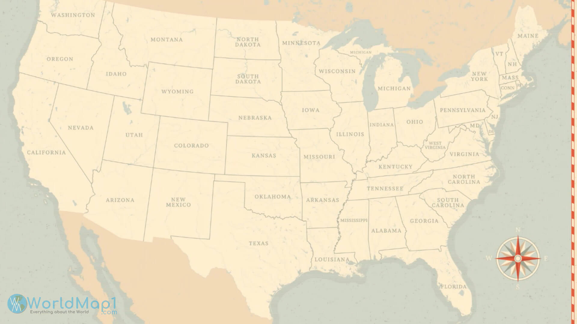
Colored Map of the United States
 Colored Map of the United States with abbreviated state letters
This color-coded map of the United States shows each state with its official abbreviation, providing a clear visual for recognizing states at a glance. The alternating colours help to differentiate between neighbouring states, improving readability and making it easier to quickly identify locations - perfect for educational or planning purposes.
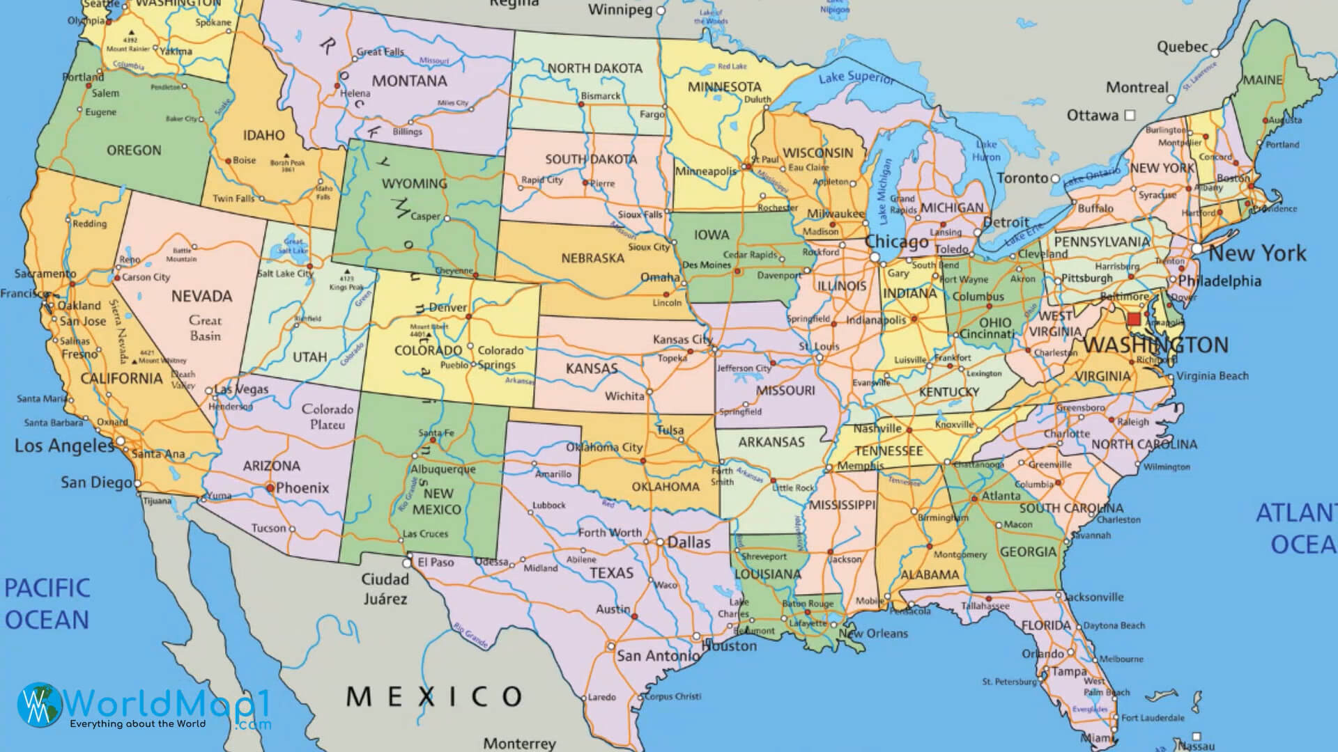
Detailed Colored Map of the United States with States and Interstate Roads
 Colored Map of the US with states and interstate roads
This comprehensive map of the United States is colour-coded by state and includes an extensive network of interstate highways, making it ideal for travel planning and educational purposes. With clear labelled major cities and roads, this map provides a detailed view of the country's connectivity and state boundaries, perfect for exploring the USA.
Colorful USA Map with States and Capital Cities
 Colorful USA Map with states and capital cities
This detailed, colorful map of the United States highlights each state and its capital, making it an excellent resource for geography study, travel planning, and educational purposes. With well-defined boundaries and labels, this map offers a vivid representation of the US states and their capitals, enhancing visual appeal and understanding.
Fragment of the Earth with High Relief US Map
 Fragment of the Earth with high relief map of the United States and North America.
This satellite image shows a stunning fragment of the Earth, highlighting North America and the United States with high-relief details. Visible landforms and natural features make it an immersive way to view the region from space, offering a sense of scale and topography that enhances geographic understanding and visual appeal.
Please view more USA Maps
High Detailed United States of America Road Map Large Color Map of the USA Free Printable United States Map with States The Map of The United States United States Earth Map and Satellite Images US Interstate Highway Map with Major Cities US Political Map with Capital Washington, Most Important Cities Rivers and Lakes
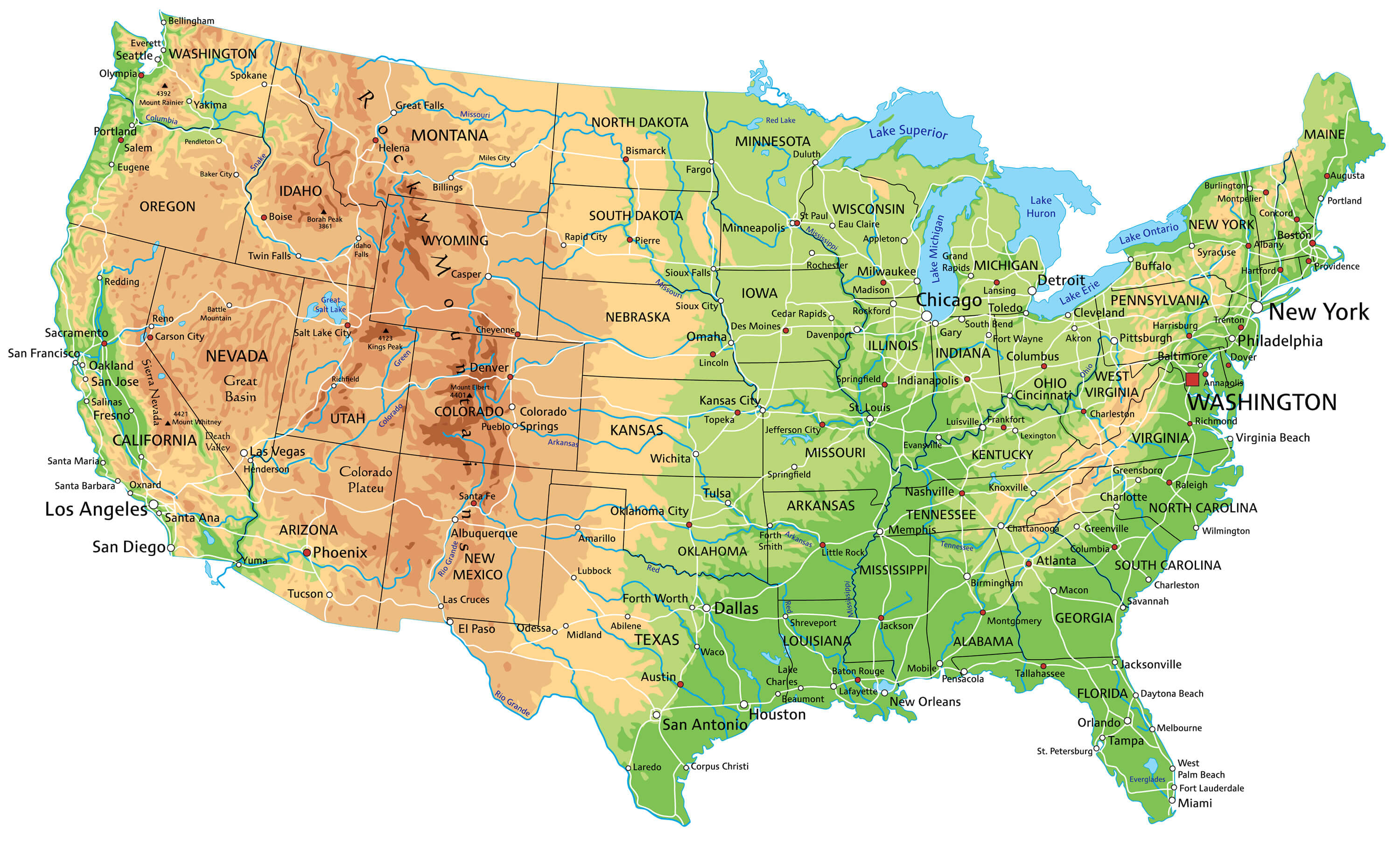
Free Printable United States Physical Map with States
 Detailed physical map of the United States showing states, rivers, and landforms.
This free printable physical map of the United States highlights each state with detailed geographic features like mountains, rivers, and plateaus. Ideal for educational purposes, it provides a visual understanding of the country's diverse topography, including the Rocky Mountains, Great Plains and coastal areas. Perfect for students and visitors alike.
Detailed the United States Map with rivers and highways
 Comprehensive map of the United States showing rivers and highways.
This detailed map of the United States highlights major rivers and highways, providing a clear overview of the country's water systems and transportation routes. Perfect for travellers, students and geography enthusiasts, it shows connections between states, including major highways and river routes. Ideal for planning trips or studying US geography.
United States Map with National Boundaries and State Borders
 The US Map with National Boundaries and State Borders
This vintage-style map of the United States highlights state and national boundaries, providing a clear overview of state divisions and neighbouring borders. Perfect for educational and decorative use, this map offers a historical aesthetic with a focus on state boundaries, making it a great addition to classrooms, offices or home decor.
Hand-Drawn United States Map Featuring All States
 Hand-drawn map of the United States showing all states and borders.
This hand-drawn style map of the United States shows each state with unique, detailed boundaries, providing an artistic and informal representation of the country. Perfect for use in creative projects, classrooms or décor, this map captures a customised, hand-crafted look while clearly displaying all state divisions, adding a touch of artistry to educational visuals.
Where is located the US on the World Map
 Map showing the location of the United States in North America.
This map highlights the United States on a global scale, showing its geographical location in North America. The map includes all US states in shades of blue for easy identification, with neighbouring Canada and Mexico also visible. An inset globe provides a zoomed-in view of the US in relation to the rest of the world, ideal for geographical context.
High Detailed Physical Map of the United States of America
 Detailed physical map of the United States with states and natural features.
This high-resolution physical map of the United States shows detailed natural features such as mountain ranges, rivers, lakes and plains in each state. Ideal for educational and reference use, this map provides a clear view of the diverse terrain of the USA and neighbouring Canada and Mexico for a complete geographical context.
High Detailed Road Map of the United States with Major Cities
 Detailed United States road map with major cities and interstate highways.
This comprehensive road map of the United States highlights major cities, highways and rivers in each state. With clear labelling of cities such as New York, Chicago and Los Angeles, this map is a valuable resource for planning road trips and exploring the country's vast network of highways and major routes. Perfect for travel or educational purposes.
High Detailed USA Interstate Road Map with State Capitals and Boundaries
 Detailed USA interstate road map showing state capitals and boundaries.
This detailed map of the United States shows interstate highways, state capitals, and boundaries. States are clearly outlined, with capitals marked for easy reference. The interstate network connects major cities nationwide. Great for trip planning, education, or reference, this map provides a comprehensive view of U.S. roadways and political divisions.
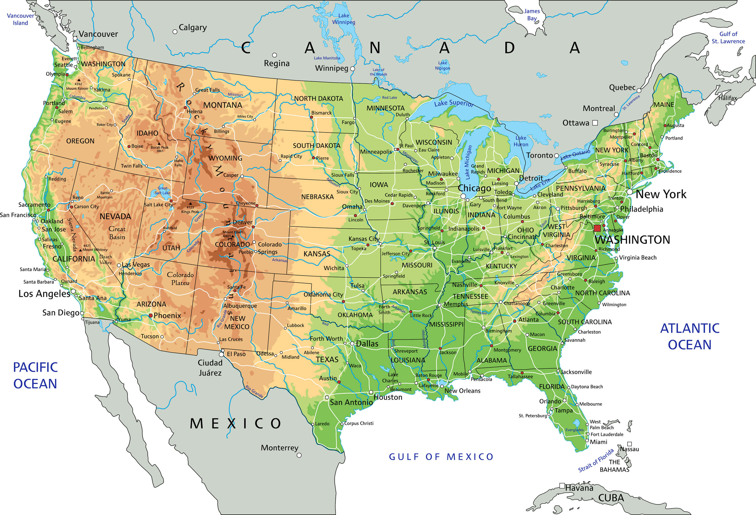
High Resolution United States Physical Map with Geographic Features
 High resolution physical map of the United States with geographic features and major cities.
This high-resolution physical map of the United States depicts the country's diverse geography, from mountain ranges and deserts in the west to lush green regions in the east. Major cities, rivers and other natural features are clearly marked, making it an excellent resource for educational purposes, travel planning or geographical reference.
Highly Detailed Map of United States with Cities Roads Railways
 Highly detailed map of the United States showing cities, roads, and railways.
This comprehensive map of the United States is rich in detail, highlighting major cities, roads and rail networks throughout the country. With an emphasis on transportation routes and urban centres, this map is an ideal resource for travellers, geography enthusiasts or anyone interested in exploring the connectivity of the USA.
More United States Maps, and US Images from Space


