Free Printable United States Map with States
Printable United State Map with State Names, Northern US States and Canada Satellite Map, Physical Features Map of the United States, Political Map of USA with State Names, Printable Blank Map of the United States, Satellite Map of the United States, Satellite Map of USA and Neighboring Countries, Printable United States Metro Cities Map, and more maps, satellite images...
Printable US map with state names and major cities labeled.This printable map of the United States shows all 50 states with names and major cities clearly marked. The colourful design makes it easy to identify states and locate important cities, making it ideal for educational purposes, travel planning or as a visual reference for learning US geography.
Looking for a clear and detailed United States map? This page offers a free large printable map of the United States, complete with state names, major cities, and boundaries. Perfect for students, teachers, or anyone planning a trip across the country, these printable US maps provide a convenient way to explore or study the layout of the 50 states. Whether you need a printable color United States map or a map of the United States with clearly marked cities, you’ll find the right option here to fit your needs.
This free USA map with states and cities is easy to download and print, making it ideal for classroom or personal use. With options that range from basic state outlines to detailed maps showing major cities, these maps of the United States are versatile and accessible for any purpose. Dive into the geography of America and enhance your learning with a printable United States map that brings the country's landscape into clear focus. 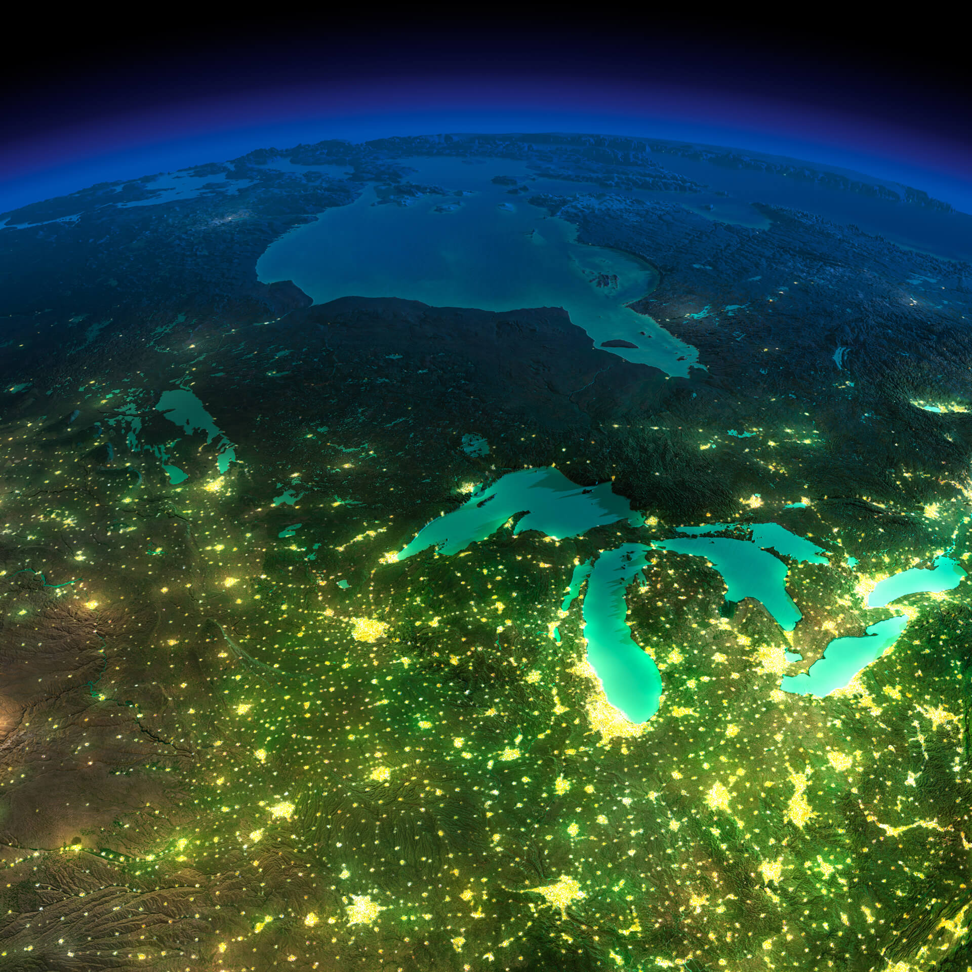
Northern US and Canada satellite map showing city lights at night.
This satellite image shows the northern United States and parts of Canada at night, with city lights illuminating urban areas around the Great Lakes. The glowing clusters of cities highlight population centres, creating a striking view of the US state's and Canada's territories geography and urban distribution from space.
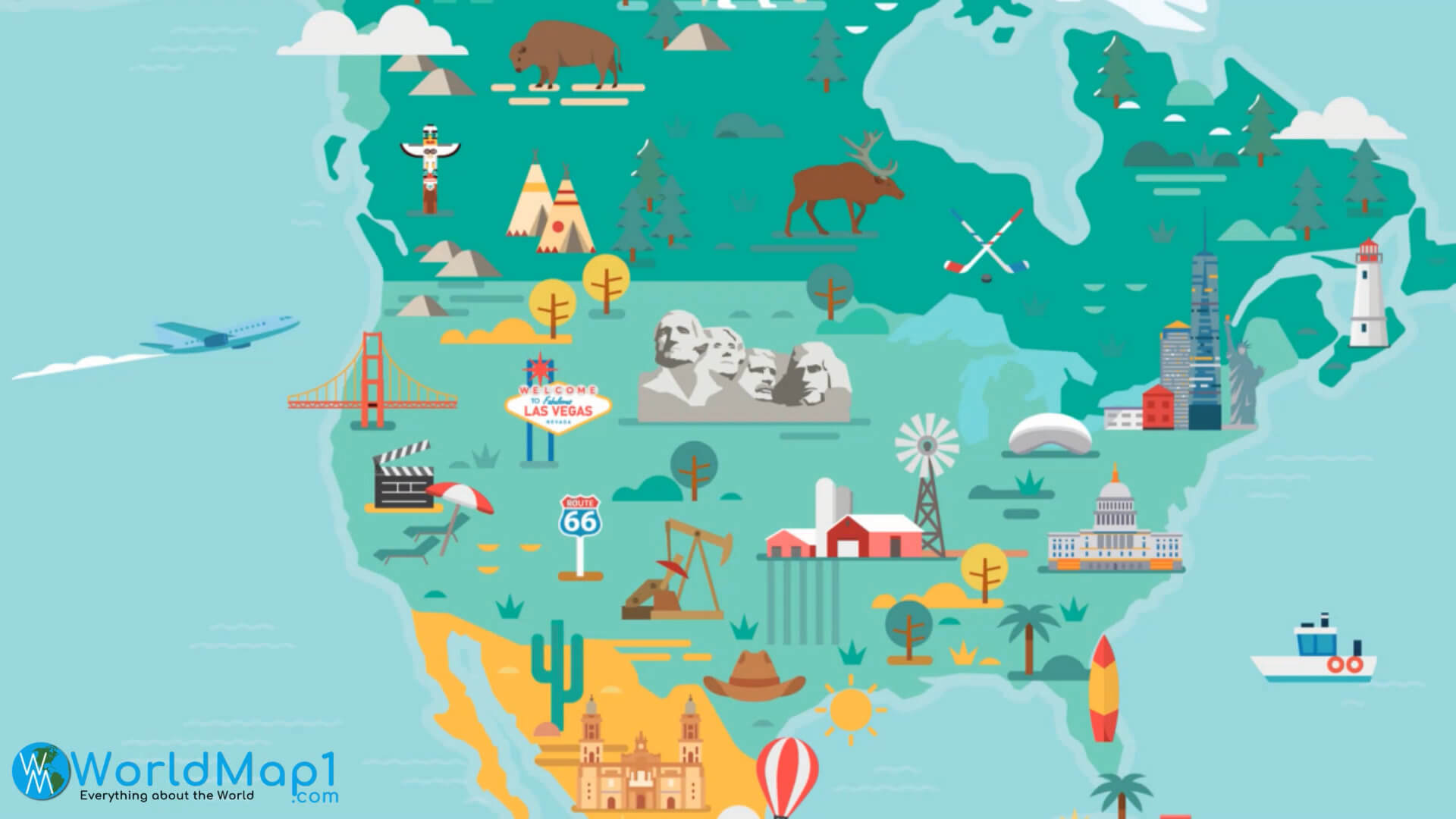
Illustrated US travel map showing landmarks and famous attractions.
This illustrated travel map of the United States highlights popular landmarks and cultural icons across the nation, including the Statue of Liberty, Mt. Rushmore, the Golden Gate Bridge, and Route 66. It's designed to inspire travel and showcase the country's diverse attractions and regions in a visually stunning way.

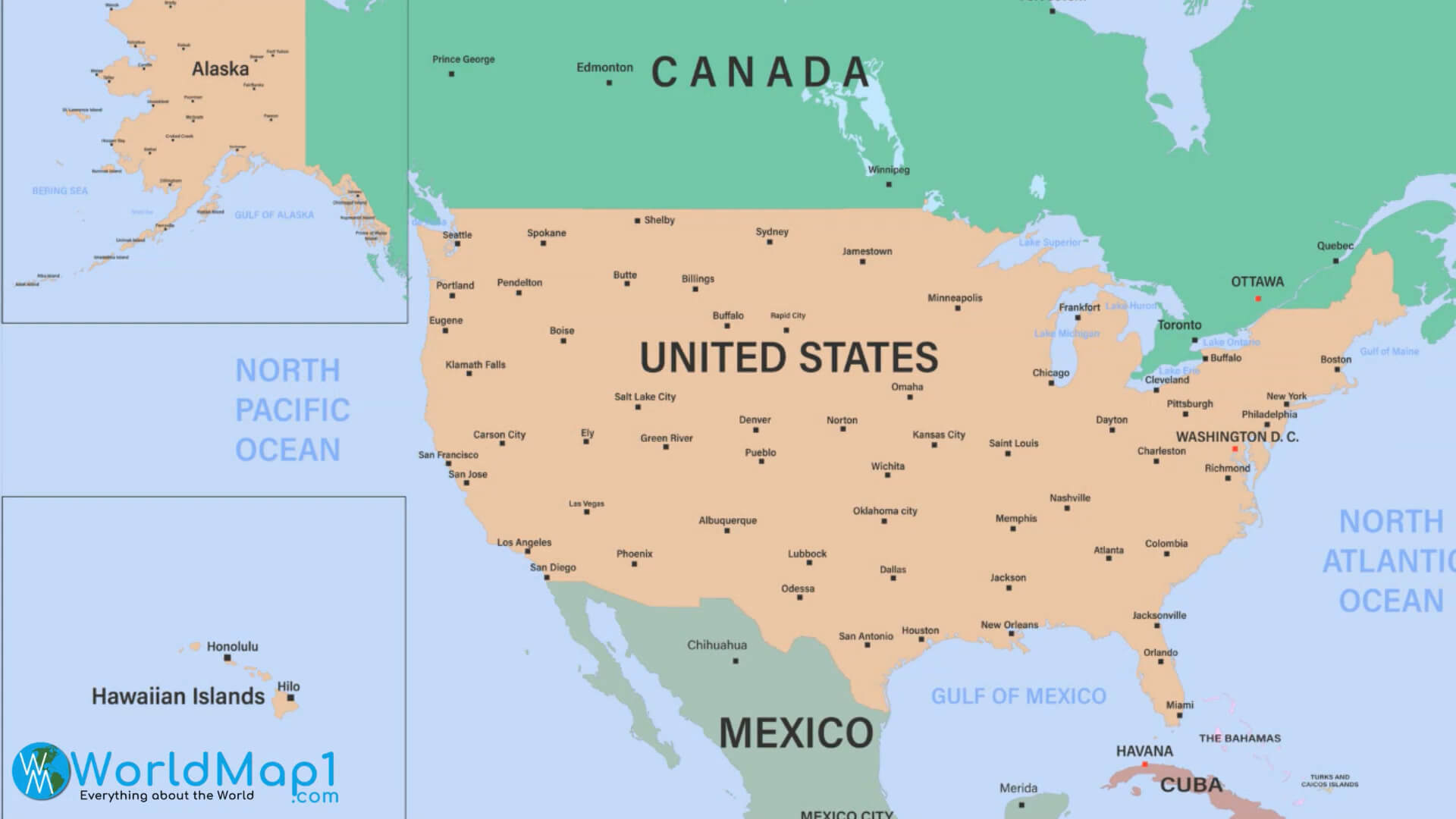
Political map of USA with state names and borders.
This political map of the United States shows all 50 states with clearly labeled names and borders. It provides a clear view of the country’s layout, ideal for educational, reference, or travel planning purposes. The map also includes Alaska and Hawaii in insets for a complete representation of the USA.

Printable Blank Map of the United States
Map of US States with Abbreviated Letters for Quick Reference.
This minimalist map of the United States shows each state by its two-letter postal abbreviation, providing a quick-reference layout ideal for study or visual clarity. Its simple design makes it perfect for educational materials, quizzes, or as a stylish infographic on US geography.

Printable US map with state names and major cities in vibrant colors.
This printable map of the United States displays all 50 states by name, and includes major cities throughout the country. The vibrant colour scheme makes it easy to distinguish each state, making it ideal for educational purposes, geography studies or travel planners. Perfect for the classroom or as a visual guide to US geography.
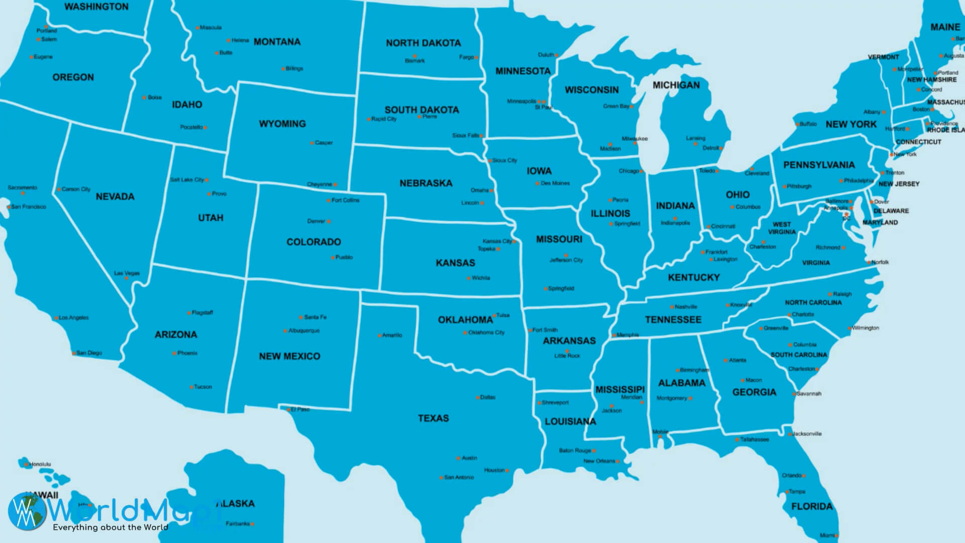
Printable US map with state names and capitals in blue color scheme.
This printable map of the United States shows each state with its name and capital city, presented in a clean blue colour scheme. Ideal for educational and reference purposes, it provides an easy-to-read layout for learning the locations of states and capitals across the country. Perfect for classroom or home use.
Printable US map showing major metropolitan cities and regions
This printable map of the United States highlights the major metropolitan areas of the country, allowing for a clear view of the major urban centers. It's ideal for understanding the distribution of metropolitan areas in the US, making it useful for educational, travel or demographic reference purposes. Inset maps include Alaska and Hawaii for comprehensive coverage.

Simple US Map with State Names for Easy Reference.
This straightforward map of the United States shows all 50 states with names in a clean, green color scheme. Ideal for educational and reference purposes, it offers a simple layout for quickly locating and identifying states. Perfect for classrooms, study materials or general geographic reference.

Satellite view of the United States with detailed landscape features.
This stunning satellite map captures the United States from space, showing natural landscapes, mountain ranges and coastlines in amazing detail. It provides a unique perspective on the country, highlighting geographical features and weather patterns. Ideal for education, geography and space enthusiasts.

Satellite Map of the United States from space at night with city lights visible.
This satellite map captures the United States at night, highlighting the vibrant city lights across the country. The illuminated areas reveal major urban centres, creating a striking visual of population density and infrastructure. This image offers a unique, captivating perspective for geography and astronomy enthusiasts.

Satellite Map of the USA showcasing landscape and geographical features
This satellite map provides a comprehensive view of the United States, highlighting key geographical features such as mountain ranges, rivers and coastlines. This visual provides an insightful look at the natural terrain, making it an excellent resource for geography enthusiasts and educators.

Satellite Map of USA and Neighboring Countries with Detailed Terrain
This satellite map provides a high-resolution view of the United States and neighboring countries, showcasing the diverse terrain from the mountainous West to the plains and the Great Lakes region. The detailed visualization is ideal for understanding the geographic and topographic diversity of North America.
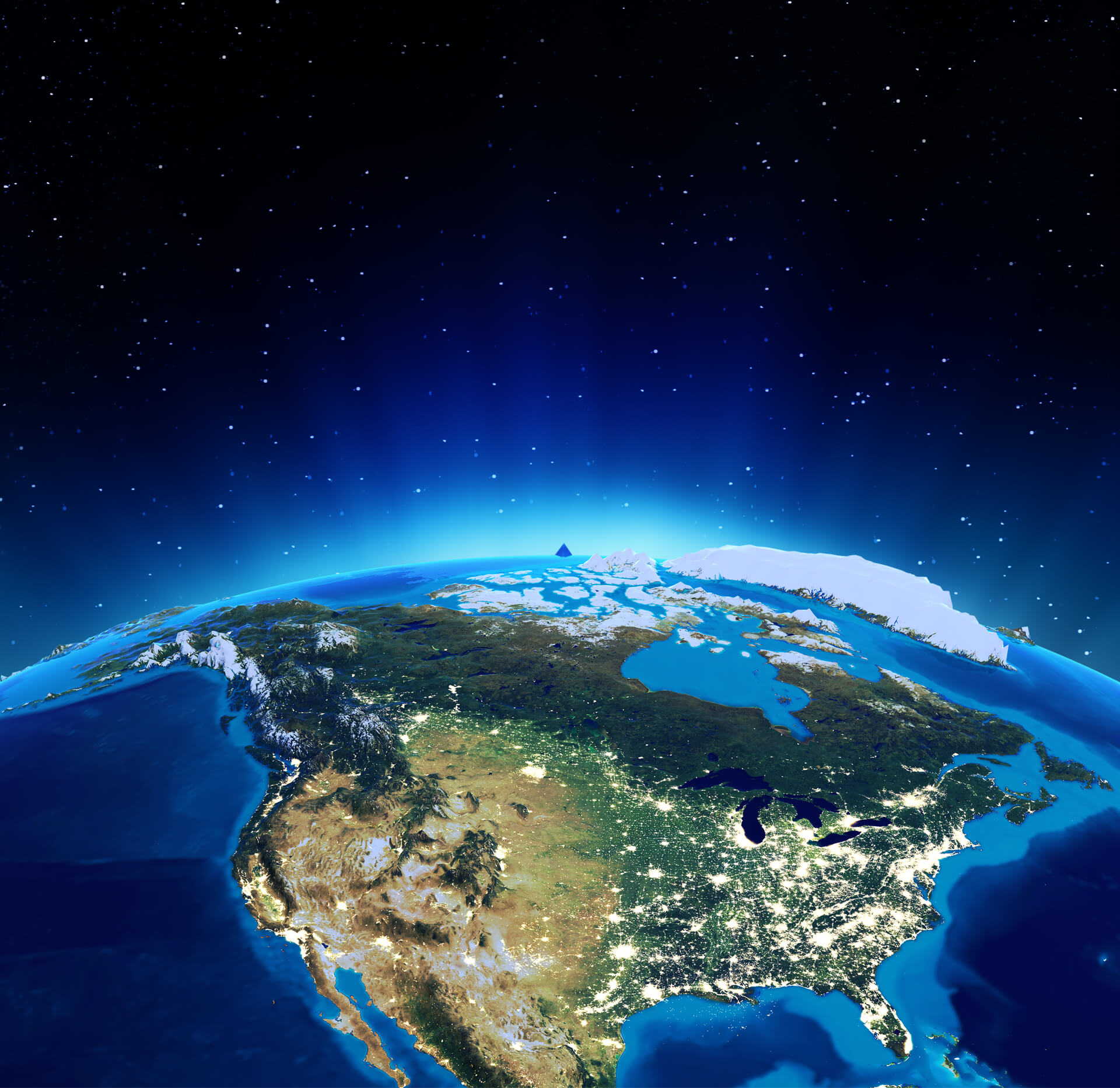
Satellite Map of USA and North America at Night with City Lights Visible.
This breathtaking satellite image captures the United States and North America from space, showing the continent's illuminated cities against the night sky. The view highlights geographic features, including mountain ranges and the Great Lakes, and highlights urban areas glowing under the stars.
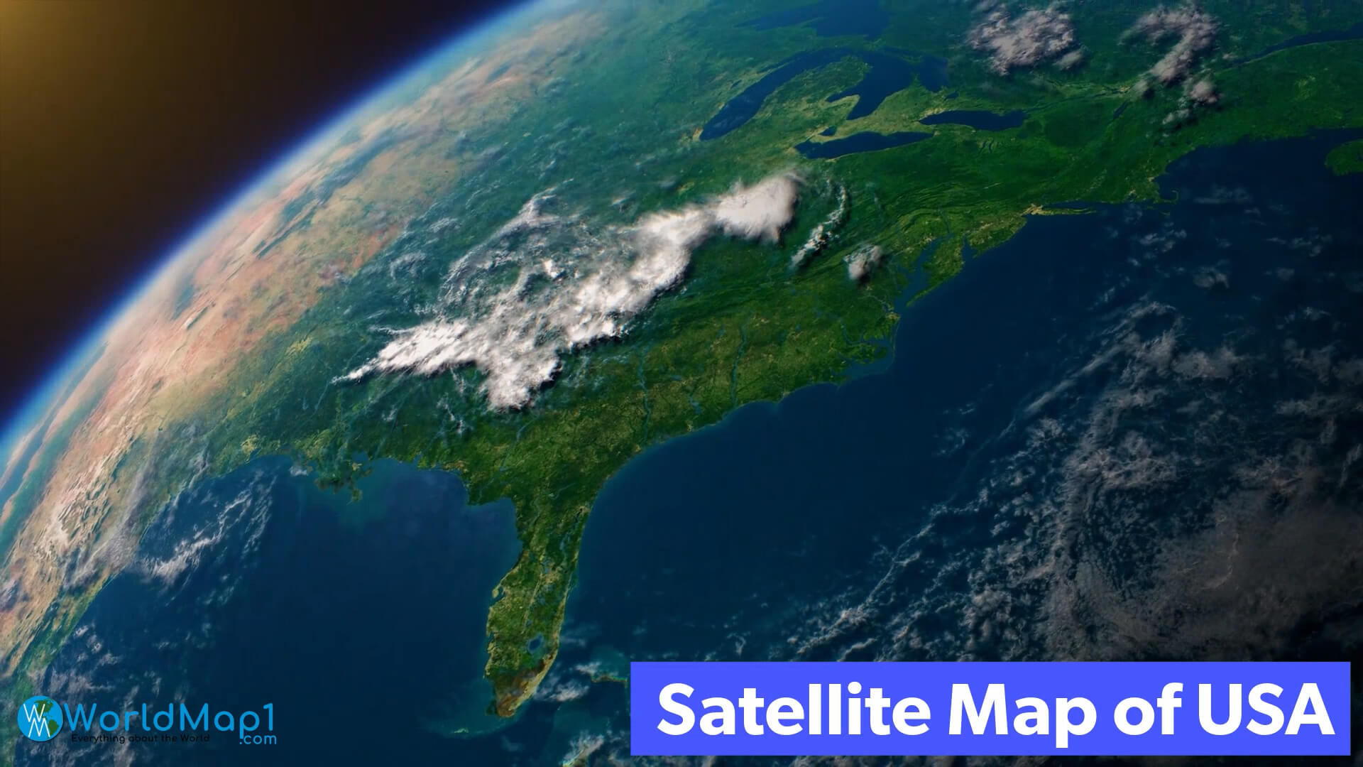
Satellite Map of USA, Florida, East Coast, and Atlantic Ocean from Space.
This satellite image shows the southeastern United States, highlighting Florida, the east coast and the surrounding Atlantic Ocean. Captured from space, the view shows cloud patterns over the landscape, with detailed topography of the eastern region and coastal areas.
This free USA map with states and cities is easy to download and print, making it ideal for classroom or personal use. With options that range from basic state outlines to detailed maps showing major cities, these maps of the United States are versatile and accessible for any purpose. Dive into the geography of America and enhance your learning with a printable United States map that brings the country's landscape into clear focus.
Free Printable High Detailed United States Map with States
Please subscribe on "World Guide" channnel on Youtube at youtube.com/c/WorldGuide
Northern US States and Canada Satellite Map at Night

Northern US and Canada satellite map showing city lights at night.
Illustrated US Travel Map with Iconic Landmarks and Attractions

Illustrated US travel map showing landmarks and famous attractions.
Political Map of USA with State Names

Political map of USA with state names and borders.
Printable Blank Map of the United States

Printable Blank Map of the United States
Please view more USA Maps
High Detailed United States of America Road Map Large Color Map of the USA Free Printable United States Map with States The Map of The United States United States Earth Map and Satellite Images US Interstate Highway Map with Major Cities US Political Map with Capital Washington, Most Important Cities Rivers and LakesPrintable US Map with States Labeled by two-letter Abbreviations

Map of US States with Abbreviated Letters for Quick Reference.
Colorful Printable United States Map with State Names and Major Cities

Printable US map with state names and major cities in vibrant colors.
Printable United States Map with State Names and Capitals

Printable US map with state names and capitals in blue color scheme.
Printable United States Metro Cities Map

Printable US map showing major metropolitan cities and regions
Printable US Map with State Names

Simple US Map with State Names for Easy Reference.
Satellite Map of the United States at Day Time

Satellite view of the United States with detailed landscape features.
Satellite Map of the US at Night Time

Satellite Map of the United States from space at night with city lights visible.
Detailed Satellite View of the USA and Surrounding Areas

Satellite Map of the USA showcasing landscape and geographical features
Satellite Map of USA and Neighboring Countries

Satellite Map of USA and Neighboring Countries with Detailed Terrain
Satellite Map of USA and North America

Satellite Map of USA and North America at Night with City Lights Visible.
Satellite Map of USA with Florida and East Coast View from Space

Satellite Map of USA, Florida, East Coast, and Atlantic Ocean from Space.
More United States Maps, and US Images from Space
- Head of Performance Marketing
- Head of SEO
- Linkedin Profile: linkedin.com/in/arifcagrici
Address: Hakarinne 2 Espoo, 02100 Uusimaa - Finland
Email: [email protected]
Phone: +358 44 230 0982
Worldmap1.com Blog
Email: [email protected]
Phone: +358 44 230 0982
Worldmap1.com Blog
Copyright WorldMap1.com 2004 - 2025. All rights reserved. Privacy Policy | Disclaimer
