Tapiola Where Located A Jewel Within Espoo, Finland
Geographic Location and Map: Tapiola, often regarded as the "Garden City," is a prominent district within Espoo, Finland. Located just west of Helsinki, Tapiola is bordered by the districts of Otaniemi, Westend, and Leppävaara.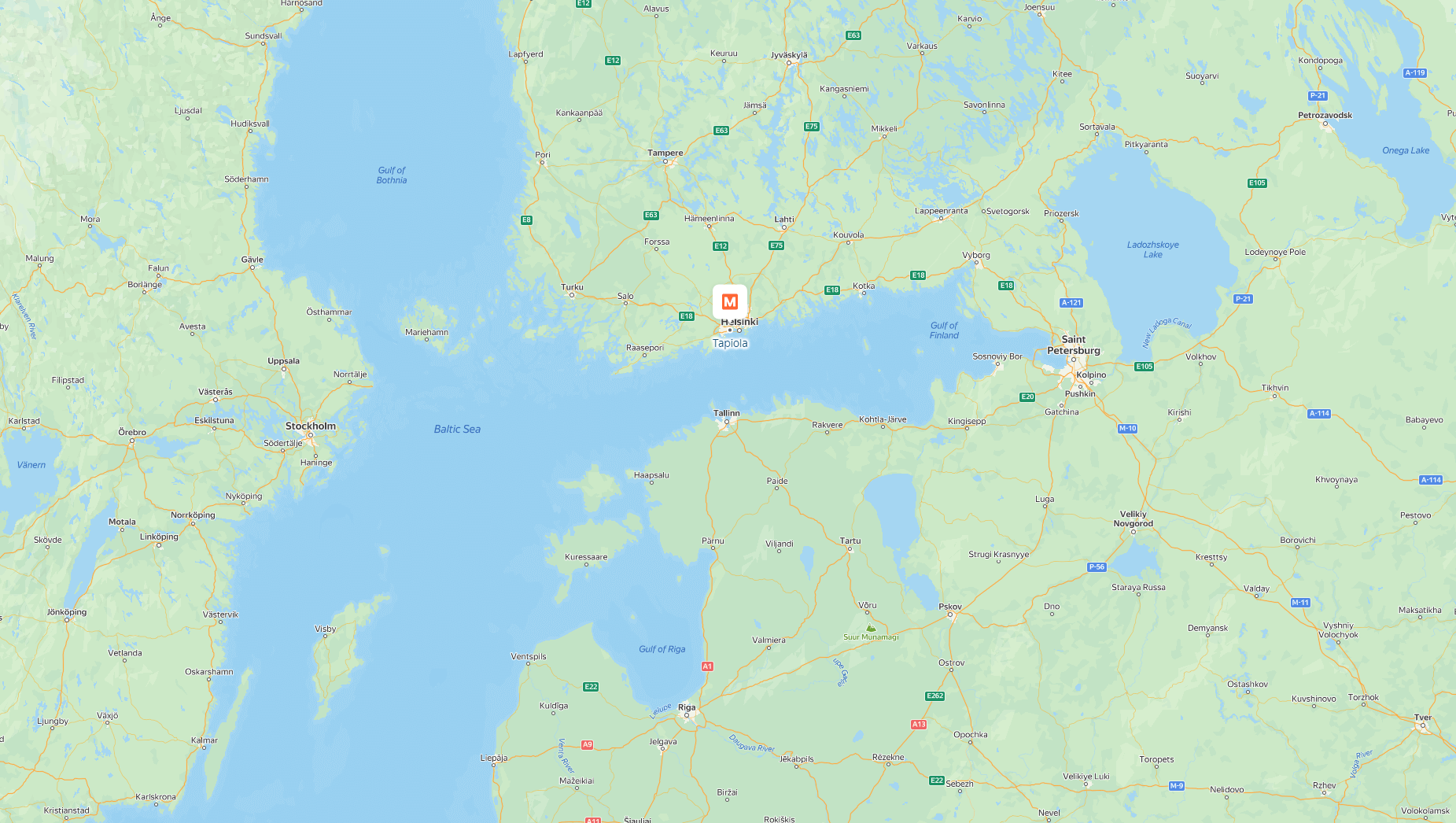
The area is well-known for its green spaces, residential architecture, and proximity to the sea, making it a desirable place to live. On a map, Tapiola is easily identifiable within the southern part of Espoo, offering a balance of natural beauty and urban convenience. Tapiola covers a total area of 3.5 square kilometers (1.4 square miles).

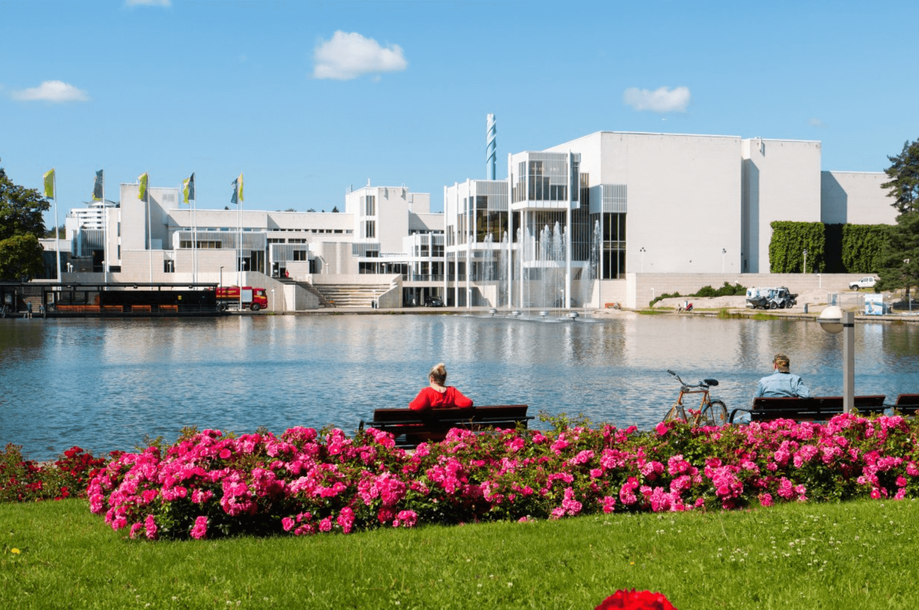 Tapiola was developed in the 1950s as a model garden city, embodying the ideals of modernist urban planning. The area was designed to combine residential living with ample green spaces, making it a pioneering example of suburban development in Finland. The original architecture and planning reflect the post-war optimism and are now considered culturally and historically significant.
 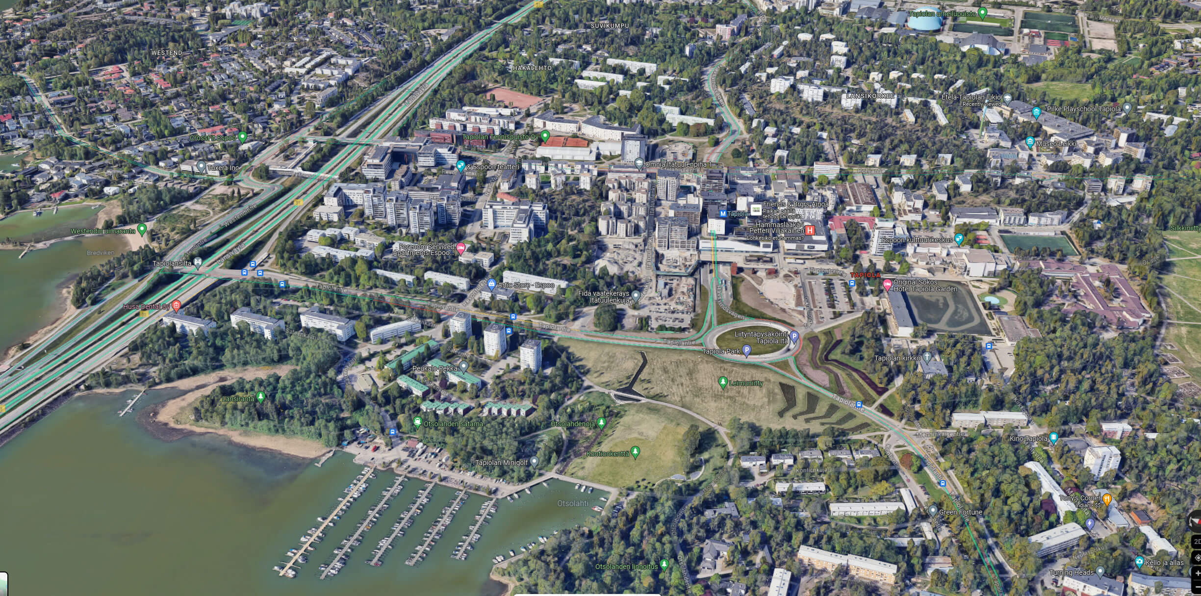 Today, Tapiola is home to a diverse population, including families, professionals, and retirees. The district has seen steady growth over the years, partly due to its excellent amenities and strategic location near Helsinki. Tapiola's population is a mix of long-time residents and newer inhabitants attracted by its modern conveniences and high quality of life.
In 2012, Tapiola had a total population of 9,325, with a population density of 2,700 people per square kilometer (6,900 per square mile).
In Tapiola, 89.9% of the population speaks Finnish, 6.4% speaks Swedish, and 3.7% speaks other languages. 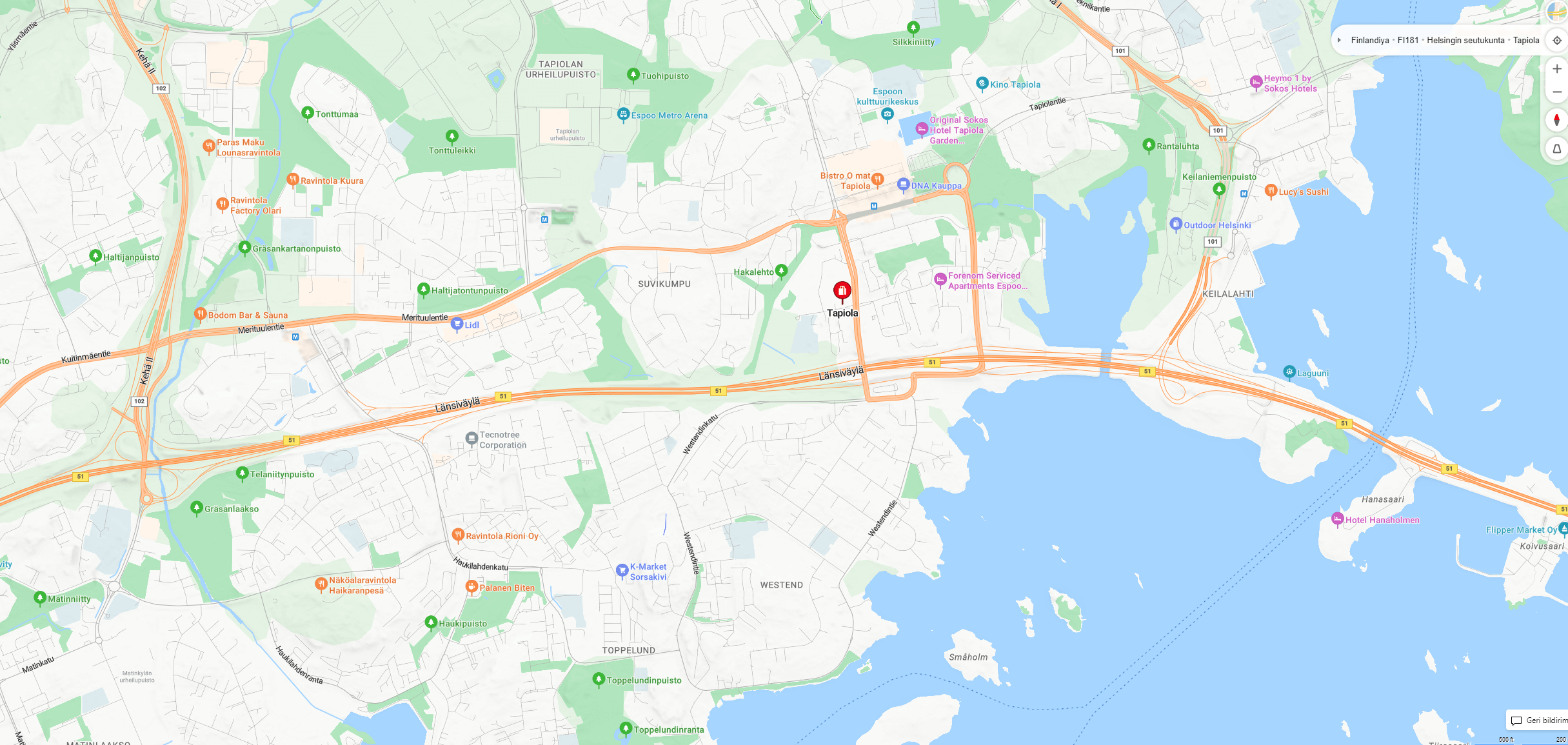 Economically, Tapiola is a thriving hub within Espoo. It hosts a mix of residential, commercial, and cultural establishments. The Tapiola Business Park is a significant economic driver, housing various companies, from startups to multinational corporations. The district's proximity to Aalto University in Otaniemi also contributes to its vibrant economic landscape, with many students and professionals living and working in the area.
 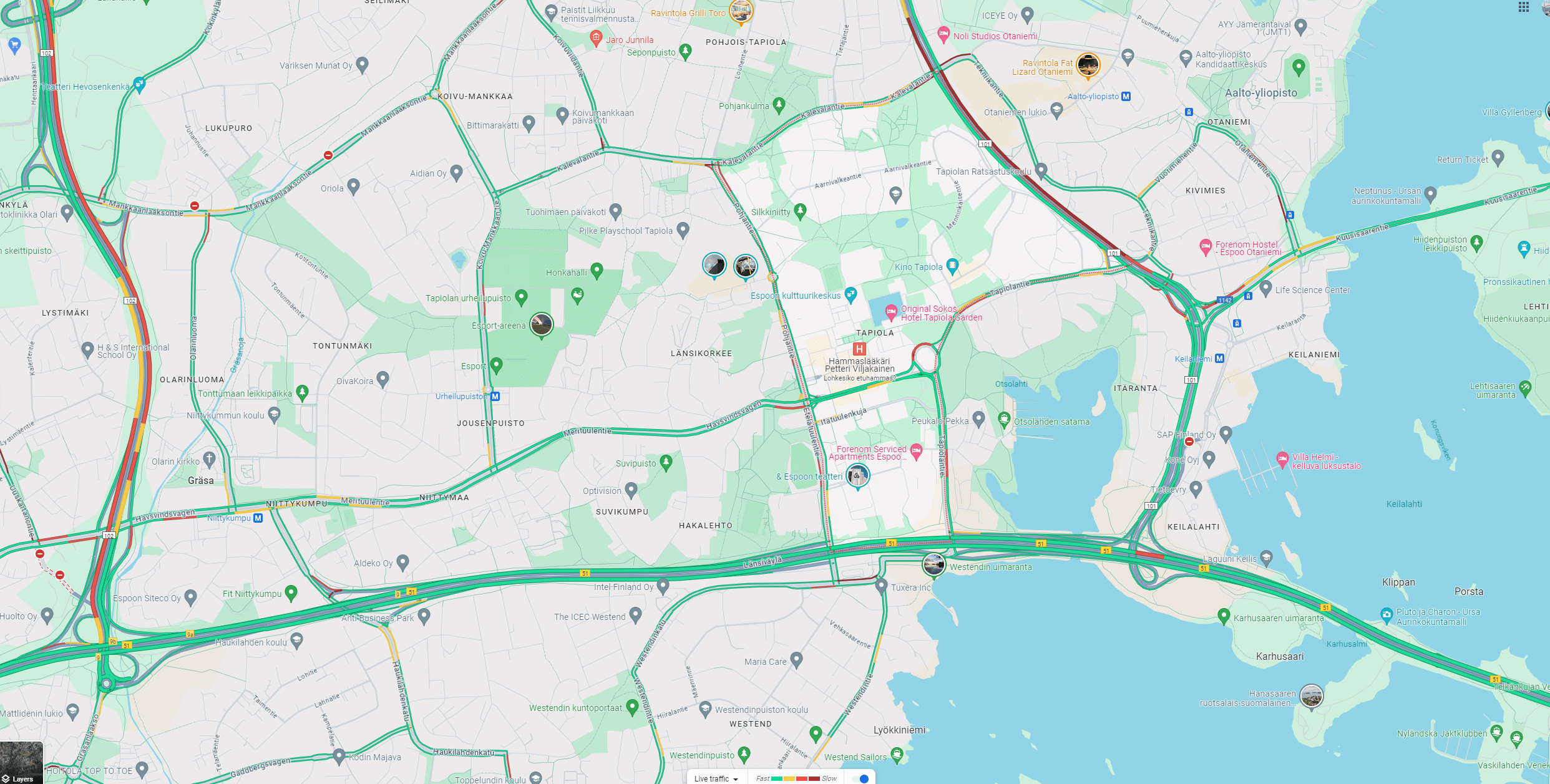 Tapiola is well-connected by public transport, making it easily accessible from other parts of Espoo and the greater Helsinki area. The district is served by the Helsinki Metro, with a station in the heart of Tapiola. Additionally, numerous bus routes pass through the area, providing efficient connections to surrounding districts and beyond. This connectivity makes Tapiola a convenient location for both residents and visitors.
 This overview captures the essence of Tapiola, offering insight into its geographic, historic, and economic significance within Espoo.
Historical Background
Tapiola was developed in the 1950s as a model garden city, embodying the ideals of modernist urban planning. The area was designed to combine residential living with ample green spaces, making it a pioneering example of suburban development in Finland. The original architecture and planning reflect the post-war optimism and are now considered culturally and historically significant. Tapiola Demographics
Today, Tapiola is home to a diverse population, including families, professionals, and retirees. The district has seen steady growth over the years, partly due to its excellent amenities and strategic location near Helsinki. Tapiola's population is a mix of long-time residents and newer inhabitants attracted by its modern conveniences and high quality of life. Tapiola, Espoo Economy
Economically, Tapiola is a thriving hub within Espoo. It hosts a mix of residential, commercial, and cultural establishments. The Tapiola Business Park is a significant economic driver, housing various companies, from startups to multinational corporations. The district's proximity to Aalto University in Otaniemi also contributes to its vibrant economic landscape, with many students and professionals living and working in the area. Public Transport in Tapiola
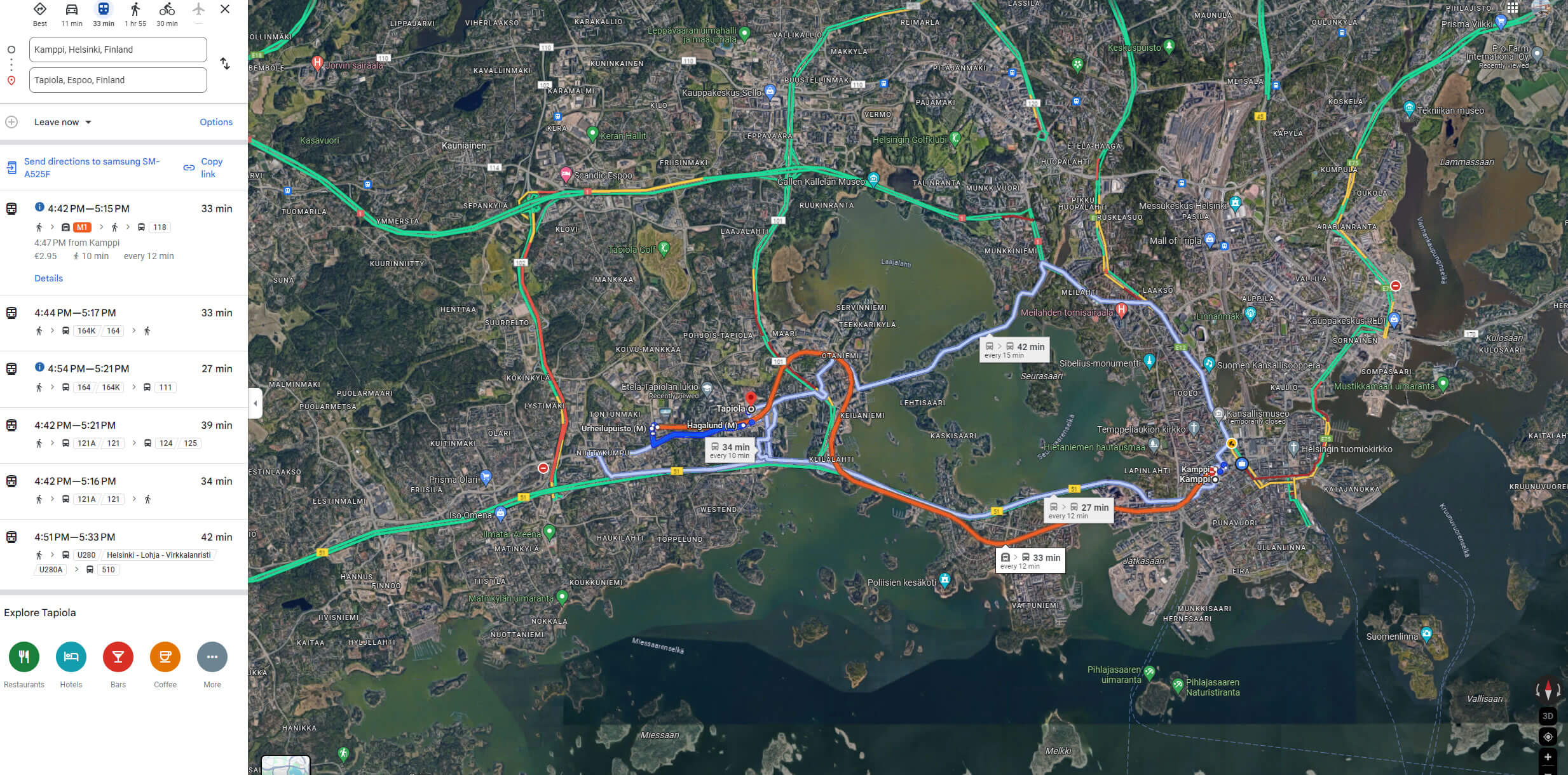
Tapiola is well-connected by public transport, making it easily accessible from other parts of Espoo and the greater Helsinki area. The district is served by the Helsinki Metro, with a station in the heart of Tapiola. Additionally, numerous bus routes pass through the area, providing efficient connections to surrounding districts and beyond. This connectivity makes Tapiola a convenient location for both residents and visitors. How can you get from Kamppi to Tapiola by public transport
You can take the Helsinki M1 Metro. Board the metro at Kamppi station, heading westbound on the Länsimetro (Western Metro M1) line. After approximately 13 minutes, you'll arrive at Tapiola station. If you prefer to take a bus, you can catch one of the frequent buses from Kamppi's bus terminal heading towards Espoo. The bus journey also takes around 15-20 minutes, depending on traffic. Both Metro and Bus options are quick and convenient for reaching Tapiola.How can you travel from Kamppi to Tapiola by bus
You can take bus lines 104, 111, 112, or 194. These buses depart from the Kamppi bus terminal and head towards Tapiola. The journey typically takes around 15-20 minutes. This overview captures the essence of Tapiola, offering insight into its geographic, historic, and economic significance within Espoo. For more Helsinki Maps and About Finland
- Head of Performance Marketing
- Head of SEO
- Linkedin Profile: linkedin.com/in/arifcagrici