Explore Andalucia in Southern Spain 1
An Itinerary for Beautiful Moorish Andalucia, highlights of Andalucia, small group trip to Spain, Andalucia is blessed with a wealth of culture, history, mountain scenery and plenty of sunshine. Best things to dor on this trip visit Granada, Seville, Cordoba, Malaga, Costa Del Sol, Jerez, Ronda and Nerja...

Andalusia

Andalucia Spain Political Map
Andalusia is a large autonomous region of hills, rivers and farmland bordering Spain's southern coast. It was under Moorish rule from the 8th-15th centuries. 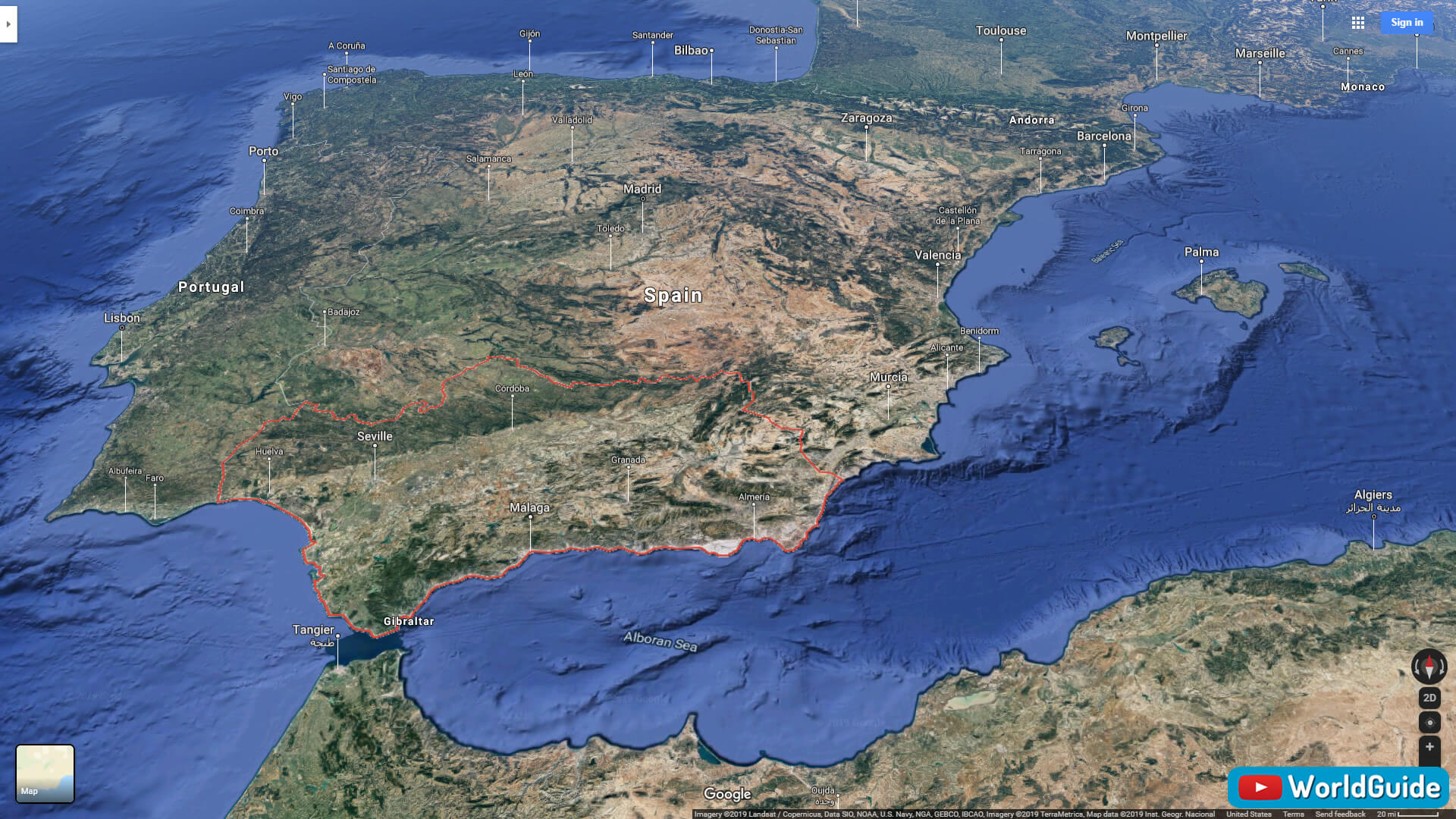
Andalucia Spain Physical Map
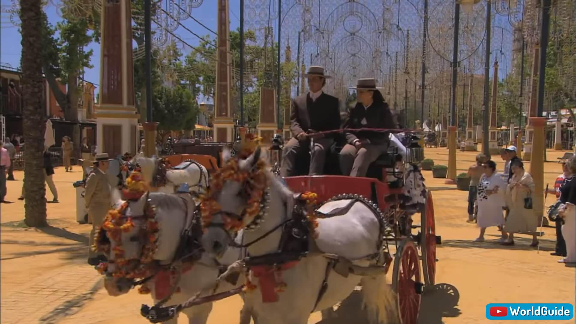
The fair grounds are jangling with fancy carrieges.
Dance of a Castanet

The horses are bred and trained

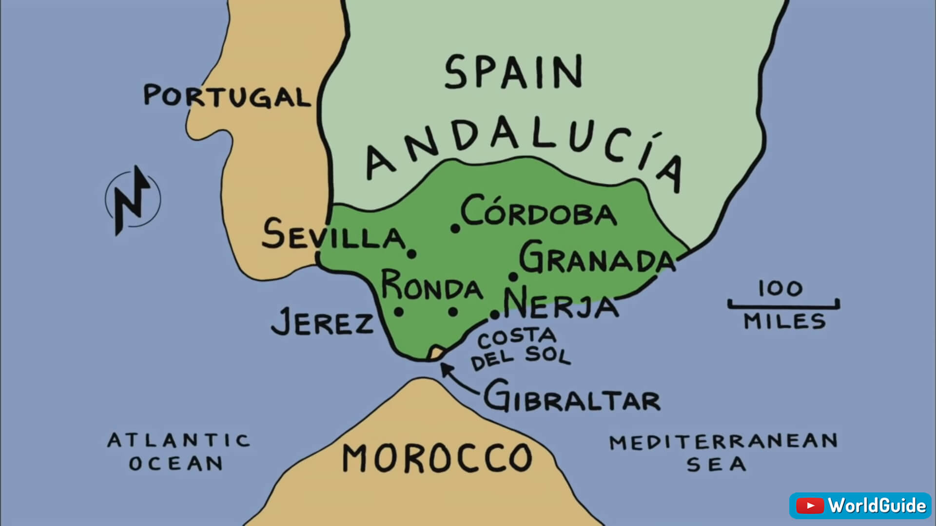
Andalucia Spain Travel Map
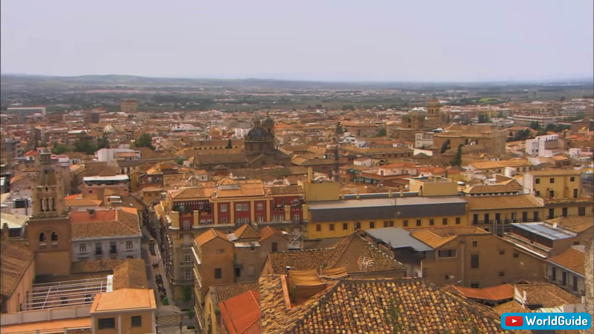
Granada

Sierra Mountains, Granada
Granada is a city in southern Spain's Andalusia region, in the foothills of the Sierra Nevada mountains. It's known for grand examples of medieval architecture dating to the Moorish occupation, especially the Alhambra. Granada has a population of 917,445 (2018). Granada Spain
Granada Spain
Alhambra Palace, the last and greatest palace Moorish palace

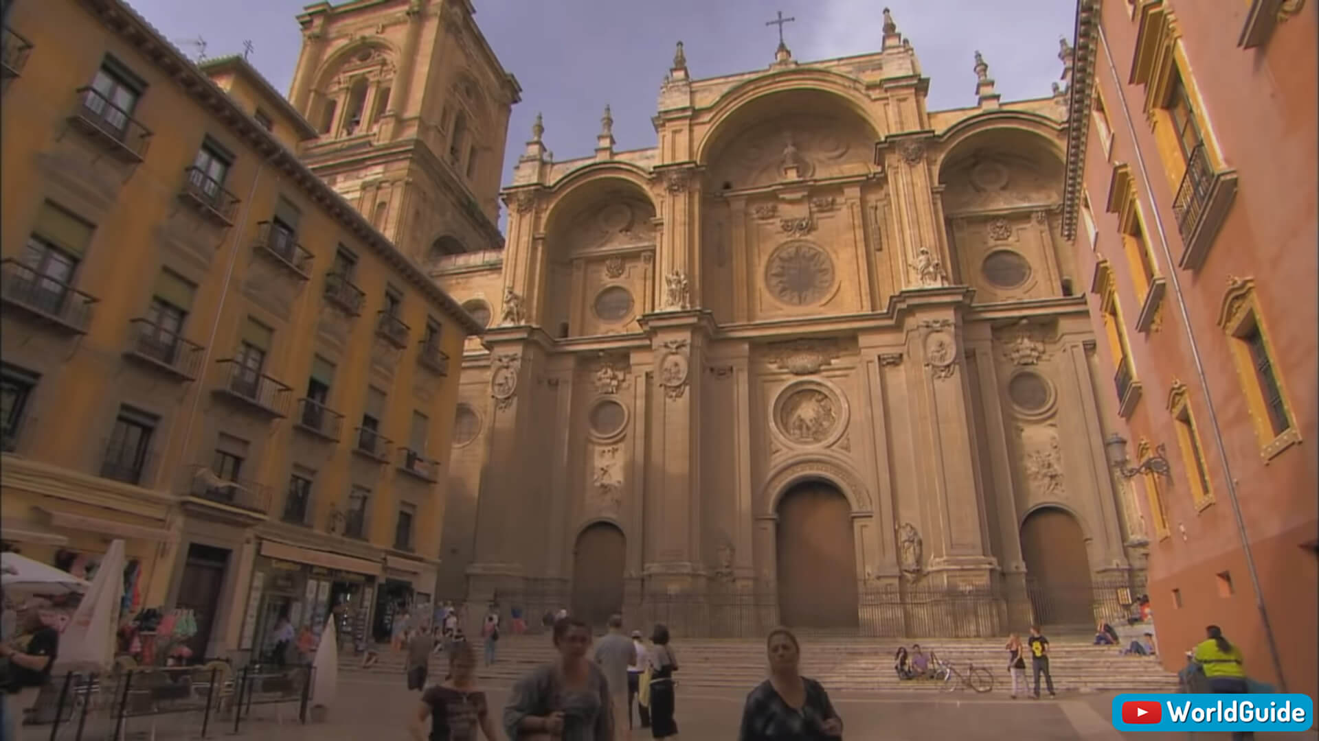
Granada Cathedral

Christian Triump Granada
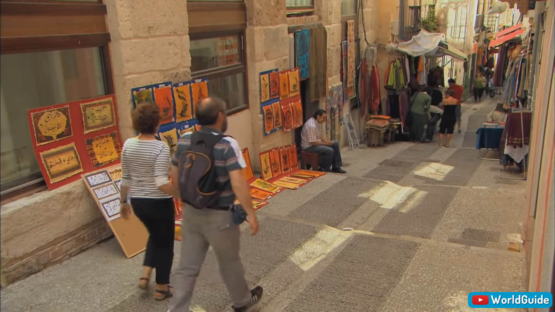
Granada Street Market
Alhambra Palace a view from the St. Nicolas Terrace

Costa Del Sol

Cordoba

Travel Guide Cordoba Spain
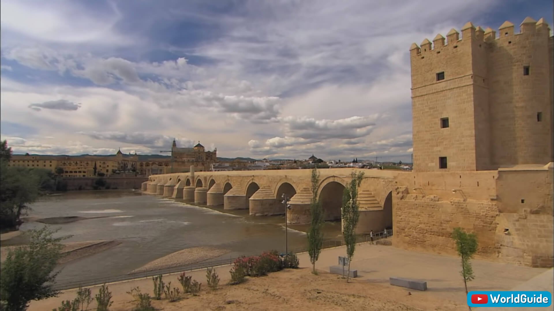
Cordoba River and Glouries Past. The Tower of Calahorra to one side of the Roman Bridge.
Cordoba River and Castle
Interior of the Mosque–Cathedral of Córdoba.


Cordoba Andalucia Spain
Flamenco Dance

Zahara a Moorish Castle in the 13th Century
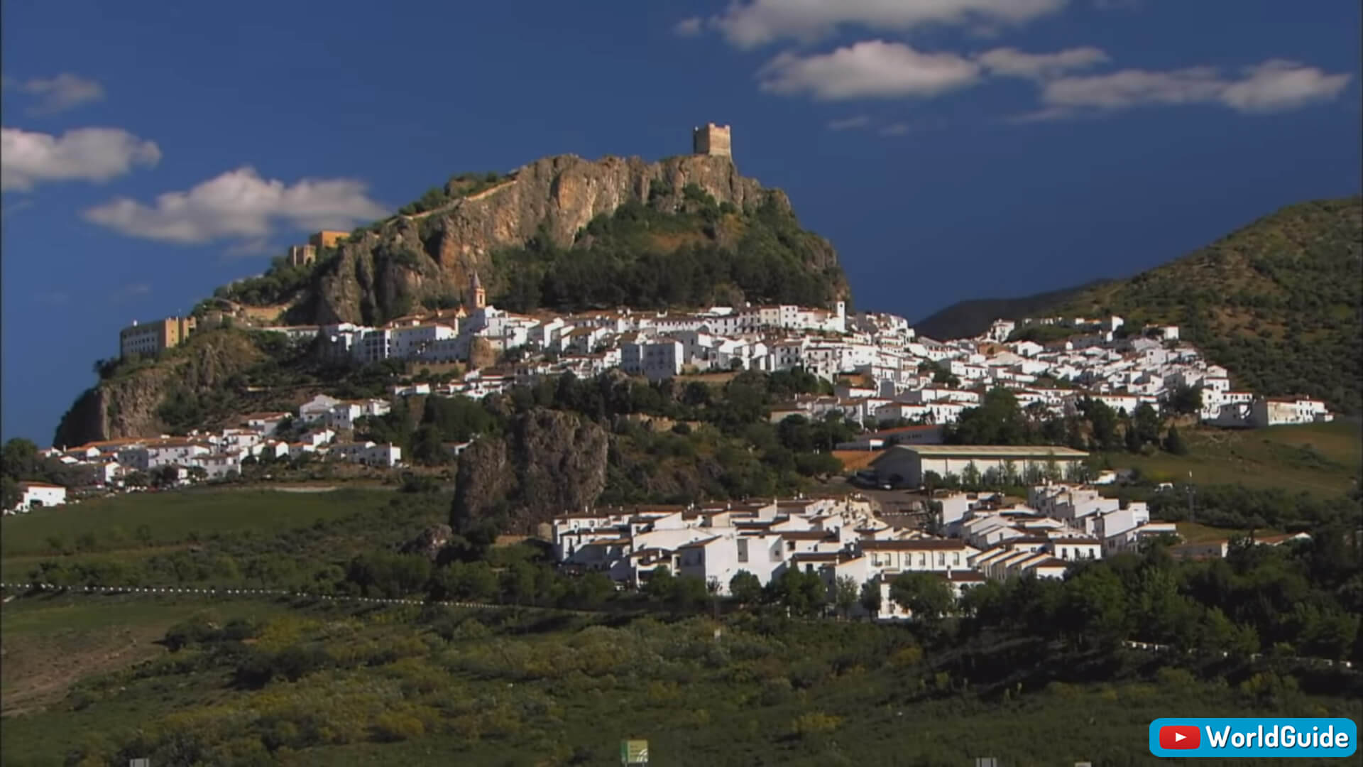
Zahara Moorish Castle
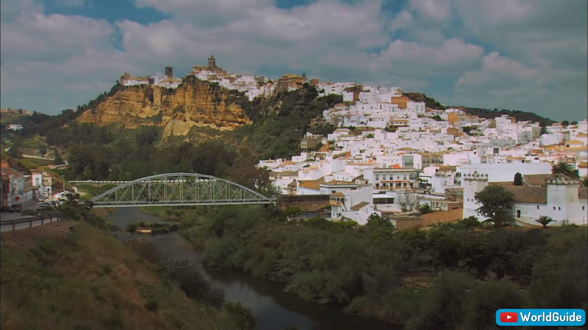
Arcos de la Frontera
Click for Explore Andalucia in Southern Spain 2
- Head of Performance Marketing
- Head of SEO
- Linkedin Profile: linkedin.com/in/arifcagrici
Address: Hakarinne 2 Espoo, 02100 Uusimaa - Finland
Email: [email protected]
Phone: +358 44 230 0982
Worldmap1.com Blog
Email: [email protected]
Phone: +358 44 230 0982
Worldmap1.com Blog
Copyright WorldMap1.com 2004 - 2025. All rights reserved. Privacy Policy | Disclaimer