Explore Canada's Diversity Through Maps
Explore Canada's vast landscapes and diverse regions with this comprehensive collection of maps, offering detailed insights into its provinces, cities, and natural wonders.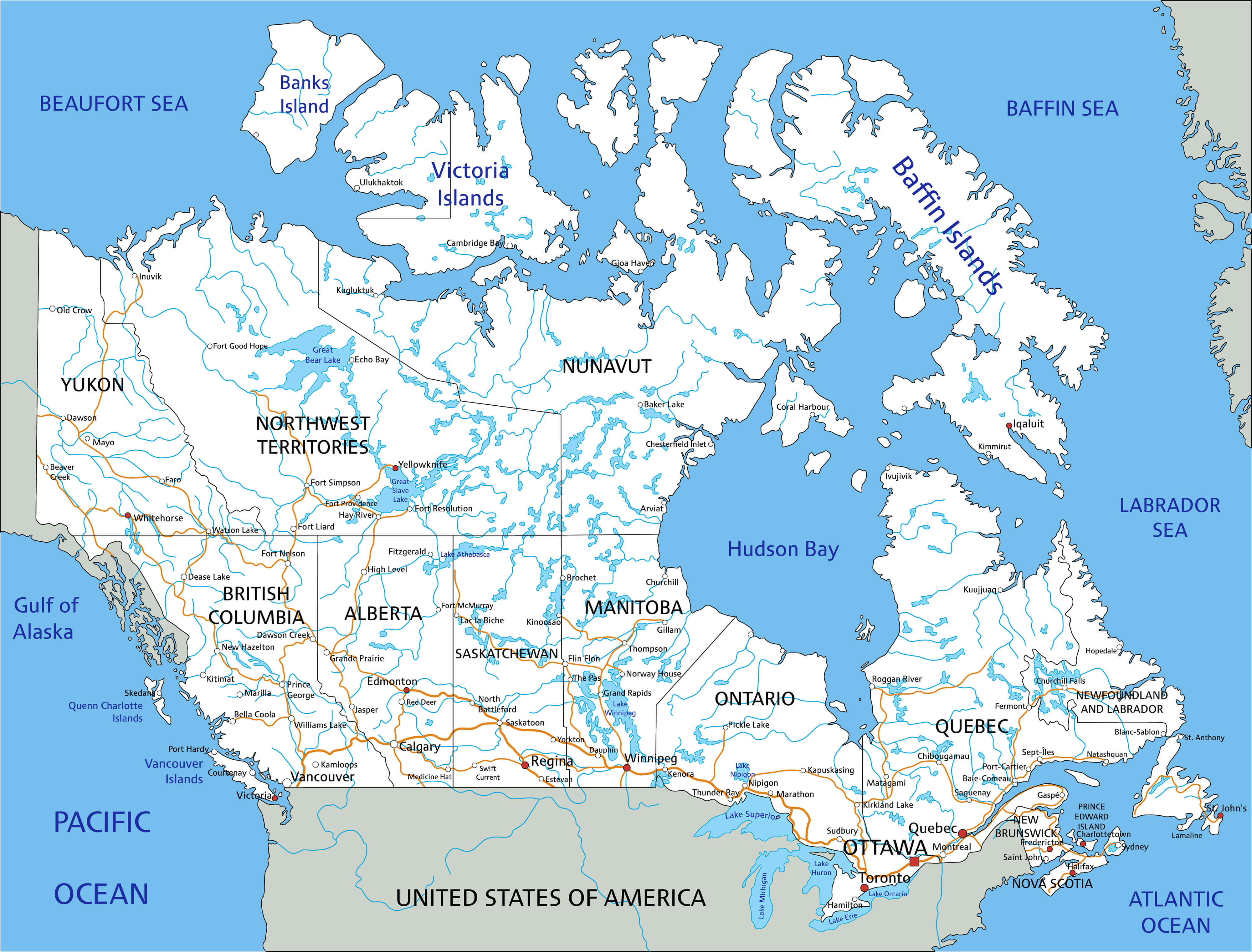
Canada Maps Collection
Please subscribe on "World Guide" channnel on Youtube at youtube.com/c/WorldGuide
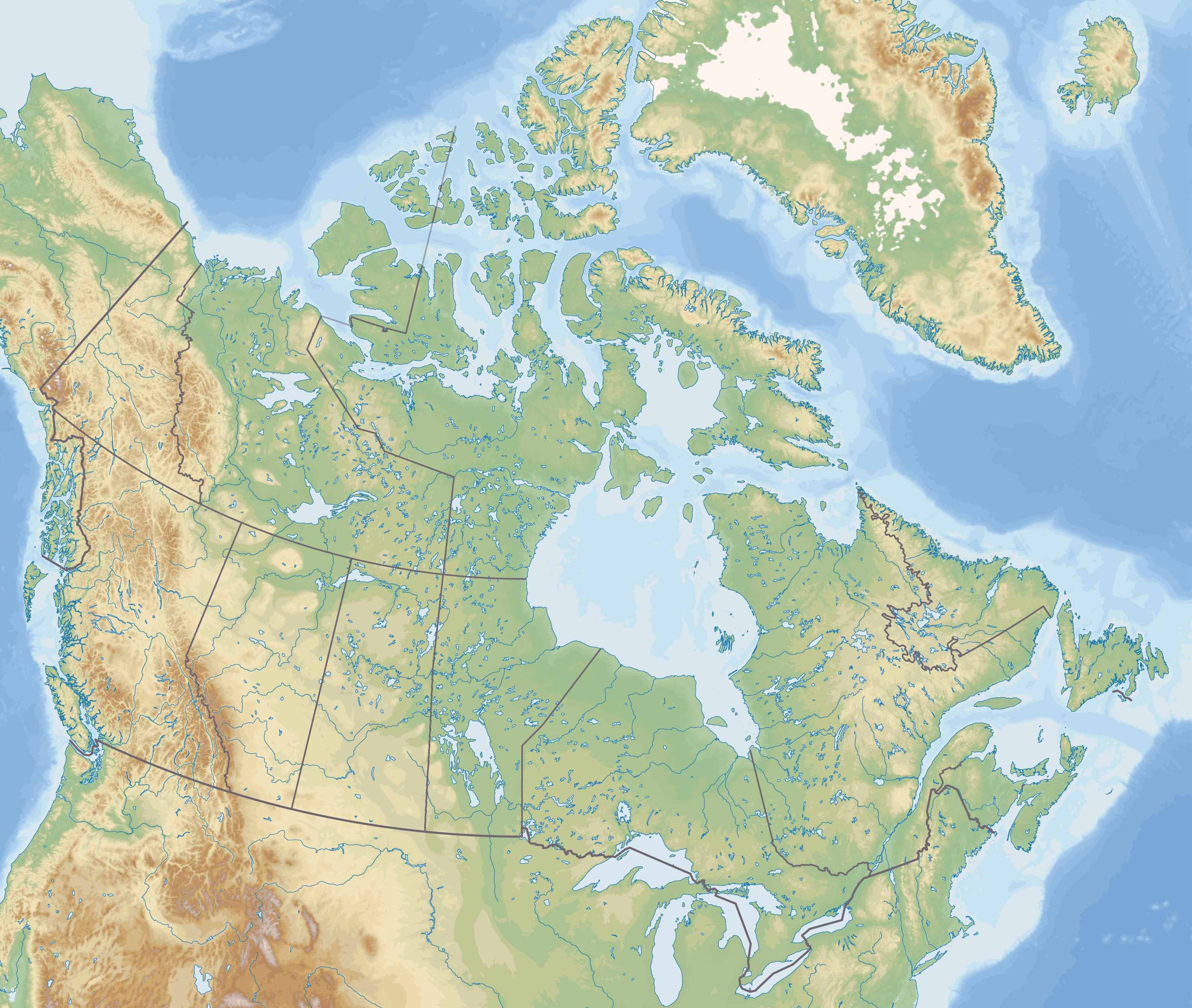
1. Canada Physical Map
The physical map of Canada showcases the country's natural landscape features. You'll see the towering Rockies, the vast Canadian Shield, and the countless lakes and rivers that define this nation. The color gradations help distinguish elevations and terrain types, offering a vivid representation of Canada's physical geography.
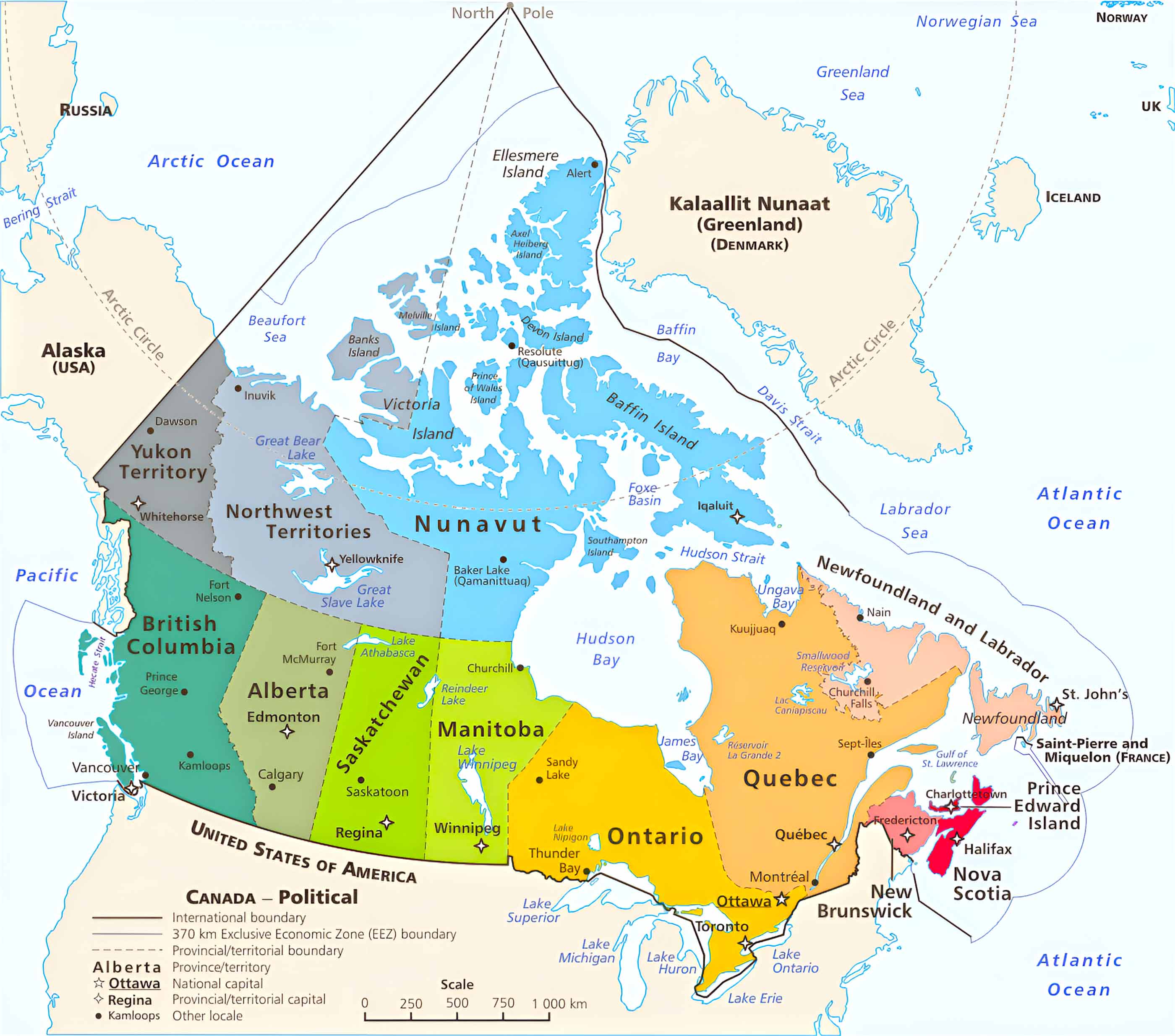
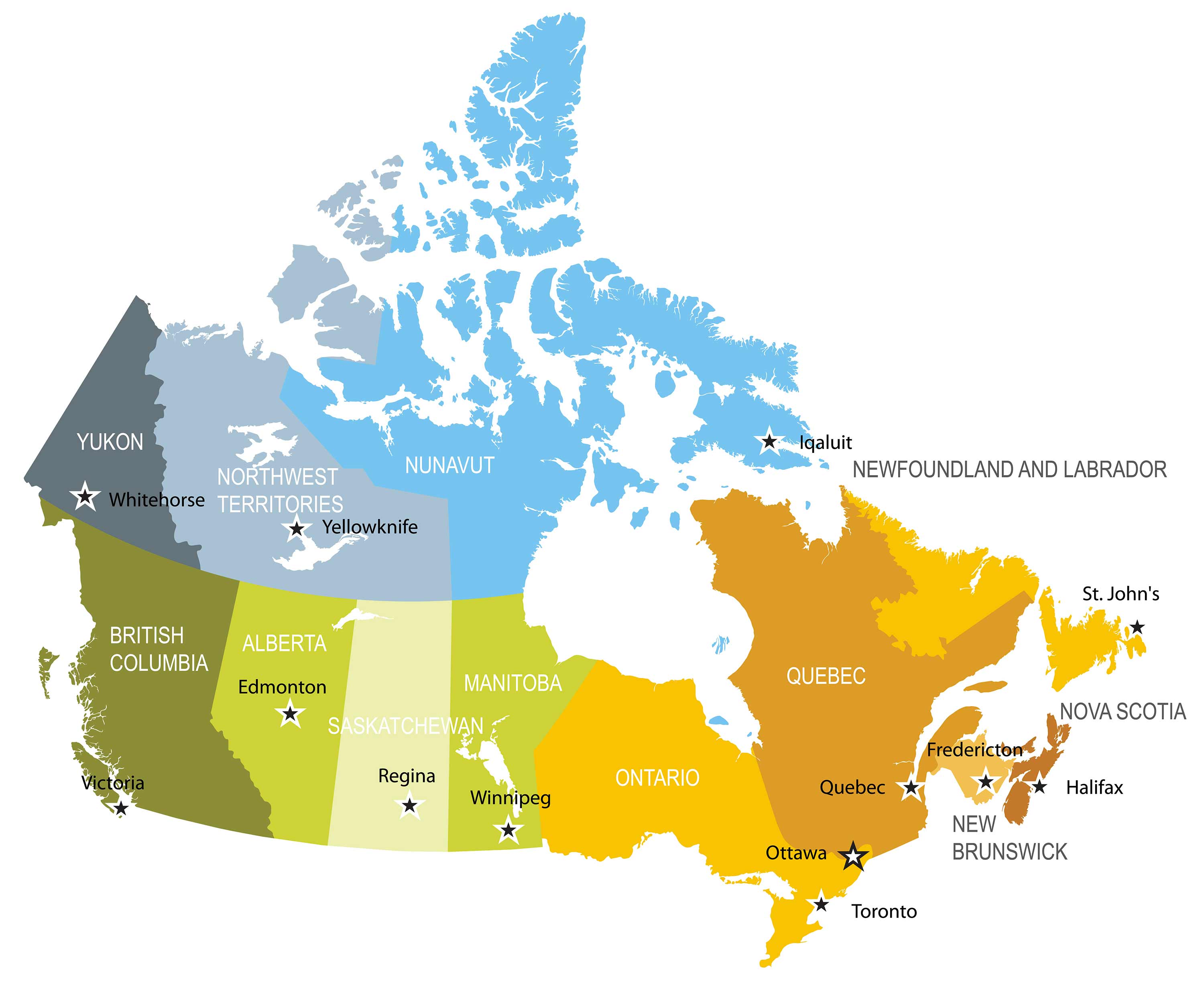
2. Canada Political Map
Canada's political map is a window into its governmental structure. It delineates the provinces and territories, each with its distinct boundaries and capital cities. This map highlights Canada's vastness and the diversity of its political regions, from Quebec's French-speaking heritage to the Arctic communities of Nunavut.
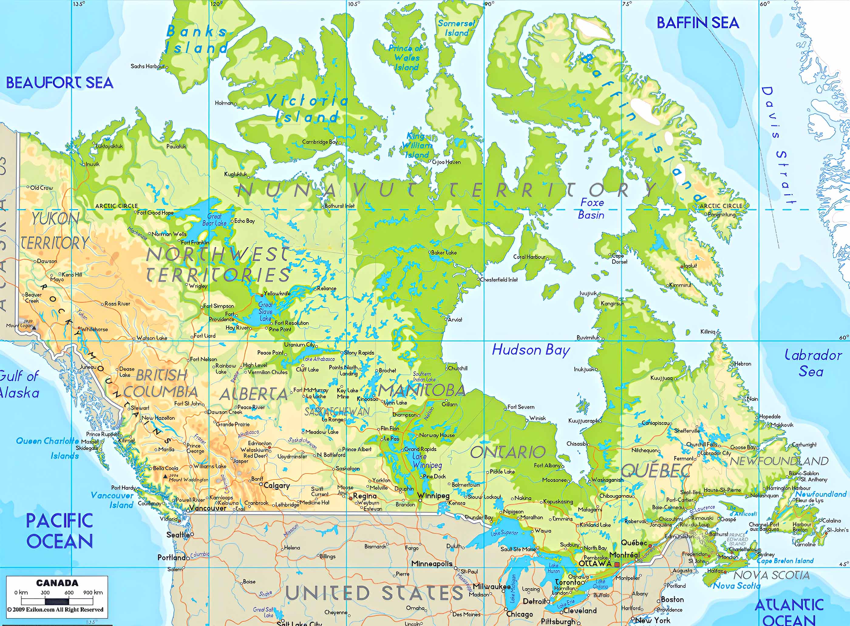
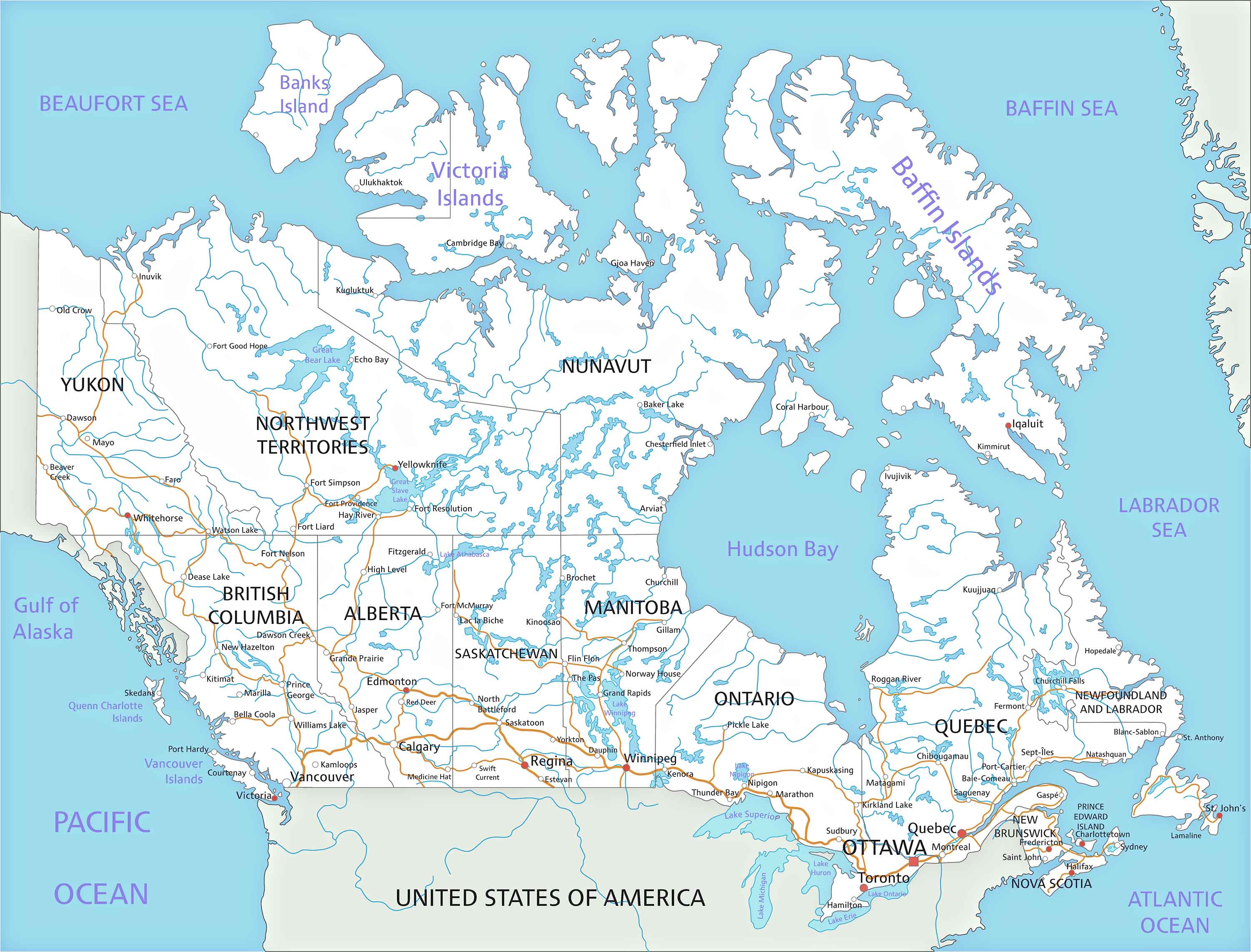
3. Canada Topographic Map
Topography lovers, rejoice! Canada's topographic map is a detailed representation of the country's surface, showing elevations, landforms, and other physical features. This map is essential for understanding the lay of the land, from the flat prairies to the rugged mountain ranges.
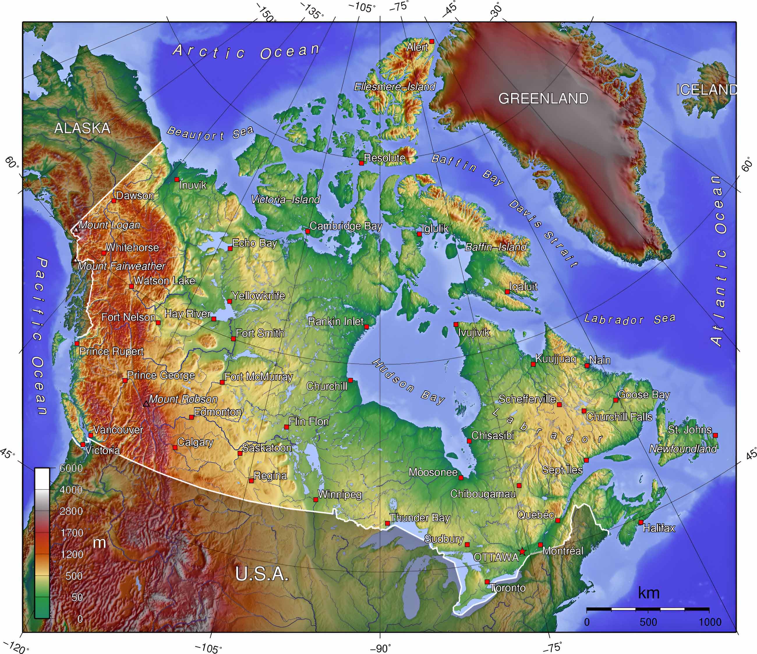
4. Canada Relief Map
A relief map offers a 3D representation of Canada's terrain, emphasizing elevations and depressions. The raised features of this map type bring a tactile and visual depth, making it easier to grasp the country's diverse topography.
5. Canada Geological Map
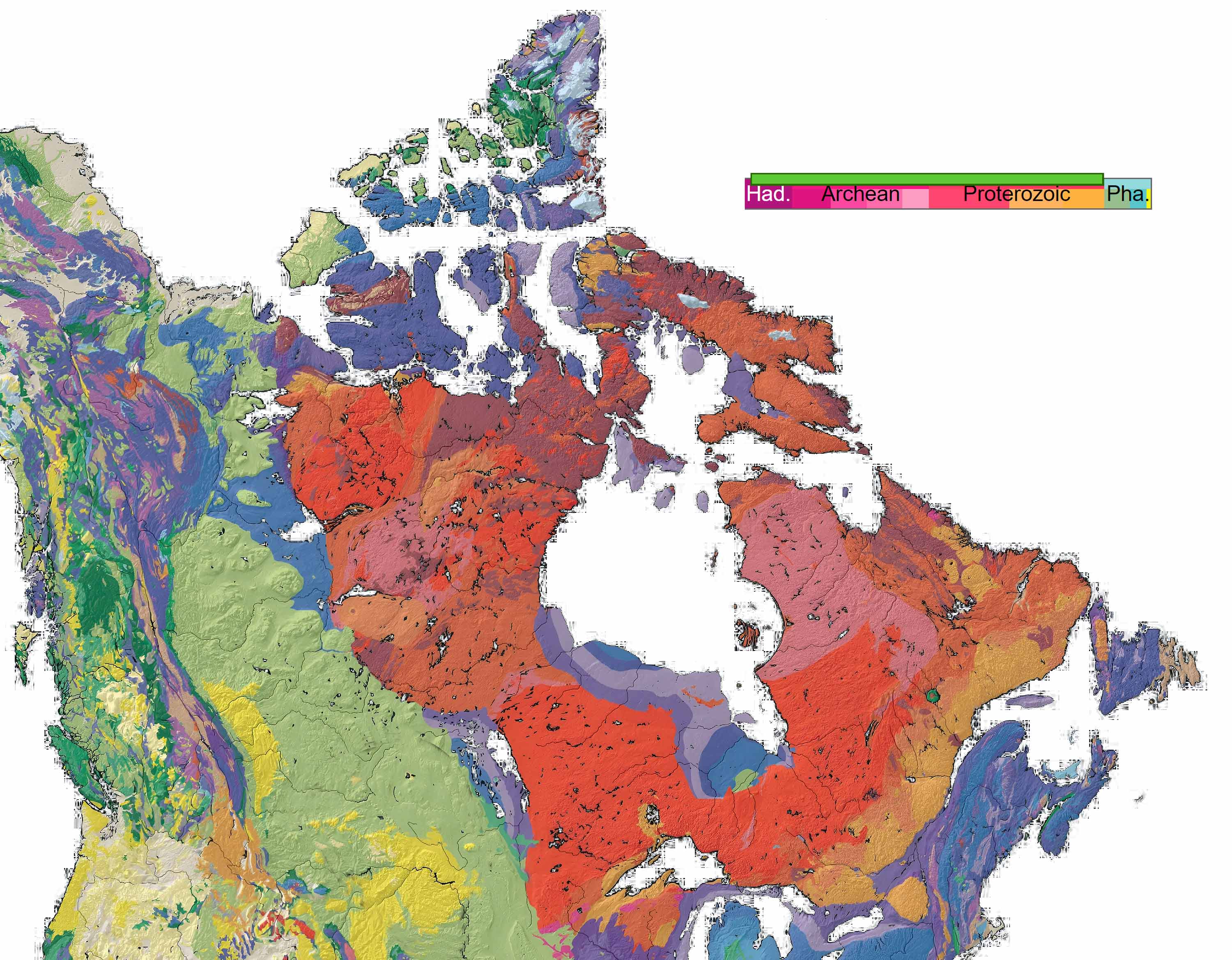
Explore Canada's geological wonders with this map! It illustrates the types of rocks and earth formations found across the country. This map is a treasure trove for understanding Canada's geological history, from ancient bedrock to recent glacial deposits.
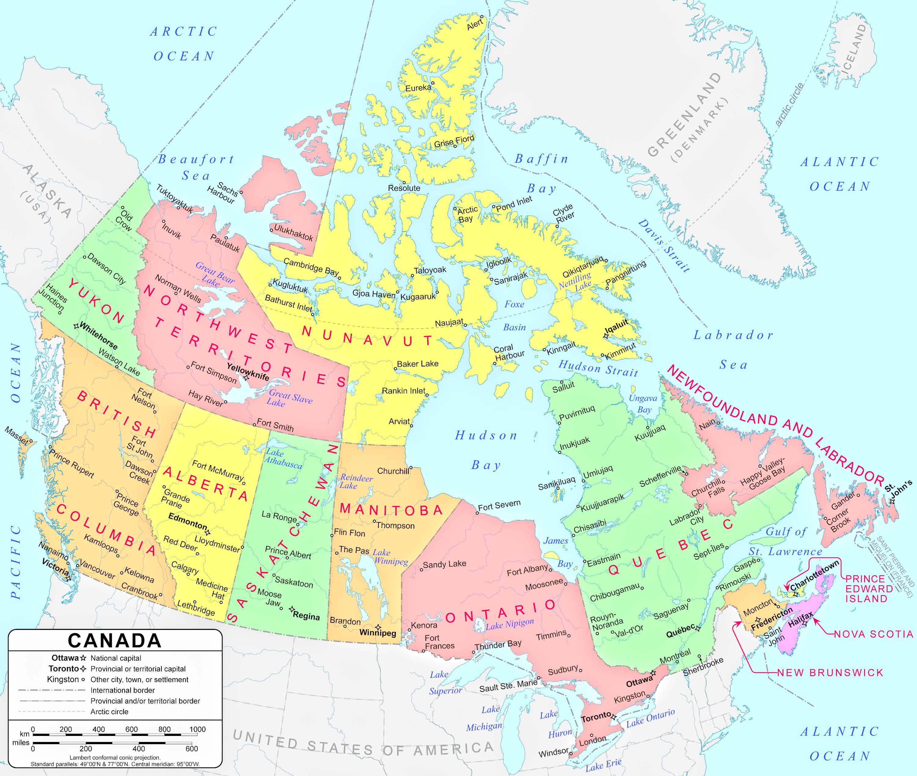
6. Canada Cities, Counties, Capitals Map
Zooming into urban areas, this map showcases Canada's major cities. It highlights urban centers like Toronto, Vancouver, and Montreal, offering insights into the country's urban planning, city layouts, and key landmarks.
7. Canada Historical Map (1856)
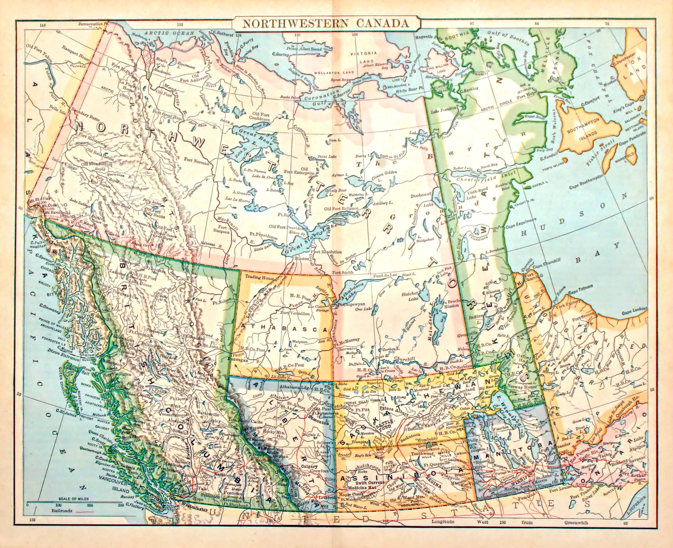
Travel back in time with Canada's historical maps. These maps provide a glimpse into Canada's past, showing territorial changes, historical events, and the evolution of its provinces and cities.
8. Canada Regions Map
Discover the various regions of Canada, each with its unique characteristics. This map divides the country into cultural, economic, or geographical regions, offering a different perspective on Canadian diversity.
9. Canada Administrative Divisions Map
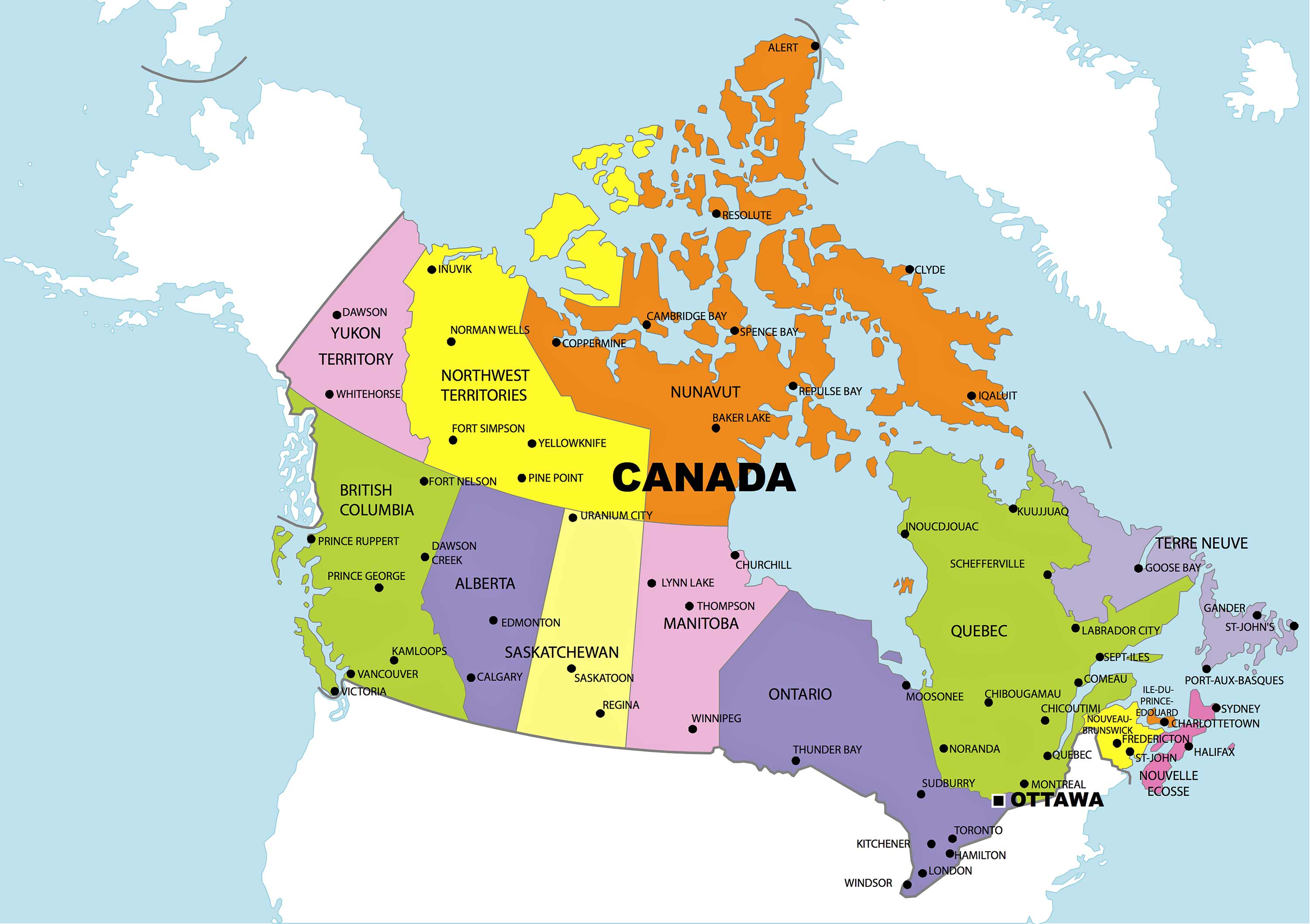
Understand Canada's administrative framework with this map. It outlines provinces, territories, and their subdivisions, highlighting the country's political and administrative structures.
10. Canada Transit Map
Navigate Canada's public transportation systems with the transit map. This includes major train routes, bus lines, and other public transport networks, especially in urban areas like Toronto's TTC or Vancouver's TransLink.
11. Canada Road Map
Plan your next Canadian road trip with this detailed road map. It features major highways, regional roads, and scenic routes, perfect for exploring Canada's vast and varied landscapes by car.
12. Canada Train-Railway Map
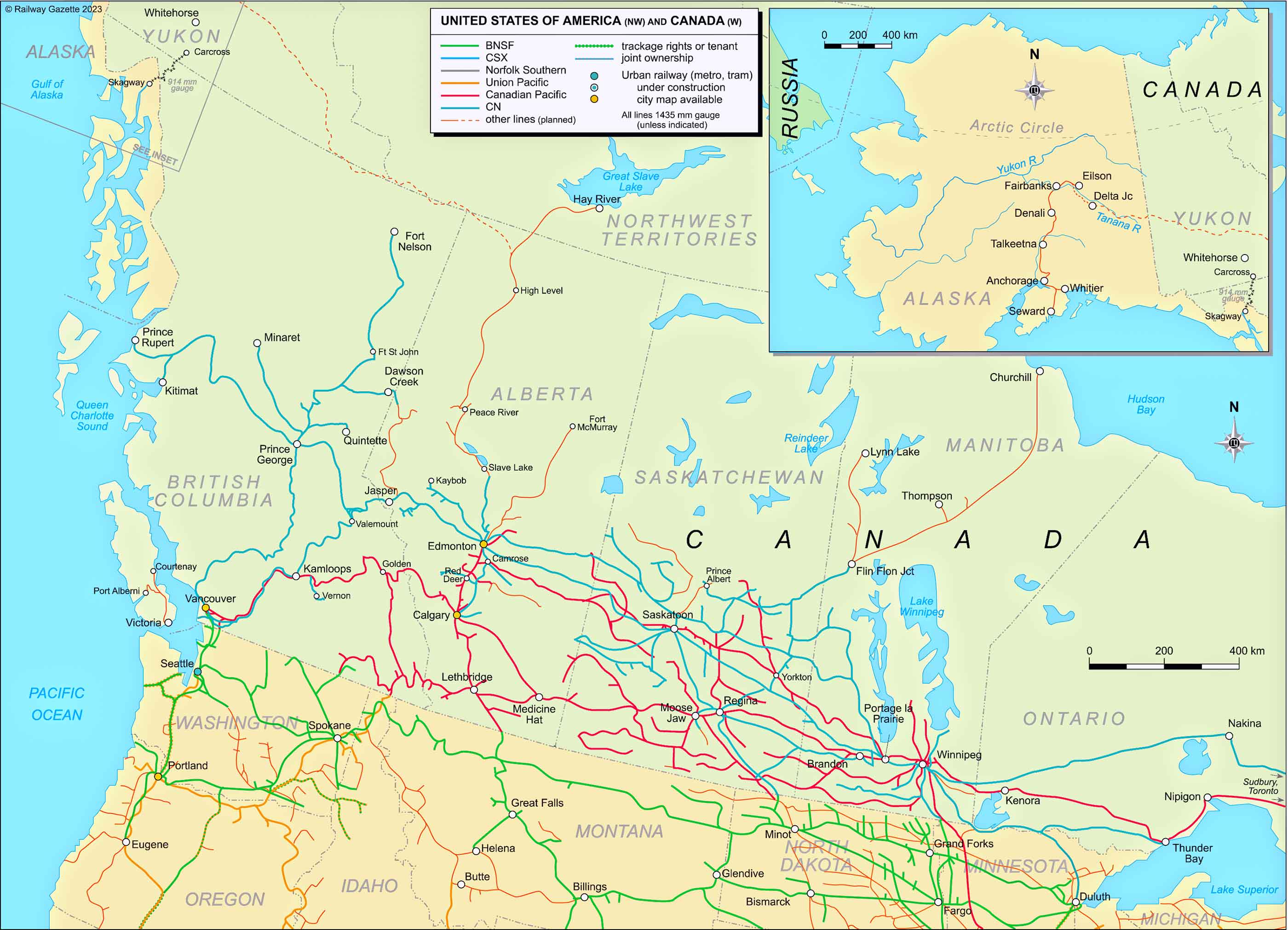
All aboard for a journey across Canada's railway network! This map shows major train routes, including the iconic transcontinental railways, highlighting how rail travel weaves through the Canadian landscape.
13. Canada Climatic Map
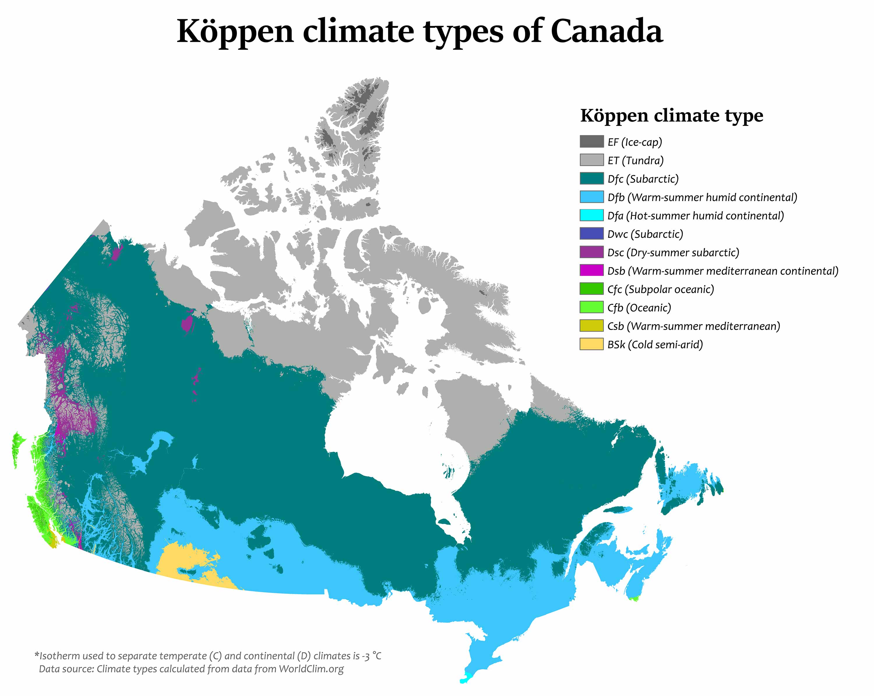
Understand Canada's diverse climates with this map. It illustrates different climatic zones, from the Arctic cold in the north to the temperate regions in the south, affecting everything from wildlife to human activities.
14. Canada Blank Map
A blank map of Canada offers a clean slate for educational or recreational purposes. It's perfect for testing your geographical knowledge or for planning purposes.
15. Canada Flag Map
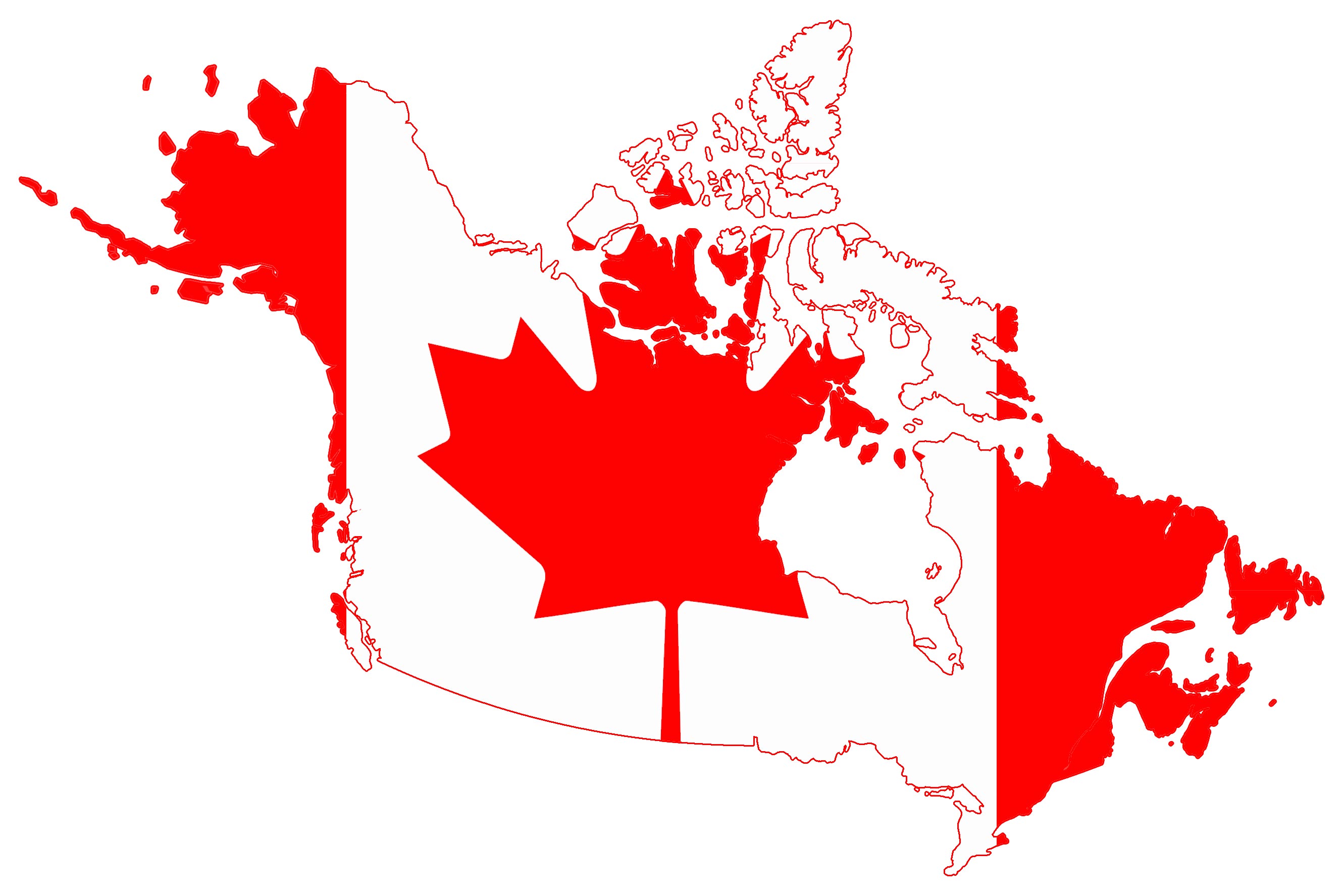
This unique map integrates the iconic Canadian flag into the country's outline, symbolizing national pride and identity. It's a colorful representation of Canada's unity and diversity.
16. Canada Travel-Tourist Map
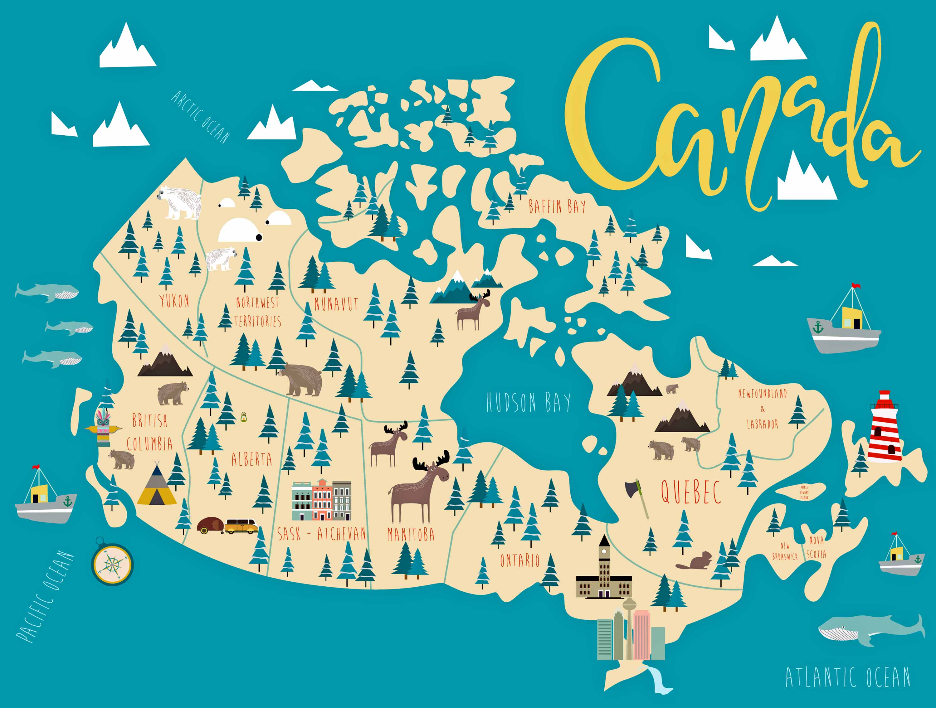
Ideal for travelers, this map highlights tourist attractions, natural wonders, and must-visit places across Canada. From Niagara Falls to the Rocky Mountains, this map is your guide to Canada's top sights.
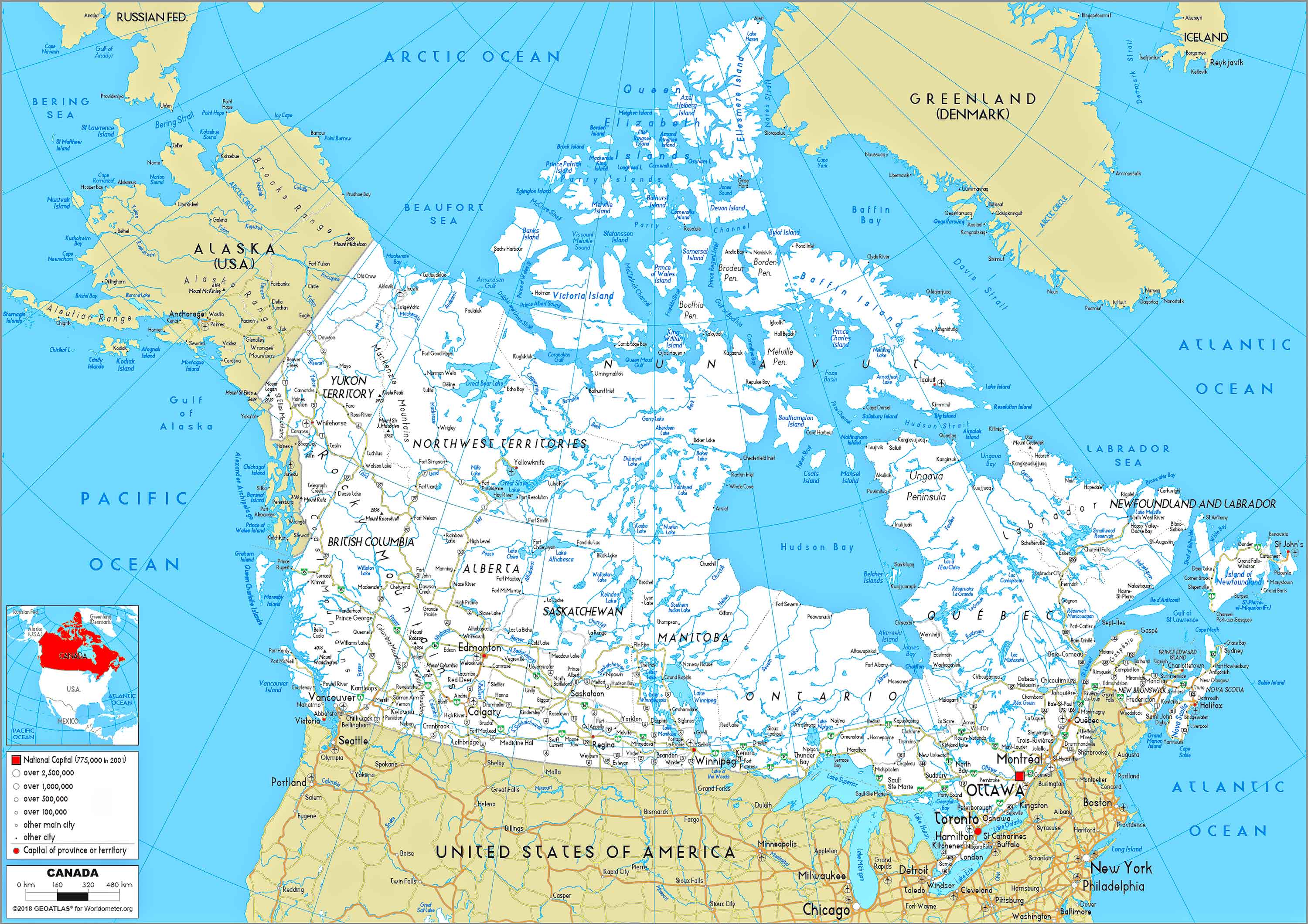
17. Map of Canada's Location in the Word Map
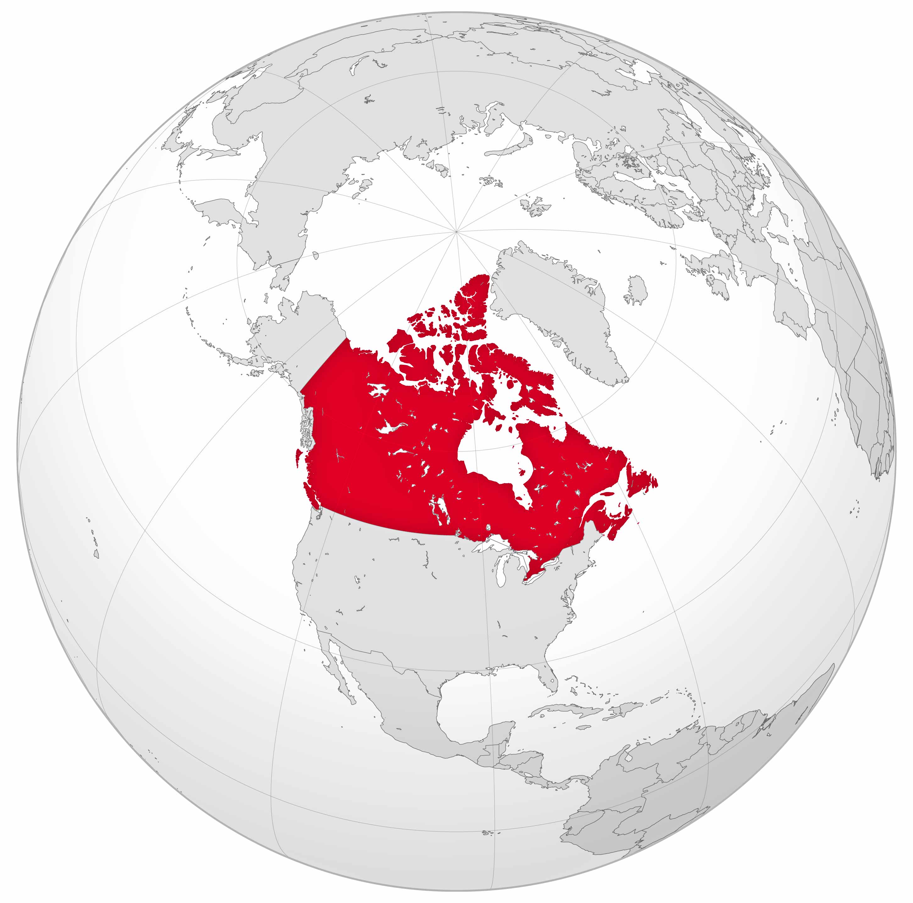
Its position on the world map of Canada provides a geographical context for North America. This map helps in visualizing the distance and relationship between the two.
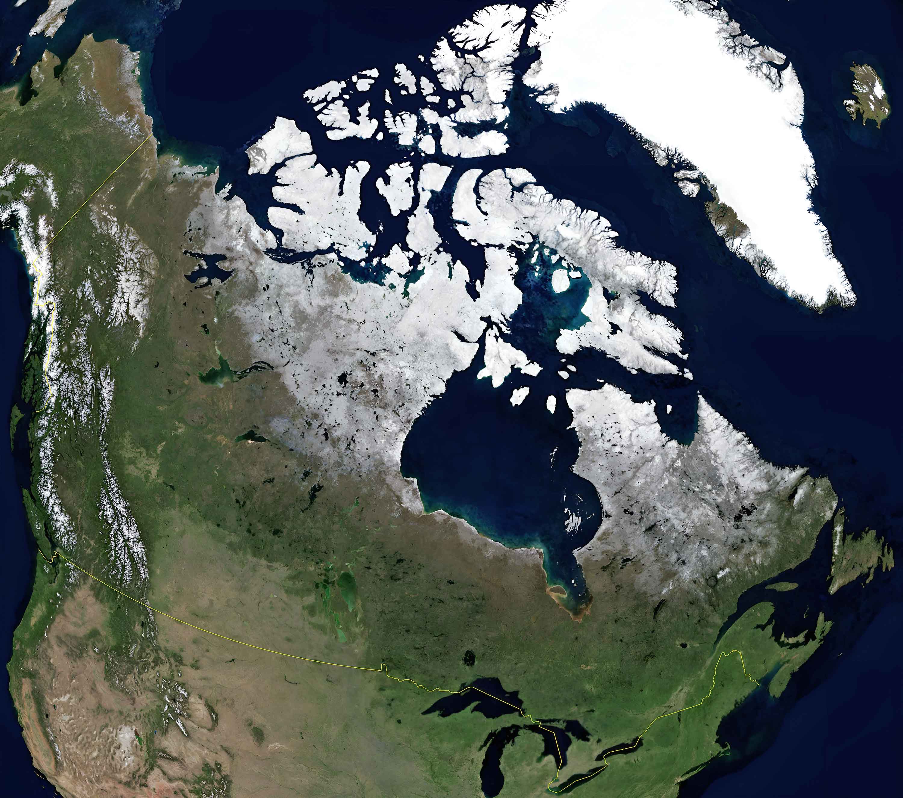
17. Canada Earth Satellite Map
For more Canada Maps and About Canada
- Head of Performance Marketing
- Head of SEO
- Linkedin Profile: linkedin.com/in/arifcagrici
Email: [email protected]
Phone: +358 44 230 0982
Worldmap1.com Blog
Copyright WorldMap1.com 2004 - 2025. All rights reserved. Privacy Policy | Disclaimer