15 Best Places to Visit in Istanbul
Top 15 Places to See in Istanbul & Things to do in Istanbul, Top-Rated Tourist Attractions in Istanbul and most visited touristic places; Hagia Sophia, Blue Mosque, Topkapi Palace and more sites...
15 Best Places to Visit in Istanbul - Youtube Video
Please subscribe on "World Guide" channnel on Youtube at youtube.com/c/WorldGuide
#1 Hagia Sophia
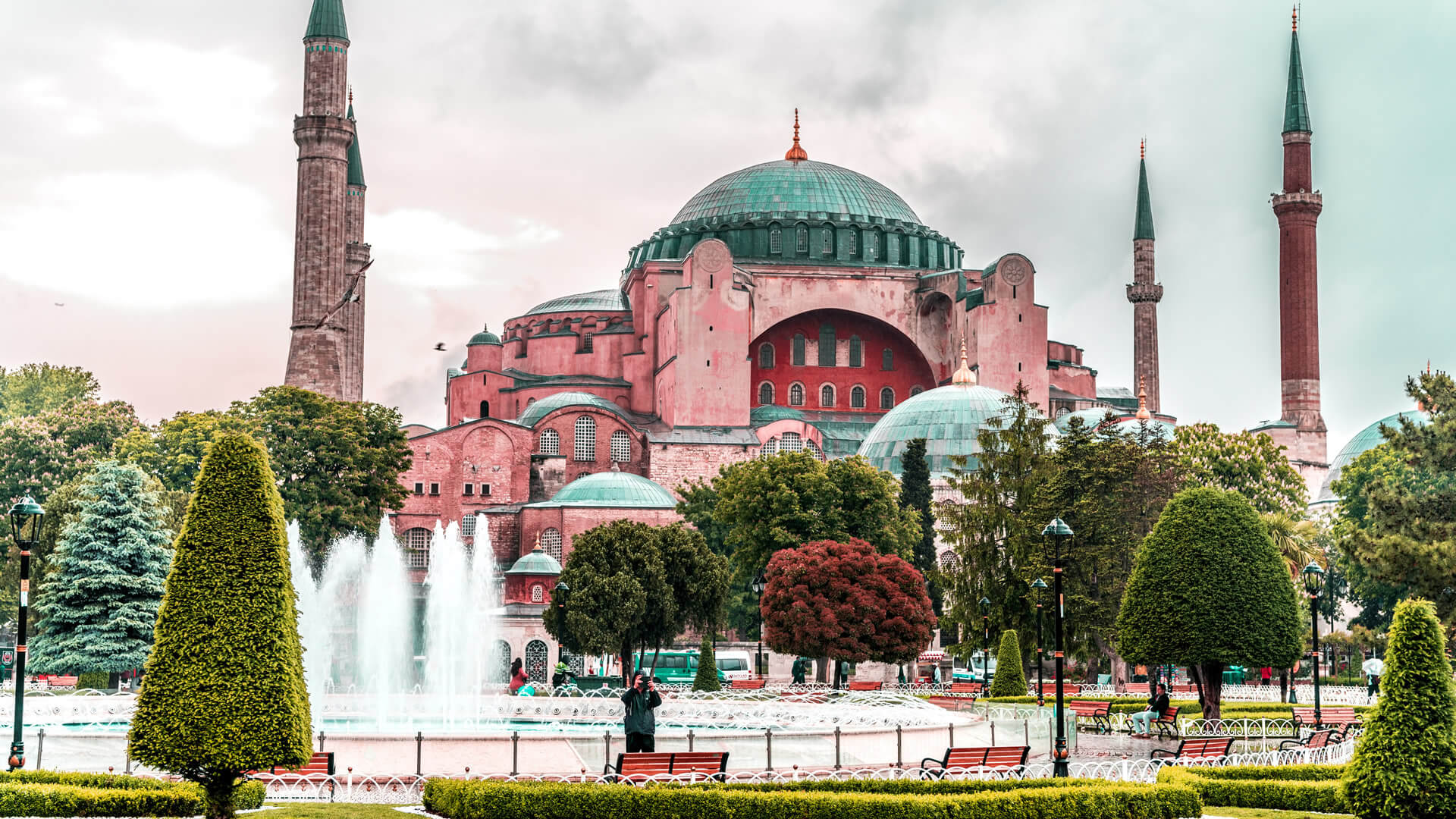 Located in the Sultanahmet neighborhood, Hagia Sophia is a former church and museum, now a mosque. It is one of the world's greatest architectural works and accepted as the 8th wonder of the world, experience the history in the Roman, Byzantine, and Ottoman Empires. As it serves as a mosque now, entrance to Hagia Sophia is FREE of charge.
 Hagia Sophia, and formerly the Church of Hagia Sophia, is a Late Antique place of worship in Istanbul, designed by the Greek geometers Isidore of Miletus and Anthemius of Tralles.
Hagia Sophia was built in 537 as the patriarchal cathedral of the imperial capital of Constantinople, it was the largest Christian church of the eastern Roman Empire and the Eastern Orthodox Church. After the Fall of Constantinople, it was converted into a mosque by Ottoman Empire in 1453. In 1935, Ataturk established it as a museum. In 2020, Hagia Sophia re-opened as a mosque.
Where is Located Hagia Sophia - Google Map
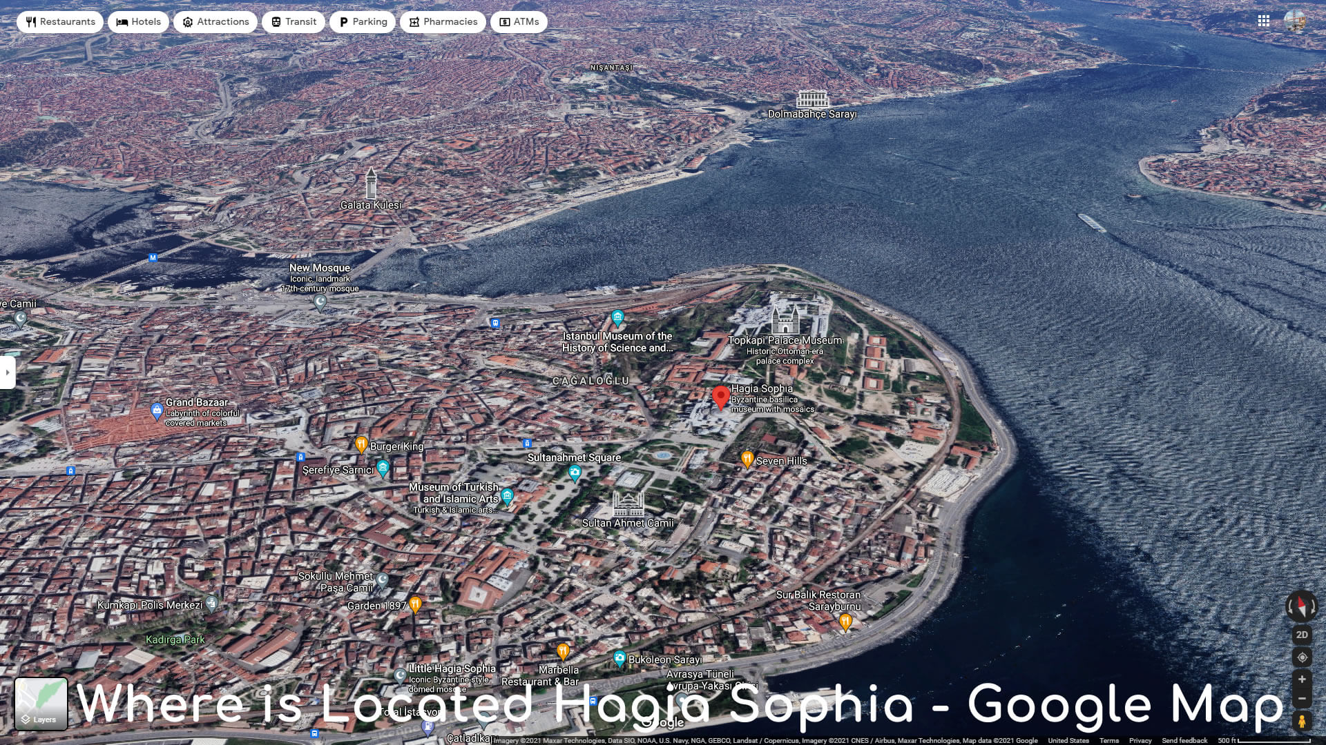
- Address: Sultan Ahmet, Ayasofya Meydani No:1, 34122 Fatih / Istanbul
- Opening Hours: 9AM - 6PM (Monday-Friday) / Saturday and Sunday closed
- Phone: +90 212 522 1750
- Architects: Isidore of Miletus, Anthemius of Tralles
- Opened: December 27, 537 AD
- Architectural style: Byzantine architecture
- Height: 56 m
- Materials: Ashlar, Roman brick
- Function: Mosque
#2 Blue Mosque
 Sultan Ahmed Mosque, also known as the Blue Mosque, is an Ottoman-era historical imperial mosque located in Istanbul, Turkey. A functioning mosque, it also attracts large numbers of tourist visitors around the World. Blue Mosque was constructed between 1609 and 1616 during the rule of Ottoman Empire Ahmed I.
 Sultan Ahmed Mosque contains Ahmed's tomb, a madrasah and a hospice. Hand-painted blue tiles adorn the mosque's interior walls, and at night the mosque is bathed in blue as lights frame the mosque's five main domes, six minarets and eight secondary domes.
The Blue Mosque sits right across to the Hagia Sophia. The Blue Mosque was included in the UNESCO World Heritage Site list in 1985 under the name of "Historic Areas of Istanbul".
A 2-min walk from the Hippodrome of Constantinople
Where is Located Blue Mosque - Google Map
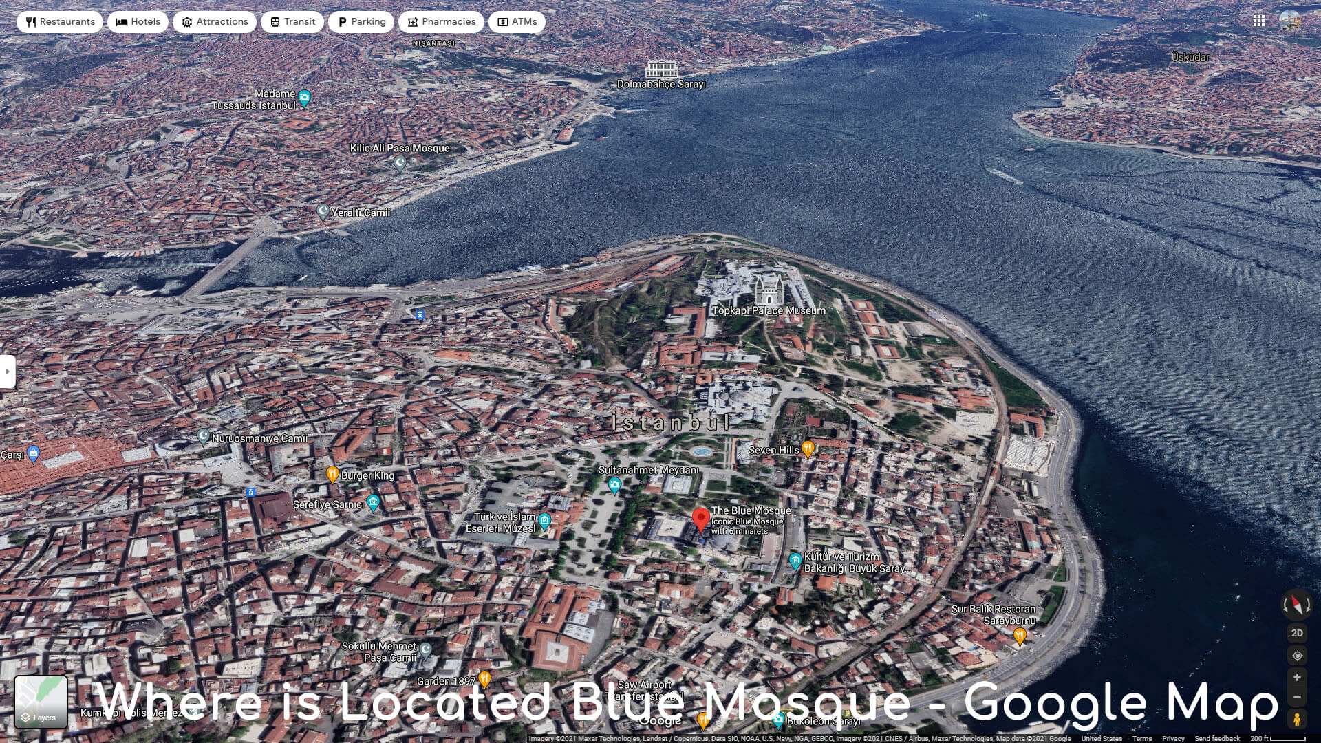
- Address: Sultan Ahmet, Atmeydani Cd. No:7, 34122 Fatih / Istanbul
- Opening Hours: 9AM - 7PM (Monday-Sunday)
- Architect: Sedefkar Mehmed Agha
- Construction Started: 1609
- Architectural styles: Islamic architecture, Ottoman architecture
- Opened: 1616
- Capacity: 10,000
#3 Topkapi Palace
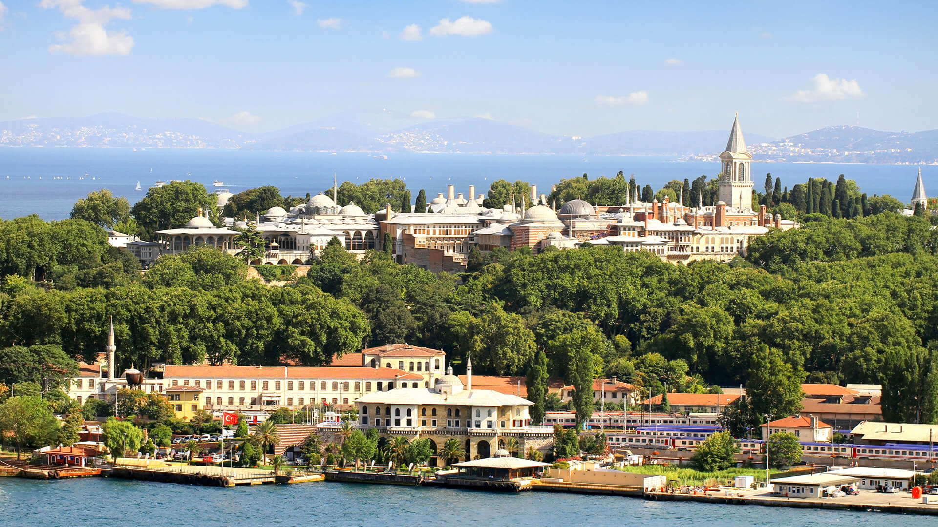 The Topkapi Palace (Cannon Gate Palace) or the Seraglio, is a large museum in the east of the Fatih district of Istanbul in Turkey. Topkapi Palace served as the main residence and administrative headquarters of the Ottoman sultans in the 15th and 16th centuries.
 Six years after the conquest of Constantinople, Sultan Mehmed the Conqueror ordered construction, began in 1459 Topkapi was originally called the "New Palace" to distinguish it from the Old Palace in Beyazit Square. The complex expanded over the centuries, with major renovations after the 1509 earthquake and the 1665 fire. The palace complex consists of four main courtyards and many smaller buildings. Female members of the Sultan's family lived in the harem, and leading state officials, including the Grand Vizier, held meetings in the Imperial Council building.

After the 17th century, Topkapi gradually lost its importance. The sultans of that period preferred to spend more time in their new palaces along the Bosphorus. In 1856 Sultan Abdulmejid I decided to move the court to the newly built Dolmabahce Palace. Topkapi retained some of its functions, including the imperial treasury, library and mint.
Where is Located Topkapi Palace - Google Map
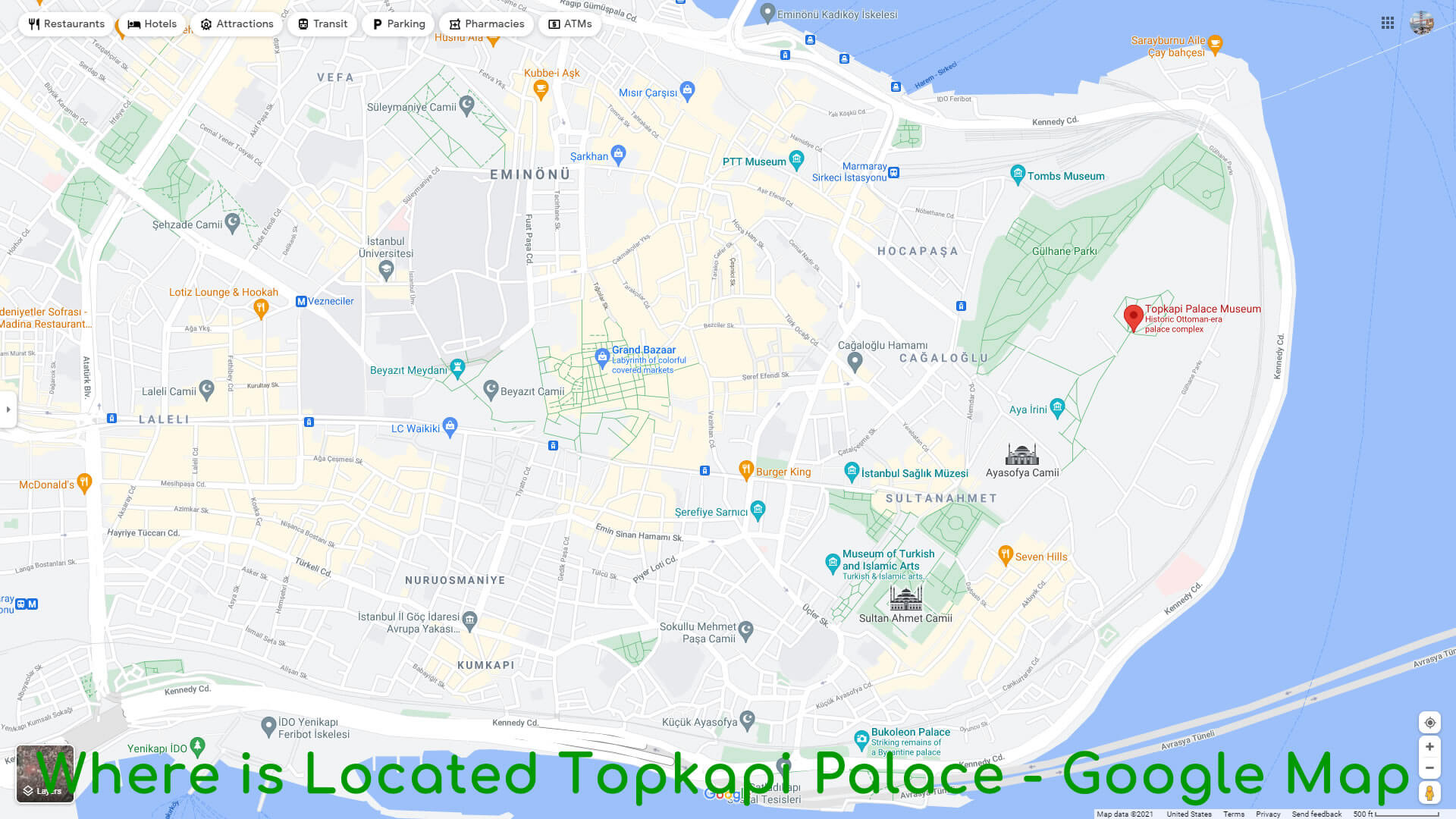
- Address: Cankurtaran, 34122 Fatih / Istanbul
- Opening Hours: 10AM - 4PM (Wednesday-Monday) / Tuesday Closed
- Phone: +90 212 512 0480
- Architects: Mimar Sinan, Sarkis Balyan, Davut Aga, Acem Ali
- Opened: 1460
- Architectural style: Ottoman architecture
- Construction started: 1459
- Function: Palace, Museum
- UNESCO World Heritage Site inscription: 1985
#4 Sultanahmet Sqaure
 Sultanahmet Square (Turkish: Sultanahmet Meydani), or the Hippodrome of Constantinople is a square in Istanbul, Turkey. Previously, it was a circus that was the sporting and social centre of Constantinople, capital of the Byzantine Empire.
 The word hippodrome comes from the Greek hippos (pp), horse, and dromos (dµ), path or way. For this reason, it is sometimes also called Atmeydani ("Horse Square") in Turkish. Horse racing and chariot racing were popular pastimes in the ancient world and hippodromes were common features of Greek cities in the Hellenistic, Roman and Byzantine eras.
Where is Located Sultanahmet District - Google Map
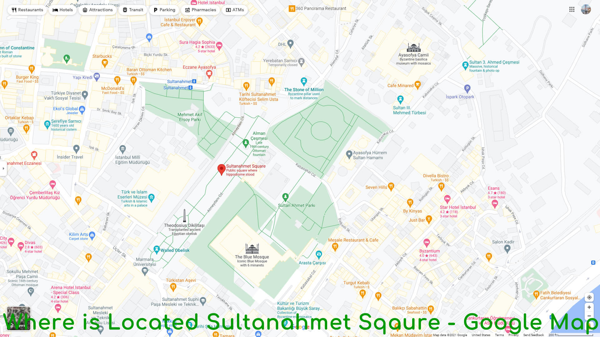
Hippodrome monuments Serpent Column
To raise the image of his new capital, Constantine and his successors, especially Theodosius the Great, brought works of art from all over the empire to adorn it. The monuments were set up in the middle of the Hippodrome, the spina. Among these was the sacrificial tripod of Plataea, now known as the Serpent Column, cast to celebrate the victory of the Greeks over the Persians during the Persian Wars in the 5th century BC. Obelisk of Thutmose III
Another emperor to adorn the Hippodrome was Theodosius the Great, who in 390 brought an obelisk from Egypt and erected it inside the racing track. Carved from pink granite, it was originally erected at the Temple of Karnak in Luxor during the reign of Thutmose III in about 1490 BC. Theodosius had the obelisk cut into three pieces and brought to Constantinople. The top section survives, and it stands today where Theodosius placed it, on a marble pedestal. The granite obelisk has survived nearly 3,500 years in astonishingly good condition. Walled Obelisk
In the 10th century the Emperor Constantine Porphyrogenitus built another obelisk at the other end of the Hippodrome. It was originally covered with gilded bronze plaques, but they were sacked by Latin troops in the Fourth Crusade. The stone core of this monument also survives, known as the Walled Obelisk.
Statues of Porphyrius
Seven statues were erected on the Spina of the Hippodrome in honour of Porphyrius the Charioteer, a legendary charioteer of the early 6th century who in his time raced for the two parties which were called "Greens" and "Blues". None of these statues have survived. The bases of two of them have survived and are displayed in the Istanbul Archaeological Museum. #5 Dolmabahce Palace
 Dolmabahce Palace located in the Besiktas district of Istanbul, Turkey, on the European coast of the Bosporus strait, used as the main administrative center of the Ottoman Empire from 1856 to 1887 and from 1909 to 1922. Yildiz Palace was used in the interim period from 1887 and 1909.
Dolmabahce Palace was built by the Empire's 31st Sultan, Abdulmecid I, between the years 1843 and 1856. Previously, the Sultan and his family had lived at the Topkapi Palace, but as the medieval Topkapi was lacking in contemporary style, luxury, and comfort, as compared to the palaces of the European monarchs, Abdulmecid decided to build a new modern palace near the site of the former Besiktas Sahil Palace. Haci Said Aga was responsible for the construction works, while the project was realized by architects Garabet Balyan, his son Nigogayos Balyan and Evanis Kalfa (members of the Armenian Balyan family of Ottoman court architects). Where is Located Dolmabahce Palace - Google Map
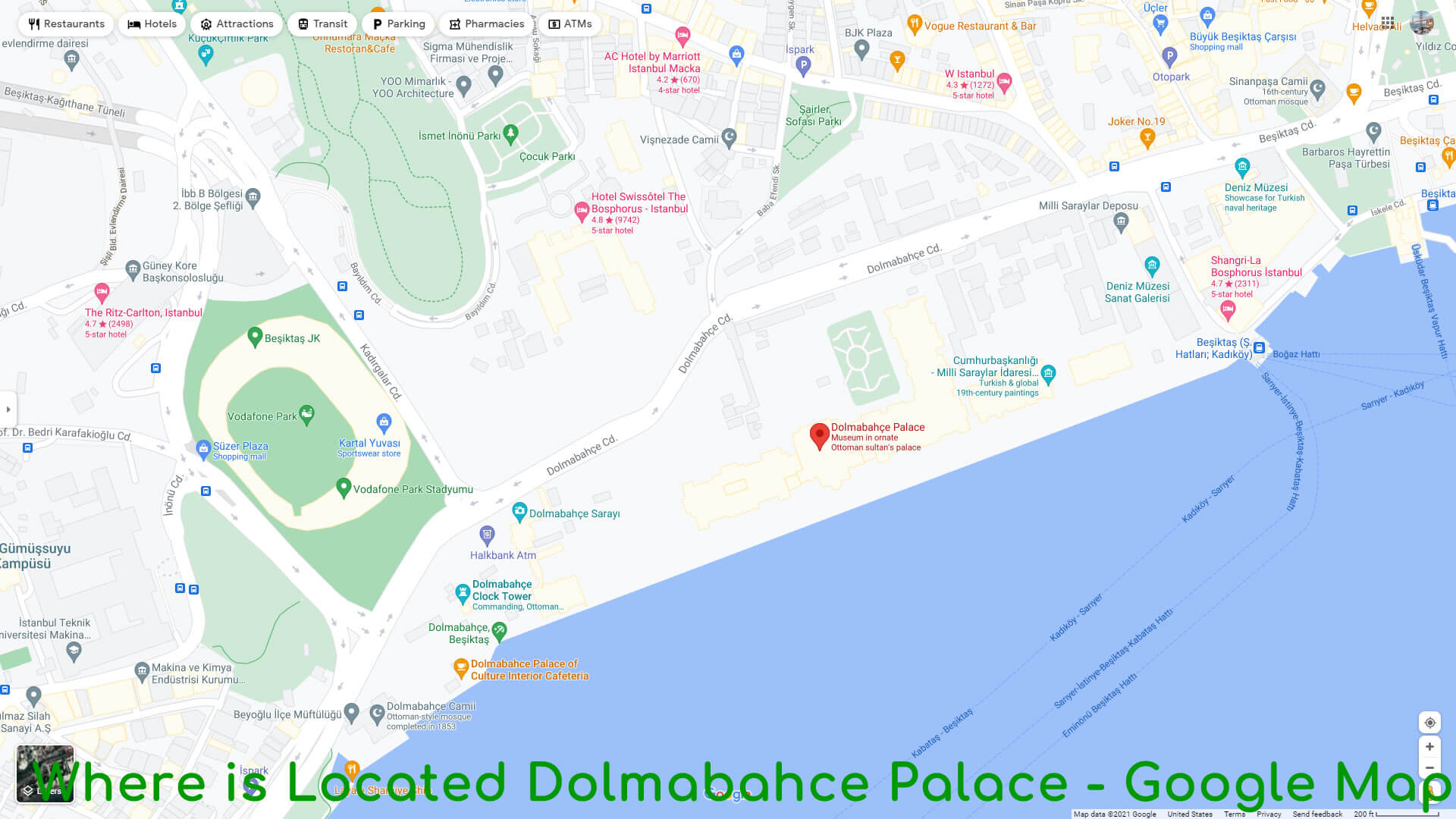
- Address: Visnezade, Dolmabahce Cd., 34357 Besiktas / Istanbul
- Opening Hours: 9AM - 4PM (Tuesday-Sunday) / Monday closed
- Phone: +90 212 236 9000
- Architect: Mihran Mesrobian
- Opened: 1823
- Architectural Styles: Baroque Revival architecture, Rococo Revival
- Construction started: 1843
- Owner: Turkish state
#6 Suleymaniye Mosque
 The Suleymaniye Mosque is an Ottoman imperial mosque located on the Third Hill of Istanbul, Turkey. The mosque was commissioned by Suleiman the Magnificent and designed by the imperial architect Mimar Sinan. An inscription specifies the foundation date as 1550 and the inauguration date as 1557.
Behind the qibla wall of the mosque is an enclosure containing the separate octagonal mausoleums of Suleiman the Magnificent and that of his wife Hurrem Sultan (Roxelana). For 462 years, the Suleymaniye Mosque was the largest mosque in the city, until it was surpassed by the Camlica Mosque in 2019. The Suleymaniye Mosque is one of the best-known sights of Istanbul, and from its location on the Third Hill, it commands an extensive view of the city around the Golden Horn. Where is Located Suleymaniye Mosque - Google Map
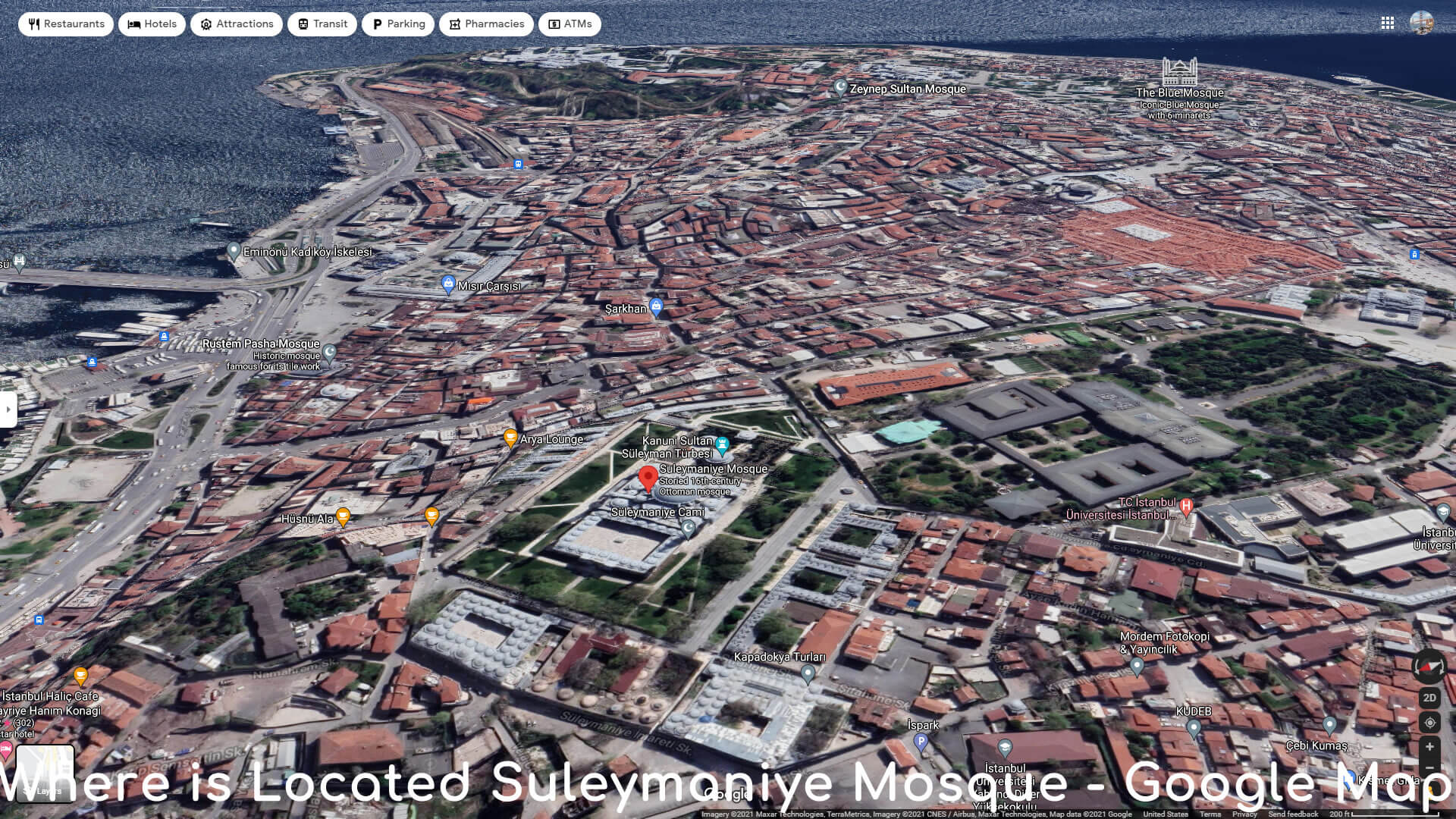
- Address: Suleymaniye Mah, Prof. Siddik Sami Onar Cd. No:1, 34116 Fatih / Istanbul
- Opening Hours: Open 24 hours (Mondayday-Sunday)
- Architect: Mimar Sinan
- Burials: Suleiman the Magnificent, Hurrem Sultan
- Architectural styles: Ottoman architecture, Islamic architecture
- Opened: 1558
- Number of minarets: 4
- Groundbreaking: 1550
#7 Istanbul Archaeology Museums
 The Istanbul Archaeology Museums are a group of three archaeological museums located in the Eminonu quarter of Istanbul, Turkey, near Gulhane Park and Topkapi Palace.
The Ottoman sultan Abdulaziz (r. 1861–1876) was impressed by the archaeological museums in Paris (30 June – 10 July 1867), London (12–23 July 1867) and Vienna (28–30 July 1867) which he visited in the summer of 1867, and ordered a similar archaeological museum to be established in Istanbul. The Istanbul Archaeology Museums consists of three museums:
- Archaeological Museum (in the main building)
- Museum of the Ancient Orient
- Museum of Islamic Art (in the Tiled Kiosk).
It houses over one million objects that represent almost all of the eras and civilizations in world history. Where is Located Istanbul Archaeology Museums - Google Map
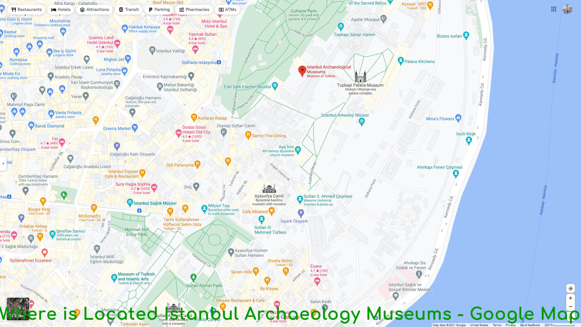
- Address: Cankurtaran, 34122 Fatih / Istanbul
- Opening Hours: 9AM - 7PM (Monday-Sunday)
- Phone: (0212) 520 77 41
- Founder: Osman Hamdi Bey
- Founded: June 13, 1891
- Architect: Alexander Vallaury
- Architectural style: Neoclassical architecture
- Collection size: 1+ million objects
- Director: Zeynep Kiziltan
#8 Grand Bazaar (Kapali Carsi)
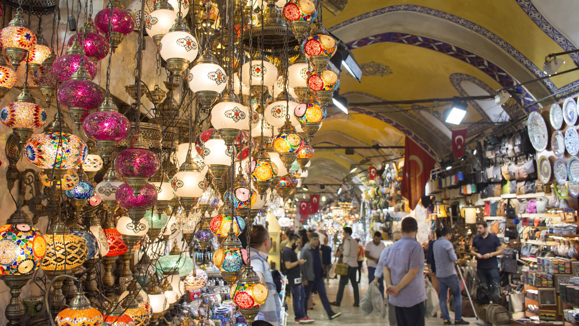 The Grand Bazaar in Istanbul is one of the largest and oldest covered markets in the world, with 61 covered streets and over 4,000 shops on a total area of 30,700 m², attracting between 250,000 and 400,000 visitors daily. In 2014, it was listed No.1 among the world's most-visited tourist attractions with 91,250,000 annual visitors. The Grand Bazaar at Istanbul is often regarded as one of the first shopping malls of the world.
 Where is Located Grand Bazaar - Google Map
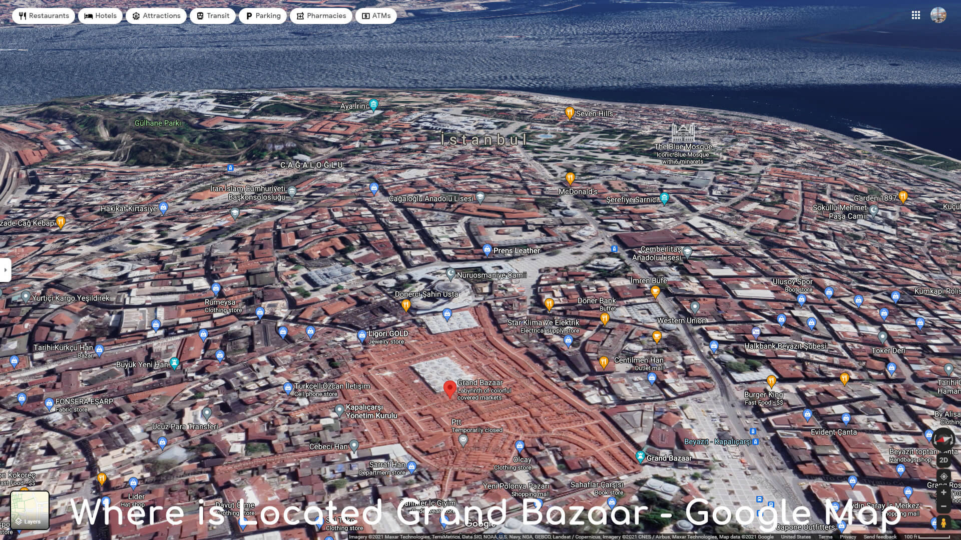
- Address: Beyazit, Kalpakcilar Cd. No:22, 34126 Fatih / Istanbul
- Opening Hours: 10AM - 6PM (Monday-Sunday)
- Phone: (0212) 519 12 48
- Opened: 1461
- Beginning date: 1455
#9 Spice Bazaar
 The Spice Bazaar in Istanbul, Turkey is one of the largest bazaars in the city. Located in the Eminonu quarter of the Fatih district, it is the most famous covered shopping complex after the Grand Bazaar.
There are several documents suggesting that the name of the bazaar was first "New Bazaar". Then it got its name "Egyptian Bazaar" (Turkish: Misir Carsisi) because it was built with the revenues from the Ottoman eyalet of Egypt in 1660. The word misir has a double meaning in Turkish: "Egypt" and "maize". This is why sometimes the name is wrongly translated as "Corn Bazaar". The bazaar was (and still is) the center for spice trade in Istanbul, but in recent years shops of other types are gradually replacing the sellers of spices.
The building itself is part of the kulliye (complex) of the New Mosque. The revenues obtained from the rented shops inside the bazaar building were used for the upkeeping of the mosque. Where is Located Spice Bazaar - Google Map
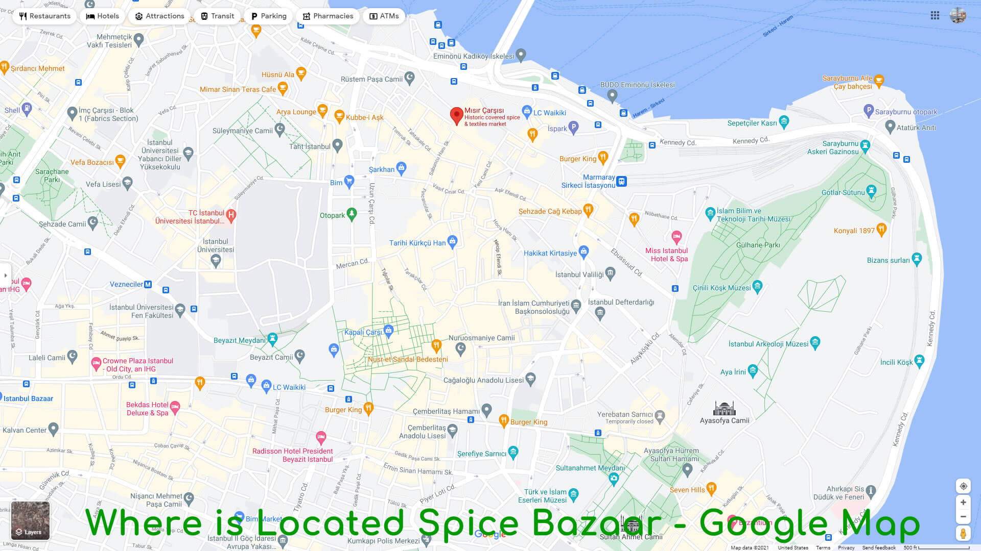
- Address: Rustem Pasa, Erzak Ambari Sok. No:92, 34116 Fatih/Istanbul
- Opening Hours: 9AM - 7PM (Monday-Friday) / Saturday 8AM–7:30PM / Sunday 9:30AM–7PM
- Phone: (0212) 513 65 97
- Architectural style: Ottoman architecture
#10 Basilica Cistern
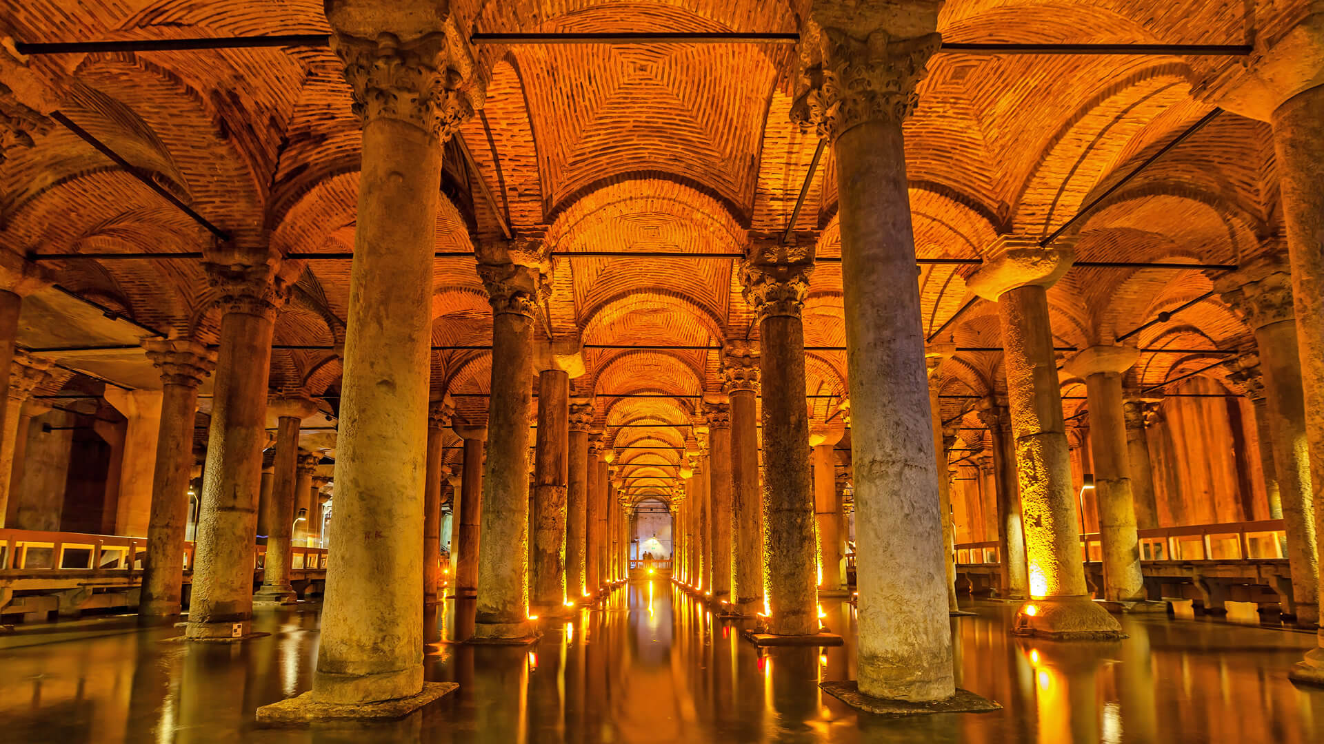 The Basilica Cistern, or Cisterna Basilica, is the largest of several hundred ancient cisterns that lie beneath the city of Istanbul, Turkey. he cistern, located 150 metres (490 ft) southwest of the Hagia Sophia on the historical peninsula of Sarayburnu, was built in the 6th century during the reign of Byzantine Emperor Justinian I. Today it is kept with little water, for public access inside the space.
This subterranean cistern, in Greek kinsterne (st), was called Basilica because it was located under a large public square on the First Hill of Constantinople, the Stoa Basilica. At this location, and prior to constructing the cistern, a great Basilica stood in its place, built between the 3rd and 4th centuries during the Early Roman Age as a commercial, legal and artistic centre. The basilica was reconstructed by Illus after a fire in 476.
A 3-min walk from the Hagia Sophia Where is Located Basilica Cistern - Google Map
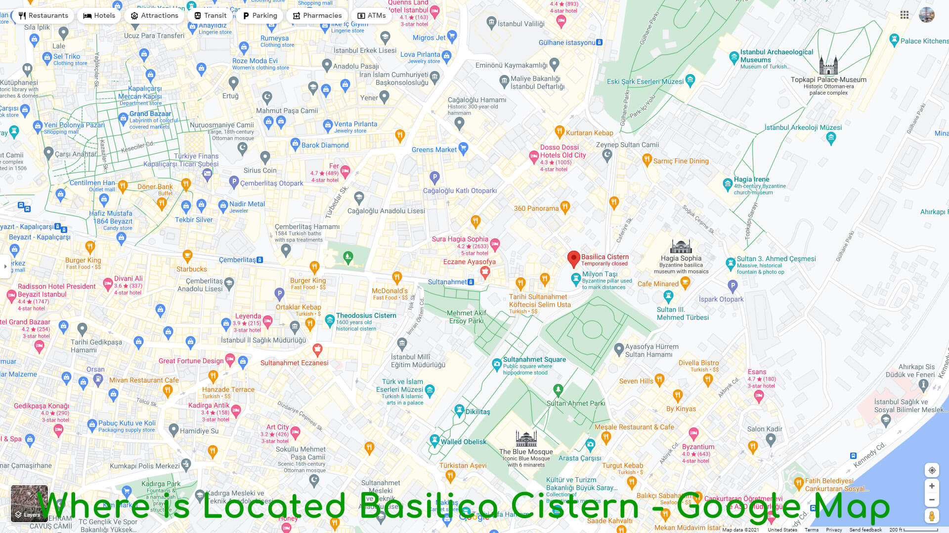
- Address: Alemdar, Yerebatan Cd. 1/3, 34110 Fatih/Istanbul
- Phone: (0212) 512 15 70
- Opened: 1987
- Architectural styles: Byzantine architecture, Ancient Greek architecture
#11 Galata Tower
 The Galata Tower, called Christea Turris by the Genoese, is a medieval stone tower in the Galata/Karakoy quarter of Istanbul, Turkey, just to the north of the Golden Horn's junction with the Bosphorus. It is a high, cone-capped cylinder that dominates the skyline and offers a panoramic vista of Istanbul's historic peninsula and its environs.
 Where is Located Galata Tower - Google Map
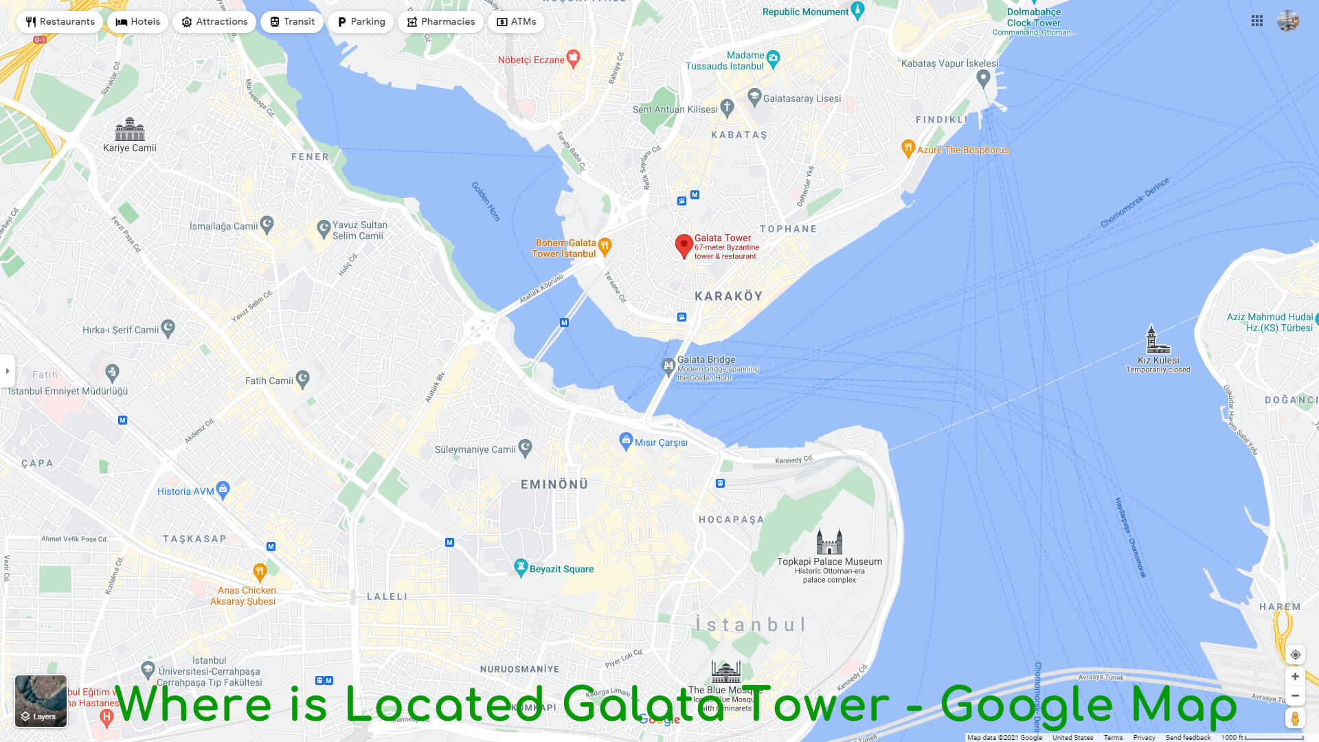
- Address: Bereketzade, Galata Kulesi, 34421 Beyoglu/Istanbul
- Opening Hours: 8:30AM - 12AM (Monday-Sunday)
- Phone: (0212) 245 41 41
- Height: 63 m
- Opened: 1348
- Architect: Koksal Anadol
- Architectural style: Romanesque architecture
- Floors: 9
- Function: Tower
#12 Bosphorus Strait
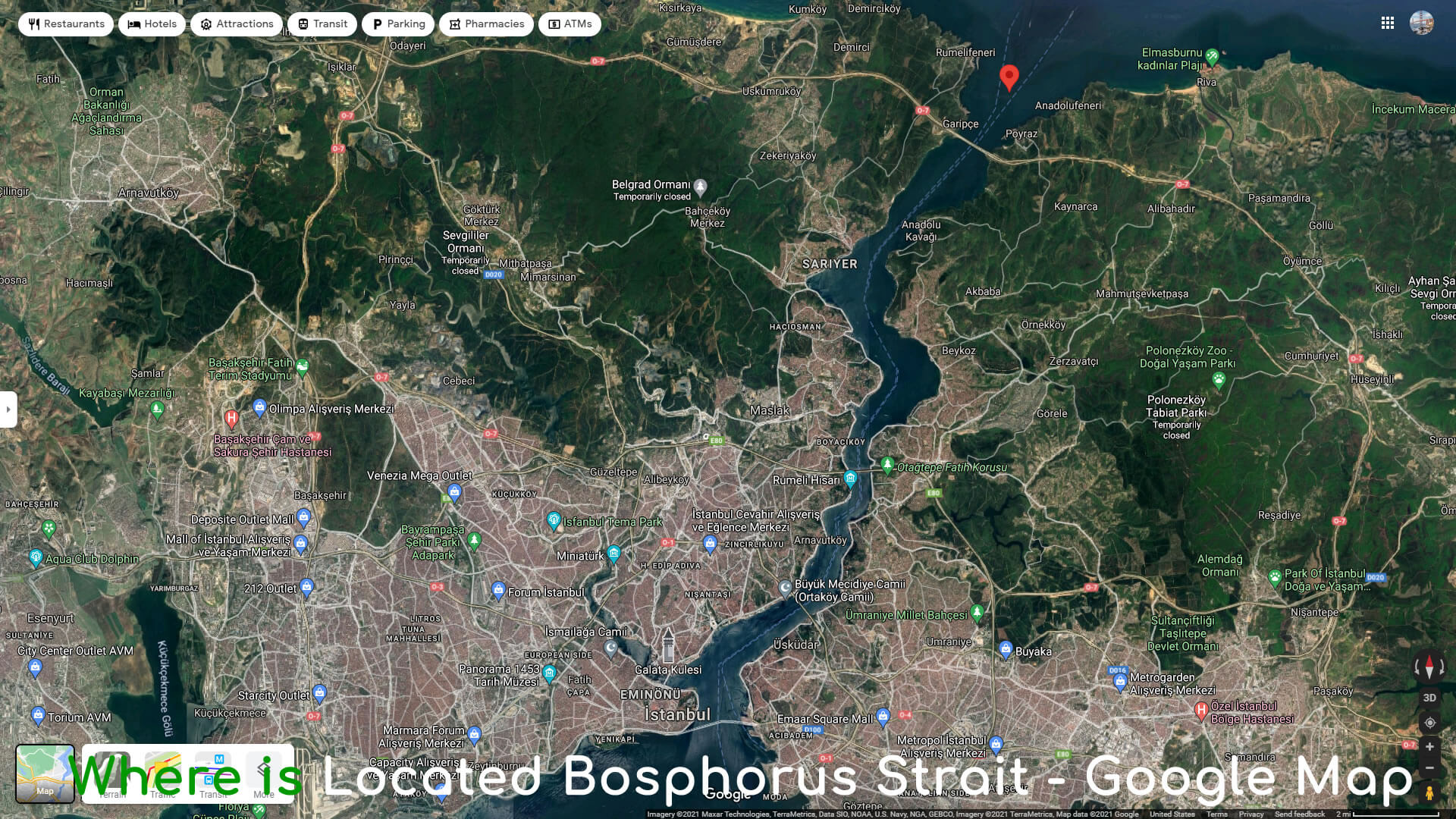
 The Bosporus or Bosphorus, also known as the Strait of Istanbul, is a narrow, natural strait and an internationally significant waterway located in northwestern Turkey. It forms part of the continental boundary between Europe and Asia, and divides Turkey by separating Anatolia from Thrace.
It is the world's narrowest strait used for international navigation. The Bosporus connects the Black Sea with the Sea of Marmara, and, by extension via the Dardanelles, the Aegean and Mediterranean seas, and by the Kerch Strait, the sea of Azov.
Most of the shores of the strait, except for those in the north, are heavily settled, straddled by the city of Istanbul's metropolitan population of 17 million inhabitants extending inland from both coasts.
Together with the Dardanelles, the Bosporus forms the Turkish Straits. - Mean depth: 65 m
- Max. depth: 110 m (360 ft)
- Basin countries: Turkey
- Min. width: 700 m (2,300 ft)
Where is Located Bosphorus Strait - Google Map
#13 Princes' Islands
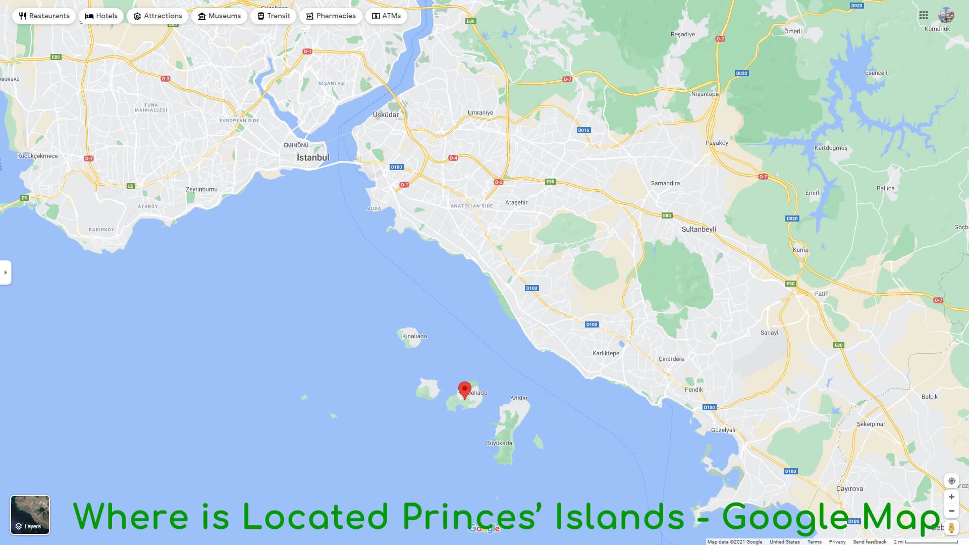
 The Princes' Islands are a cluster of 9 islands southeast of Istanbul in the Sea of Marmara. Mainly car-free, the islands are known for their horse-drawn carriages (phaetons). At the highest point of Buyukada, the largest island, the 6th-century Hagia Yorgi Church has panoramic views. Nearby are the pine forests of Dil Burnu National Park. The Museum of the Princes' Islands has exhibits on the islands' history.
 - Mayor: Erdem Gul
- City: Istanbul
- Area code(s): 0-216
- University: Halki seminary
Where is Located Princes' Islands - Google Map
#14 Istiklal Street
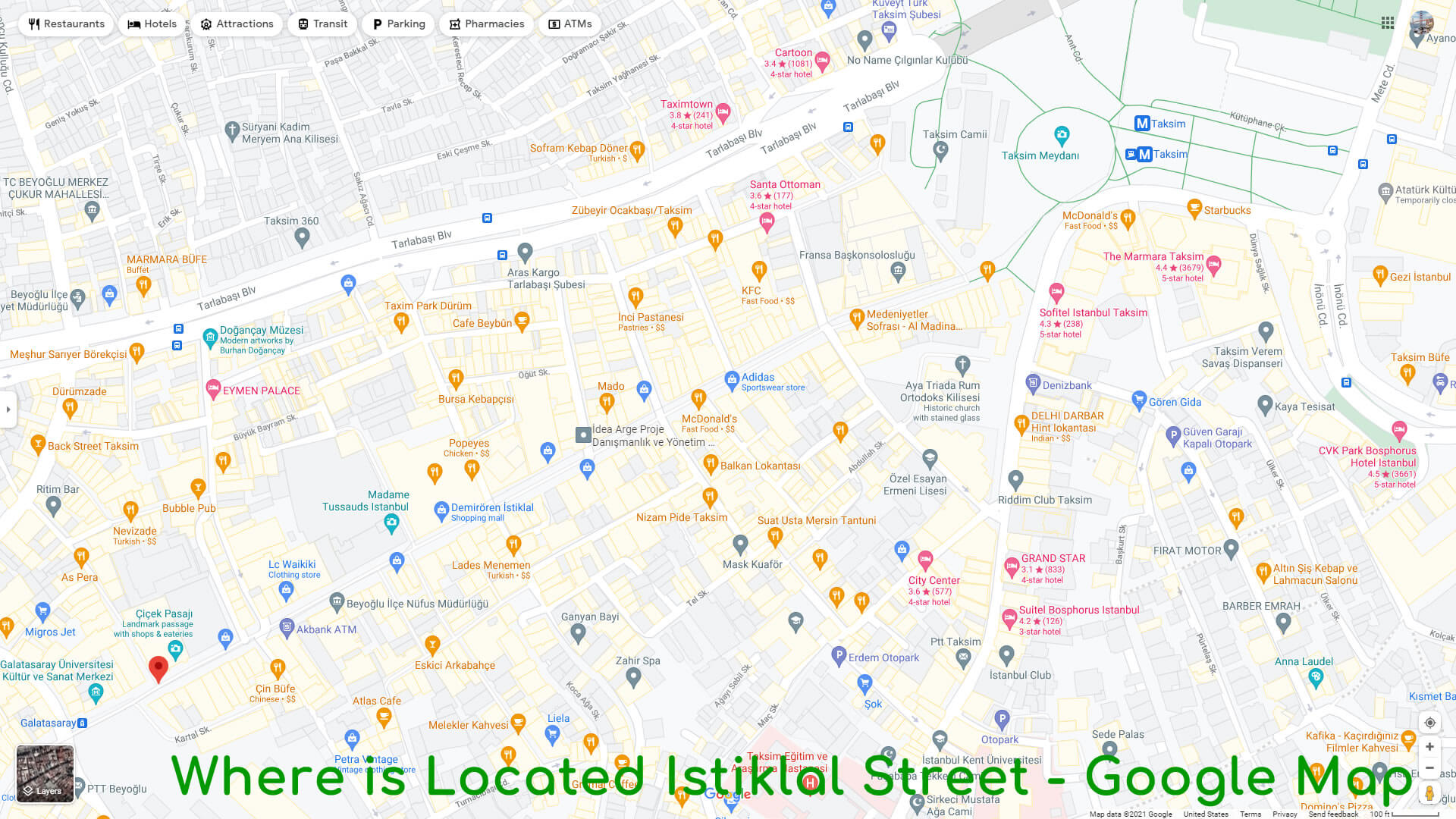
 Istiklal Avenue, historically known as the Grand Avenue of Pera is one of the most famous avenues in Istanbul, Turkey, visited by nearly 3 million people in a single day over the course of weekends. Located in the historic Beyoglu (Pera) district, it is an elegant pedestrian street, 1.4 kilometres (0.87 mi) long, which houses boutiques, music stores, bookstores, art galleries, cinemas, theatres, libraries, cafés, pubs, nightclubs with live music, historical patisseries, chocolateries and restaurants.
The avenue, surrounded by late Ottoman era buildings (mostly from the 19th and early 20th centuries) that were designed with the Neo-Classical, Neo-Gothic, Renaissance Revival, Beaux-Arts, Art Nouveau and First Turkish National Architecture styles; as well as a few Art Deco style buildings from the early years of the Turkish Republic, and a number of more recent examples of modern architecture; starts from the northern end of Galata (the medieval Genoese quarter) at Tunel Square and ultimately leads up to Taksim Square.
Galatasaray Square is located at approximately the center of the avenue and is home to the oldest secondary school in Turkey: the Galatasaray High School (Galatasaray Lisesi), originally known as the Galata Sarayi Enderun-u Humayunu (Galata Palace Imperial School). - Length: 1.4 km
- Major cities: Istanbul
Where is Located Istiklal Street - Google Map
#15 Istanbul Aquarium
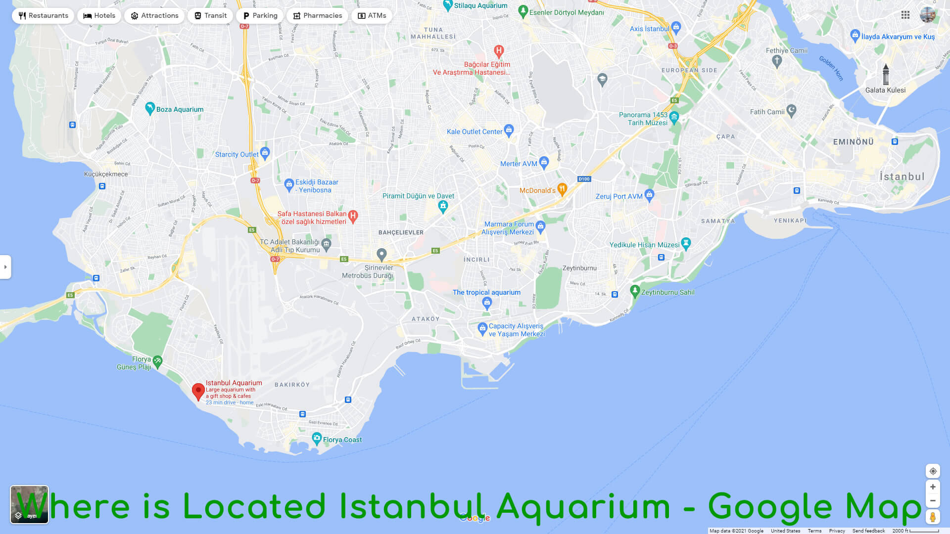
 Istanbul Aquarium is a public aquarium in Istanbul, Turkey. It opened its doors in April 2011, is an official member of World Association of Zoos and Aquariums (WAZA). The site is 5 km from Ataturk International Airport, near the motorway and railway transportation systems in Florya, which is at the southwest coast of Istanbul.
 Where is Located Istanbul Aquarium - Google Map
- Address: Senlikkoy, Yesilkoy Halkali Cd. No:93, 34153 Florya/Istanbul
- Opening Hours: 10AM - 7PM (Monday-Sunday)
- Phone: 444 9 744
- Exhibits: Amazon Rain Forests, South Pole Area, Red Sea Area,
- Opened: April 1, 2011
Serpent Column
To raise the image of his new capital, Constantine and his successors, especially Theodosius the Great, brought works of art from all over the empire to adorn it. The monuments were set up in the middle of the Hippodrome, the spina. Among these was the sacrificial tripod of Plataea, now known as the Serpent Column, cast to celebrate the victory of the Greeks over the Persians during the Persian Wars in the 5th century BC.Obelisk of Thutmose III
Another emperor to adorn the Hippodrome was Theodosius the Great, who in 390 brought an obelisk from Egypt and erected it inside the racing track. Carved from pink granite, it was originally erected at the Temple of Karnak in Luxor during the reign of Thutmose III in about 1490 BC. Theodosius had the obelisk cut into three pieces and brought to Constantinople. The top section survives, and it stands today where Theodosius placed it, on a marble pedestal. The granite obelisk has survived nearly 3,500 years in astonishingly good condition.Walled Obelisk
In the 10th century the Emperor Constantine Porphyrogenitus built another obelisk at the other end of the Hippodrome. It was originally covered with gilded bronze plaques, but they were sacked by Latin troops in the Fourth Crusade. The stone core of this monument also survives, known as the Walled Obelisk.Statues of Porphyrius
Seven statues were erected on the Spina of the Hippodrome in honour of Porphyrius the Charioteer, a legendary charioteer of the early 6th century who in his time raced for the two parties which were called "Greens" and "Blues". None of these statues have survived. The bases of two of them have survived and are displayed in the Istanbul Archaeological Museum.#5 Dolmabahce Palace
 Dolmabahce Palace located in the Besiktas district of Istanbul, Turkey, on the European coast of the Bosporus strait, used as the main administrative center of the Ottoman Empire from 1856 to 1887 and from 1909 to 1922. Yildiz Palace was used in the interim period from 1887 and 1909.
 Dolmabahce Palace was built by the Empire's 31st Sultan, Abdulmecid I, between the years 1843 and 1856. Previously, the Sultan and his family had lived at the Topkapi Palace, but as the medieval Topkapi was lacking in contemporary style, luxury, and comfort, as compared to the palaces of the European monarchs, Abdulmecid decided to build a new modern palace near the site of the former Besiktas Sahil Palace. Haci Said Aga was responsible for the construction works, while the project was realized by architects Garabet Balyan, his son Nigogayos Balyan and Evanis Kalfa (members of the Armenian Balyan family of Ottoman court architects).
Where is Located Dolmabahce Palace - Google Map

- Address: Visnezade, Dolmabahce Cd., 34357 Besiktas / Istanbul
- Opening Hours: 9AM - 4PM (Tuesday-Sunday) / Monday closed
- Phone: +90 212 236 9000
- Architect: Mihran Mesrobian
- Opened: 1823
- Architectural Styles: Baroque Revival architecture, Rococo Revival
- Construction started: 1843
- Owner: Turkish state
#6 Suleymaniye Mosque
 The Suleymaniye Mosque is an Ottoman imperial mosque located on the Third Hill of Istanbul, Turkey. The mosque was commissioned by Suleiman the Magnificent and designed by the imperial architect Mimar Sinan. An inscription specifies the foundation date as 1550 and the inauguration date as 1557.
 Behind the qibla wall of the mosque is an enclosure containing the separate octagonal mausoleums of Suleiman the Magnificent and that of his wife Hurrem Sultan (Roxelana). For 462 years, the Suleymaniye Mosque was the largest mosque in the city, until it was surpassed by the Camlica Mosque in 2019. The Suleymaniye Mosque is one of the best-known sights of Istanbul, and from its location on the Third Hill, it commands an extensive view of the city around the Golden Horn.
Where is Located Suleymaniye Mosque - Google Map

- Address: Suleymaniye Mah, Prof. Siddik Sami Onar Cd. No:1, 34116 Fatih / Istanbul
- Opening Hours: Open 24 hours (Mondayday-Sunday)
- Architect: Mimar Sinan
- Burials: Suleiman the Magnificent, Hurrem Sultan
- Architectural styles: Ottoman architecture, Islamic architecture
- Opened: 1558
- Number of minarets: 4
- Groundbreaking: 1550
#7 Istanbul Archaeology Museums
 The Istanbul Archaeology Museums are a group of three archaeological museums located in the Eminonu quarter of Istanbul, Turkey, near Gulhane Park and Topkapi Palace.
 The Ottoman sultan Abdulaziz (r. 1861–1876) was impressed by the archaeological museums in Paris (30 June – 10 July 1867), London (12–23 July 1867) and Vienna (28–30 July 1867) which he visited in the summer of 1867, and ordered a similar archaeological museum to be established in Istanbul.
The Istanbul Archaeology Museums consists of three museums:
- Archaeological Museum (in the main building)
- Museum of the Ancient Orient
- Museum of Islamic Art (in the Tiled Kiosk).
Where is Located Istanbul Archaeology Museums - Google Map

- Address: Cankurtaran, 34122 Fatih / Istanbul
- Opening Hours: 9AM - 7PM (Monday-Sunday)
- Phone: (0212) 520 77 41
- Founder: Osman Hamdi Bey
- Founded: June 13, 1891
- Architect: Alexander Vallaury
- Architectural style: Neoclassical architecture
- Collection size: 1+ million objects
- Director: Zeynep Kiziltan
#8 Grand Bazaar (Kapali Carsi)
 The Grand Bazaar in Istanbul is one of the largest and oldest covered markets in the world, with 61 covered streets and over 4,000 shops on a total area of 30,700 m², attracting between 250,000 and 400,000 visitors daily. In 2014, it was listed No.1 among the world's most-visited tourist attractions with 91,250,000 annual visitors. The Grand Bazaar at Istanbul is often regarded as one of the first shopping malls of the world.
 Where is Located Grand Bazaar - Google Map

- Address: Beyazit, Kalpakcilar Cd. No:22, 34126 Fatih / Istanbul
- Opening Hours: 10AM - 6PM (Monday-Sunday)
- Phone: (0212) 519 12 48
- Opened: 1461
- Beginning date: 1455
#9 Spice Bazaar
 The Spice Bazaar in Istanbul, Turkey is one of the largest bazaars in the city. Located in the Eminonu quarter of the Fatih district, it is the most famous covered shopping complex after the Grand Bazaar.
 There are several documents suggesting that the name of the bazaar was first "New Bazaar". Then it got its name "Egyptian Bazaar" (Turkish: Misir Carsisi) because it was built with the revenues from the Ottoman eyalet of Egypt in 1660. The word misir has a double meaning in Turkish: "Egypt" and "maize". This is why sometimes the name is wrongly translated as "Corn Bazaar". The bazaar was (and still is) the center for spice trade in Istanbul, but in recent years shops of other types are gradually replacing the sellers of spices.
The building itself is part of the kulliye (complex) of the New Mosque. The revenues obtained from the rented shops inside the bazaar building were used for the upkeeping of the mosque.
Where is Located Spice Bazaar - Google Map

- Address: Rustem Pasa, Erzak Ambari Sok. No:92, 34116 Fatih/Istanbul
- Opening Hours: 9AM - 7PM (Monday-Friday) / Saturday 8AM–7:30PM / Sunday 9:30AM–7PM
- Phone: (0212) 513 65 97
- Architectural style: Ottoman architecture
#10 Basilica Cistern
 The Basilica Cistern, or Cisterna Basilica, is the largest of several hundred ancient cisterns that lie beneath the city of Istanbul, Turkey. he cistern, located 150 metres (490 ft) southwest of the Hagia Sophia on the historical peninsula of Sarayburnu, was built in the 6th century during the reign of Byzantine Emperor Justinian I. Today it is kept with little water, for public access inside the space.
 This subterranean cistern, in Greek kinsterne (st), was called Basilica because it was located under a large public square on the First Hill of Constantinople, the Stoa Basilica. At this location, and prior to constructing the cistern, a great Basilica stood in its place, built between the 3rd and 4th centuries during the Early Roman Age as a commercial, legal and artistic centre. The basilica was reconstructed by Illus after a fire in 476.
A 3-min walk from the Hagia Sophia
Where is Located Basilica Cistern - Google Map

- Address: Alemdar, Yerebatan Cd. 1/3, 34110 Fatih/Istanbul
- Phone: (0212) 512 15 70
- Opened: 1987
- Architectural styles: Byzantine architecture, Ancient Greek architecture
#11 Galata Tower
 The Galata Tower, called Christea Turris by the Genoese, is a medieval stone tower in the Galata/Karakoy quarter of Istanbul, Turkey, just to the north of the Golden Horn's junction with the Bosphorus. It is a high, cone-capped cylinder that dominates the skyline and offers a panoramic vista of Istanbul's historic peninsula and its environs.
 Where is Located Galata Tower - Google Map

- Address: Bereketzade, Galata Kulesi, 34421 Beyoglu/Istanbul
- Opening Hours: 8:30AM - 12AM (Monday-Sunday)
- Phone: (0212) 245 41 41
- Height: 63 m
- Opened: 1348
- Architect: Koksal Anadol
- Architectural style: Romanesque architecture
- Floors: 9
- Function: Tower
#12 Bosphorus Strait
 The Bosporus or Bosphorus, also known as the Strait of Istanbul, is a narrow, natural strait and an internationally significant waterway located in northwestern Turkey. It forms part of the continental boundary between Europe and Asia, and divides Turkey by separating Anatolia from Thrace.
 It is the world's narrowest strait used for international navigation. The Bosporus connects the Black Sea with the Sea of Marmara, and, by extension via the Dardanelles, the Aegean and Mediterranean seas, and by the Kerch Strait, the sea of Azov.
Most of the shores of the strait, except for those in the north, are heavily settled, straddled by the city of Istanbul's metropolitan population of 17 million inhabitants extending inland from both coasts.
Together with the Dardanelles, the Bosporus forms the Turkish Straits.
- Mean depth: 65 m
- Max. depth: 110 m (360 ft)
- Basin countries: Turkey
- Min. width: 700 m (2,300 ft)
Where is Located Bosphorus Strait - Google Map

#13 Princes' Islands
 The Princes' Islands are a cluster of 9 islands southeast of Istanbul in the Sea of Marmara. Mainly car-free, the islands are known for their horse-drawn carriages (phaetons). At the highest point of Buyukada, the largest island, the 6th-century Hagia Yorgi Church has panoramic views. Nearby are the pine forests of Dil Burnu National Park. The Museum of the Princes' Islands has exhibits on the islands' history.
 - Mayor: Erdem Gul
- City: Istanbul
- Area code(s): 0-216
- University: Halki seminary
Where is Located Princes' Islands - Google Map

#14 Istiklal Street
 Istiklal Avenue, historically known as the Grand Avenue of Pera is one of the most famous avenues in Istanbul, Turkey, visited by nearly 3 million people in a single day over the course of weekends. Located in the historic Beyoglu (Pera) district, it is an elegant pedestrian street, 1.4 kilometres (0.87 mi) long, which houses boutiques, music stores, bookstores, art galleries, cinemas, theatres, libraries, cafés, pubs, nightclubs with live music, historical patisseries, chocolateries and restaurants.
 The avenue, surrounded by late Ottoman era buildings (mostly from the 19th and early 20th centuries) that were designed with the Neo-Classical, Neo-Gothic, Renaissance Revival, Beaux-Arts, Art Nouveau and First Turkish National Architecture styles; as well as a few Art Deco style buildings from the early years of the Turkish Republic, and a number of more recent examples of modern architecture; starts from the northern end of Galata (the medieval Genoese quarter) at Tunel Square and ultimately leads up to Taksim Square.
Galatasaray Square is located at approximately the center of the avenue and is home to the oldest secondary school in Turkey: the Galatasaray High School (Galatasaray Lisesi), originally known as the Galata Sarayi Enderun-u Humayunu (Galata Palace Imperial School).
- Length: 1.4 km
- Major cities: Istanbul
Where is Located Istiklal Street - Google Map

#15 Istanbul Aquarium
 Istanbul Aquarium is a public aquarium in Istanbul, Turkey. It opened its doors in April 2011, is an official member of World Association of Zoos and Aquariums (WAZA). The site is 5 km from Ataturk International Airport, near the motorway and railway transportation systems in Florya, which is at the southwest coast of Istanbul.
 Where is Located Istanbul Aquarium - Google Map

- Address: Senlikkoy, Yesilkoy Halkali Cd. No:93, 34153 Florya/Istanbul
- Opening Hours: 10AM - 7PM (Monday-Sunday)
- Phone: 444 9 744
- Exhibits: Amazon Rain Forests, South Pole Area, Red Sea Area,
- Opened: April 1, 2011
- Head of Performance Marketing
- Head of SEO
- Linkedin Profile: linkedin.com/in/arifcagrici
