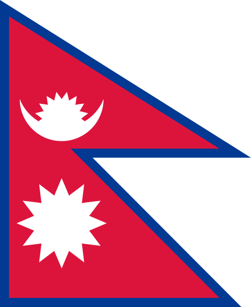
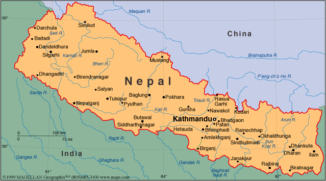
Nepal Map
Discover the location of Nepal on the world map - explore its cities, landmarks, and natural wonders! Navigate Nepal with our detailed map and learn about its diverse geography, culture, and history.

- Capital : Kathmandu
- Population : 26,494,504
- GDP : $17.921 billion
- Per Capita : $623.624
- Calling Code : +977
- Jobless Rate : 3.00%
- Time Zone : +5.45
Where is located Nepal on the Map
Nepal is a landlocked country located in South Asia. It is situated in the Himalayas and bordered by China to the north and India to the south, east, and west.
Nepal is a country located in South Asia and is bordered by China to the north and India to the south, east, and west. It is known for its majestic Himalayan mountains, including Mount Everest, the highest mountain peak in the world. Nepal has a rich cultural heritage, with diverse ethnic groups and languages. The capital city is Kathmandu, which is a popular destination for tourists to explore the city's ancient temples and traditional architecture. This map of Nepal provides an overview of the country's geography and major cities.
For more about Nepal >>
MAP OF NEPAL

NEPAL LOCATION MAP

WHERE IS NEPAL IN THE WORLD

CITIES MAP OF NEPAL

INDIA NEPAL MAP

MAP OF NEPAL ASIA

MAP OF NEPAL WORL

MAP OF NEP

Brief information about Nepal
Nepal is a landlocked country located in South Asia, bordered by China to the north and India to the south, east, and west. The country has a diverse geography, ranging from the Himalayan mountain range to the fertile plains of the Terai region.Here is some statistical information about Nepal:
Nepal is a landlocked country located in South Asia, bordered by China to the north and India to the south, east, and west. The country has an area of 147,181 square kilometers and a population of over 30 million people, with Kathmandu as its capital and largest city. Nepal is known for its diverse geography, including the Himalayan mountain range, which contains the world's highest peak, Mount Everest.A Collection of Nepal Maps and Nepal Satellite Images
MAP OF NEPAL

NEPAL LOCATION MAP

WHERE IS NEPAL IN THE WORLD

CITIES MAP OF NEPAL

INDIA NEPAL MAP

MAP OF NEPAL ASIA

MAP OF NEPAL WORLD

MAP OF NEPAL

MAP NEPAL

NEPA ASIA MAP

NEPAL MAP INDIA CHINA

NEPAL MAP

NEPAL SATELLITE MAP

NEPAL DISTRICS MAP

NEPAL MAP

NEPAL MAP

NEPAL MAPS

NEPAL POLITICAL MAP

NEPAL REGIONS MAP

PHYSICAL MAP OF NEPAL

PROVINCES MAP OF NEPAL

NEPAL EARTH MAP

- Head of Performance Marketing
- Head of SEO
- Linkedin Profile: linkedin.com/in/arifcagrici
Address: Hakarinne 2 Espoo, 02100 Uusimaa - Finland
Email: [email protected]
Phone: +358 44 230 0982
Worldmap1.com Blog
Email: [email protected]
Phone: +358 44 230 0982
Worldmap1.com Blog
Copyright WorldMap1.com 2004 - 2025. All rights reserved. Privacy Policy | Disclaimer

