Nebraska map guide to exploring the Cornhusker State! Located in the Great Plains region of the United States, Nebraska is known for its wide-open spaces, friendly people, and rich history.
With our Nebraska map, you can explore the state's cities, highways, and topography with just a few clicks. From the bustling city of Omaha to the historic town of Scottsbluff, there's something for everyone in Nebraska.
Nebraska's economy is diverse, with industries ranging from agriculture and manufacturing to finance and healthcare. The state is also home to several universities and colleges, including the University of Nebraska-Lincoln and Creighton University.
Whether you're planning a road trip, researching a school project, or simply satisfying your curiosity, our map has everything you need to discover all that Nebraska has to offer. So join us on a virtual tour of the Cornhusker State and experience its beauty and history for yourself!
MAP OF NEBRASKA
NEBRASKA COUNTIES MAP
Brief information about nebraska, US
The capital of Nebraska is Lincoln, while its largest city is Omaha. The state is known for its vast prairies, rolling hills, and vibrant urban areas.
Nebraska's economy is diverse, with a mix of industries that include agriculture, manufacturing, finance, and healthcare. The state is a leading producer of corn, soybeans, and beef, and is also home to several major food processing companies.
Nebraska has a rich cultural heritage, with strong ties to Native American history and pioneer settlement. The state is home to several museums, historic sites, and cultural festivals that celebrate its diverse heritage.
Tourism is an important industry in Nebraska, with visitors coming to see attractions such as Chimney Rock, the Strategic Air Command Museum, and the Henry Doorly Zoo and Aquarium. Nebraska is also known for its friendly people and strong sense of community, making it a great place to live and visit.
Nebraska is a state located in the Great Plains region of the United States. With an area of approximately 77,354 square miles (200,330 square kilometers), it is the 16th largest state in the country. According to the United States Census Bureau, Nebraska has an estimated population of approximately 1.9 million people as of 2020.
The population of Nebraska is predominantly white, with smaller populations of African American, Hispanic/Latino, and Asian residents. The state has a median age of 36.8 years, which is slightly younger than the national median.
Nebraska's history dates back to the arrival of Native American tribes such as the Pawnee and the Omaha. European settlement of the area began in the 1800s, and Nebraska became a state in 1867. During the 19th century, Nebraska played an important role in westward expansion, serving as a stop on the Oregon Trail and the Pony Express.
Nebraska's economy is diverse, with industries such as agriculture, manufacturing, finance, and healthcare contributing to its overall strength. The state is a leading producer of corn, soybeans, and beef, and is home to several major food processing companies. Manufacturing is another important industry, with products including machinery, plastics, and processed foods. The finance and healthcare sectors are also growing in Nebraska, with several major companies and medical centers located throughout the state.
Overall, Nebraska is known for its friendly people, strong sense of community, and diverse economy. Whether you're interested in history, agriculture, or simply exploring the Great Plains, Nebraska has something for everyone.
A Collection of Nebraska Maps and Nebraska Satellite Images
MAP OF NEBRASKA
NEBRASKA MAP
NEBRASKA POLITICAL MAP
NEBRASKA COUNTIES MAP
NEBRASKA COUNTY MAP
NEBRASKA HISTORICAL MAP
NEBRASKA HISTORICAL MAP 1899
NEBRASKA MAP OMAHA
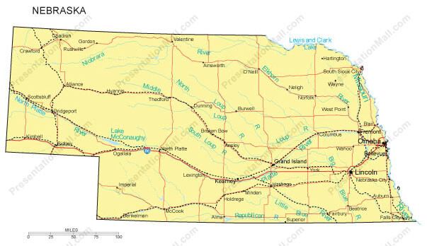
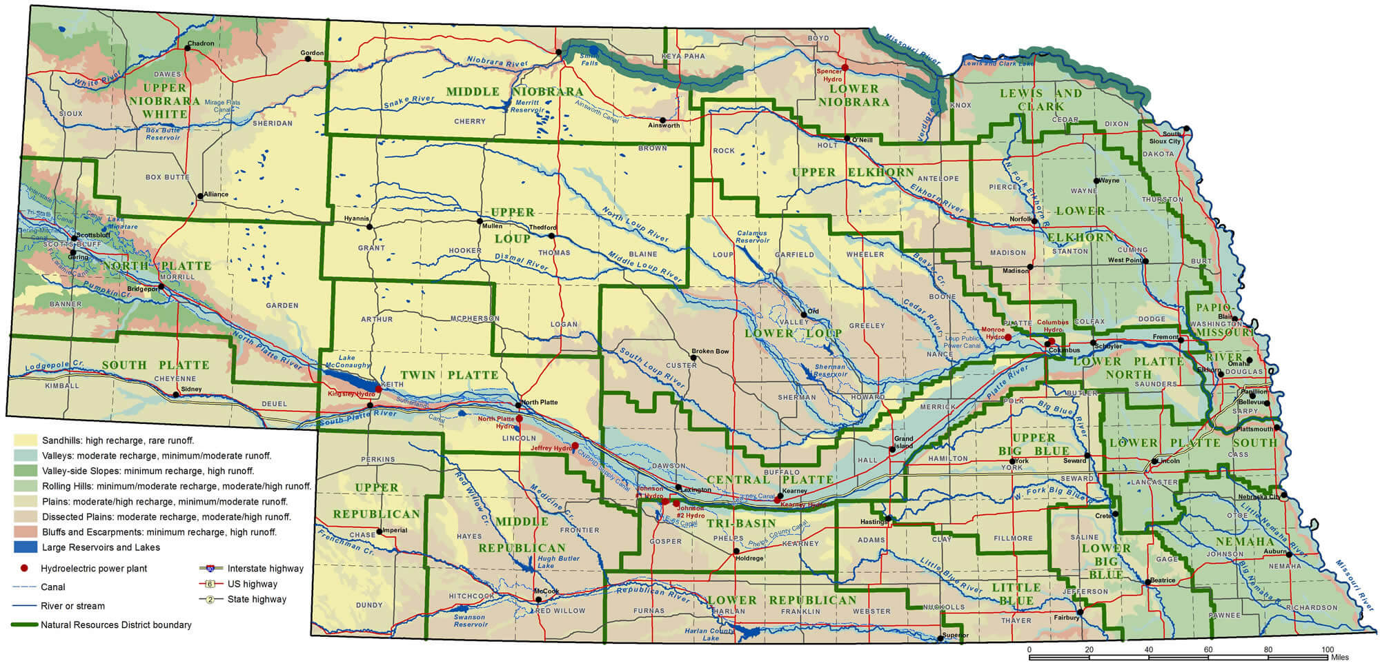
NEBRASKA PHYSICAL MAP
NEBRASKA POLITICAL MAP
NEBRASKA REFERENCE MAP
NEBRASKA RIVER MAP
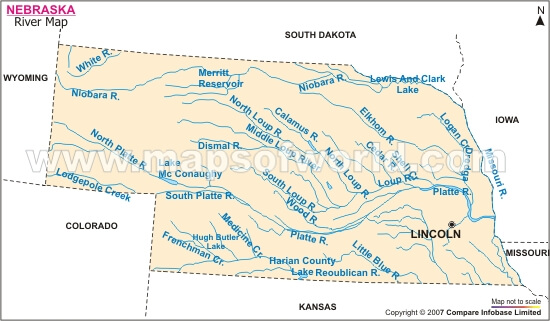
NEBRASKA RIVERS MAP
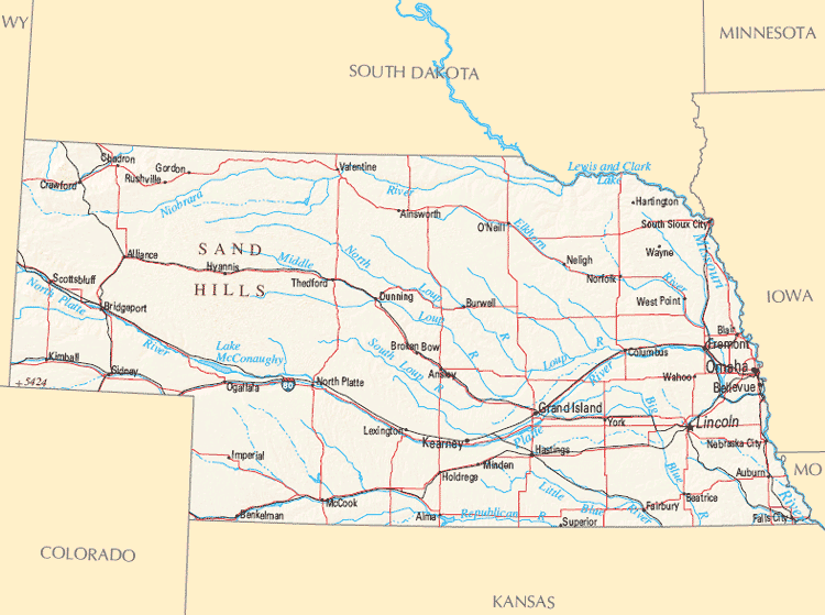
NEBRASKA ROAD MAP
NEBRASKA SATELLITE IMAGE
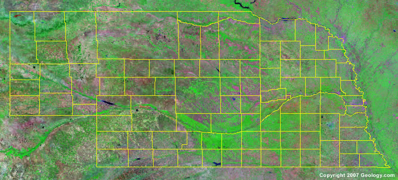
NEBRASKA STATE MAP
A collection of Nebraska Maps
Author: Arif Cagrici