
- Capital :
Port Louis
- Population :
1,291,456
- GDP :
$11.224 billion
- Per Capita :
$8,654
- Calling Code :
+230
- Jobless Rate :
7.90%
- Time Zone :
+4
Where is located Mauritius on the Map
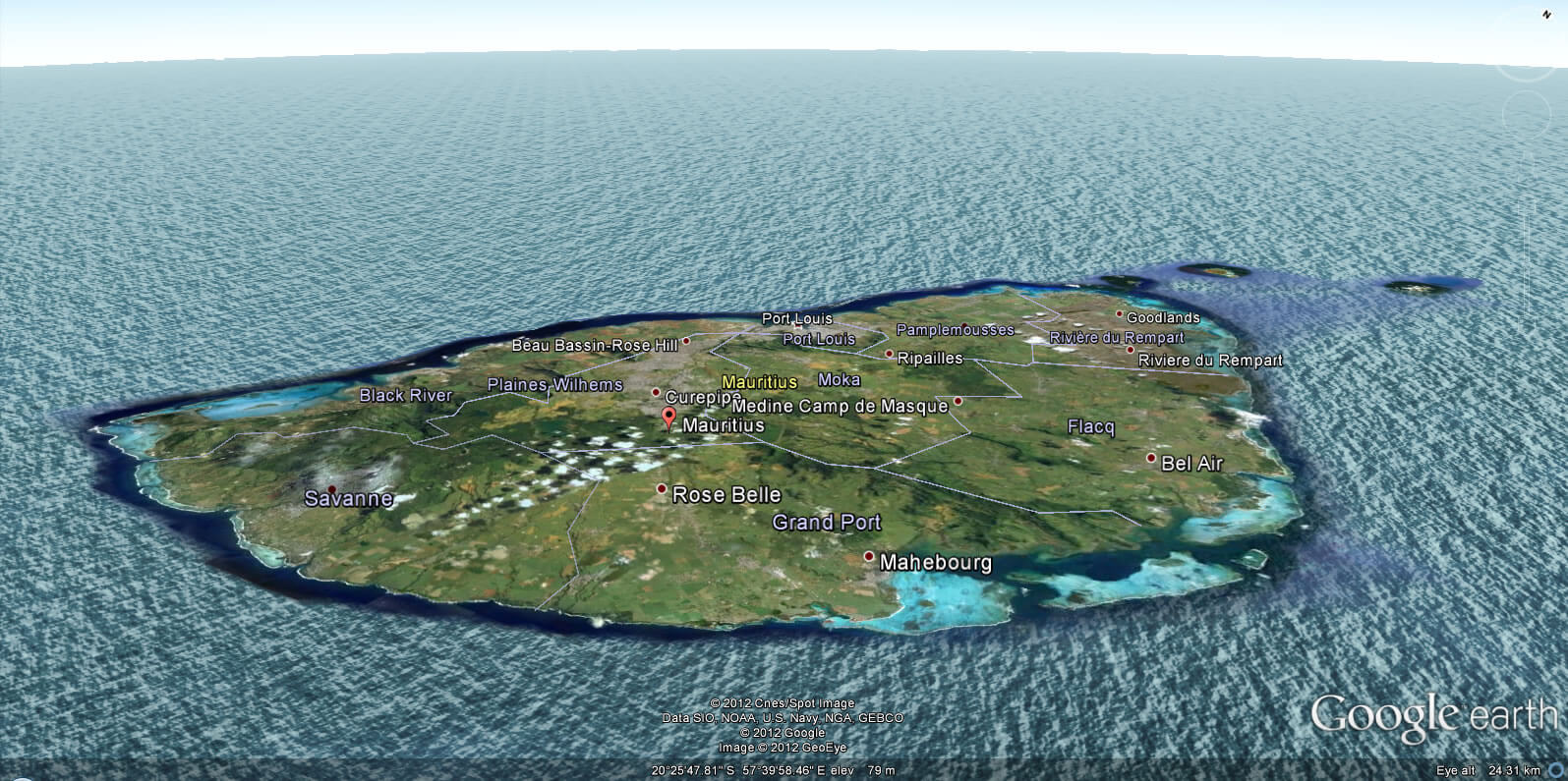
Mauritius is located in the Indian Ocean, approximately 2,000 kilometers off the southeast coast of the African continent, east of Madagascar. It is part of the Mascarene Islands, which also include Réunion and Rodrigues. The island nation of Mauritius is south of the Equator and is considered part of the continent of Africa.
With Mauritius detailed map, you'll gain an unparalleled understanding of this unique country nestled in the azure waters of the Indian Ocean.
Explore Mauritius from the convenience of your screen. Our map provides you with an in-depth look at the island's geography - its stunning beaches, the charming cities, lush national parks, and the mountainous interior. Whether you're planning a trip or just indulging your curiosity, our map serves as a reliable resource for every traveler.
Learn about the historical landmarks, local attractions, and cultural hotspots that make Mauritius an enticing destination. As you navigate across the map, you'll discover the diverse locations that mark Mauritius's cultural blend of French, Indian, Creole, and Chinese influences.
The island nation of Mauritius is much more than a speck in the Indian Ocean; it's a world filled with a rich blend of cultures, a thriving biodiversity, and breathtaking landscapes. So why wait? Embark on your virtual journey of Mauritius today, and let our map be your guide to this island paradise.
MAP OF MAURITIUS

WHERE IS MAURITIUS IN THE WORLD

MAURITIUS LOCATION MAP

MAP OF MAURITIUS
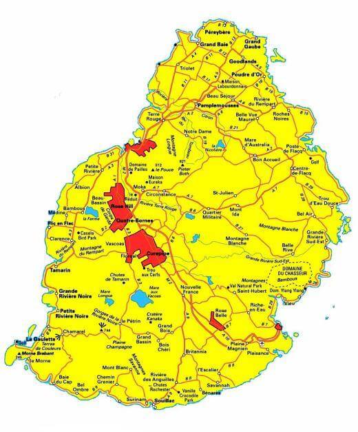
MAP MAURITIUS

MAURITIUS MAP

MAURITIUS CITIES MA

MAURITIUS ELEVATION M

Brief information about Mauritius
Mauritius is a beautiful island nation located in the Indian Ocean, about 2,000 kilometers off the southeast coast of Africa, east of Madagascar. It is part of the Mascarene Islands, along with Réunion and Rodrigues. The country spans approximately 2,040 square kilometers, making it the 170th largest nation in terms of land area.
Mauritius is known for its stunning landscapes, which include white sandy beaches, clear blue waters, lush green sugar cane fields, and majestic mountains. The island has a rich biodiversity and is home to many species found nowhere else in the world.
The country has a diverse population, made up of several ethnic groups including Indo-Mauritians, Creole, Sino-Mauritians, and Franco-Mauritians. This mix has resulted in a multilingual, multicultural society. The main languages spoken are Mauritian Creole, French, and English, with English being the official language.
Mauritius has a mixed developing economy based on manufactured exports, agriculture, tourism, and financial services. The island nation has one of the highest GDP per capita in Africa.
The capital and largest city is Port Louis, known for its French colonial architecture and vibrant market. Other significant towns include Beau Bassin-Rose Hill, Vacoas-Phoenix, and Quatre Bornes.
Mauritius is a parliamentary republic, and it gained independence from Britain on March 12, 1968. The island is known for its stable politics and regular peaceful transitions of power.
Overall, Mauritius is a unique blend of diverse cultures, stunning landscapes, and a robust economy, making it a vibrant and exciting destination.
Mauritius, an island nation in the Indian Ocean, has a rich history, diverse demographic profile, and a steadily developing economy. Here are some key statistics and facts about the country:
Area: Mauritius has a total area of approximately 2,040 square kilometers (788 square miles), making it the 170th largest nation in terms of land area. The island is surrounded by beautiful coral reefs, and its landscape is marked by stunning beaches, mountains, and rich biodiversity.
Population: As of my knowledge cut-off in September 2021, the population of Mauritius was around 1.3 million. The exact population could vary, so for the most accurate and recent data, please refer to an up-to-date source like the United Nations population estimates.
Demographics: Mauritius has a diverse population consisting of several ethnic groups. Indo-Mauritians make up the majority, accounting for about two-thirds of the population. Creole (people of mixed African and European descent), Chinese, and Franco-Mauritians (of French descent) also form significant minorities.
Languages: The population is multilingual, although English is the official language. Most people speak Mauritian Creole, a French-based creole, in day-to-day life. French and Bhojpuri are also commonly spoken.
Religion: Hinduism is the religion of about half the population, making it the most practiced religion in the country. Christianity, especially Roman Catholicism, and Islam also have a significant number of followers.
History: Mauritius was known to Arab and Malay sailors as early as the 10th century. Europeans discovered the island around 1500, and it was subsequently colonized by the Dutch, French, and British. Mauritius finally gained independence from Britain on March 12, 1968.
Economy: The economy of Mauritius has undergone a remarkable transformation since independence, from a low-income, agriculturally based economy to a diversified, upper middle-income economy with growing industrial, financial, and tourist sectors. Mauritius is also a member of the African Economic Community and the World Trade Organization.
Capital and Major Cities: The capital and largest city of Mauritius is Port Louis, known for its French colonial architecture. Other significant towns include Beau Bassin-Rose Hill, Vacoas-Phoenix, and Curepipe.
This information provides a statistical overview of Mauritius. For the most recent data, please refer to trusted and current sources.
A Collection of Mauritius Maps and Mauritius Satellite Images
MAP OF MAURITIUS

WHERE IS MAURITIUS IN THE WORLD

MAURITIUS LOCATION MAP

MAP OF MAURITIUS

MAP MAURITIUS

MAURITIUS MAP

MAURITIUS CITIES MAP

MAURITIUS ELEVATION MAP

MAURITIUS LAND MAP

MAURITIUS LOCATION MAP WORLD

MAURITIUS MAP
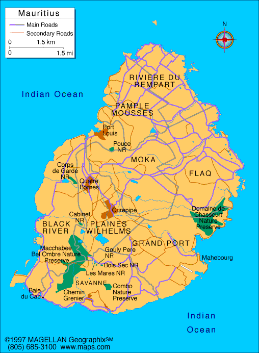
MAURITIUS MAP

MAURITIUS MAP ISLAND
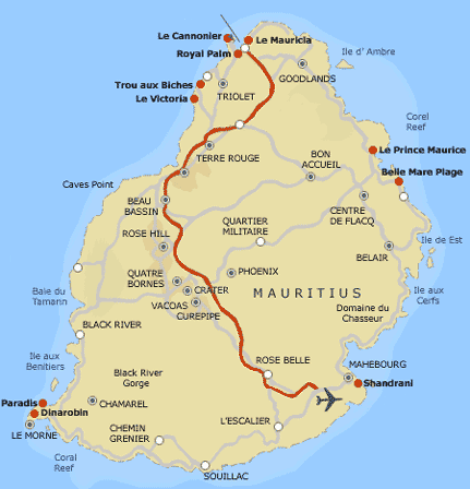
MAURITIUS MAP MADAGASKAR

MAURITIUS PHYSICAL MAP

MAURITIUS RELIEF MAP
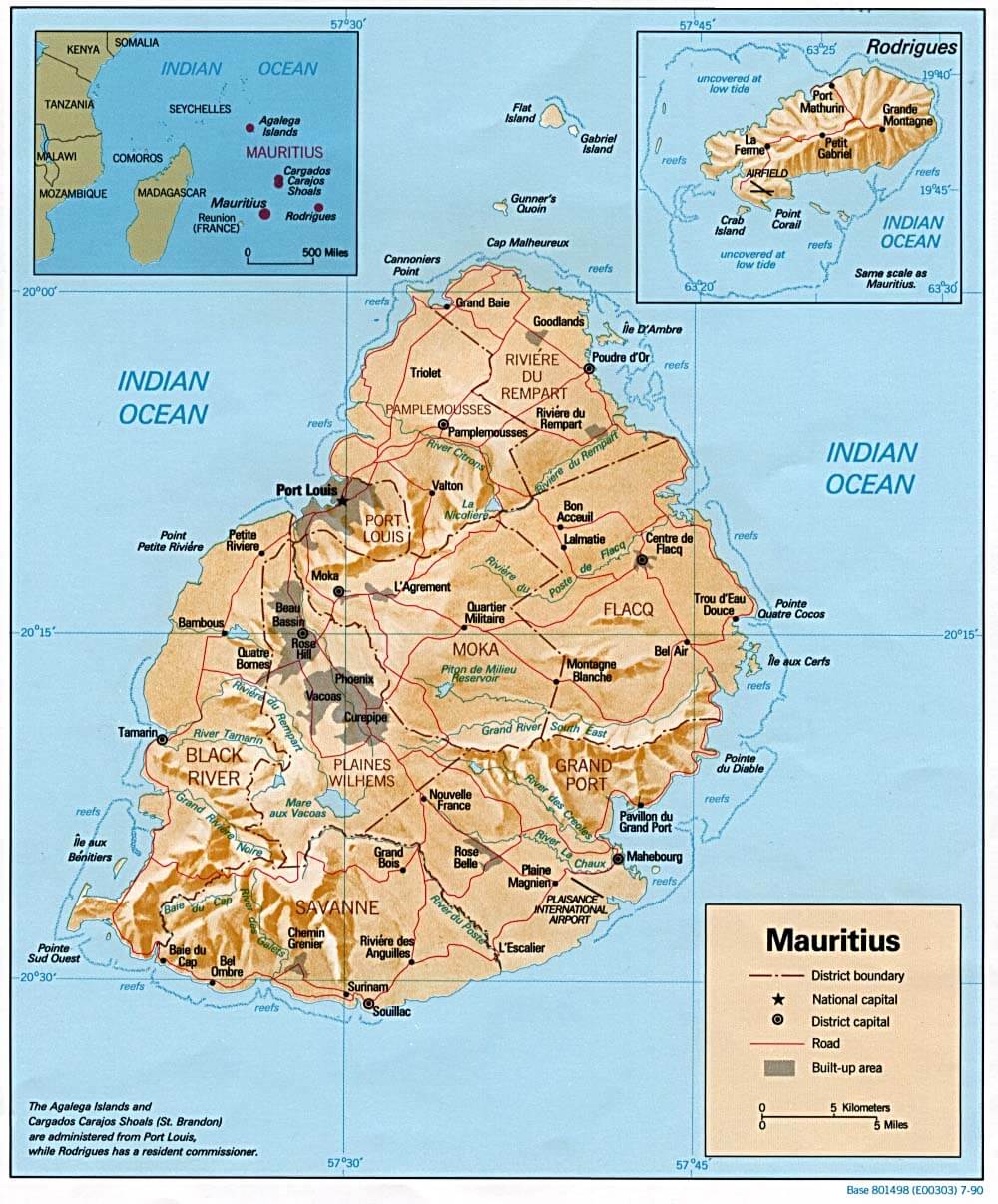
MAURITIUS RESORTS MAP

MAURITIUS ROAD MAP

MAURITIUS EARTH MAP
Author: Arif Cagrici


