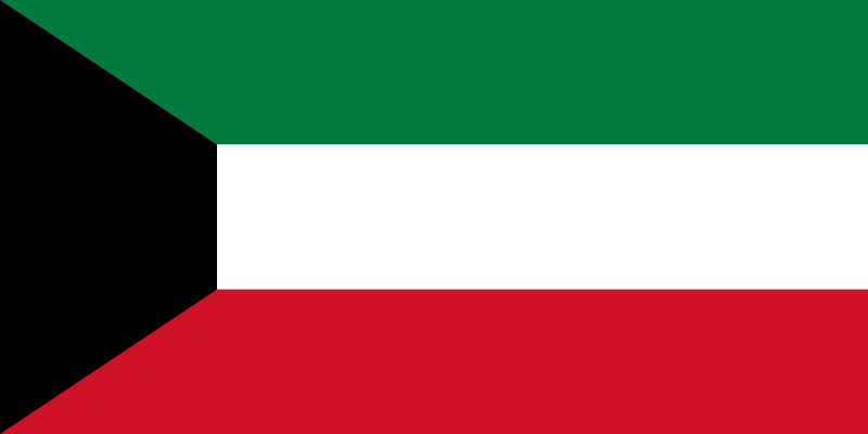
Kuwait Map
Discover the fascinating culture and rich history of Kuwait with our interactive map. Explore its stunning beaches, towering skyscrapers, and ancient landmarks with just a few clicks!
Planning a trip to Kuwait? Kuwait map has got you covered! Discover the best places to visit, from its historic museums to its luxurious shopping malls, and get ready to experience the magic of Kuwait.
Kuwait Map FQA
How many cities are in Kuwait ?
Kuwait has about 6 main cities. The largest by population are: Kuwait City; Al Ahmadi; Hawalli; Salmiya; Al Farwaniyah; Fahaheel.What are the major geographical features of Kuwait ?
Kuwait is a small Middle Eastern country on the Persian Gulf, with mostly flat desert terrain. It has sandy plains, coastal areas, and few natural freshwater resources.MAP OF KUWAIT

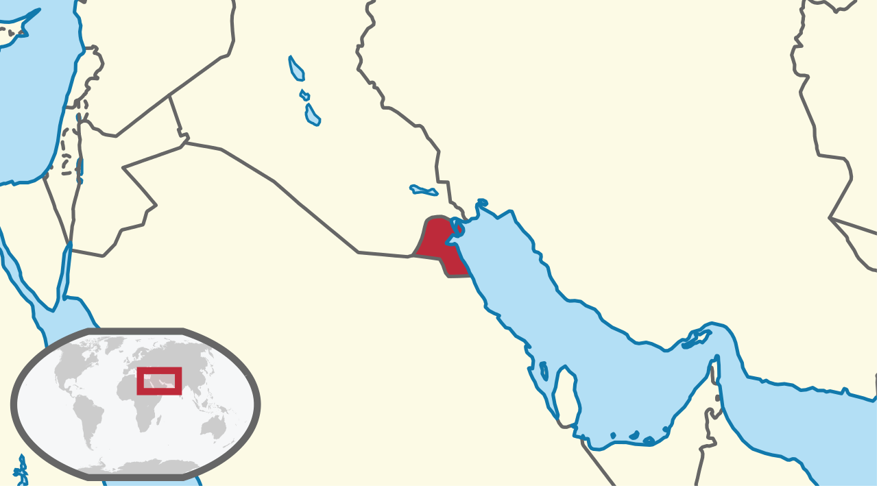
WHERE IS KUWAIT IN THE WORLD
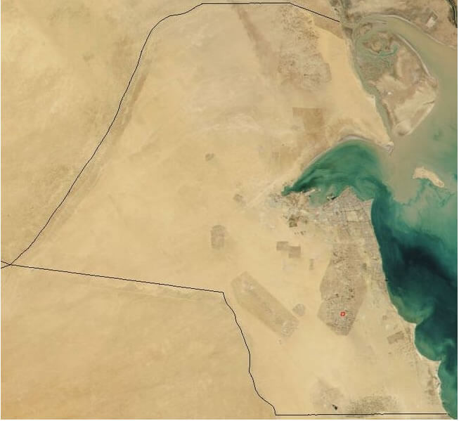
KUWAIT SATELLITE IMAGE MAP
Can I download a high-resolution map of Kuwait ?
Yes. Download high-resolution political and physical maps of Kuwait for personal or educational use. Redistribution is subject to the terms of our license.Where is located Kuwait on the Map
Kuwait is located in Western Asia, at the northern edge of the Persian Gulf, between Iraq and Saudi Arabia.
Kuwait map page provides a detailed overview of Kuwait's geography, highlighting its major cities, highways, and landmarks. Whether you're planning a trip to Kuwait or simply curious about this fascinating country, our map has everything you need to explore its vibrant culture and rich history. Discover Kuwait's stunning coastline, vast deserts, and modern urban centers, and learn about its unique blend of tradition and modernity. Join us on a journey through one of the Middle East's most dynamic and exciting nations!
For more about Kuwait >>
Brief information about Kuwait
Kuwait is a small country located in the Middle East, bordered by Iraq to the north and Saudi Arabia to the south. It covers an area of approximately 17,820 square kilometers and has a population of around 4.5 million people. The majority of the population is made up of expatriates, with Kuwaiti nationals making up only about one-third of the total population.A Collection of Kuwait Maps and Kuwait Satellite Images
MAP OF KUWAIT

WHERE IS KUWAIT IN THE WORLD

KUWAIT SATELLITE IMAGE MAP

KUWAIT CITY MAP
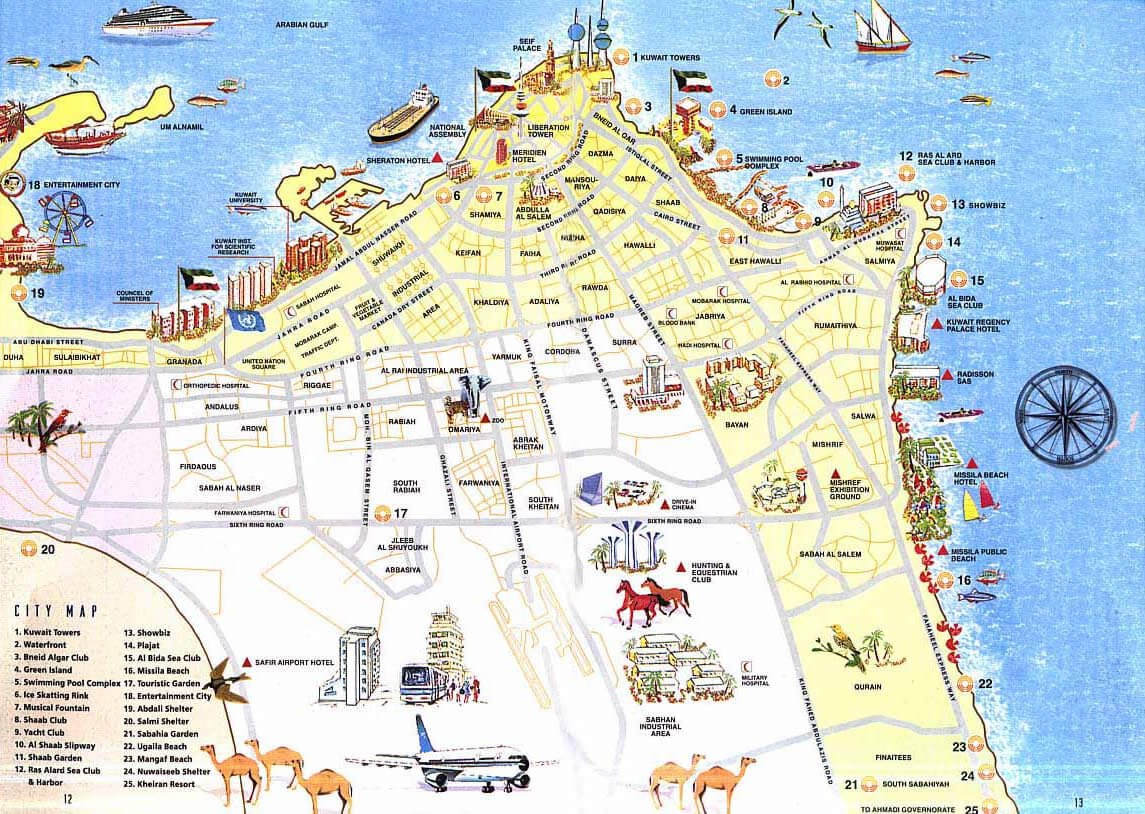
KUWAIT MAP

KUWAIT REGIONAL MAP
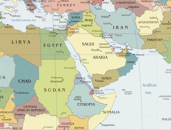
KUWAIT MAP WORLD

KUWAIT PHYSICAL MAP

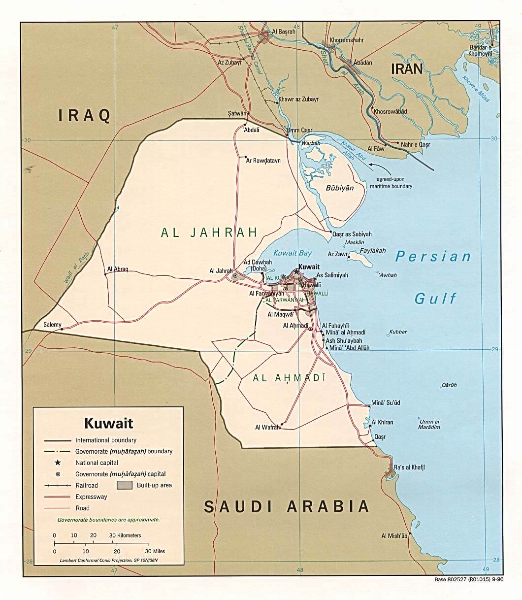
KUWAIT POLITIC MAP
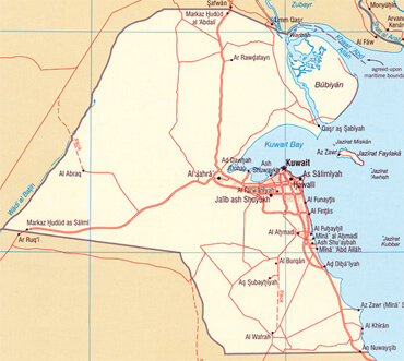
KUWAIT CITIES MAP

KUWAIT MAP

KUWAIT MAP
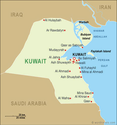
KUWAIT MAP WORLD

KUWAIT MAPS
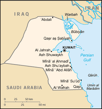
KUWAIT PHYSICAL MAP
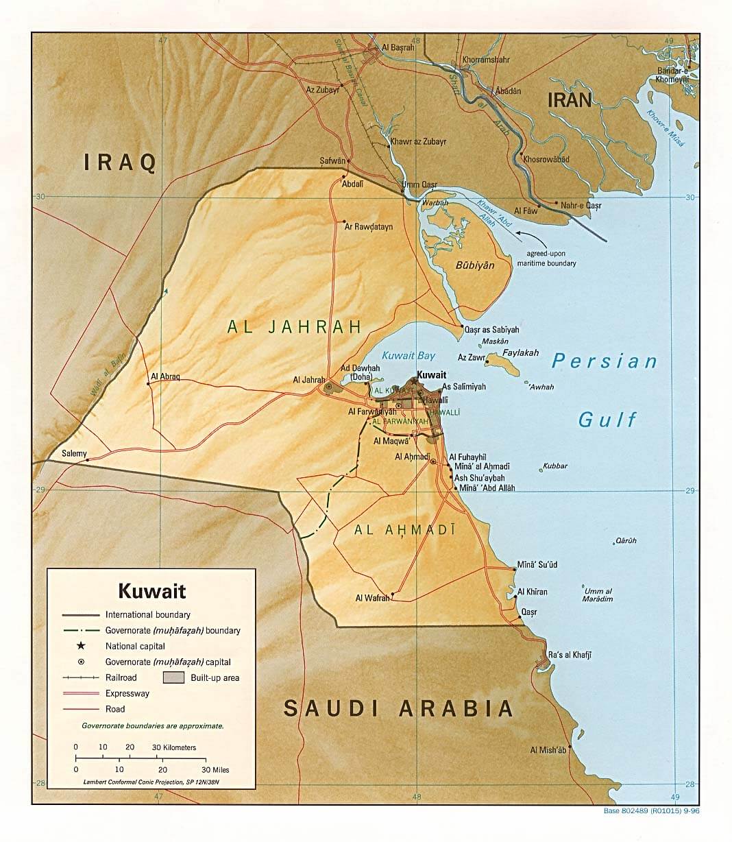
KUWAIT POLITICAL MAP
MAP OF KUWAIT MIDDLE EAST

MAP OF KUWAIT WORLD

MAP OF KUWAIT

MAP KUWAIT

- Head of Performance Marketing
- Head of SEO
- Linkedin Profile: linkedin.com/in/arifcagrici


