Cocos Islands Map

Discover the stunning Cocos Islands with our detailed map. Find your way around the islands and explore their pristine beaches, crystal-clear waters, and unique wildlife. Get to know the Cocos Islands with our comprehensive map.
Cocos Islands Flag
  • Capital : West Island
  • Population : 596
  • GDP : N/A
  • Per Capita : N/A
  • Calling Code : +61 891
  • Jobless Rate : N/A
  • Time Zone : +6,30

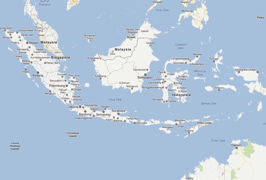
Where is located Cocos Islands on the Map


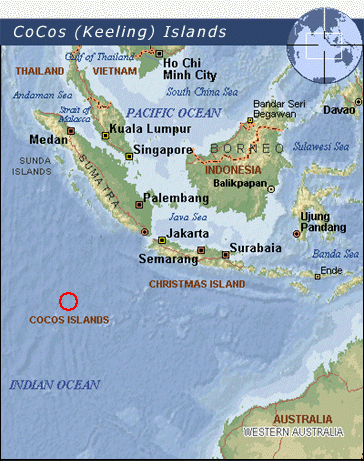
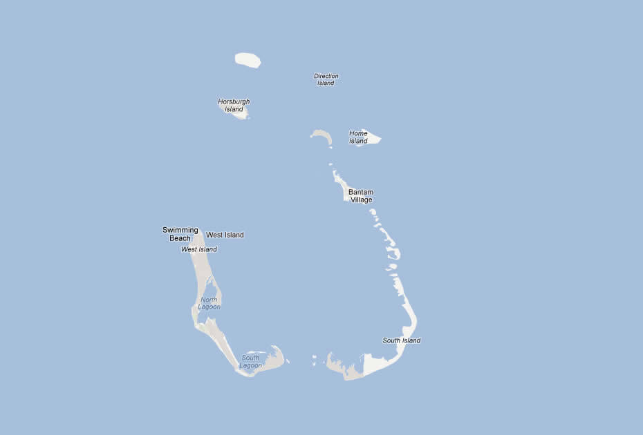
The Cocos Islands, also known as the Keeling Islands, are located in the Indian Ocean, approximately halfway between Australia and Sri Lanka. To be more specific, they are located about 2,750 kilometers (1,710 miles) northwest of Perth, the capital city of Western Australia. The islands consist of 27 coral islands, of which only two are inhabited, and cover a total land area of 14.2 square kilometers (5.5 square miles).

Cocos Islands map page, where you can explore one of Australia's most remote and fascinating territories. The Cocos Islands, also known as the Keeling Islands, are a group of 27 coral islands located in the Indian Ocean, about halfway between Australia and Sri Lanka. Only two of the islands are inhabited, and they offer visitors a unique and unforgettable experience of pristine beaches, crystal-clear waters, and stunning wildlife.

With our detailed map, you can find your way around the islands, learn about their history and culture, and discover the best spots for swimming, snorkeling, and sightseeing. So whether you're planning a trip to the Cocos Islands or simply curious about this amazing destination, we invite you to explore our map and discover all that this remote and beautiful part of Australia has to offer.

For more about Cocos Islands >>

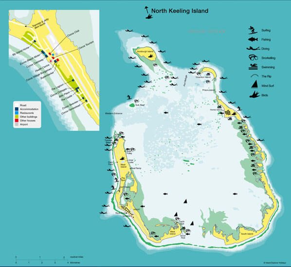
MAP OF COCOS ISLANDS

MAP OF COCOS ISLANDS

WHERE IS COCOS ISLANDS IN THE WORLD

WHERE IS COCOS ISLANDS IN THE WORLD

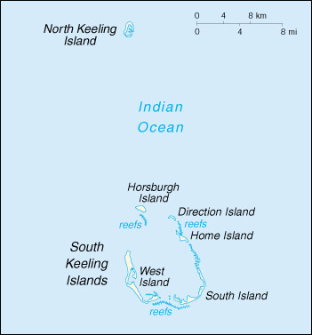
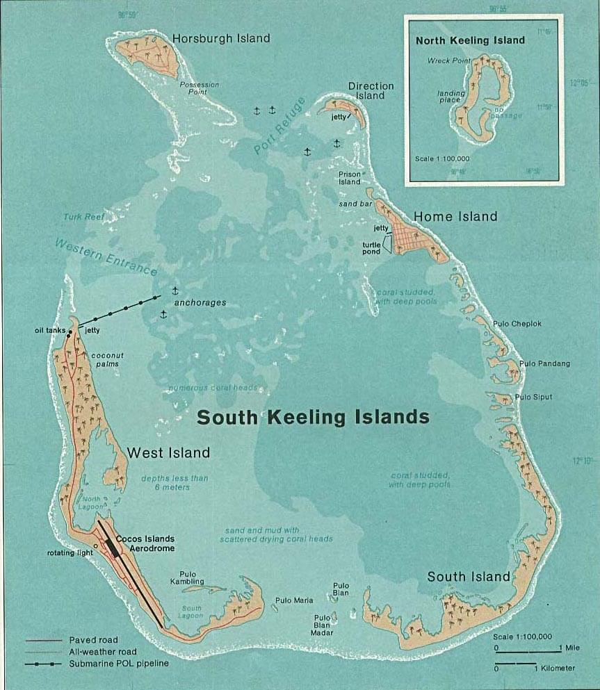
COCOS ISLANDS MAP SOUTH KEELING 1976

COCOS ISLANDS MAP SOUTH KEELING 1976

COCOS ISLAND MAP
COCOS ISLAND MAP

COCOS ISLAND MAPS

COCOS ISLAND MAPS

COCOS ISLANDS MAP INDIAN OCEAN

COCOS ISLANDS MAP INDIAN OCEAN

COCOS ISLANDS MA

COCOS ISLANDS MA

COCOS ISLAND M

COCOS ISLAND M

Brief information about Cocos Islands

The Cocos Islands, also known as the Keeling Islands, are an Australian territory located in the Indian Ocean, about halfway between Australia and Sri Lanka. The islands consist of 27 coral islands, of which only two are inhabited. The total land area of the islands is 14.2 square kilometers (5.5 square miles). The population is around 600 people, mostly of Cocos Malay descent, with English being the official language.

The islands were first settled in the early 19th century by English adventurer John Clunies-Ross and his family, who developed the coconut plantation industry on the islands. In 1955, the islands were transferred from British rule to Australian jurisdiction. Today, the economy of the Cocos Islands is based on tourism, coconut plantations, and fishing. The islands are known for their pristine beaches, clear waters, and unique wildlife, including turtles, sharks, and seabirds. The Cocos Islands are a remote and fascinating destination for visitors seeking a peaceful and exotic experience in Australia.

Area: The Cocos Islands have a total land area of 14.2 square kilometers (5.5 square miles).

Population: The islands have a population of around 600 people, according to the latest estimates.

Demographics: The majority of the population is of Cocos Malay descent, with a small number of ethnic Chinese and European residents. English is the official language, although the Cocos Malay language is also widely spoken.

History: The Cocos Islands were first settled in the early 19th century by the English adventurer John Clunies-Ross and his family, who developed the coconut plantation industry on the islands. In 1955, the islands were transferred from British rule to Australian jurisdiction, and today they are administered as an external territory of Australia.

Economy: The economy of the Cocos Islands is primarily based on tourism, coconut plantations, and fishing. The islands are known for their stunning natural beauty, with pristine beaches and crystal-clear waters that attract visitors from around the world. The coconut plantations on the islands produce copra, which is used to make coconut oil, and the fishing industry is centered around the harvesting of tuna and other species from the surrounding waters. The islands also receive financial assistance from the Australian government to support their infrastructure and services.

A Collection of Cocos Islands Maps and Cocos Islands Satellite Images

MAP OF COCOS ISLANDS
map of Cocos Islands
WorldMap1.com Donwload Now

WHERE IS COCOS ISLANDS IN THE WORLD

where is cocos islands in the world
WorldMap1.com Donwload Now

COCOS ISLANDS MAP SOUTH KEELING 1976

cocos islands map south keeling 1976
WorldMap1.com Donwload Now

COCOS ISLAND MAP

cocos island map
WorldMap1.com Donwload Now

COCOS ISLAND MAPS

cocos island maps
WorldMap1.com Donwload Now

COCOS ISLANDS MAP INDIAN OCEAN

Cocos Islands map indian ocean
WorldMap1.com Donwload Now

COCOS ISLANDS MAP

Cocos Islands map
WorldMap1.com Donwload Now

COCOS ISLAND MAP

cocos island map
WorldMap1.com Donwload Now

COCOS ISLAND MAP

cocos island map
WorldMap1.com Donwload Now

COCOS ISLANDS MAP

cocos islands map
WorldMap1.com Donwload Now

MAP OF COCOS ISLAND AUSTRALIA

map of cocos island australia
WorldMap1.com Donwload Now

MAP OF COCOS ISLAND

map of cocos island
WorldMap1.com Donwload Now

COCOS ISLANDS EARTH MAP

Cocos Islands Earth Map
WorldMap1.com Donwload Now

Author: Arif Cagrici

Largest Cities' Map of Cocos Islands