Where is Canada on the World Map?
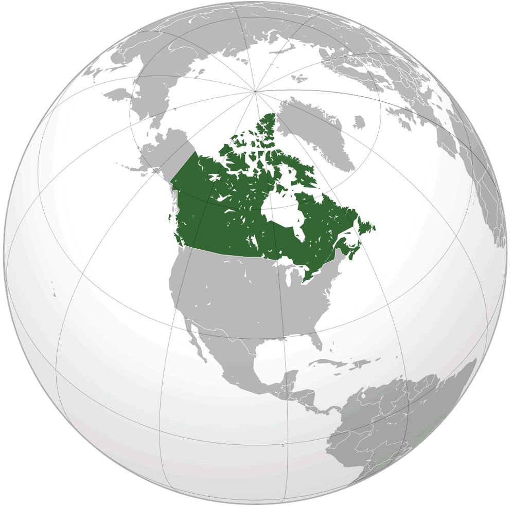
Discover the vast land of Canada with our interactive map! Explore cities, national parks, and landmarks in Canada today. The northernmost country in North America, Canada is bounded by three oceans. To the north it meets the Arctic Ocean, to the west lies the Pacific Ocean, and on the east is the Atlantic Ocean. The United States borders Canada to the south, Alaska is at its northwest end and Greenland is to the northeast.
Where is located Canada on the Map
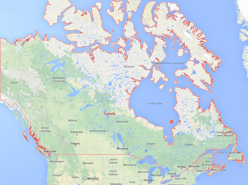
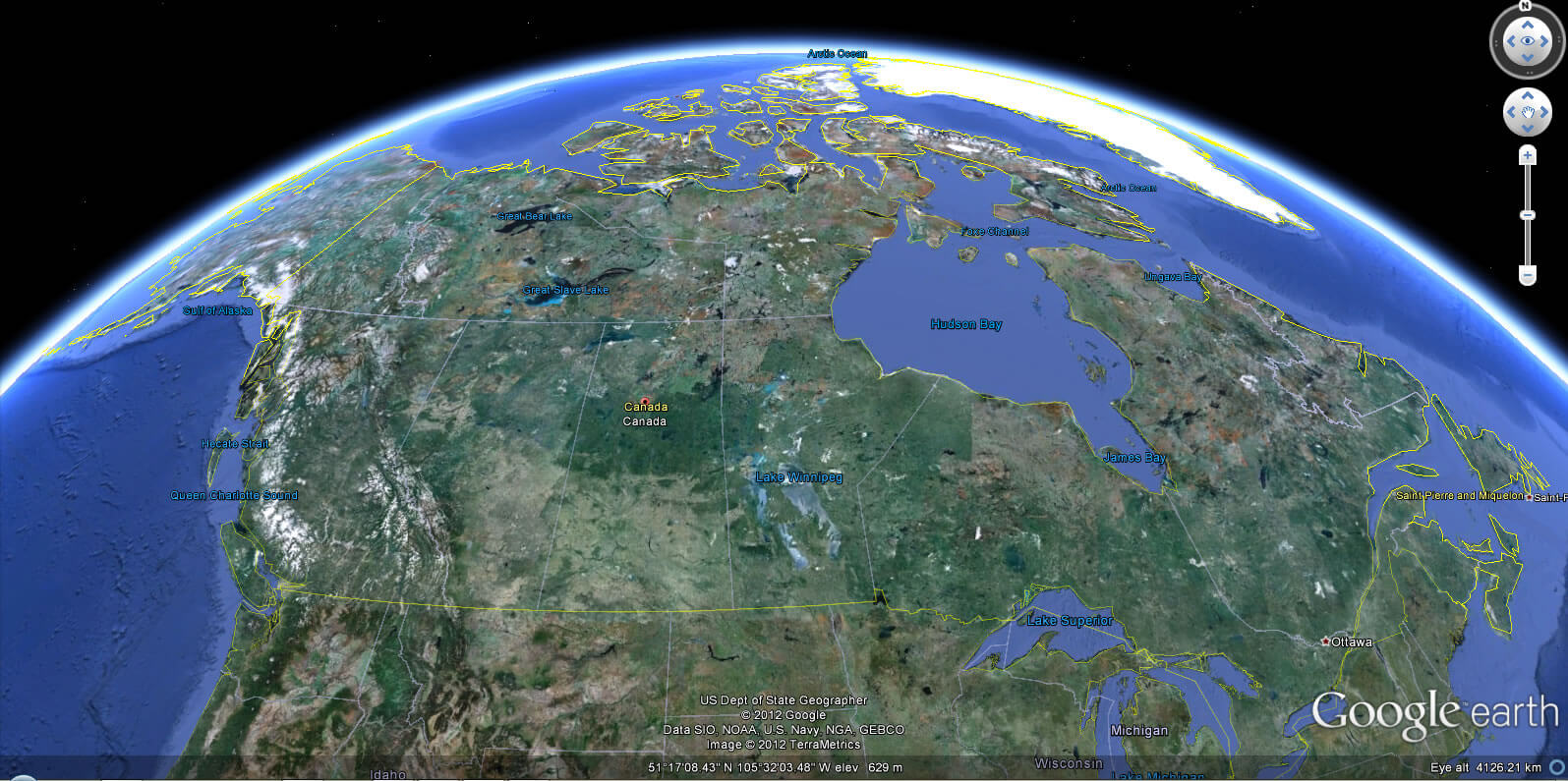
Canada is located in North America, covering a vast land area from the Pacific to the Atlantic Ocean, bordered to the north by the Arctic Ocean, and to the south by the United States.
There are mountains, wide open grassy plains, forests, hundreds of rivers and lakes with a lot of islands and other large natural areas. In fact, all the fresh water lakes of the world are in Canada.
Top 10 Must-See Destinations for Every Montreal Visitor
Please subscribe on "World Guide" channnel on Youtube at youtube.com/c/WorldGuide
10 Best Visit Destinations for Every Tourist in Vancouver
What are some facts about Canada
- Area: 9,984,670 km2 (3,855,100 sq mi)
- Population: 39,292,355 (2022)
- Population Density: 9,093,507 km2 (3,511,023 sq mi)
- GDP (nominal): $2.936 trillion (2022 est)
- GDP per capita: $56,794 (2022 est.)
- Religions:
Christianity 53.3%
No religion 34.6%
Islam 4.9%
Hinduism 2.3% - Largest Cities:
Toronto
Montreal
Vancouver
Calgary
Ottawa
Edmonton
Quebec City
Winnipeg
Hamilton
Kitchener
For more about Canada >>
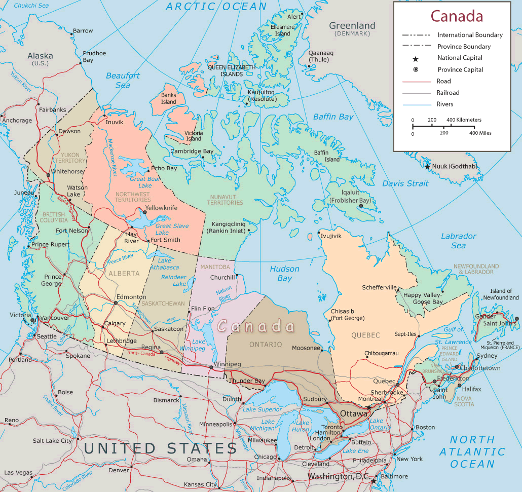
Canada National Map: Roads, Railroads and Rivers Map
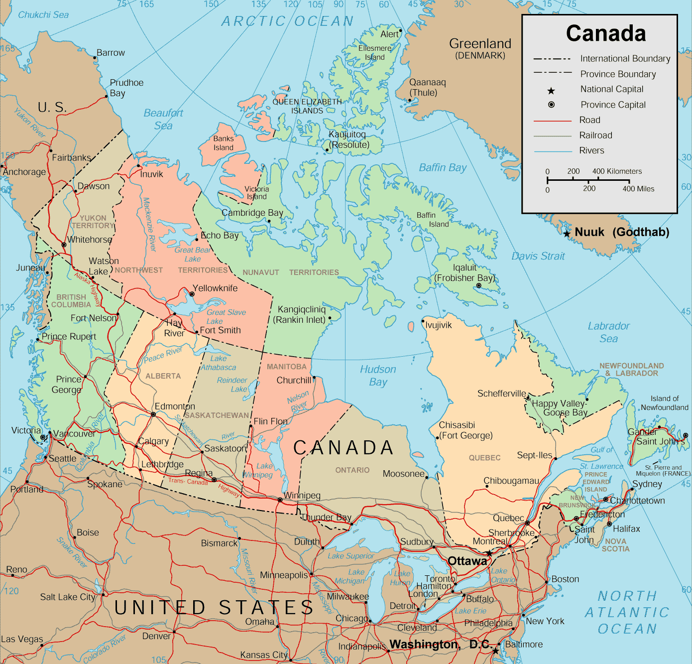
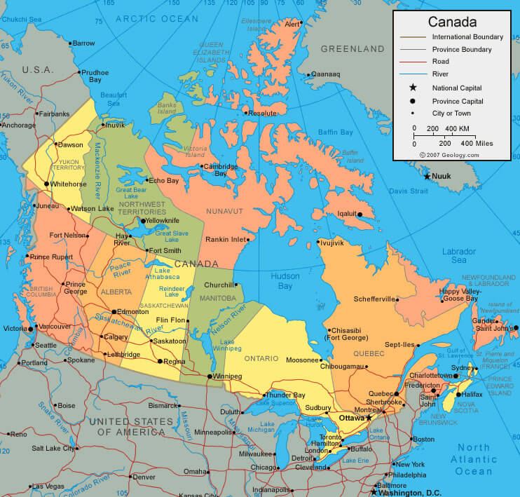
This map of Canada provides information on the country's international boundaries, provincial borders, the national capital, provincial capitals, major cities, main roads, rivers, railroads, and distances. Canada map shows Yukon, Northwest Territories, and Nunavut, are depicted with their rugged landscapes and sparse populations, while the southern regions, including provinces like Ontario, Quebec, and British Columbia, feature more densely populated areas and major cities like Ottawa, Toronto, and Vancouver.
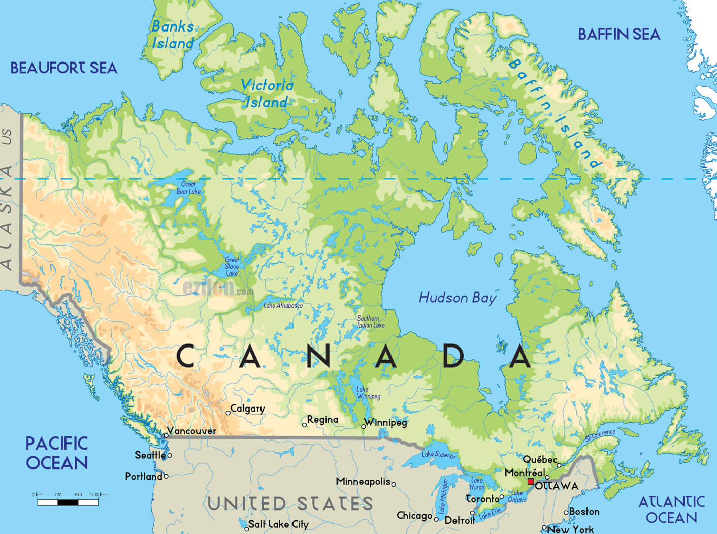
Canada Territories Map with the US International Border
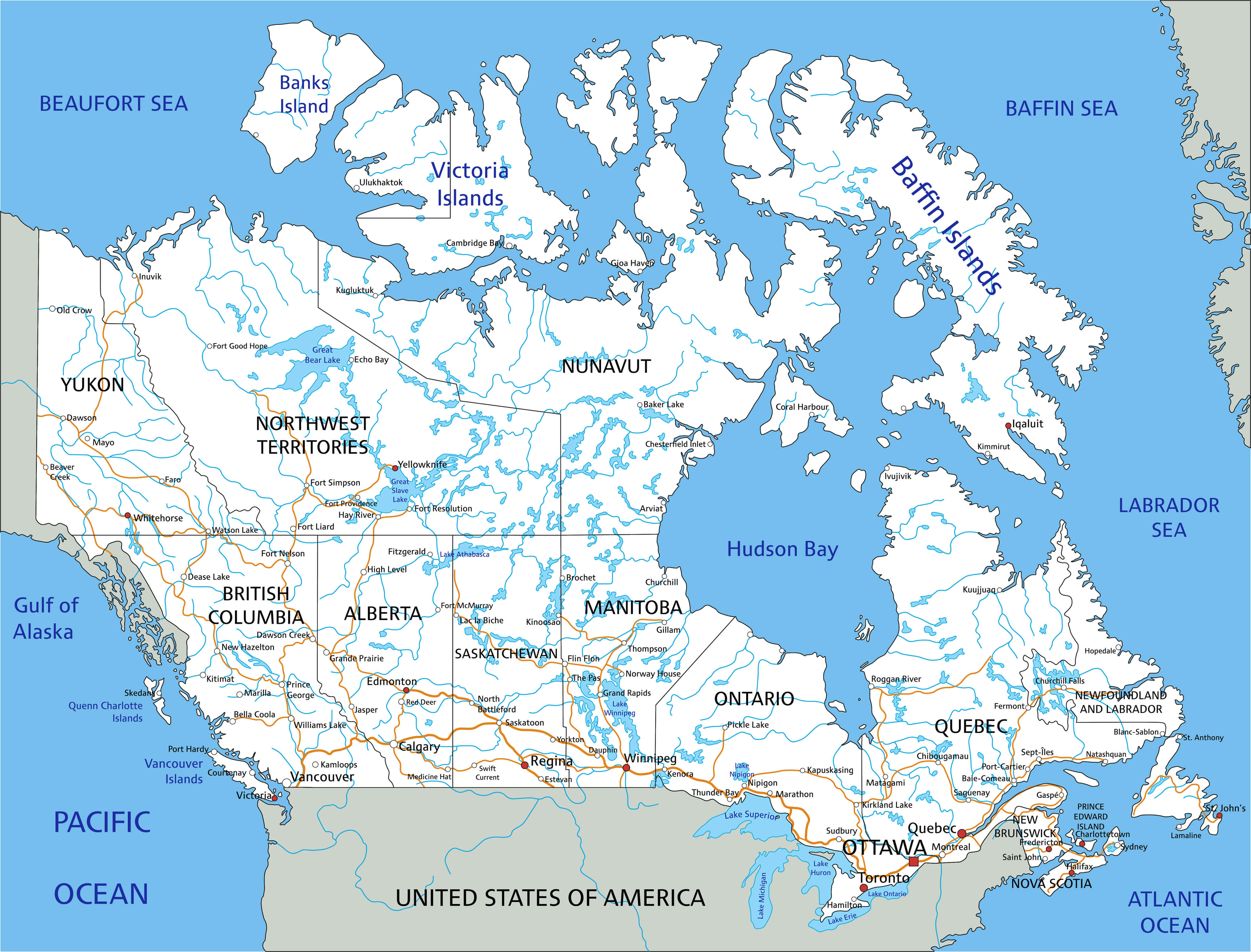
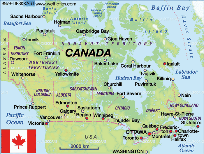
This Canada map illustrates Canada's geography, its territories, international border with the USA. The map also features major lakes and rivers, including the Great Bear Lake, Hudson Bay, and the Mackenzie River, showcasing Canada's extensive freshwater resources. Canada surrounding the Beaufort Sea, Baffin Sea, and the Pacific and Atlantic Oceans. The map marks key highways that connect major cities, such as Vancouver, Toronto, and Ottawa, facilitating transportation across this expansive nation.
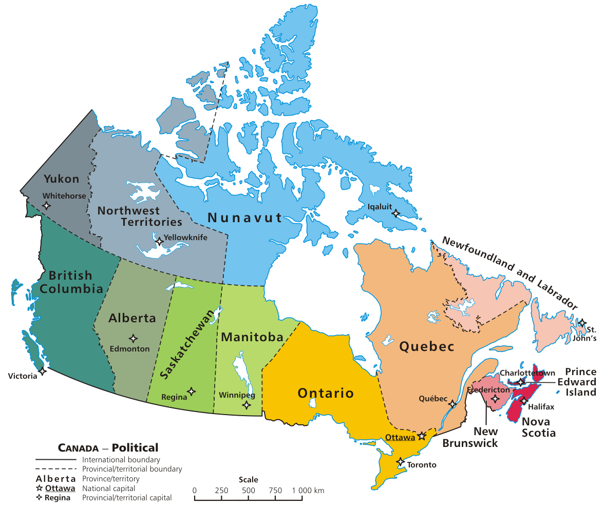
CANADA TERRITORIAL BOUNDARY MAP
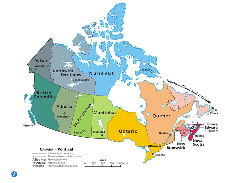
Brief information about Canada
Canada is a North American country that is the second-largest country in the world by total area, covering an area of 9.98 million square kilometers. As of 2021, Canada's estimated population is around 38 million people, making it one of the least densely populated countries in the world.A Collection of Canada Maps and Canada Satellite Images
MAP OF CANADA

WHERE IS CANADA IN THE WORLD
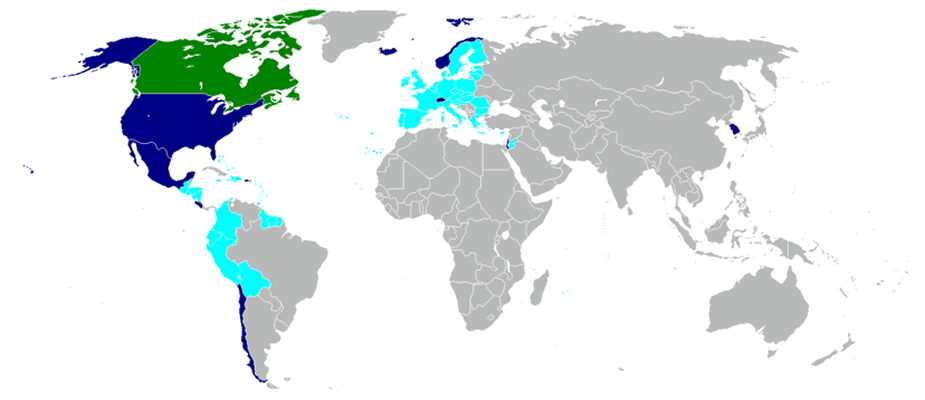
CANADA WORLD FREE TRADE AGREEMENTS 2009
CANADA TERRITORIAL BOUNDARY MAP

CANADA MAP

CANADA MAP
CANADA MAP
CANADA MAP ATLAS
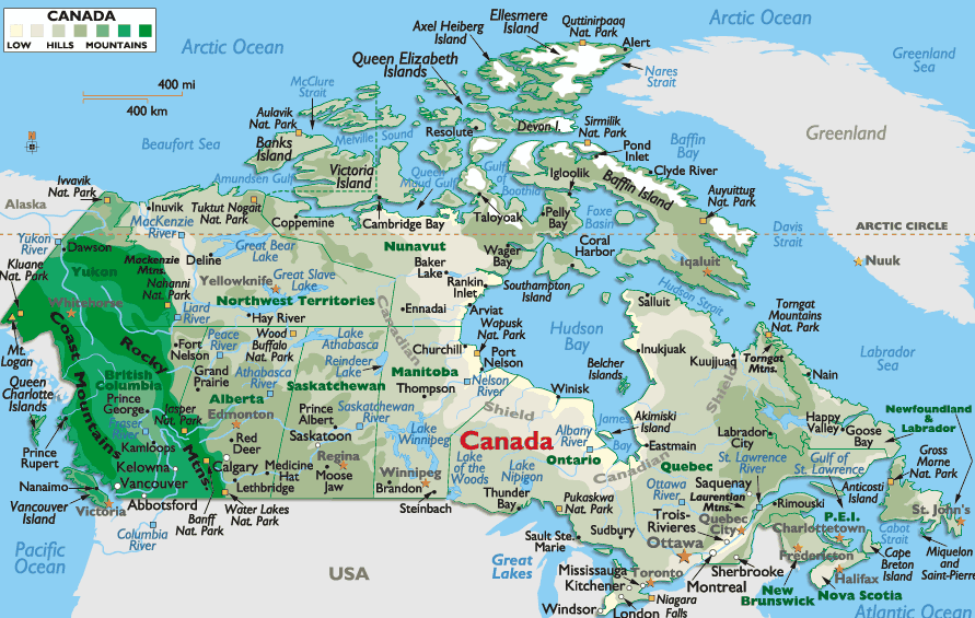
CANADA MAP CITIES

CANADA MAP NATIONAL PARK
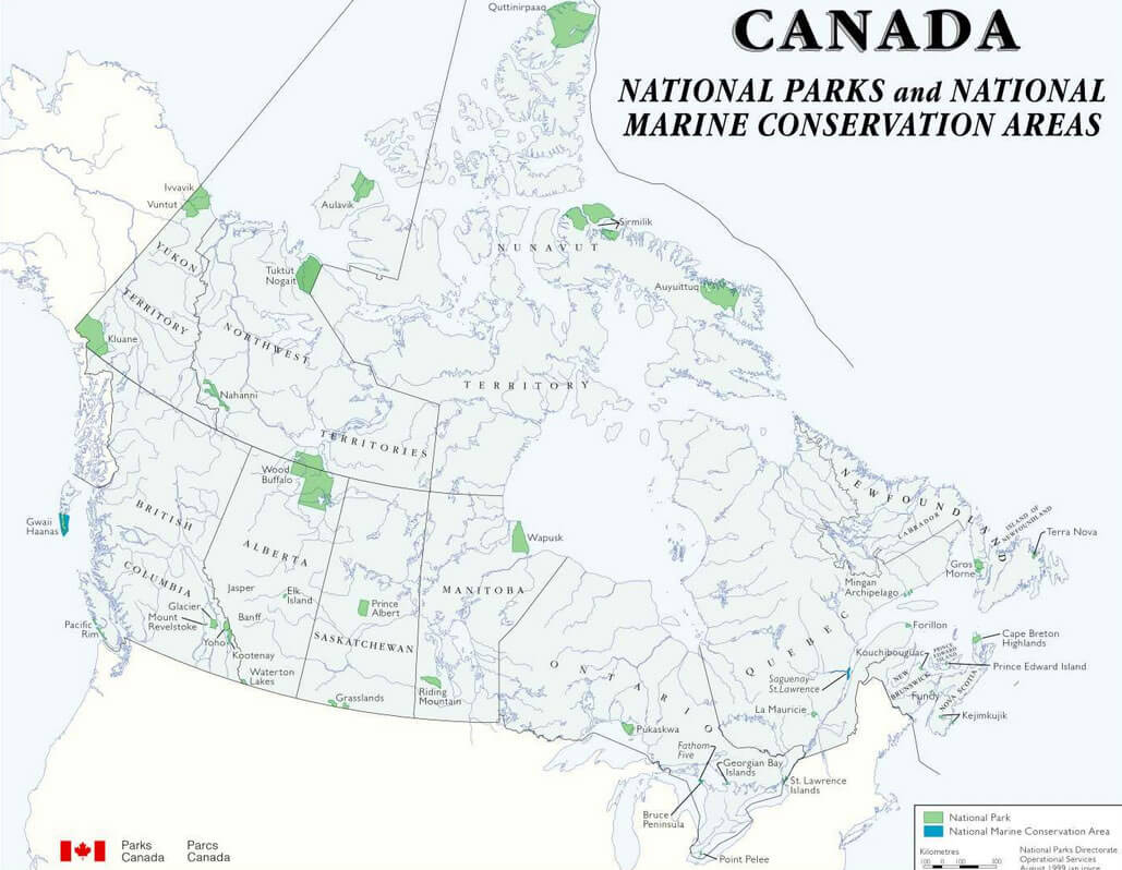
CANADA MAP PHYSICAL
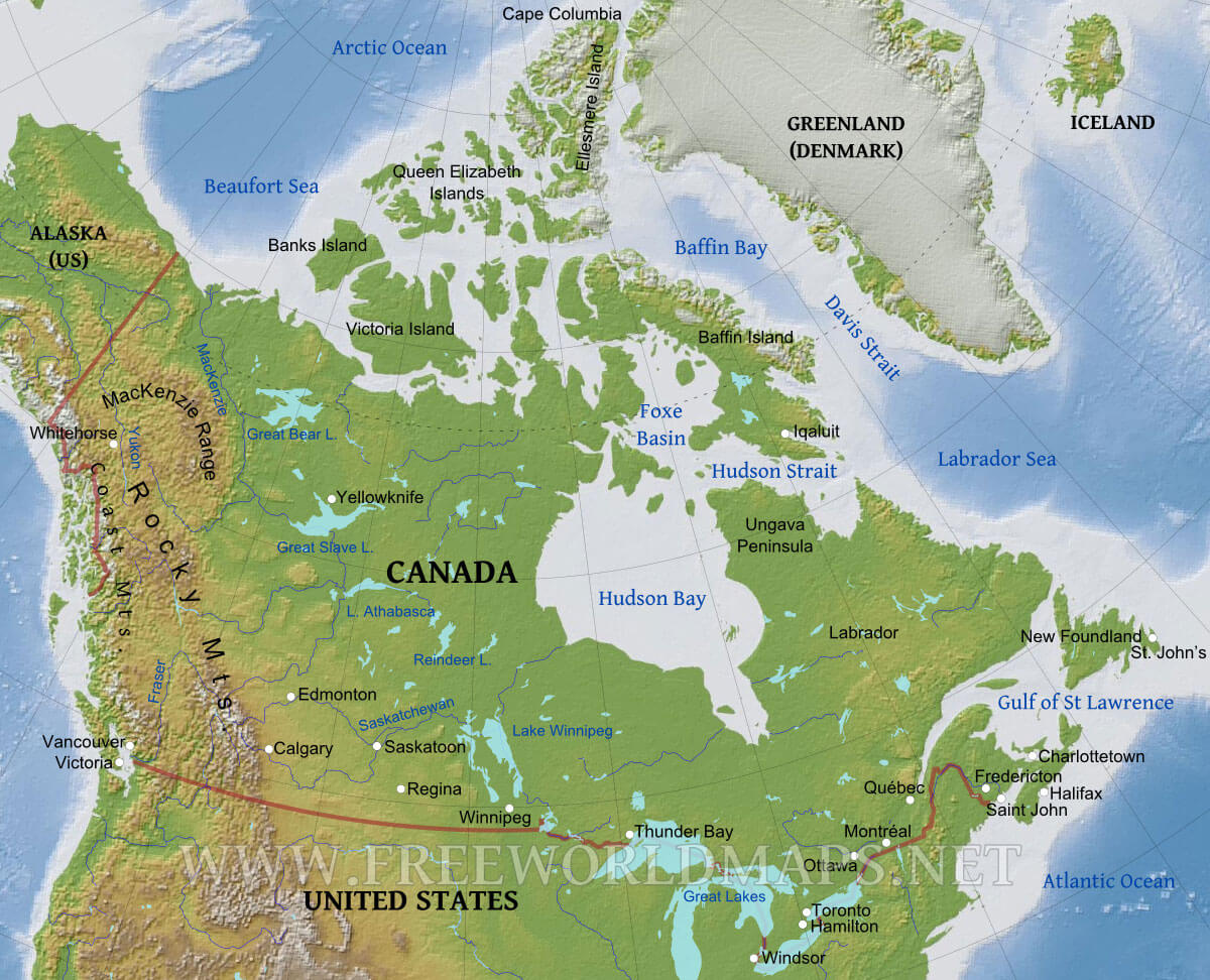
CANADA MAP STATES
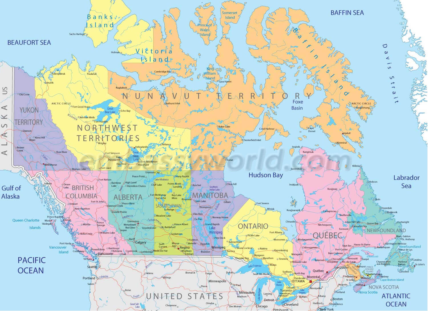
MAP CANADA
MAP CANADA L
MAP OF CANADA GOOGLE
MAP OF CANADA PHYSICAL
MAP OF CANADA POLITICAL
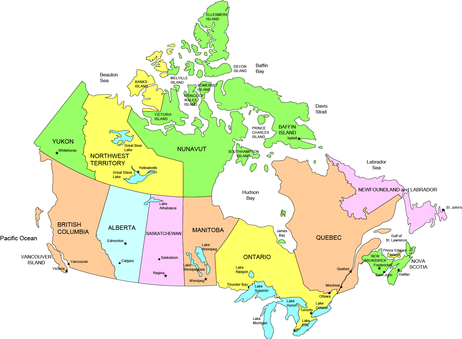
MAP OF CANADA PROVINCES
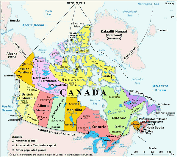
SATELLITE CANADA MAP
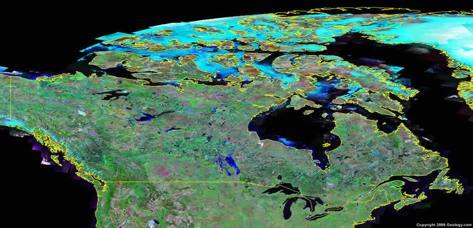
SATELLITE IMAGE OF CANADA
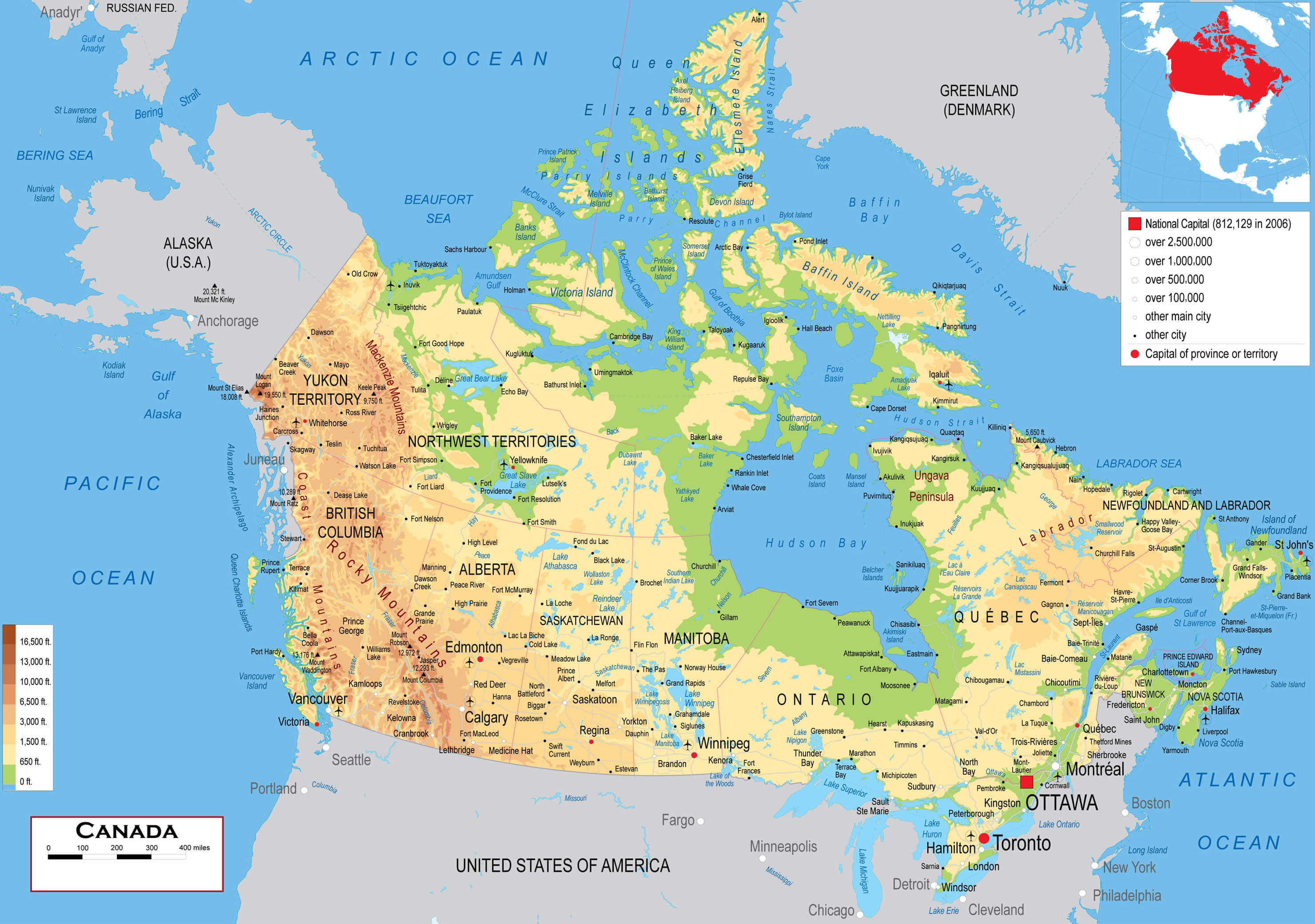
CANADA EARTH MAP
- Head of Performance Marketing
- Head of SEO
- Linkedin Profile: linkedin.com/in/arifcagrici
Largest Cities' Map of Canada
Toronto Map Montreal Map Vancouver Map Calgary Map Edmonton Map Ottawa Map Quebec City Map Winnipeg Map Kitchener Map London Map Victoria Map St. Catharines Map Halifax Map Oshawa Map Windsor Map Saskatoon Map Regina Map Barrie Map St. John's Map Abbotsford Map Kelowna Map Sherbrooke Map Guelph Map Kingston Map Moncton Map Sudbury Map Chicoutimi Jonquiere Map Thunder Bay Map Kanata Map Saint John Map Brantford Map Red Deer Map Nanaimo Map Lethbridge Map Saint Jean sur Richelieu Map White Rock Map Peterborough Map Sarnia Map Milton Map Kamloops Map Chateauguay Map Sault Ste. Marie Map Hamilton Map Chilliwack Map Drummondville Map Saint Jerome Map Medicine Hat Map Prince George Map Belleville Map Fredericton Map Fort McMurray Map Granby Map Grande Prairie Map North Bay Map Beloeil Map Cornwall Map Saint Hyacinthe Map Shawinigan Map Brandon Map Vernon Map Chatham Map Bowmanville Map Joliette Map Charlottetown Map Airdrie Map Victoriaville Map St. Thomas Map Courtenay Map Georgetown Map Salaberry de Valleyfield Map Rimouski Map Woodstock Map Sorel Tracy Map Penticton Map Prince Albert Map Campbell River Map Moose Jaw Map Cape Breton Map Midland Map Leamington Map Stratford Map Orangeville Map Timmins Map Orillia Map Walnut Grove Map Spruce Grove Map Lloydminster Map Alma Map Bolton Map Saint Georges Map Keswick Elmhurst Beach Map Stouffville Map Okotoks Map Duncan Map Parksville Map Leduc Map Val d'Or Map Rouyn Noranda Map Buckingham Map Brockville Map Sept Iles Map Truro Map Owen Sound Map Thetford Mines Map Trois Rivieres Map
Address: Hakarinne 2 Espoo, 02100 Uusimaa - Finland
Email: [email protected]
Phone: +358 44 230 0982
Worldmap1.com Blog
Email: [email protected]
Phone: +358 44 230 0982
Worldmap1.com Blog
Copyright WorldMap1.com 2004 - 2025. All rights reserved. Privacy Policy | Disclaimer

