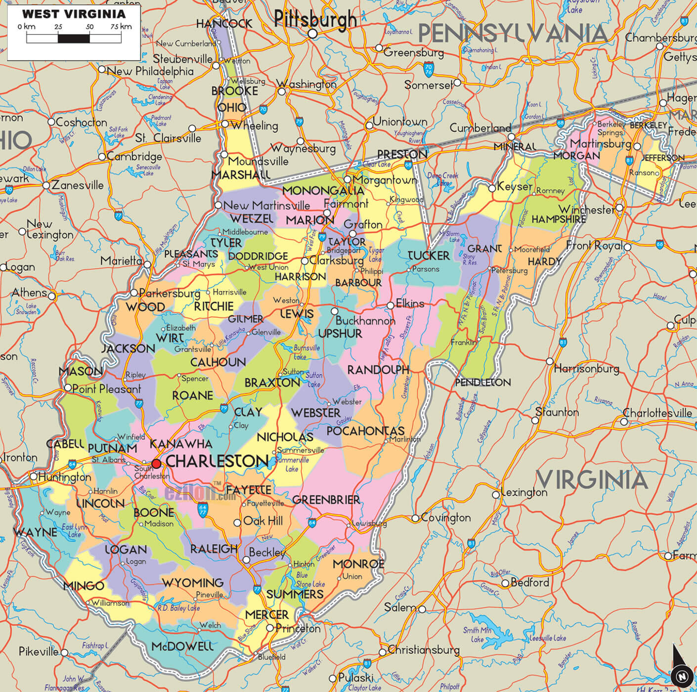
West Virginia Map
Explore the beauty of West Virginia with our detailed map. Find major cities, highways, rivers, and other landmarks on our West Virginia map. Plan your next trip to the Mountain State today!
For all West Virginia Cities Map
MAP OF WEST VIRGINIA
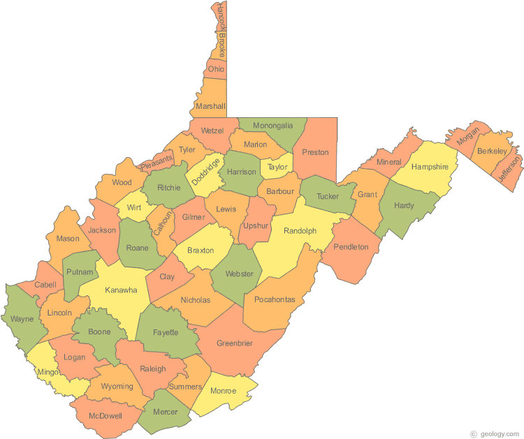
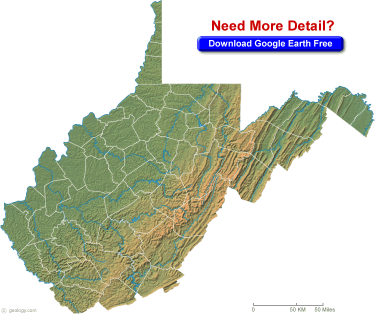
WEST VIRGINIA PHYSICAL MAP
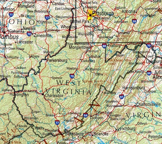
Brief information about West Virginia, US
West Virginia is a state located in the Appalachian region of the Southern United States. It is bordered by Virginia to the southeast, Kentucky to the southwest, Ohio to the northwest, and Pennsylvania to the northeast. With an area of 24,038 square miles (62,259 km²), it ranks 41st in size among the U.S. states. West Virginia has a population of approximately 1.8 million people, making it the 38th most populous state in the country.A Collection of West Virginia Maps and West Virginia Satellite Images
MAP OF WEST VIRGINIA

MAP OF WEST VIRGINIA CITIES
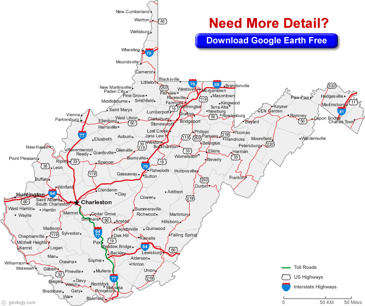
WEST VIRGINIA MAP
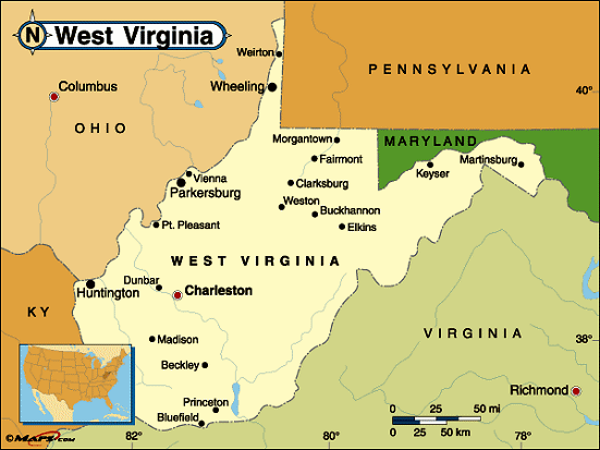
WEST VIRGINIA PHYSICAL MAP

WEST VIRGINIA POLITICAL MAP
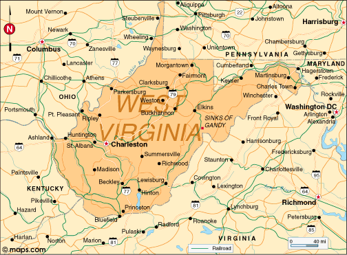
WEST VIRGINIA CITIES MAP
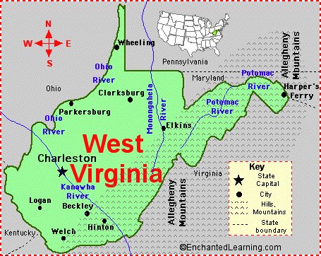
WEST VIRGINIA CITY MAP
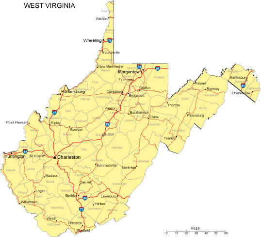
WEST VIRGINIA COUNTIES MAP

WEST VIRGINIA COUNTY SEAT MAP
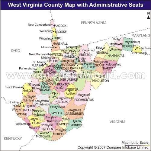
WEST VIRGINIA HISTORICAL MAP
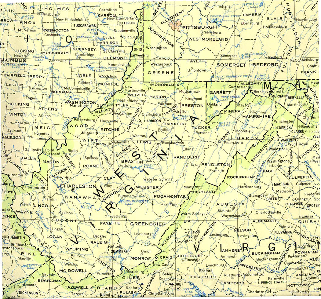
WEST VIRGINIA LAND MAP
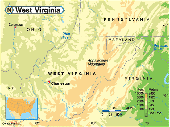
WEST VIRGINIA MAP
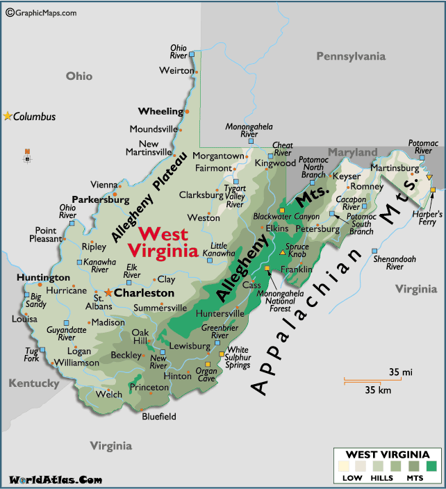
WEST VIRGINIA PHYSICAL MAP
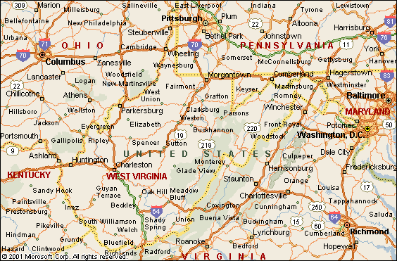
WEST VIRGINIA POLITICAL MAP
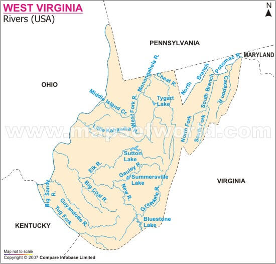
WEST VIRGINIA RIVERS MAP
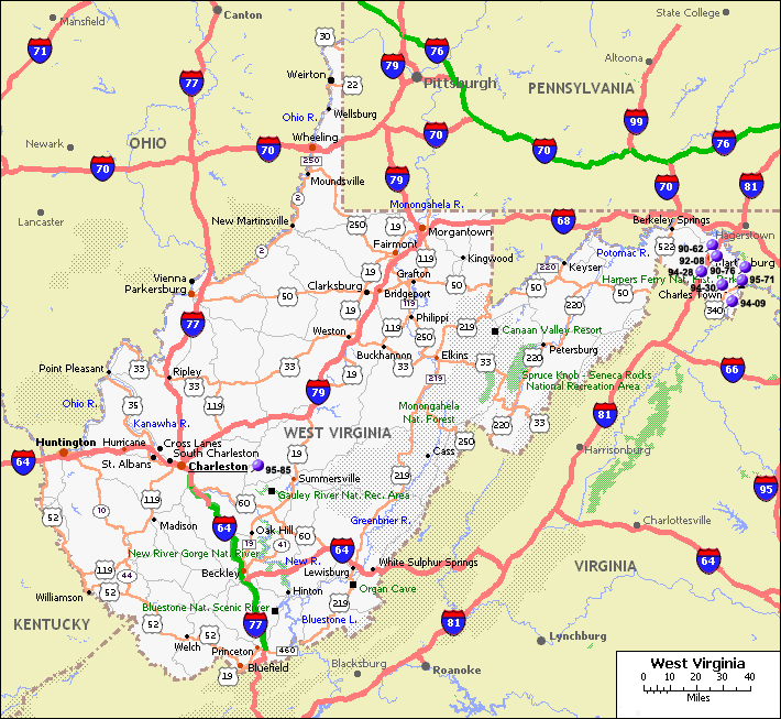
WEST VIRGINIA ROAD MAP
WEST VIRGINIA ZIP CODE MAP

A collection of West Virginia Maps
- Head of Performance Marketing
- Head of SEO
- Linkedin Profile: linkedin.com/in/arifcagrici
Largest Cities Map of West Virginia and Population
Charleston Map - 51,400 Huntington Map - 49,138 Parkersburg Map - 31,492 Morgantown Map - 29,660 Wheeling Map - 28,486 Weirton Map - 19,746 Fairmont Map - 18,704 Beckley Map - 17,614 Martinsburg Map - 17,227 Clarksburg Map - 16,578 South Charleston Map - 13,450 Teays Valley Map - 13,175 St. Albans Map - 11,044 Vienna Map - 10,749 Bluefield Map - 10,447
Address: Hakarinne 2 Espoo, 02100 Uusimaa - Finland
Email: [email protected]
Phone: +358 44 230 0982
Worldmap1.com Blog
Email: [email protected]
Phone: +358 44 230 0982
Worldmap1.com Blog
Copyright WorldMap1.com 2004 - 2025. All rights reserved. Privacy Policy | Disclaimer


